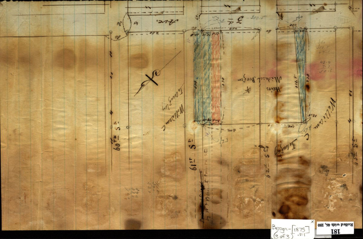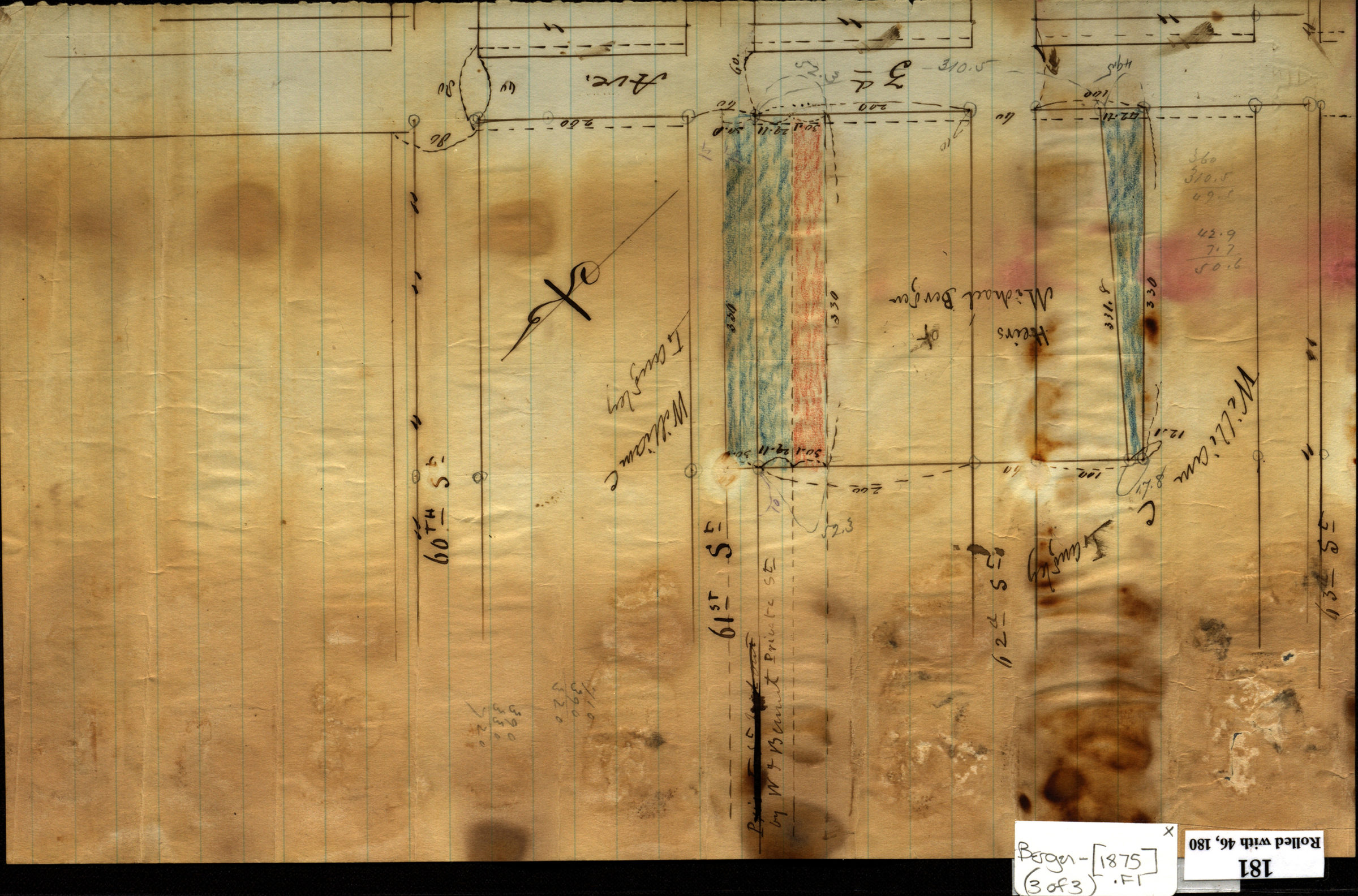
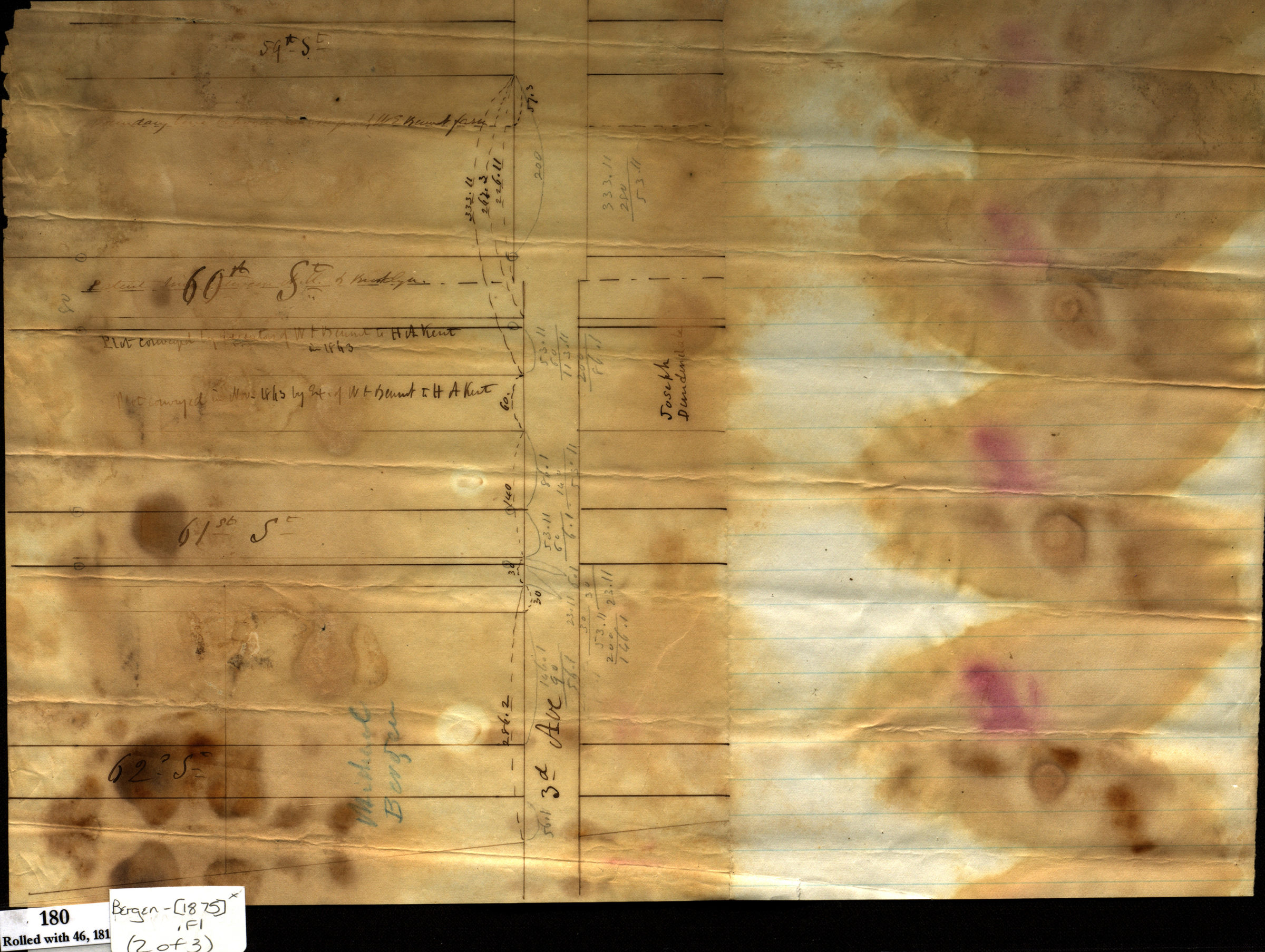

[Maps documenting reciprocal land sale of property along 3rd Avenue between heirs of Michael Bergen and William C. Langley] [ca. 1875]
Map No. Bergen-[1875].Fl
All maps cover the identical area from 62nd to 60th Streets along 3rd Avenue in modern-day Sunset Park. Title devised by cataloger. Pencil and ink. Includes calculations. Likely attributed to Teunis G. Bergen, based on handwriting on piece. Source of date from the map Land of heirs of Michael Bergen. Maps found rolled together in BHS archives and cataloged as unit to preserve context. Land of heirs of Michael Bergen. [Survey of frontage along 3rd Avenue between 62nd and 59th Streets]. Exchange between heirs of Michael Bergen & Wm. C. Langley.
Map area shown
Relation
Full catalog recordSize
34 × 39 cmDownload
Low Resolution Image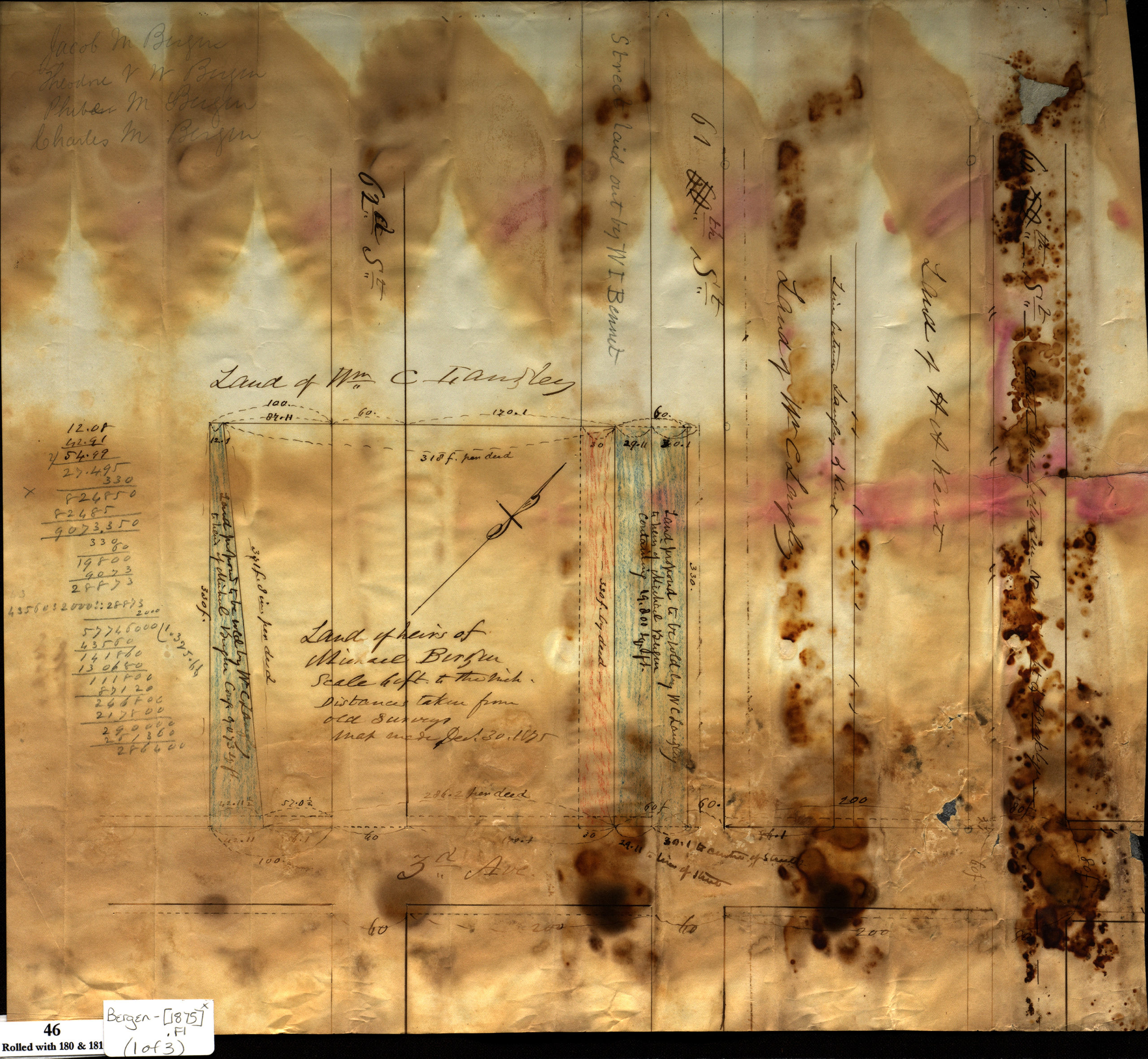
Creator
Bergen, Teunis G.,Publisher
Brooklyn Historical SocietyCitation
[Maps documenting reciprocal land sale of property along 3rd Avenue between heirs of Michael Bergen and William C. Langley]; [ca. 1875], Map Collection, Bergen-[1875].Fl; Brooklyn Historical Society.Scale
Scales differLoading zoom image...