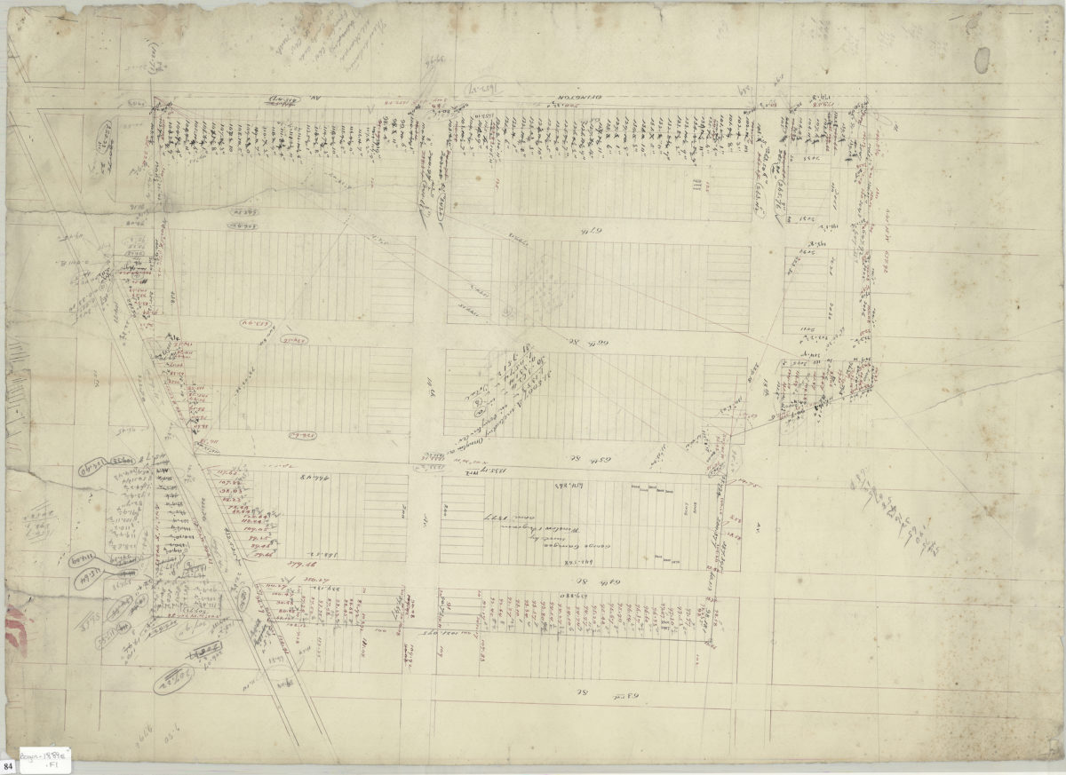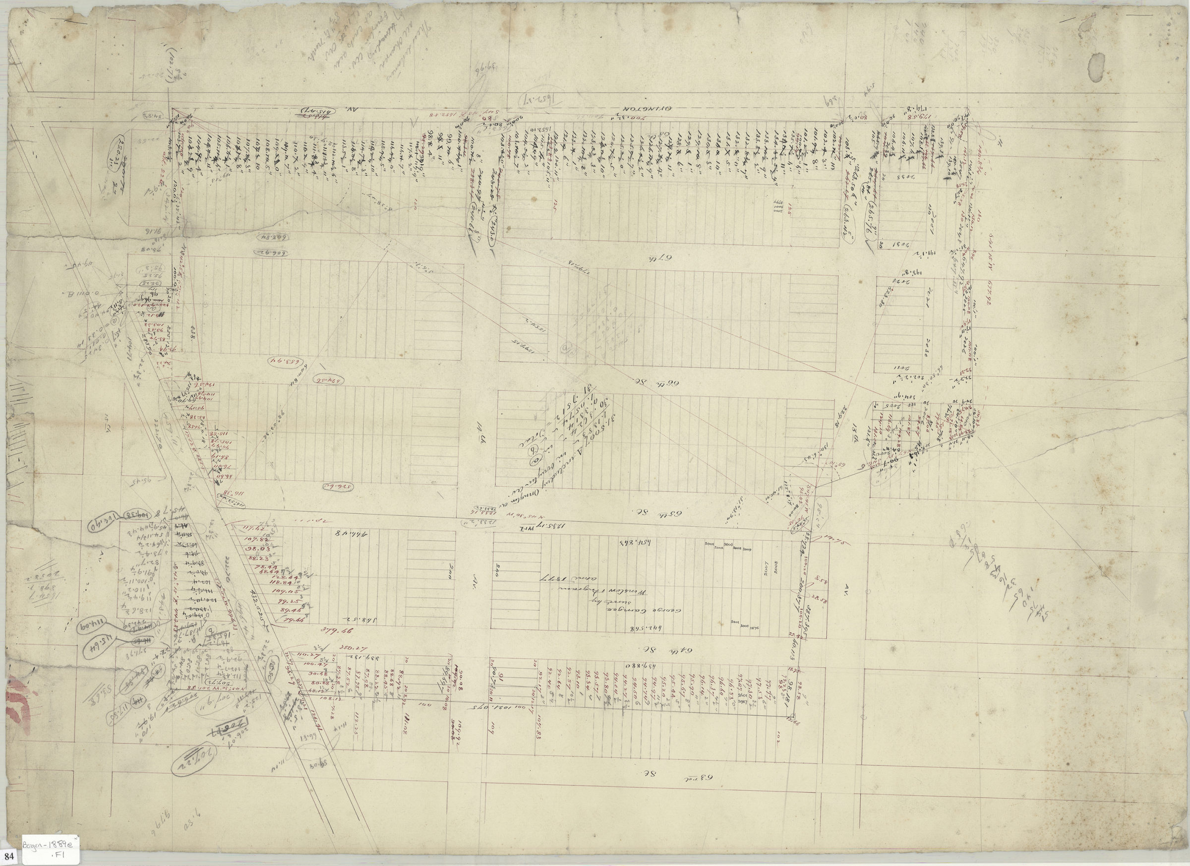
[Survey map of area bounded by 63rd Street, 15th Avenue, Ovington Avenue, and 12th Avenue] 1889
Map No. Bergen-1889e.Fl
Cadastral map covers area bounded by 63rd Street, 15th Avenue, Ovington Avenue, and 12th Avenue in modern-day Dyker Heights and Borough Park. Shows streets, property, and lots (including dimensions). Title devised by cataloger. Attributed to Van Brunt Bergen, based on handwriting on piece. On verso: drawing of footprint of unidentified building. Caption states “Formerly A. V. B. Voorhies.”
Subjects
Places
Map area shown
Relation
Full catalog recordSize
57 × 78 cmDownload
Low Resolution Image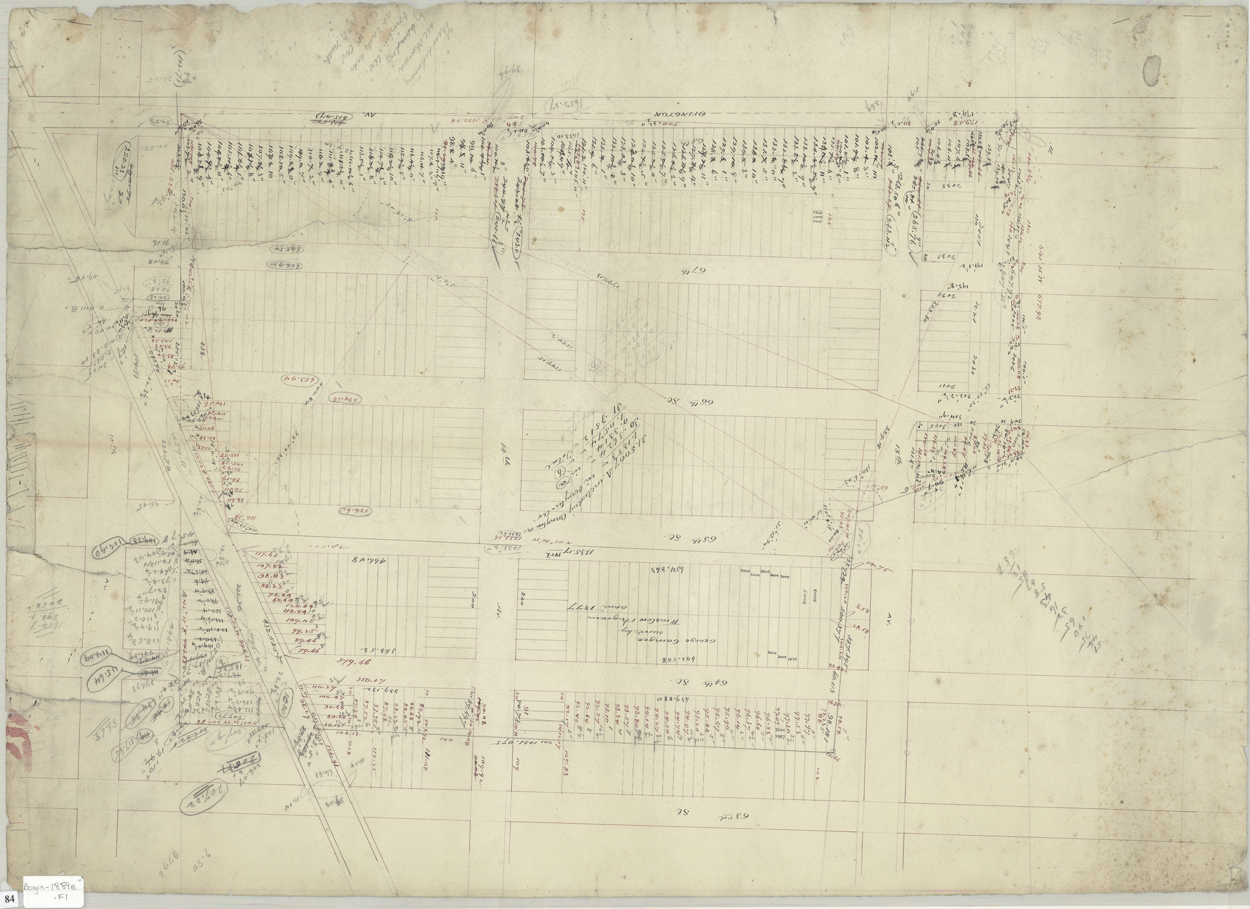
Creator
Bergen, Van Brunt,Publisher
Brooklyn Historical SocietyCitation
[Survey map of area bounded by 63rd Street, 15th Avenue, Ovington Avenue, and 12th Avenue]; 1889, Map Collection, Bergen-1889e.Fl; Brooklyn Historical Society.Scale
Scale not givenLoading zoom image...