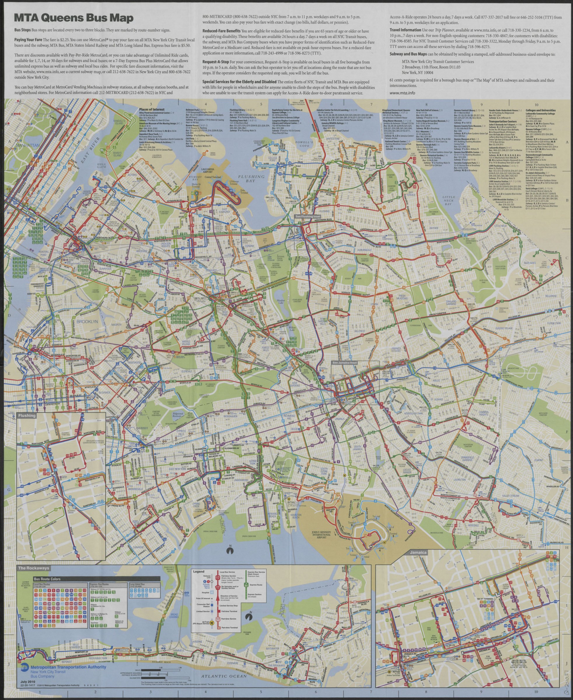
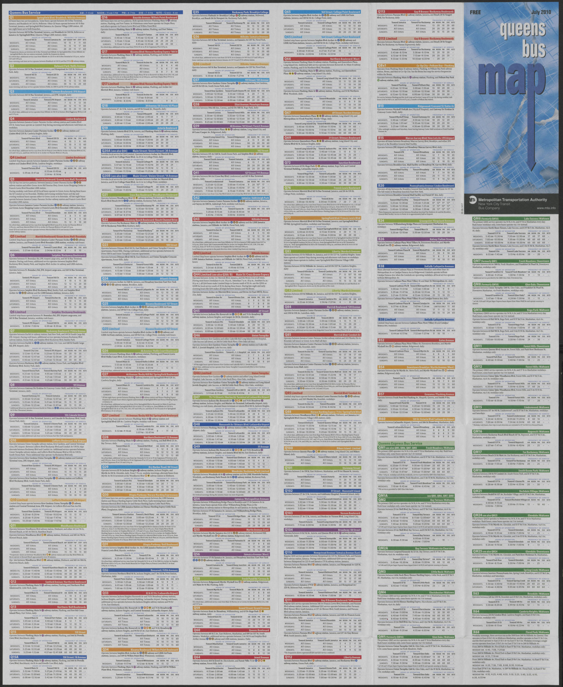
Queens bus map: free, July 2010: MTA Metropolitan Transportation Authority, New York City Transit Bus Company [ca. 2010]
Map No. Q-2010.Fl
Panel title. “© 2010 Metropolitan Transportation Authority.” Insets: Flushing — The Rockaways — Jamaica. Includes text, index to points of interest, and color-coded bus-route directory. On verso: text and color-coded bus-route directory with time/frequency tables. “22-30-1417 5 4 3 2 1.”
Map area shown
Genre
Transportation mapsRelation
Full catalog recordSize
69 × 53 cmDownload
Low Resolution Image
Creator
New York City Transit Authority,Publisher
Brooklyn Historical SocietyCitation
Queens bus map: free, July 2010: MTA Metropolitan Transportation Authority, New York City Transit Bus Company; [ca. 2010], Map Collection, Q-2010.Fl; Brooklyn Historical Society.Scale
Scale [ca. 1:42,500]Loading zoom image... 