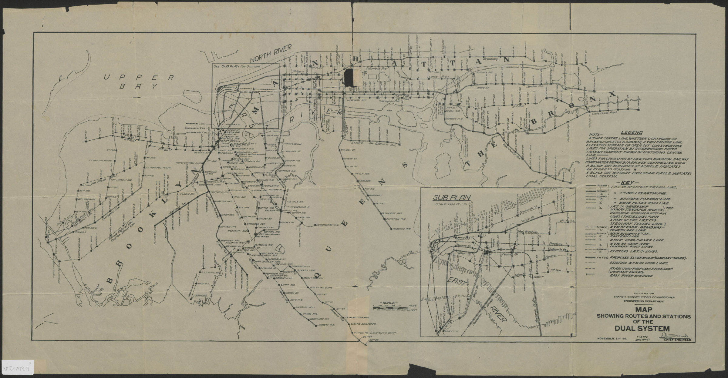
Map showing routes and stations of the dual systems 1919
Map No. NYC-1919.Fl
Covers New York City. Shows subway and elevated rail lines of the I.R.T. (Interborough Roapid Transit) and N.Y.M.Ry. (New York Municipal Railway). “File No. 3.” “Drg. No. 437.” Includes inset : “Sub plan, scale 1000 ft. = 1 in.”
Map area shown
Genre
Transportation mapsRelation
Full catalog recordSize
37 × 79 cmDownload
Low Resolution Image
Creator
New York (State); Transit Construction Commissioner,Publisher
Brooklyn Historical SocietyCitation
Map showing routes and stations of the dual systems; 1919, Map Collection, NYC-1919.Fl; Brooklyn Historical Society.Scale
Scale [ca. 1:52,000]Loading zoom image... 