Nester’s Brooklyn maps: produced and designed by Lewis J. Nesterman [1976]
Map No. B C-[1976].Fl
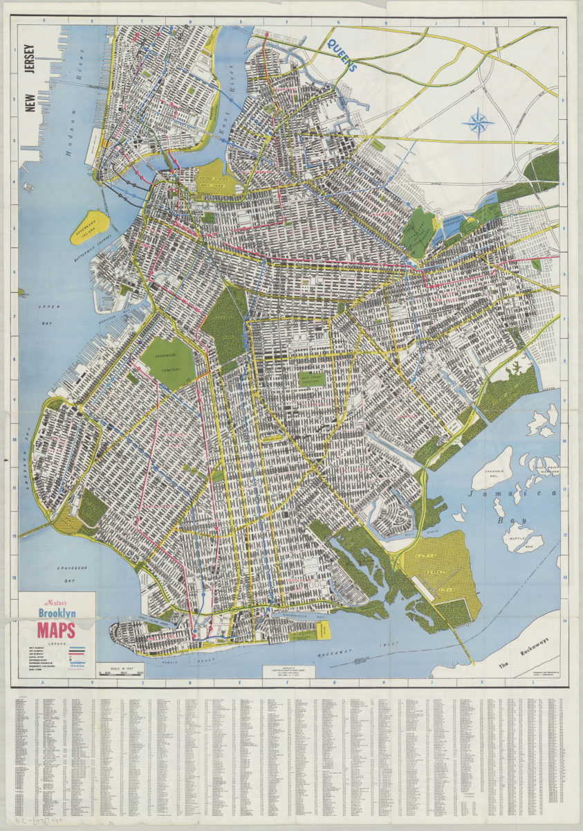
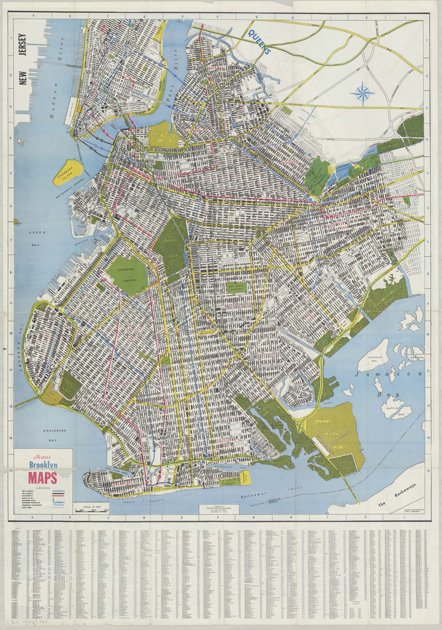
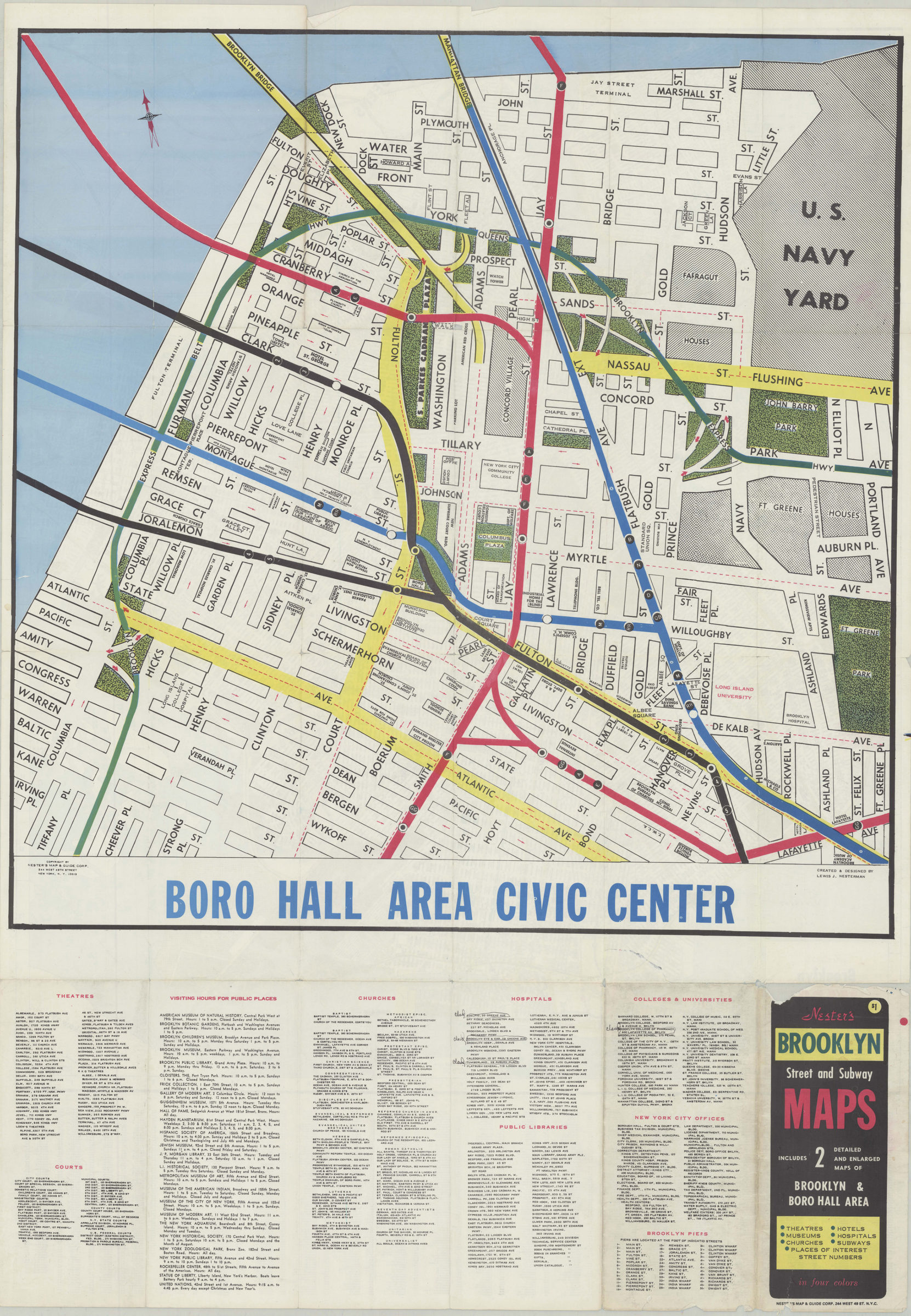
Covers Brooklyn and a portion of lower Manhattan. Shows streets, automobile routes, and subway lines. Indexed. Lists to points of interest and map of “Boro Hall area civic center” on verso.
Map area shown
Genre
MapRelation
Full catalog recordSize
79 × 66 cmDownload
Low Resolution Image
Creator
Nester's Map and Guide Corp,Publisher
Brooklyn Historical SocietyCitation
Nester’s Brooklyn maps: produced and designed by Lewis J. Nesterman; [1976], Map Collection, B C-[1976].Fl; Brooklyn Historical Society.Scale
Scale ca. 1:19,100Loading zoom image...