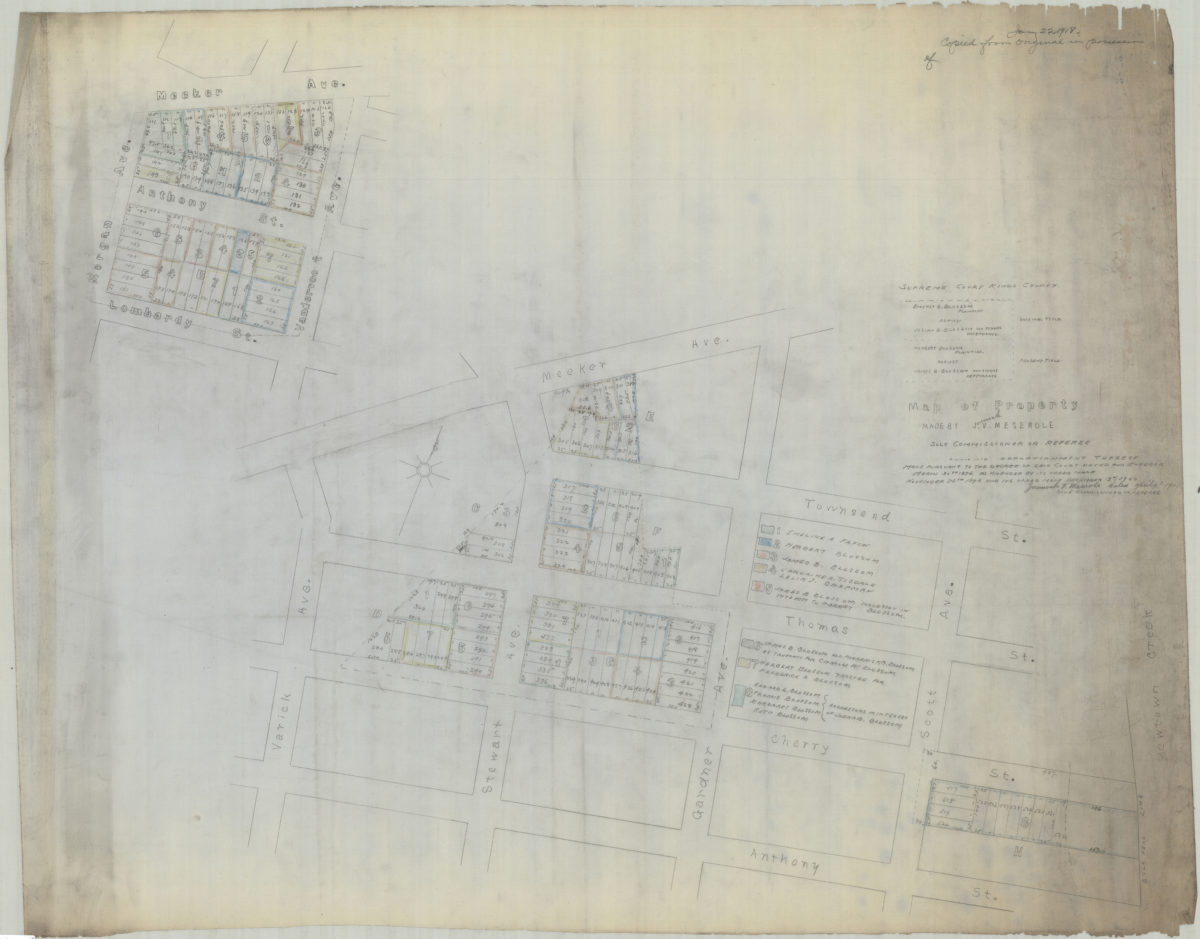
[Copy of] map of property made by J[eremiah] V. Meserole, sole commissioner or referee: showing apportionment thereof made pursuant to the decree of said court, dated and entered March 30th 1896 as amended by its order made of November 25th 1898 1918
Cadastral map covering 2 portions of modern-day Greenpoint. Shows property, including lot numbers and dimensions, and names of landowners. At head of map: “January 22, 1918, copied from original in possession of [incomplete statement].” At head of map: “Supreme Court, Kings County. Emeret B. Blossom plaintiff against Josiah B. Blossom and other defendants, original title Herbert Blossom, plaintiff against James B. Blossom and others, defendants, present title.” “Jeremiah V. Meserole dated April 9th 1901, sole commissioner or referee.” [Cadastral map of area bounded by Meeker Avenue, Vandervoo[r]t Avenue, Lombardy Street, and Morgan Avenue]. [Cadastral map of area bounded by Meeker Avenue, Townsend Street, Newtown Creek, Anthony Street and Varick Avenue].
Map area shown
Relation
Full catalog recordSize
84 × 96 cmDownload
Low Resolution Image
Creator
Meserole, J. V.,Publisher
Brooklyn Historical SocietyCitation
[Copy of] map of property made by J[eremiah] V. Meserole, sole commissioner or referee: showing apportionment thereof made pursuant to the decree of said court, dated and entered March 30th 1896 as amended by its order made of November 25th 1898; 1918, Map Collection, B P-1901(1918).Fl.Folio; Brooklyn Historical Society.Scale
Scale not given