Map of Beth[page] November 1889
Map No. L.I.--17th-18th century(1889).Fl
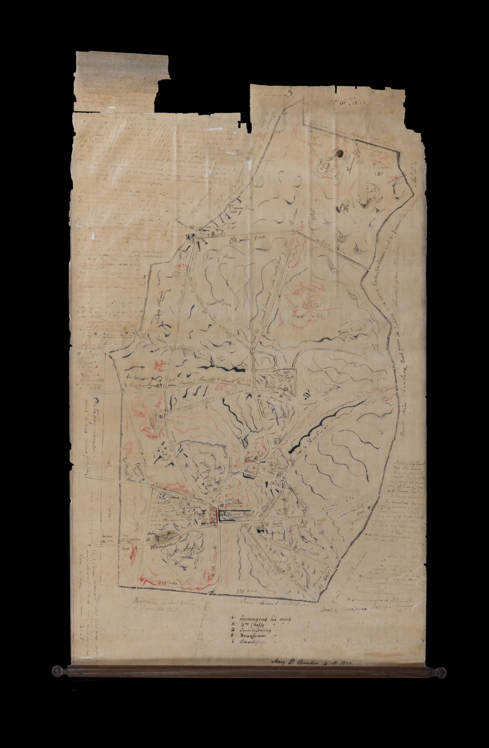
Cadastral map covering modern-day Old Bethpage, Long Island. The map shows land patents, names of landowners, buildings, and landscape details. The map covers an area identical to the map printed on page 4 of the author’s Long Island Genealogies (Albany, N.Y.: J. Munsell’s Sons, 1895). Map has extensive notes in manuscript on landowners and patents not found on the published version. Map is missing sections of uppermost right quarter, resulting in some loss of text. Mounted on board.
Map area shown
Relation
Full catalog recordSize
84 × 49 cmDownload
Low Resolution ImageCreator
Bunker, Mary Powell,Publisher
Brooklyn Historical SocietyCitation
Map of Beth[page]; November 1889, Map Collection, L.I.--17th-18th century(1889).Fl; Brooklyn Historical Society.Scale
Scale not givenLoading zoom image... 