New York: engraved by G.W. Boynton [1838]
Map No. NYC-[1838?].Fl
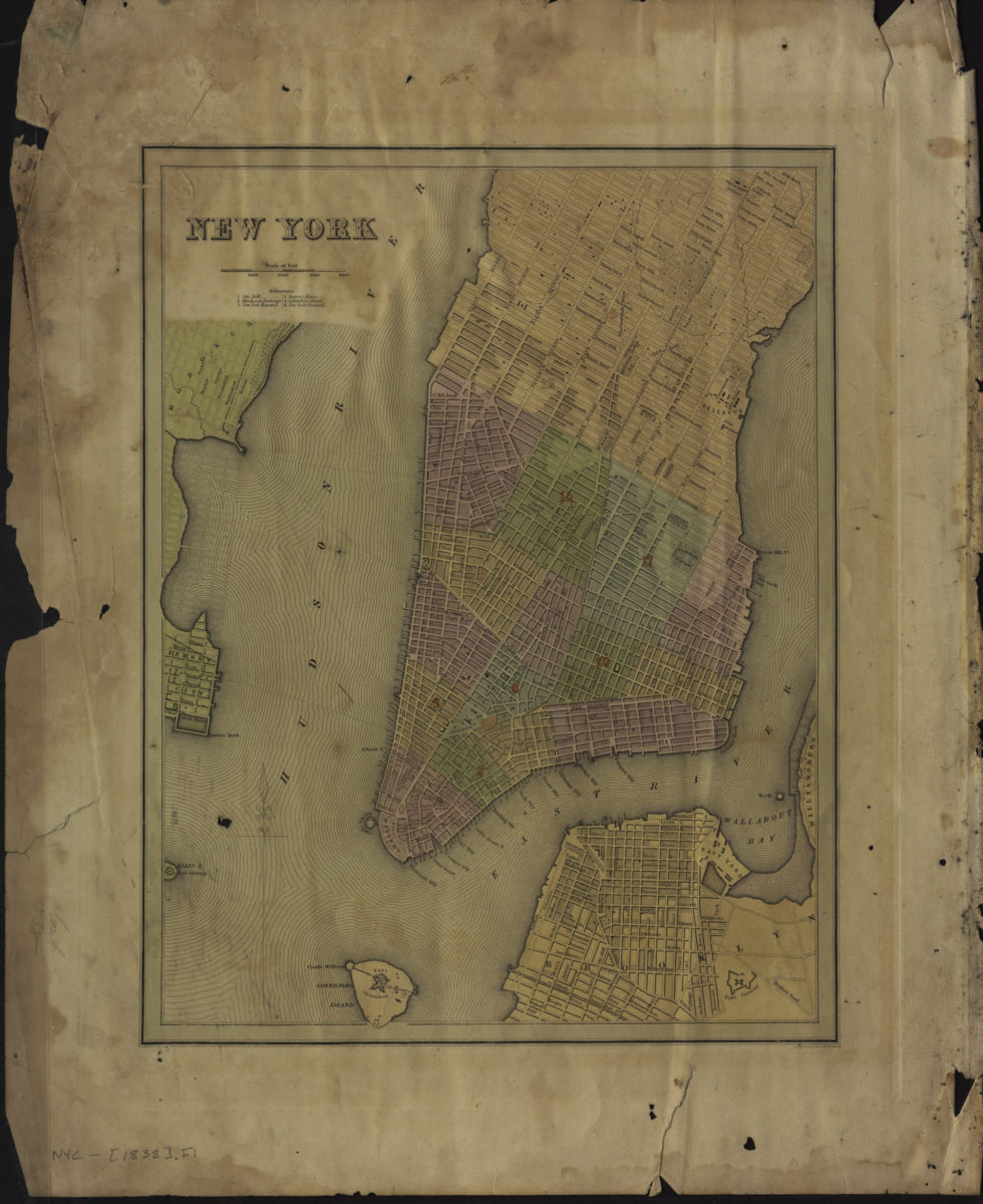
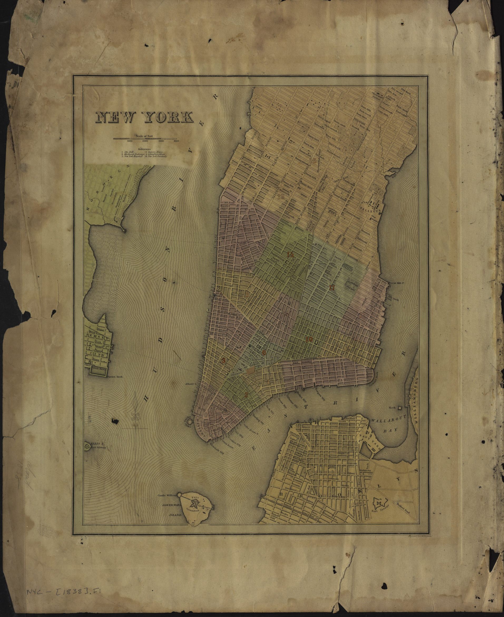
Covers Manhattan north to 53rd St., Governors Island, and portions of Hoboken and Jersey City. Also covers Brooklyn north from approximately Baltic St. to Wallabout Bay and east to Fort Greene. Shows Manhattan wards, slips, docks, and ferry lines. Includes index.
Map area shown
Genre
MapRelation
Full catalog recordSize
49 × 40 cmDownload
Low Resolution ImageCreator
Boynton, George W.,Publisher
Brooklyn Historical SocietyCitation
New York: engraved by G.W. Boynton; [1838], Map Collection, NYC-[1838?].Fl; Brooklyn Historical Society.Scale
Scale [ca. 1:24,000]Loading zoom image...