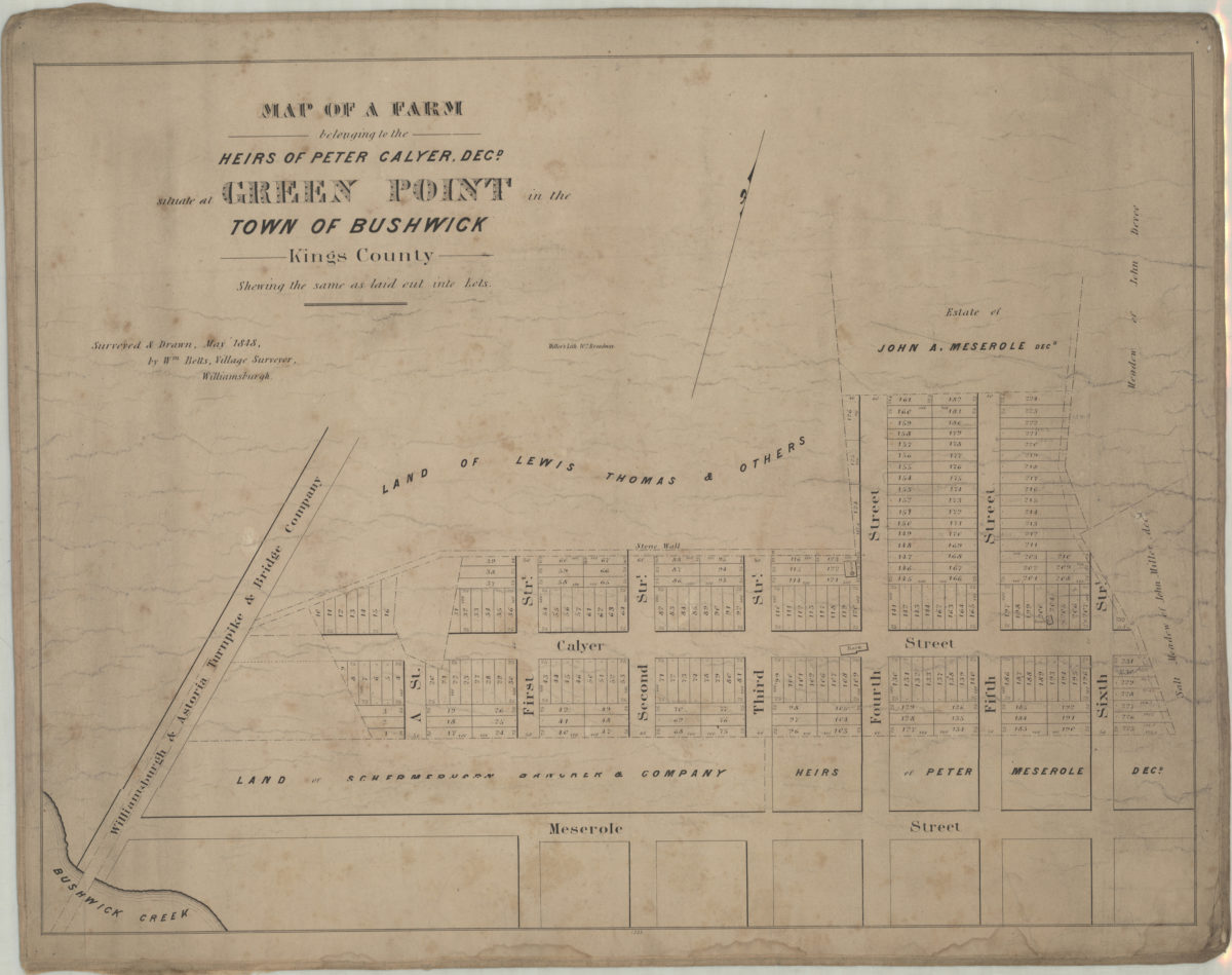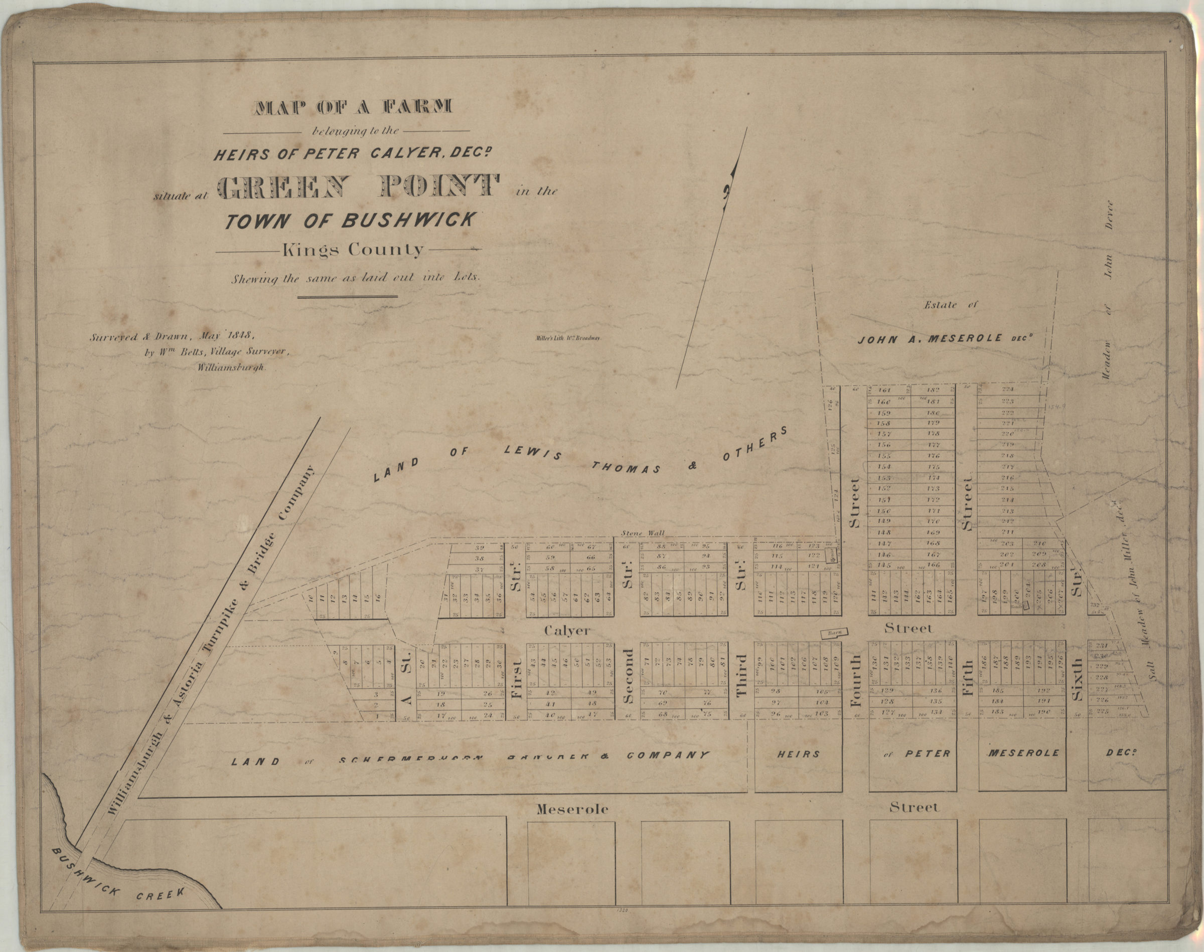
Map of a farm belonging to the heirs of Peter Calyer, decd., situate[d] at Green Point in the town of Bushwick, Kings County, shewing the same as laid out into lots: surveyed & drawn, May 1848 by Wm. Betts, village surveyor, Williamsburgh 1848
Map No. B P-[1848]a.Fl;B P-[1848]a.Fl c.2
Cadastral map covering area north from Bushwick Creek to approximately 2 blocks north of Calyer St. and east to 6th St. Shows property (including lot numbers and dimensions), names of property owners, buildings, and salt meadows. “1320”–Lower center margin. BHS has 2 copies c.2 hand col.
Map area shown
Genre
Cadastral mapsRelation
Full catalog recordSize
43 × 57 cmDownload
Low Resolution Image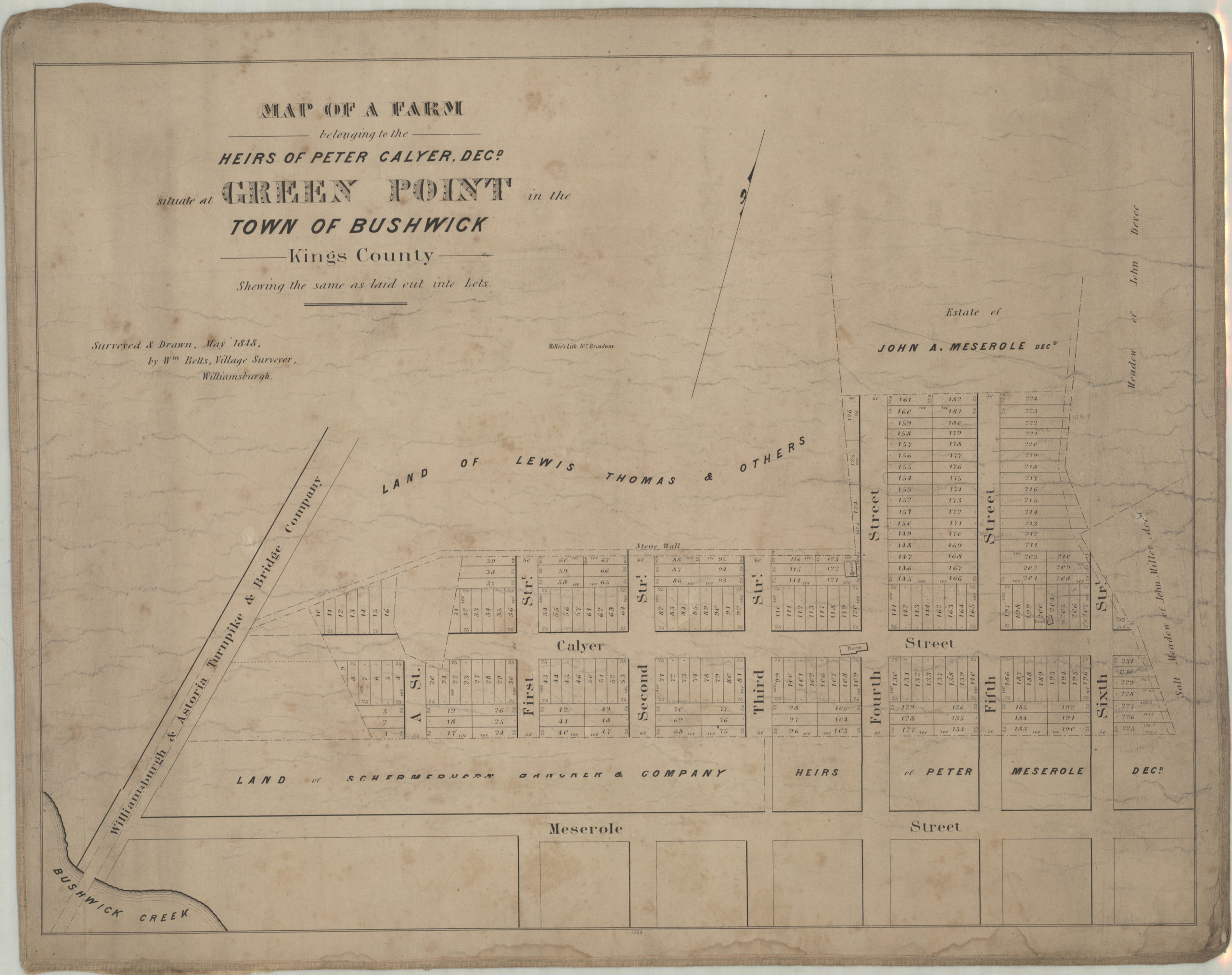
Creator
Betts, Wm.,Publisher
Brooklyn Historical SocietyCitation
Map of a farm belonging to the heirs of Peter Calyer, decd., situate[d] at Green Point in the town of Bushwick, Kings County, shewing the same as laid out into lots: surveyed & drawn, May 1848 by Wm. Betts, village surveyor, Williamsburgh; 1848, Map Collection, B P-[1848]a.Fl;B P-[1848]a.Fl c.2; Brooklyn Historical Society.Scale
Scale not givenLoading zoom image...