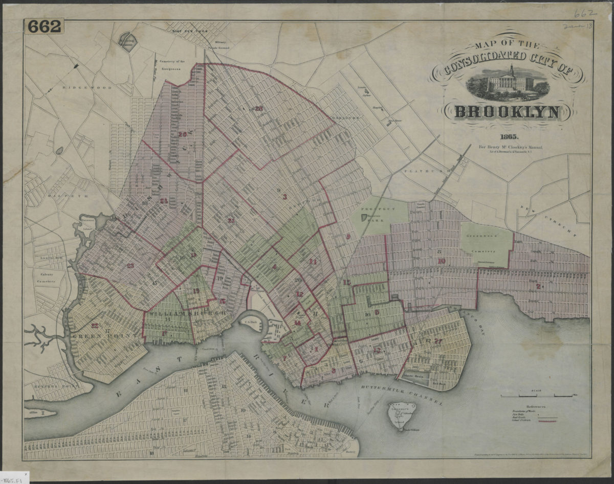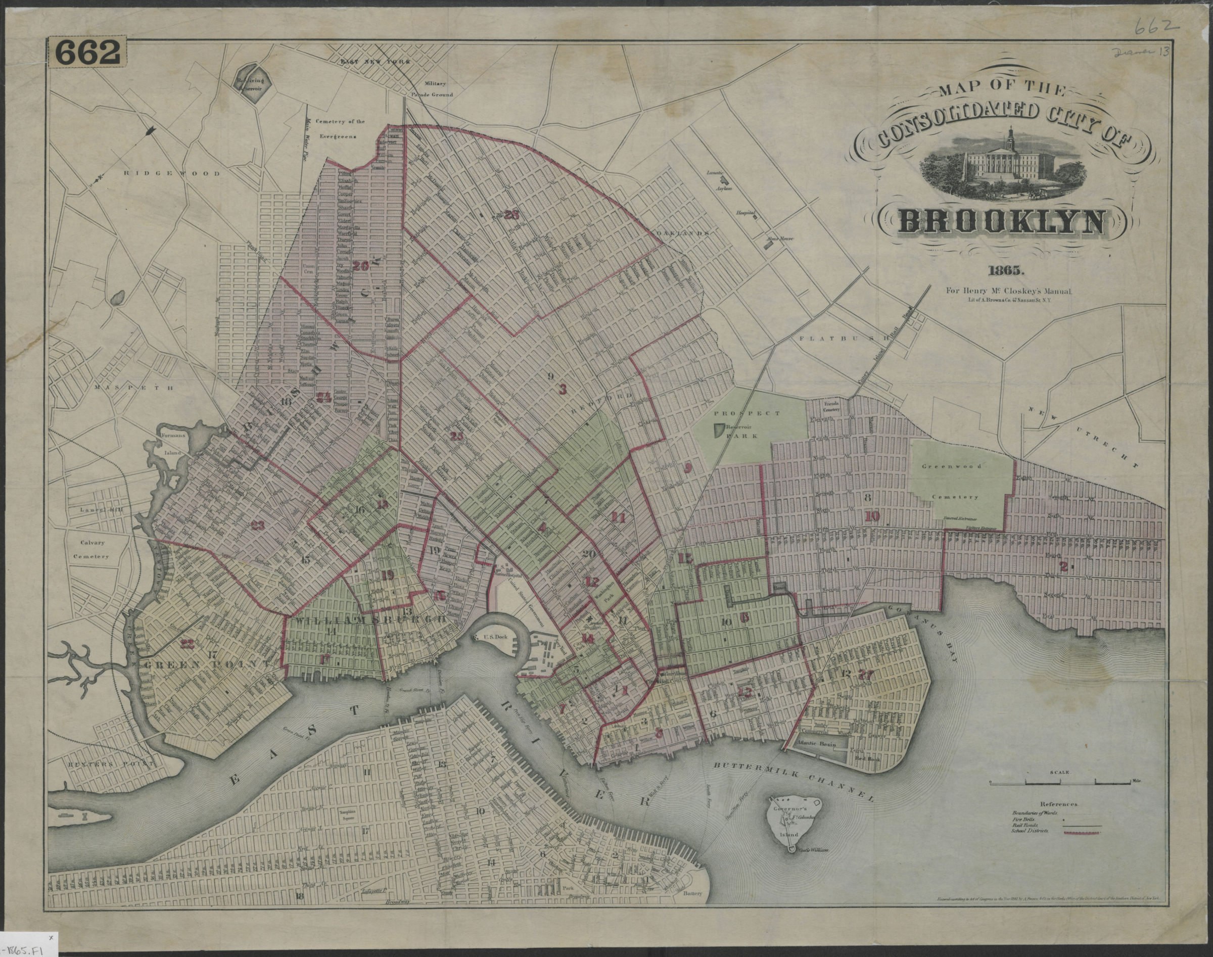
Map of the consolidated City of Brooklyn 1865
Map No. B A-1865.Fl
Covers modern Brooklyn south to 60th Street and east to the Cemetery of the Evergreens and Greenwood Cemetery. Shows boundaries of wards and school districts, location of fire bells, railroads and ferries. “Entered according to Act of Congress in the Year 1861 by A. Brown & Co. ….” “For Henry McCloskey’s Manual. Lit of A. Brown & Co….” Oriented with north to lower left of sheet. Includes key. NYHS copy soiled, lightly stained, creased, mounted on paper. Encapsulated. M008360
Map area shown
Genre
MapRelation
Full catalog recordSize
44 × 57 cmDownload
Low Resolution Image
Creator
McCloskey, Henry; A. Brown & Co.,Publisher
Brooklyn Historical SocietyCitation
Map of the consolidated City of Brooklyn; 1865, Map Collection, B A-1865.Fl; Brooklyn Historical Society.Scale
Scale [ca. 1:22,500]Loading zoom image...