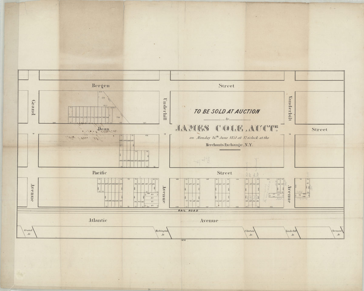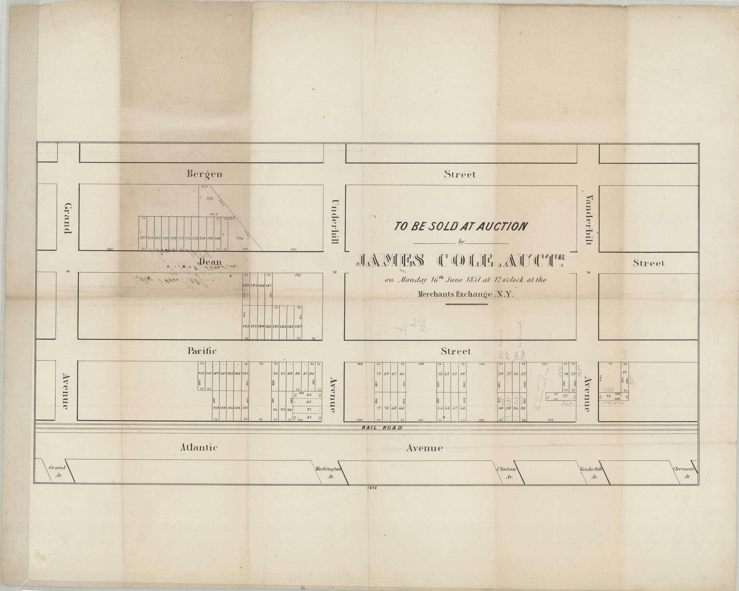
To be sold at auction by James Cole, auctr., on Monday, 16th June, 1851, at 12 o’clock at the Merchants’ Exchange, N.Y. [1851]
Map No. B P-[1851]c.Fl
Cadastral map covering area north from Bergen St. to Atlantic Ave. and east from Vanderbilt Ave. to Grand Ave. (modern-day Prospect Heights). Shows property (including lot numbers and dimensions), and a railroad. Oriented with north to the bottom. “1872”–Lower center margin. BHS copy annotated in gray pencil.
Map area shown
Genre
Cadastral mapsRelation
Full catalog recordSize
29 × 55 cmDownload
Low Resolution Image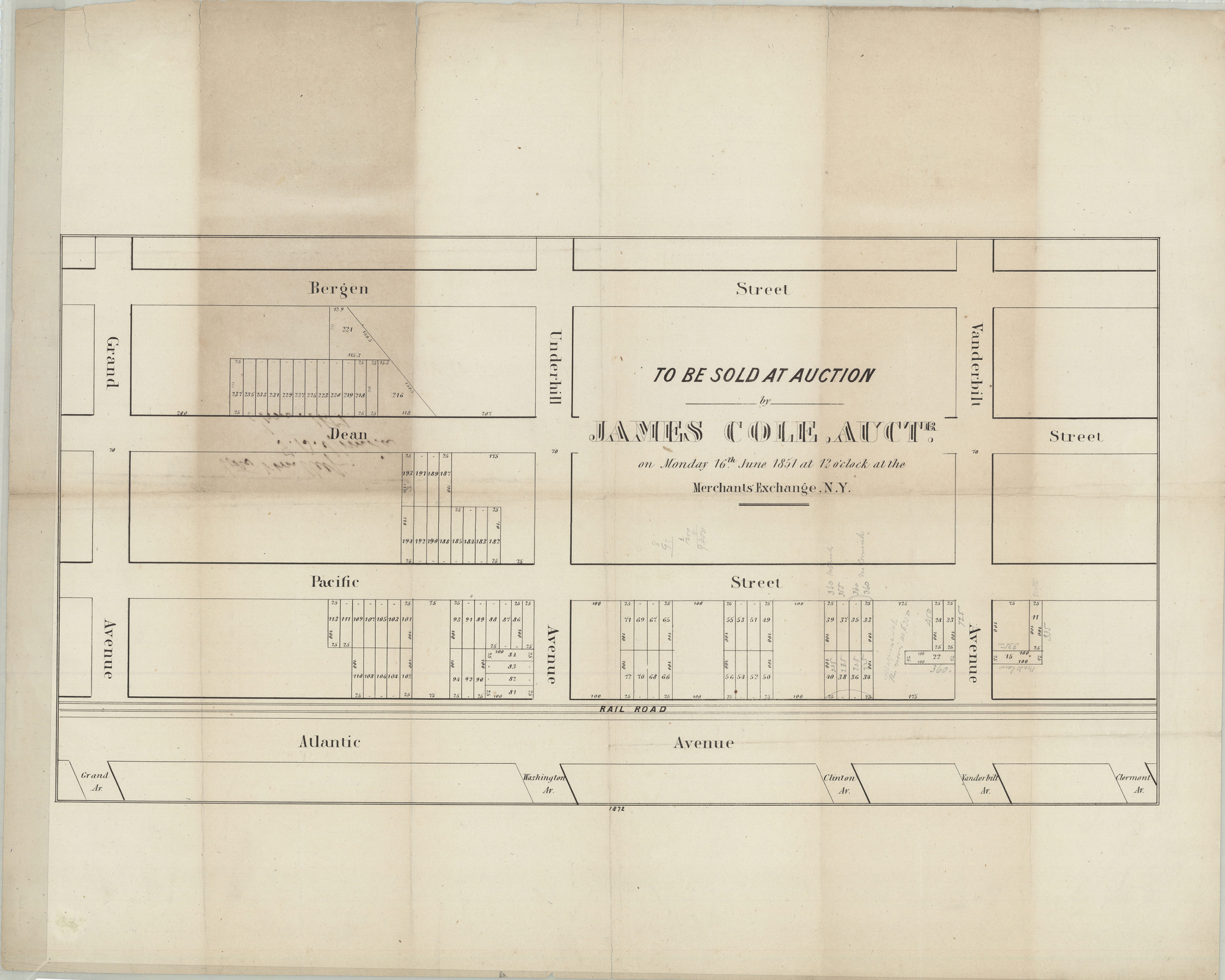
Creator
Publisher
Brooklyn Historical SocietyCitation
To be sold at auction by James Cole, auctr., on Monday, 16th June, 1851, at 12 o’clock at the Merchants’ Exchange, N.Y.; [1851], Map Collection, B P-[1851]c.Fl; Brooklyn Historical Society.Scale
Scale not givenLoading zoom image...