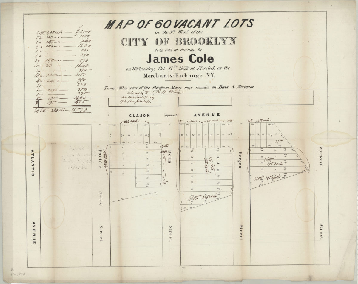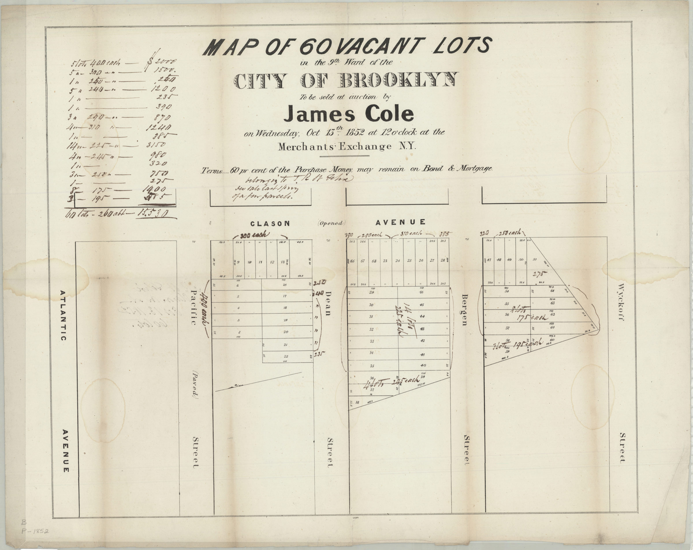
Map of 60 vacant lots in the 9th Ward of the city of Brooklyn, to be sold at auction by James Cole on Wednesday, Oct. 15th, 1852, at 12 o’clock, at the Merchants’ Exchange, N.Y. [1852]
Map No. B P-[1852].Fl
Cadastral map covering area north from Wyckoff St. to Atlantic Ave., and west from Clason Ave. approximately one block (modern-day Prospect Heights). Shows property (including lot numbers and dimensions), and status of streets. Oriented with north to the left. Includes note. “2089”–Lower center margin. BHS has 2 copies: copy 1 annotated in ink.
Map area shown
Genre
Cadastral mapsRelation
Full catalog recordSize
44 × 52 cmDownload
Low Resolution Image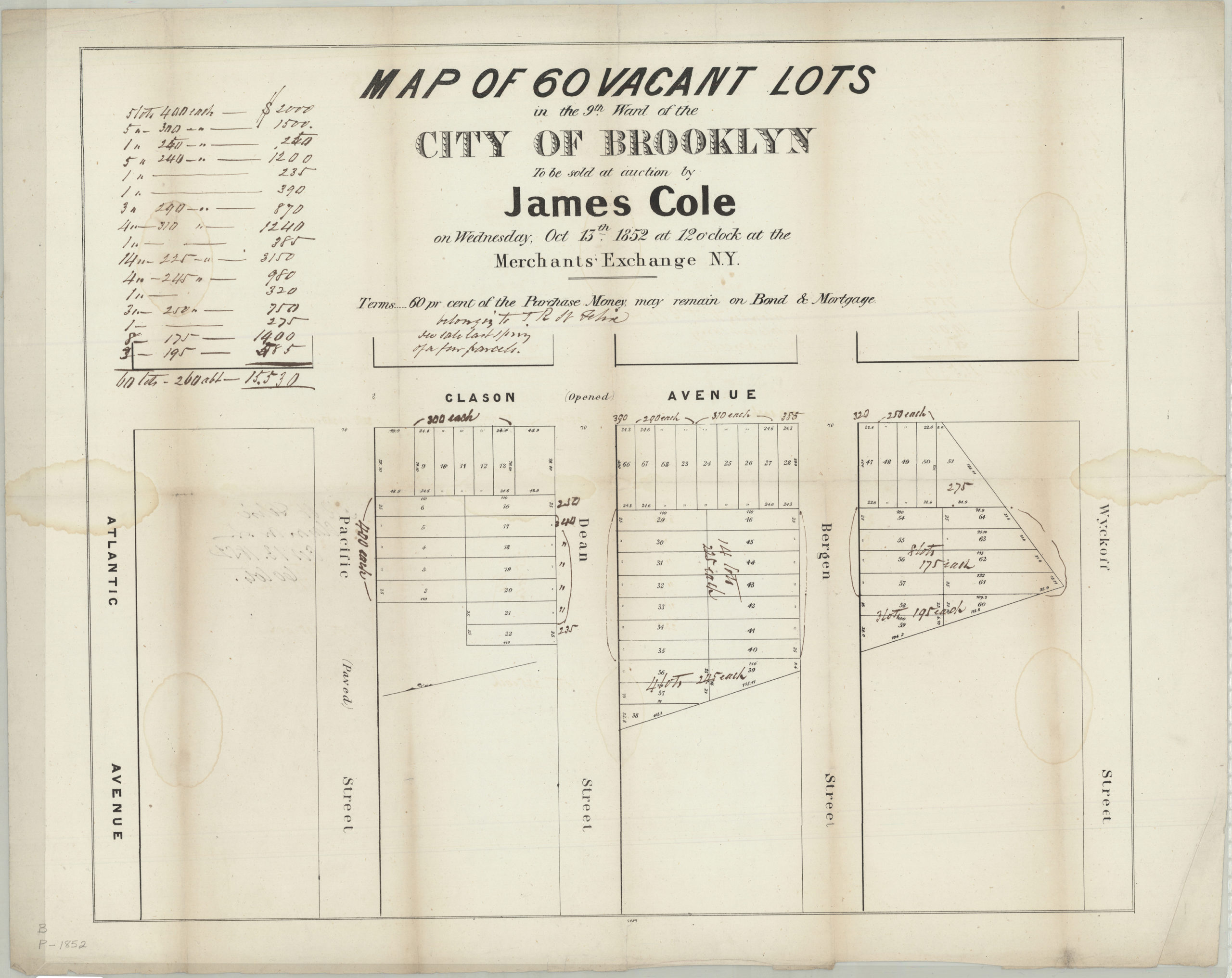
Creator
Publisher
Brooklyn Historical SocietyCitation
Map of 60 vacant lots in the 9th Ward of the city of Brooklyn, to be sold at auction by James Cole on Wednesday, Oct. 15th, 1852, at 12 o’clock, at the Merchants’ Exchange, N.Y.; [1852], Map Collection, B P-[1852].Fl; Brooklyn Historical Society.Scale
Scale not givenLoading zoom image...