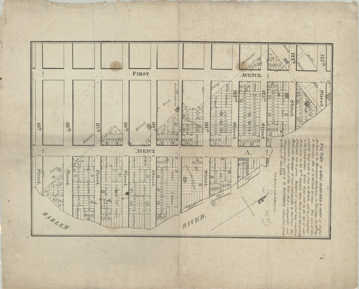
For sale by James Bleecker & Sons at public auction at the Merchants-Exchange, on Thursday, the 19th day of December, 1833, at 12 o’clock at noon [1833]
Map No. M-[1833].Fl
Cadastral map covering area north from 115th St. to 125th St. and east from 1st Ave. to the Harlem River (modern-day East Harlem). Shows property (including lot numbers, dimensions, and buildings), names of landowners, wharves, and docks. Oriented with north to the upper left. Includes text. BHS copy annotated in ink and gray pencil.
Map area shown
Genre
Cadastral mapsRelation
Full catalog recordSize
38 × 58 cmDownload
Low Resolution Image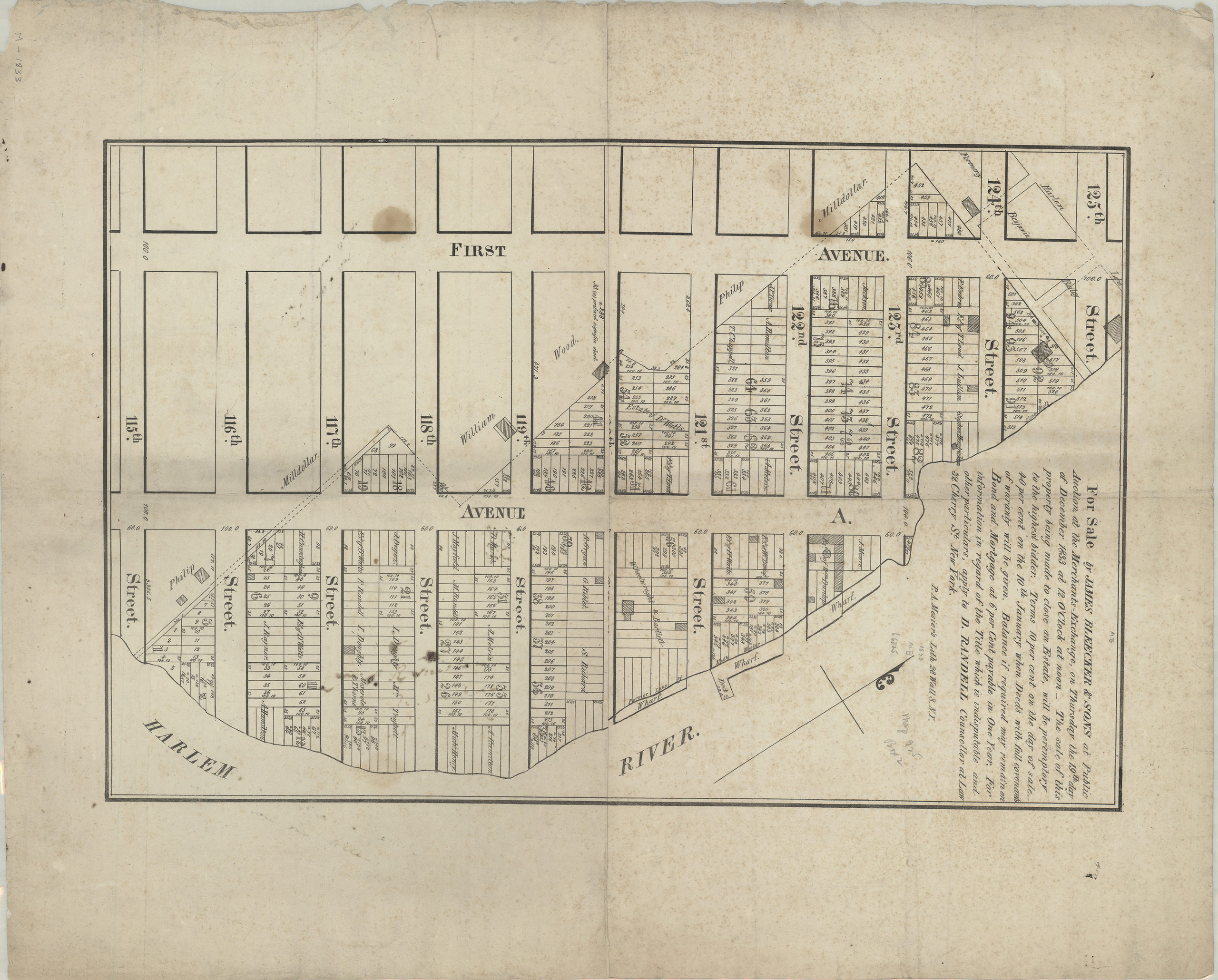
Creator
Mesier, Peter A.,Publisher
Brooklyn Historical SocietyCitation
For sale by James Bleecker & Sons at public auction at the Merchants-Exchange, on Thursday, the 19th day of December, 1833, at 12 o’clock at noon; [1833], Map Collection, M-[1833].Fl; Brooklyn Historical Society.Scale
Scale not givenLoading zoom image...