
Map of the city of Brooklyn 1856
Map No. B A-1856b.Fl
Covers Brooklyn north from 58th St. to Greenpoint and east to the Cemtery of the Evergreens. Shows wards and ferry slips. Oriented with north to the lower left. BHS copy imperfect missing significant portion of the left side, affecting map’s measurements. BHS copy annotated in gray pencil.
Map area shown
Genre
MapRelation
Full catalog recordSize
25 × 39 cmDownload
Low Resolution Image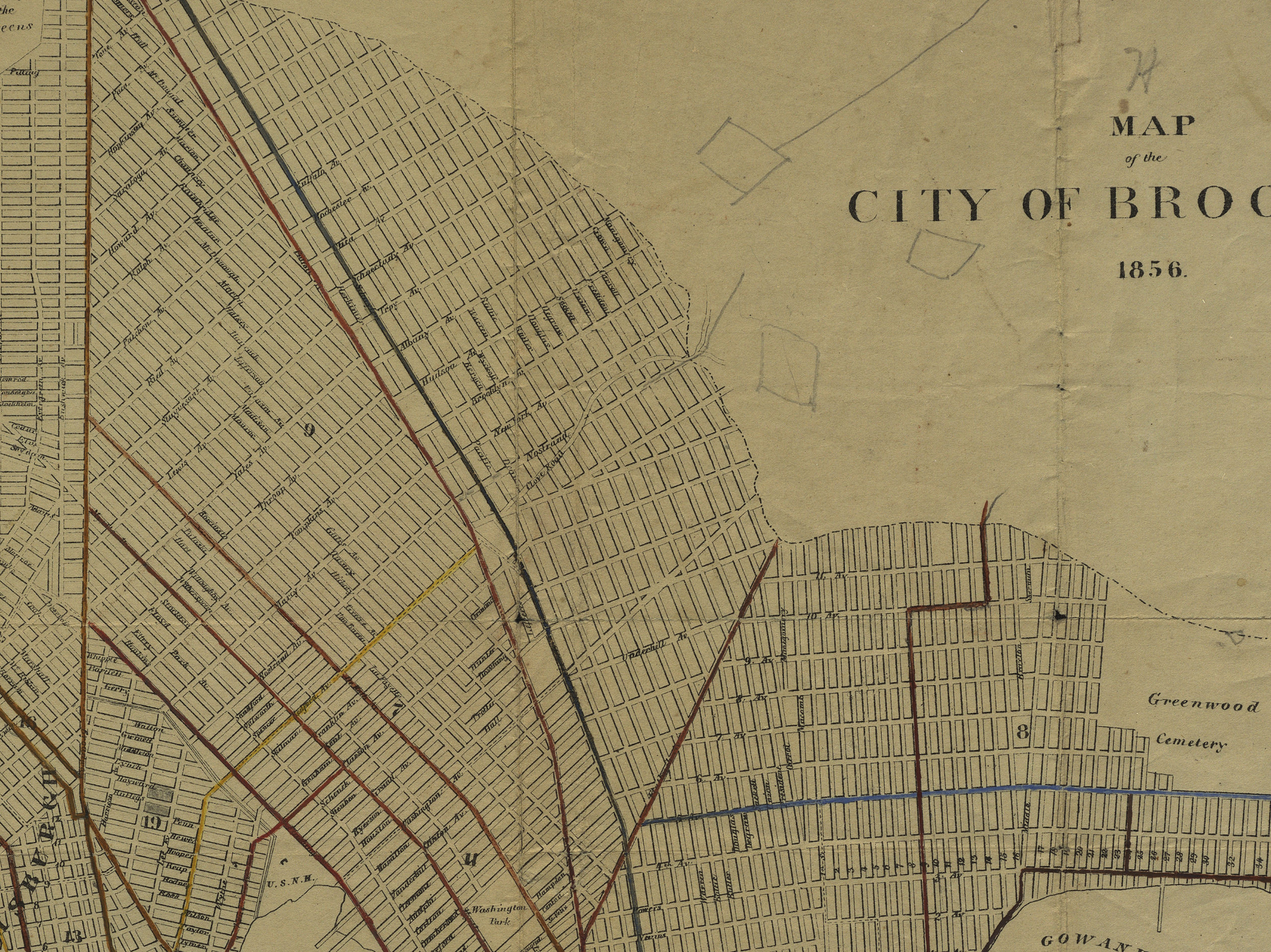
Creator
Hayward, George,Publisher
Brooklyn Historical SocietyCitation
Map of the city of Brooklyn; 1856, Map Collection, B A-1856b.Fl; Brooklyn Historical Society.Scale
Scale not givenLoading zoom image... 