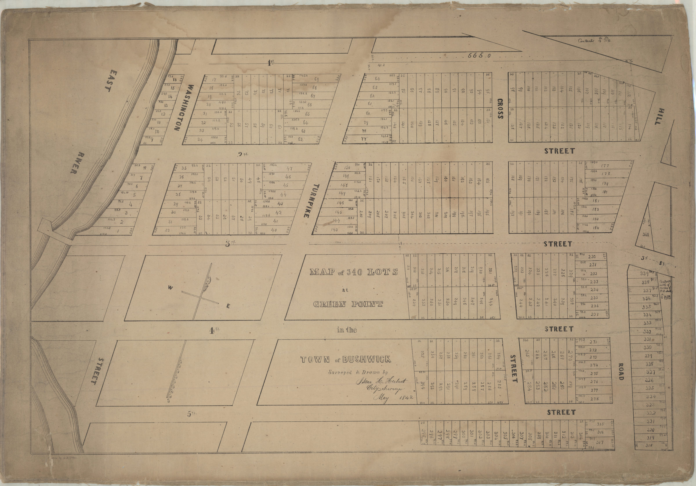
Map of 340 lots at Green Point in the town of Bushwick: surveyed & drawn by Isaac H. Heibeit, city surveyor, May 1842 [1842]
Map No. B P-[1842]a.Fl
Cadastral map covering area north from 5th St. to 1st St. and east from the East River to Hill Rd. Shows property (including lot numbers and dimensions). Orientated with north to upper right. “[Text illegible]tone by G.B. Utter”–Lower left margin.
Map area shown
Genre
Cadastral mapsRelation
Full catalog recordSize
46 × 71 cmDownload
Low Resolution Image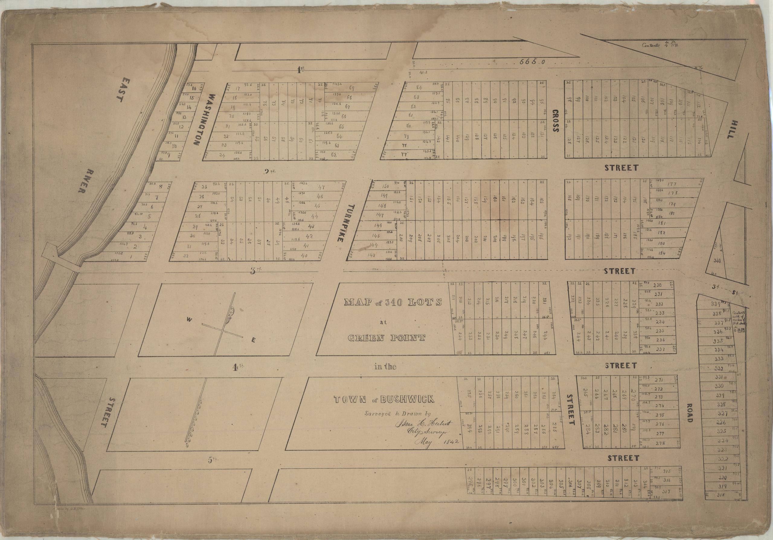
Creator
Heibeit, Isaac H.,Publisher
Brooklyn Historical SocietyCitation
Map of 340 lots at Green Point in the town of Bushwick: surveyed & drawn by Isaac H. Heibeit, city surveyor, May 1842; [1842], Map Collection, B P-[1842]a.Fl; Brooklyn Historical Society.Scale
Scale not givenLoading zoom image... 