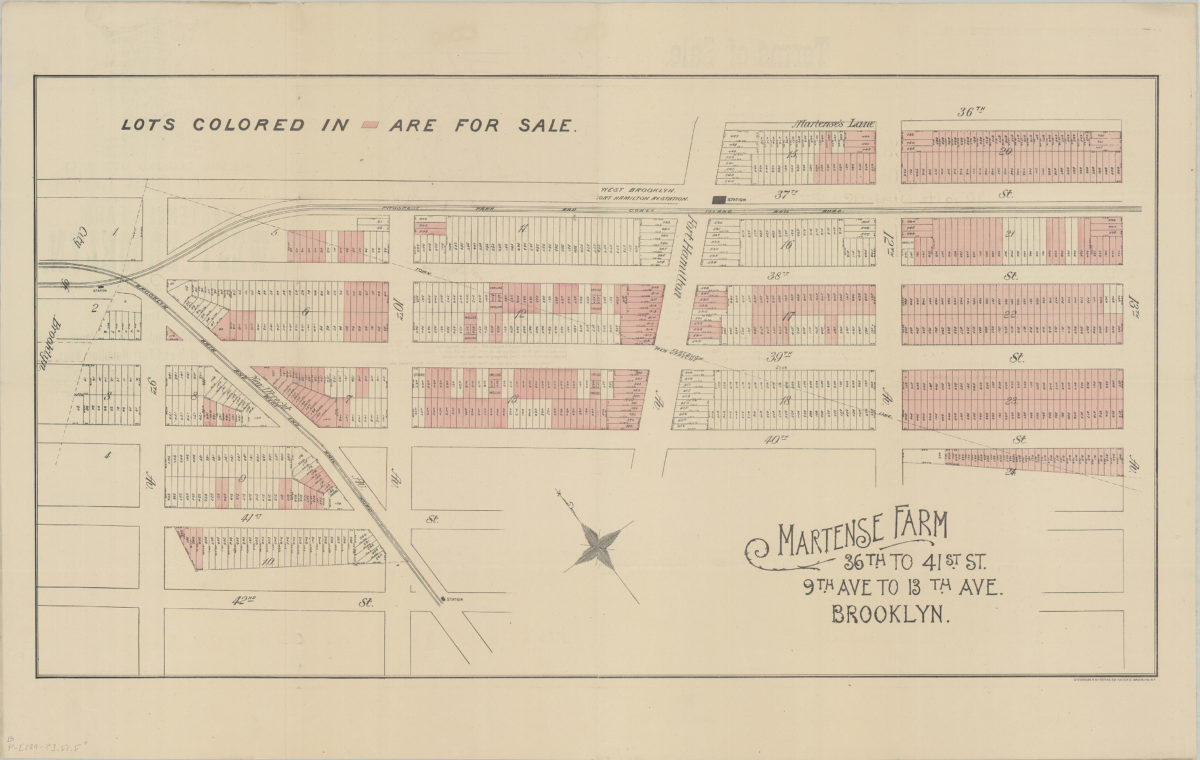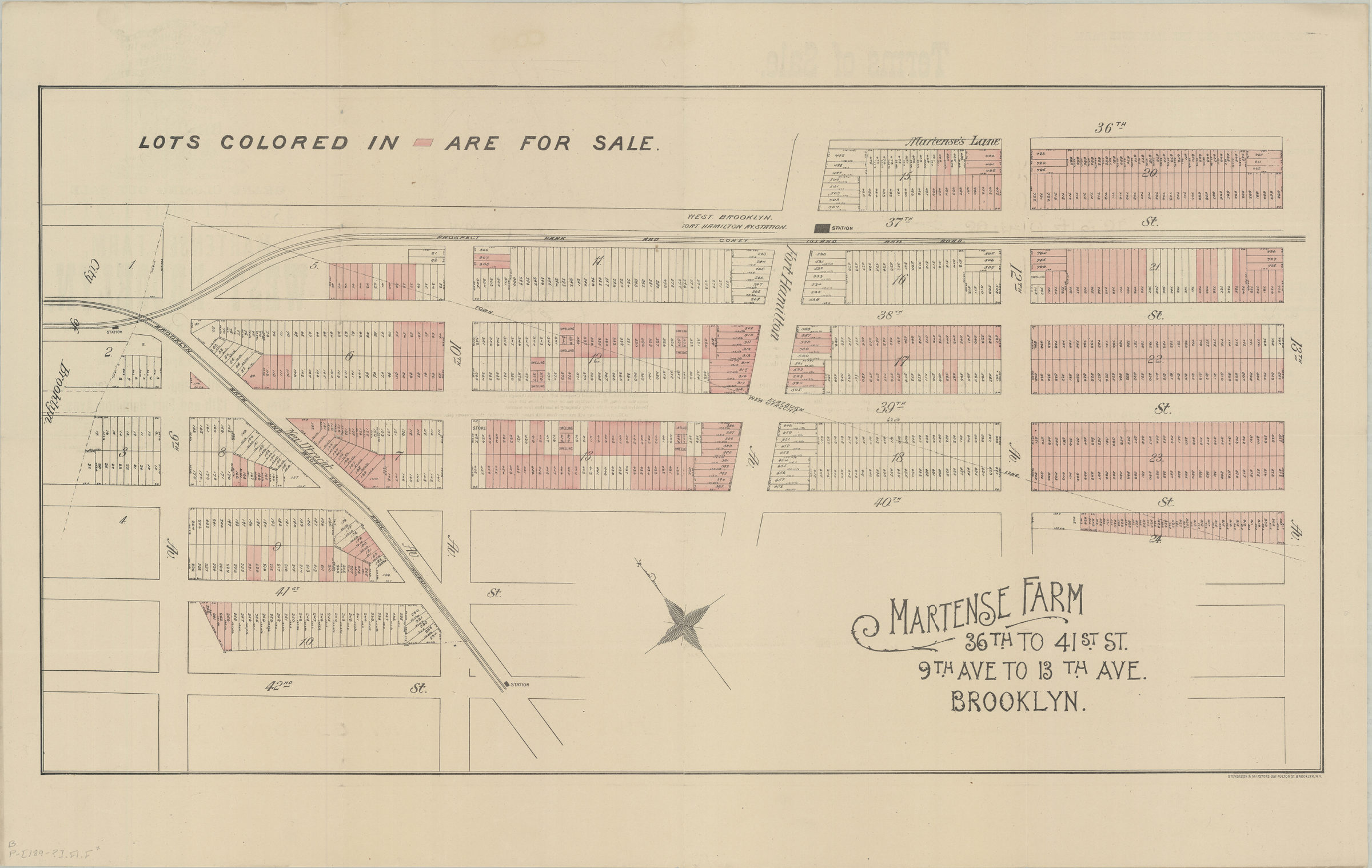
Martense Farm, 36th to 41st St., 9th Ave. to 13th Ave., Brooklyn [189?]
Map No. B P-[189-?].Fl.Folio
Cadastral map covering area in modern-day Borough Park. Shows property (including block numbers, lot numbers, and dimensions), elevated railroads, and administrative division lines. Oriented with north to the upper left.
Subjects
Places
Map area shown
Genre
Cadastral mapsRelation
Full catalog recordSize
49 × 91 cmDownload
Low Resolution Image
Creator
Stevenson and Marsters (Firm),Publisher
Brooklyn Historical SocietyCitation
Martense Farm, 36th to 41st St., 9th Ave. to 13th Ave., Brooklyn; [189?], Map Collection, B P-[189-?].Fl.Folio; Brooklyn Historical Society.Scale
Scale not givenLoading zoom image...