
Plan of the First Ward of the city of New York: showing that part of it which was the seat of the conflagaration on the night of the 16th December, 1835: engraved by J. Spittali, on metal, for the Philadelphia Saturday Courier, [1836]
Map No. M-[1836?].Fl
Covers Manhattan north from the Battery to Maiden Lane. Shows area affected by the Great Fire of 1835. Extracted from an unknown newspaper, possibly the Philadelphia Saturday Courier. Includes list of inhabitants, by street, of the fire-affected area.
Map area shown
Genre
Historical mapsRelation
Full catalog recordSize
17 × 19 cmDownload
Low Resolution Image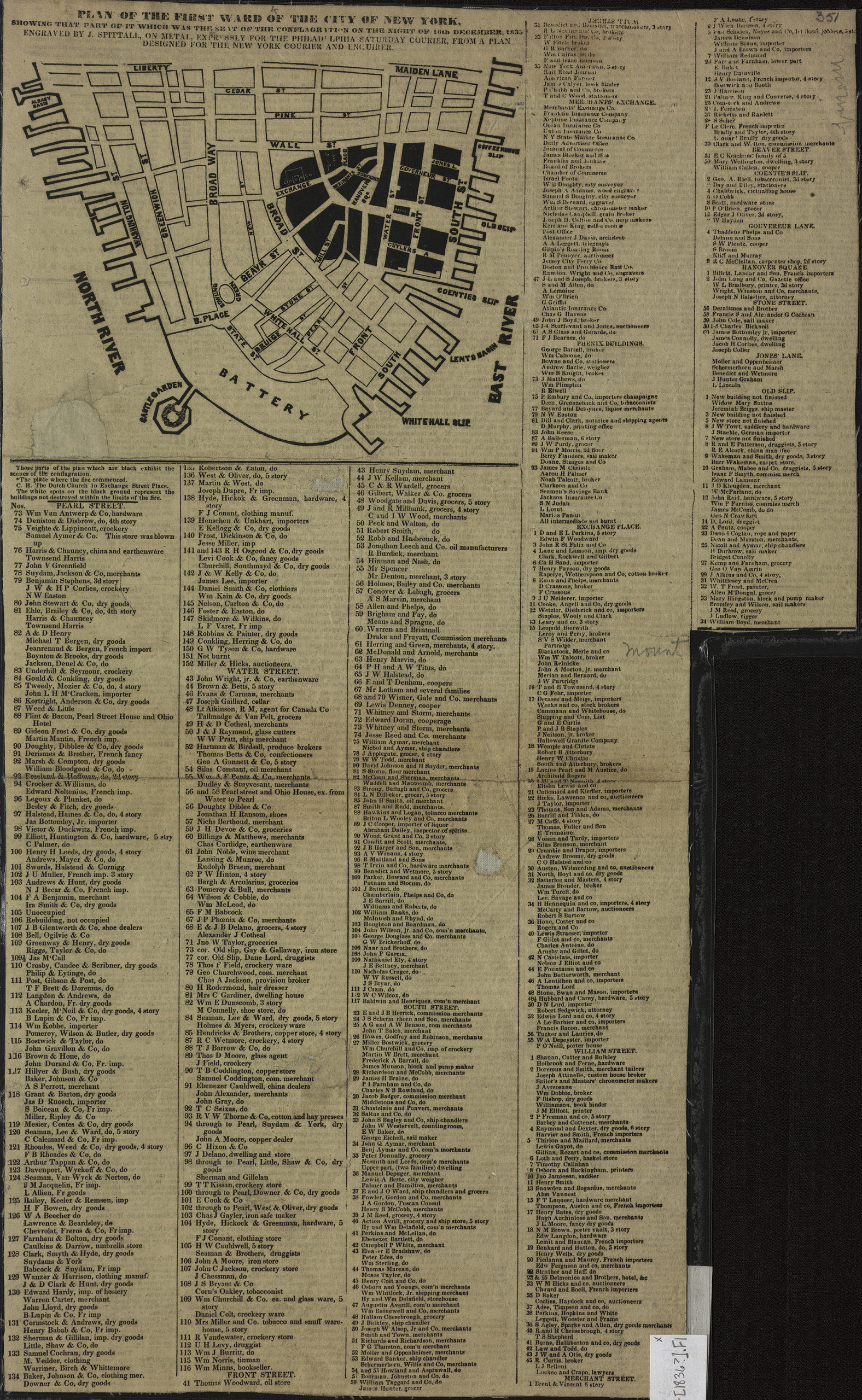
Creator
Spittali, J.,Publisher
Brooklyn Historical SocietyCitation
Plan of the First Ward of the city of New York: showing that part of it which was the seat of the conflagaration on the night of the 16th December, 1835: engraved by J. Spittali, on metal, for the Philadelphia Saturday Courier,; [1836], Map Collection, M-[1836?].Fl; Brooklyn Historical Society.Scale
Scale not givenLoading zoom image... 