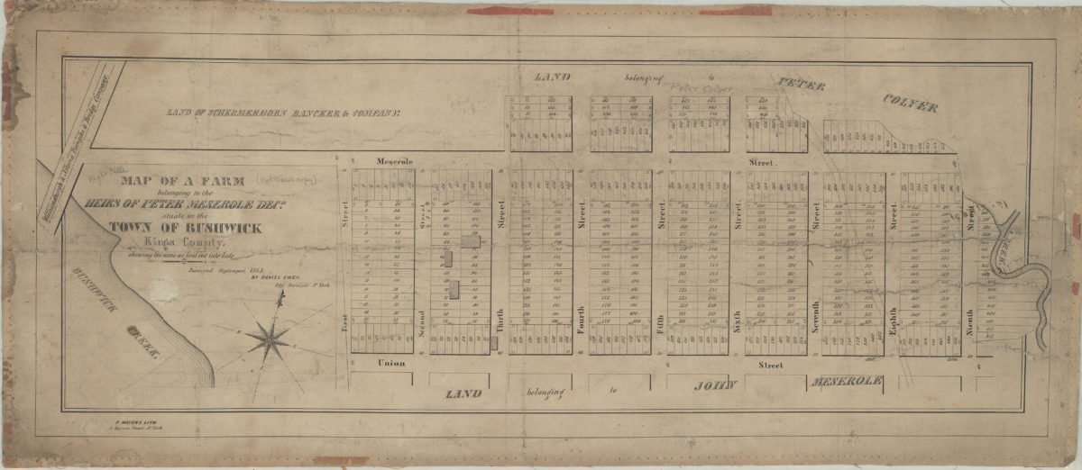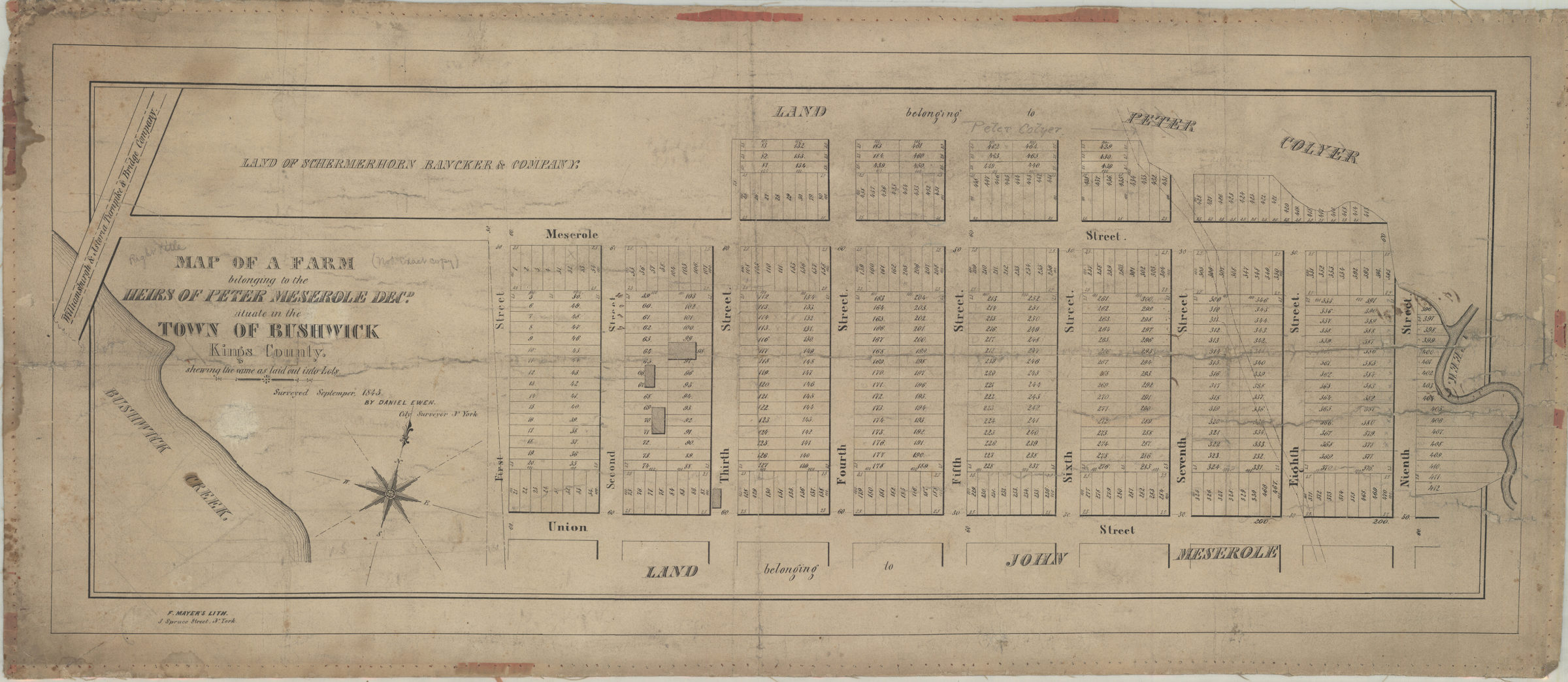
Map of a farm belonging to the heirs of Peter Meserole, decd., situate[d] in the town of Bushwick, Kings County: shewing [sic] the same as laid out into lots: surveyed Septemper [sic], 1845 by Daniel Ewen, city surveyor, N. York [1845]
Map No. B P-[1845]a.Fl
Cadastral map covering area north from Union St. to Meserole St. and east from Bushwick Creek to 9th St. (modern-day Greenpoint). Shows property (including lots, dimensions, and buildings), and names of landowners.
Map area shown
Genre
Cadastral mapsRelation
Full catalog recordSize
24 × 70 cmDownload
Low Resolution Image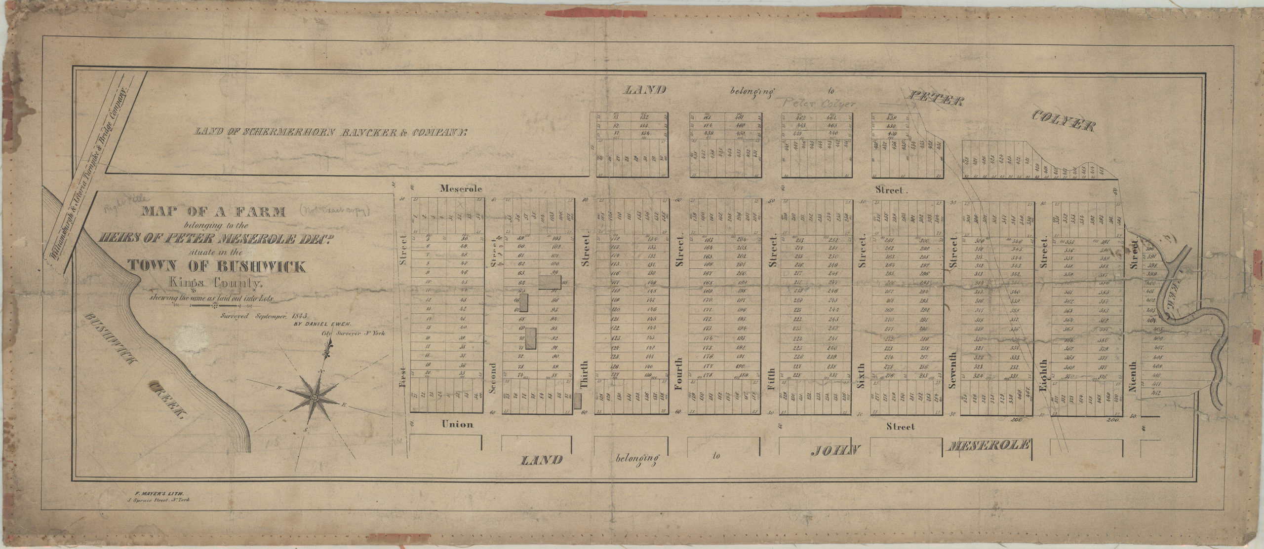
Creator
Ewen, Daniel,Publisher
Brooklyn Historical SocietyCitation
Map of a farm belonging to the heirs of Peter Meserole, decd., situate[d] in the town of Bushwick, Kings County: shewing [sic] the same as laid out into lots: surveyed Septemper [sic], 1845 by Daniel Ewen, city surveyor, N. York; [1845], Map Collection, B P-[1845]a.Fl; Brooklyn Historical Society.Scale
Scale not givenLoading zoom image...