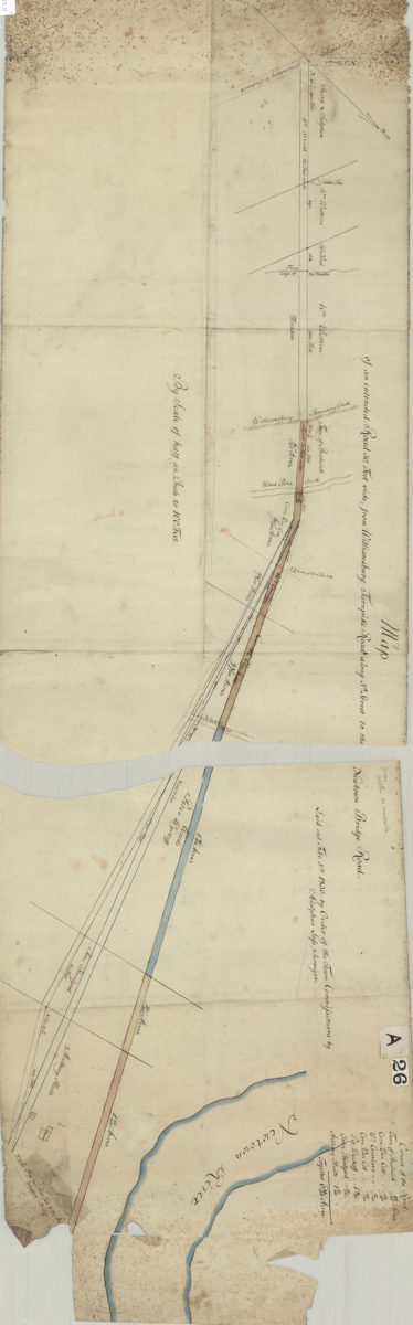
Map of an intended road 50 feet wide, from Williamsburg Turnpike Road along 5th Street to the Newtown Bridge Road: laid out … by order of the Town Commissioners: by Adolphus Lofs, surveyor February 5, 1830
Map No. B P-1830.Fl.O
Covers area in modern-day Williamsburg and Greenpoint. Also shows names of “owners of the road.” Oriented with north to the upper right.
Subjects
Places
Map area shown
Genre
Manuscript mapsRelation
Full catalog recordSize
39 × 122 cmDownload
Low Resolution Image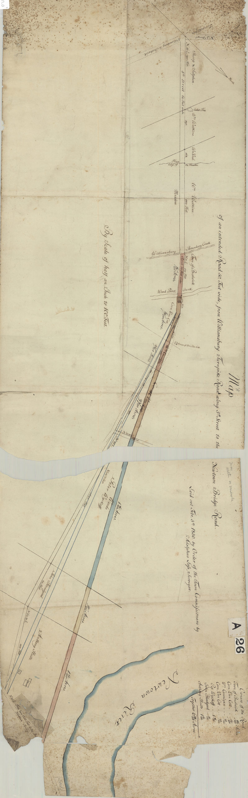
Creator
Lofs, Adolphus,Publisher
Brooklyn Historical SocietyCitation
Map of an intended road 50 feet wide, from Williamsburg Turnpike Road along 5th Street to the Newtown Bridge Road: laid out … by order of the Town Commissioners: by Adolphus Lofs, surveyor; February 5, 1830, Map Collection, B P-1830.Fl.O; Brooklyn Historical Society.Scale
Scale [1:2,400] Half 1 inLoading zoom image...