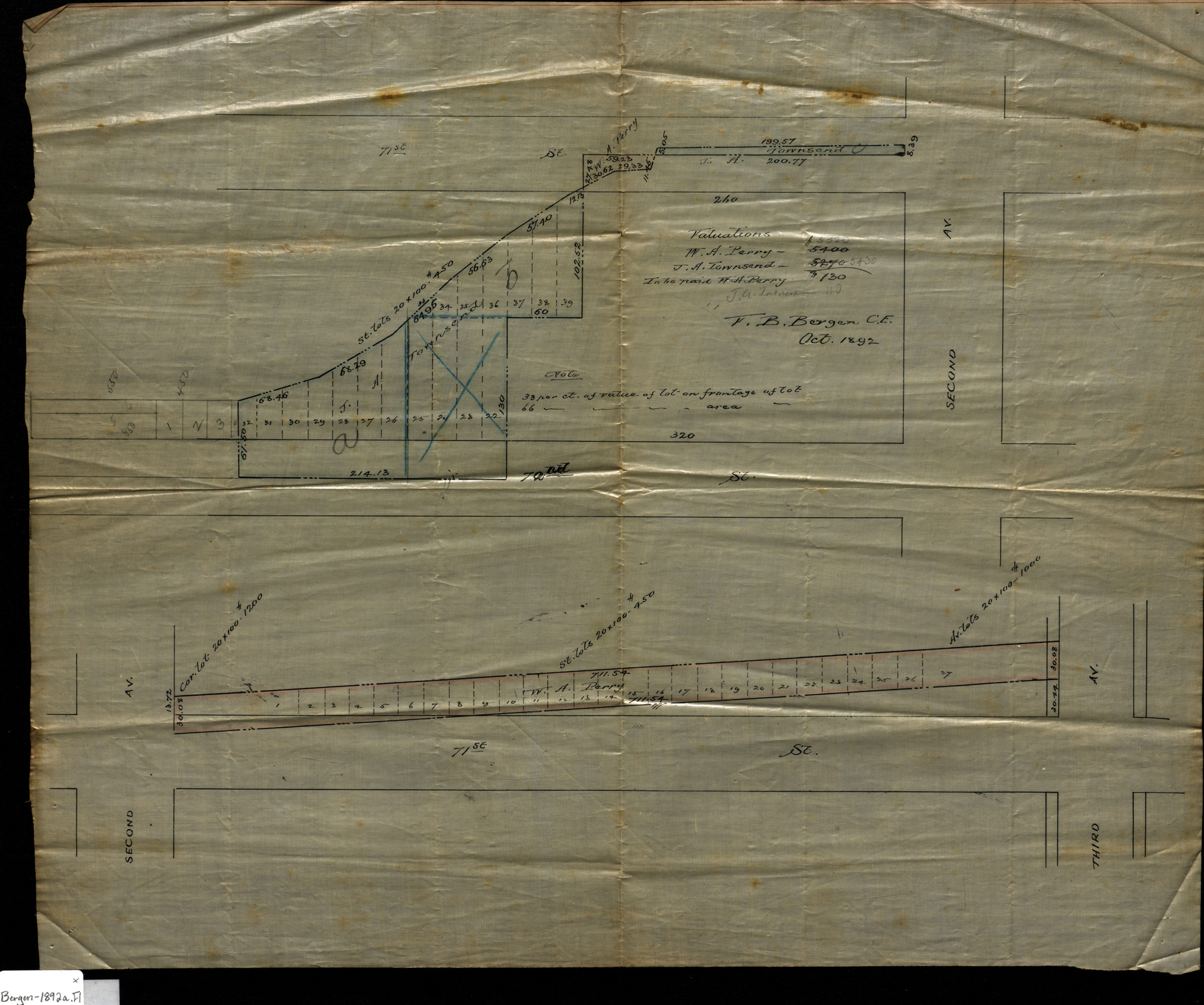

[Map of 70th St. and 71st St. at 2nd Ave.]: V.B. Bergen, C.E. October 1892
Map No. Bergen-1892a.Fl
Cadastral map covering area in modern-day Bay Ridge. Shows property (including lot numbers and dimensions), and names of landowners. Title devised by cataloger. Composed of 2 segments. Includes notes.
Map area shown
Relation
Full catalog recordSize
40 × 48 cmDownload
Low Resolution Image
Creator
Bergen, Van Brunt, Bergen, Van Brunt,Publisher
Brooklyn Historical Society, Brooklyn Historical SocietyCitation
[Map of 70th St. and 71st St. at 2nd Ave.]: V.B. Bergen, C.E.; October 1892, Map Collection, Bergen-1892a.Fl; Brooklyn Historical Society.Scale
Scale not givenLoading zoom image... 