
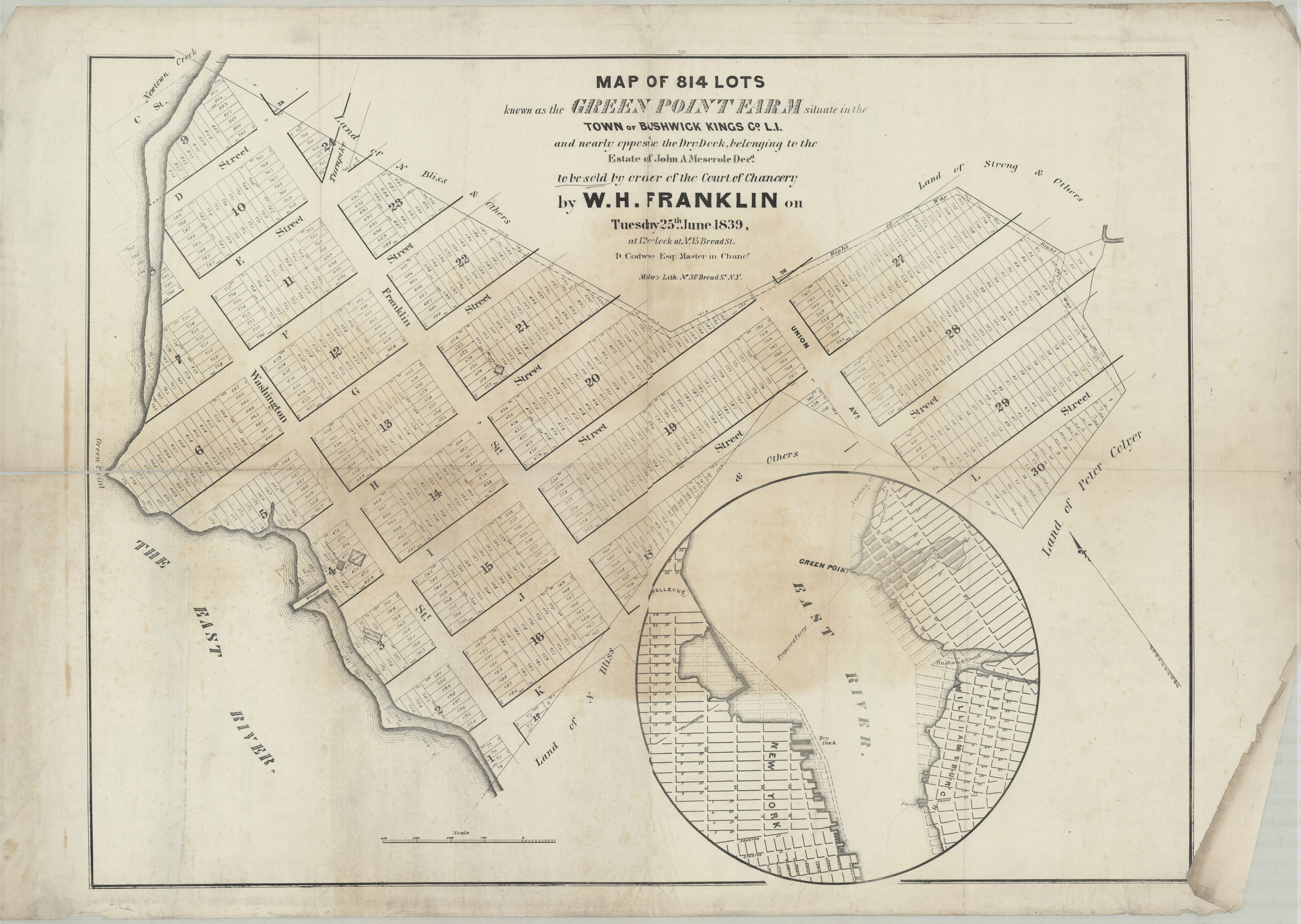
Map of 814 lots known as the Green Point Farm situate[d] in the town of Bushwick, Kings Co., L.I., and nearly opposite the dry dock belonging to the estate of John A. Meserole, decd., to be sold by order of the Court of Chancery by W.H. Franklin [1839]
Map No. B P-[1839].Fl.Folio
Cadastral map covering area east from the East River to Union St. and north from L St. to Newtown Creek (modern-day Greenpoint). Shows property (including lot numbers, dimensions, and buildings), and names of landowners. Oriented with north to the upper left. Includes inset location map. “531”–Upper center margin. BHS has 5 copies c. 2-5 are no accessible due to condition.
Map area shown
Genre
Cadastral mapsRelation
Full catalog recordSize
68 × 90 cmDownload
Low Resolution Image
Creator
Miller & Co., Miller & Co.,Publisher
Brooklyn Historical Society, Brooklyn Historical SocietyCitation
Map of 814 lots known as the Green Point Farm situate[d] in the town of Bushwick, Kings Co., L.I., and nearly opposite the dry dock belonging to the estate of John A. Meserole, decd., to be sold by order of the Court of Chancery by W.H. Franklin; [1839], Map Collection, B P-[1839].Fl.Folio; Brooklyn Historical Society.Scale
Scale [ca. 1:1,066]Loading zoom image... 