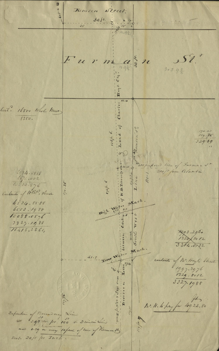
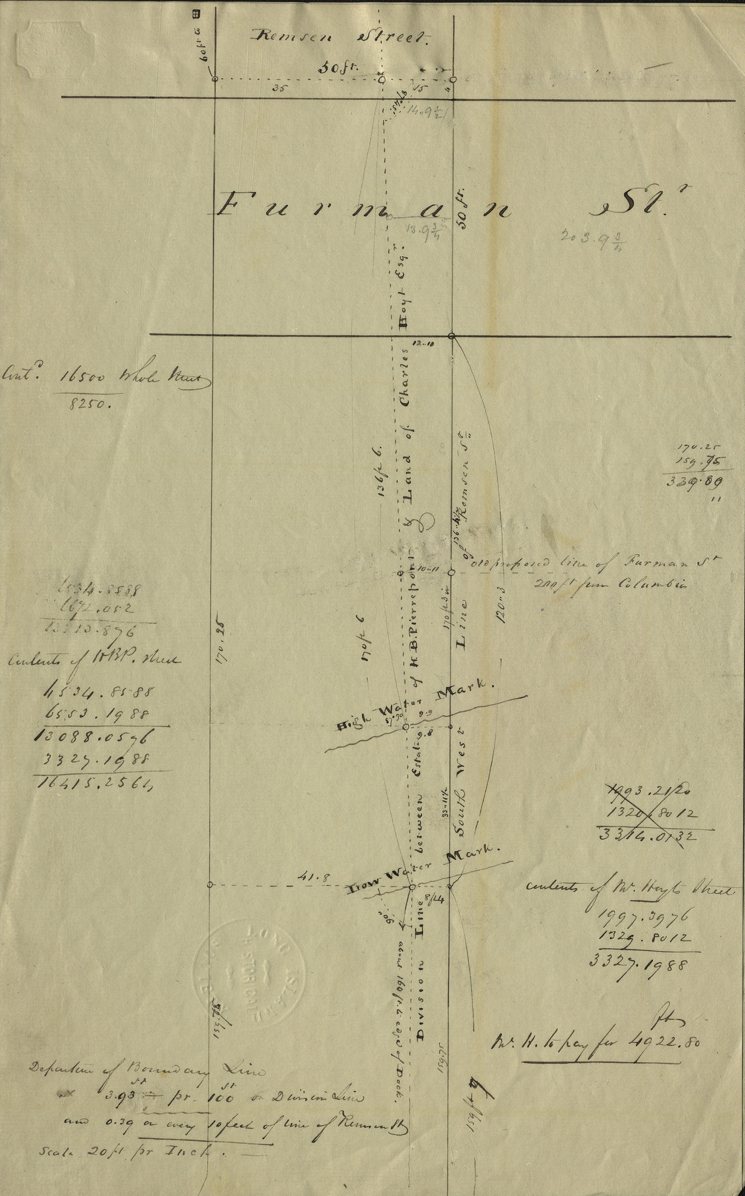
[Map of Remsen St. and Furman St.]. [18??]
Map No. B P-[18--?]i.Fl
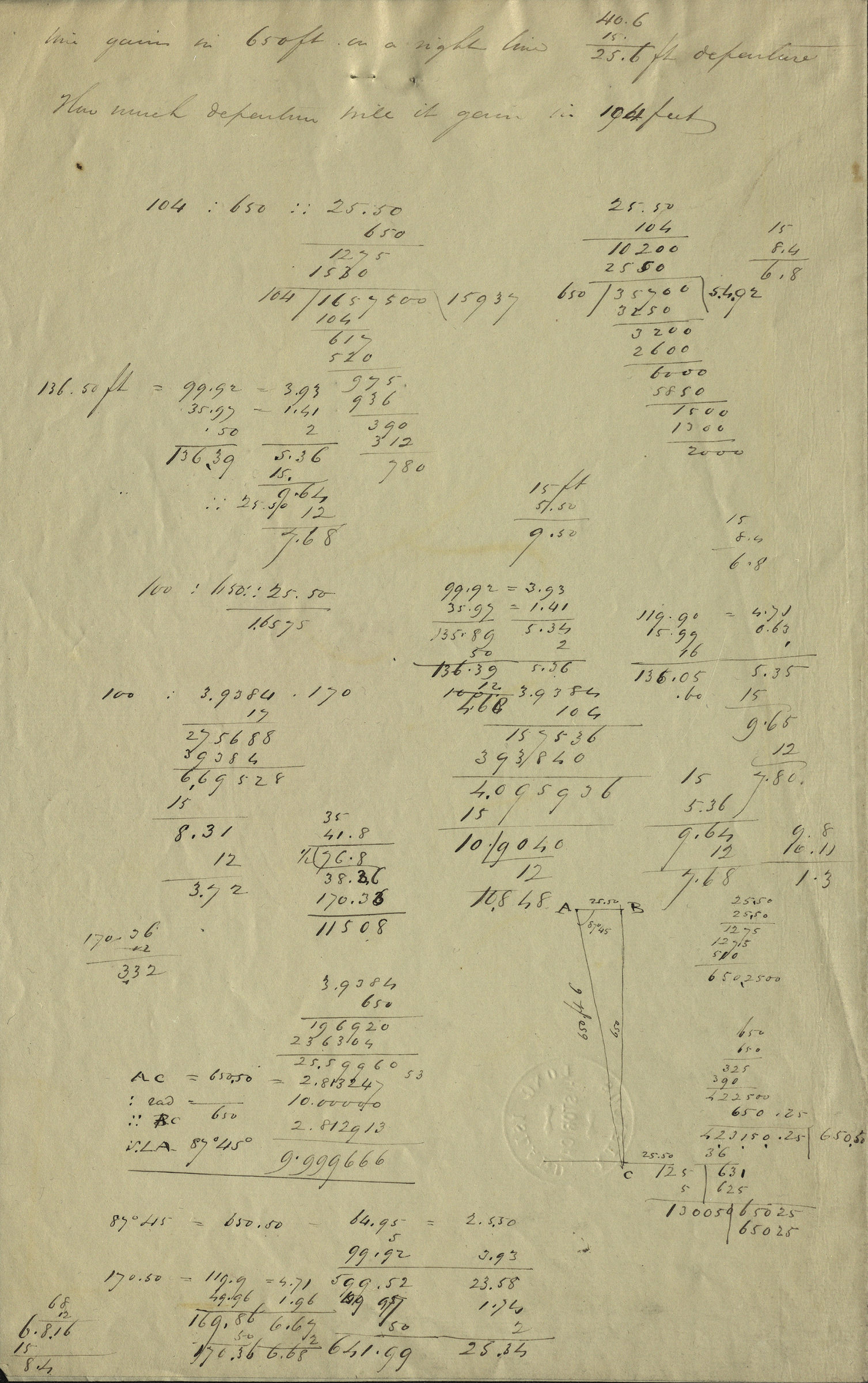
Cadastral map covering area in modern-day Brooklyn Heights. Shows property division lines, names of landowners, and high/low water marks. Title devised by cataloger. Oriented with north to the left. Includes notes and calculations. Watermarked.
Map area shown
Relation
Full catalog recordSize
32 × 40 cmDownload
Low Resolution Image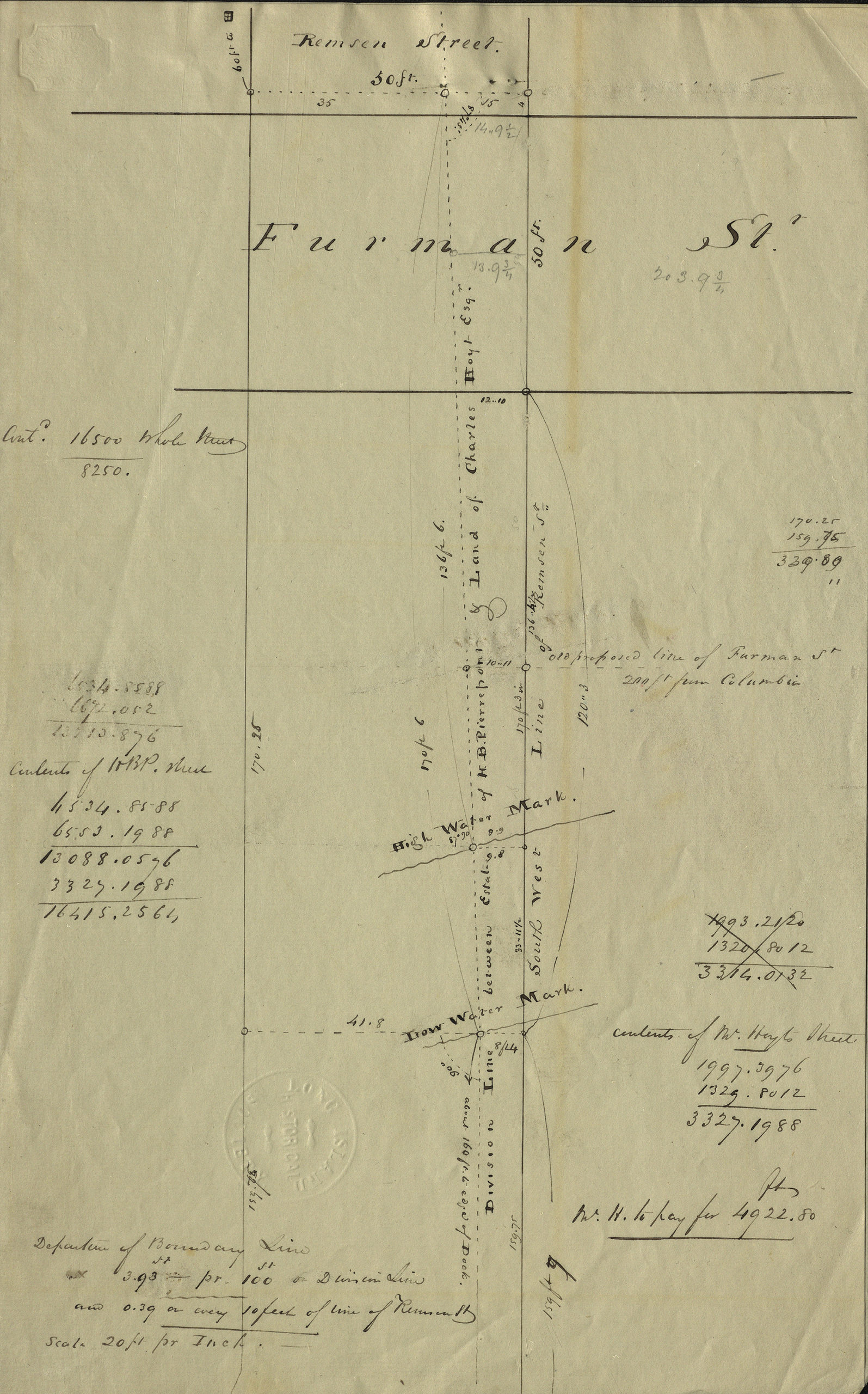
Creator
Publisher
Brooklyn Historical SocietyCitation
[Map of Remsen St. and Furman St.].; [18??], Map Collection, B P-[18--?]i.Fl; Brooklyn Historical Society.Scale
Scale not givenLoading zoom image...