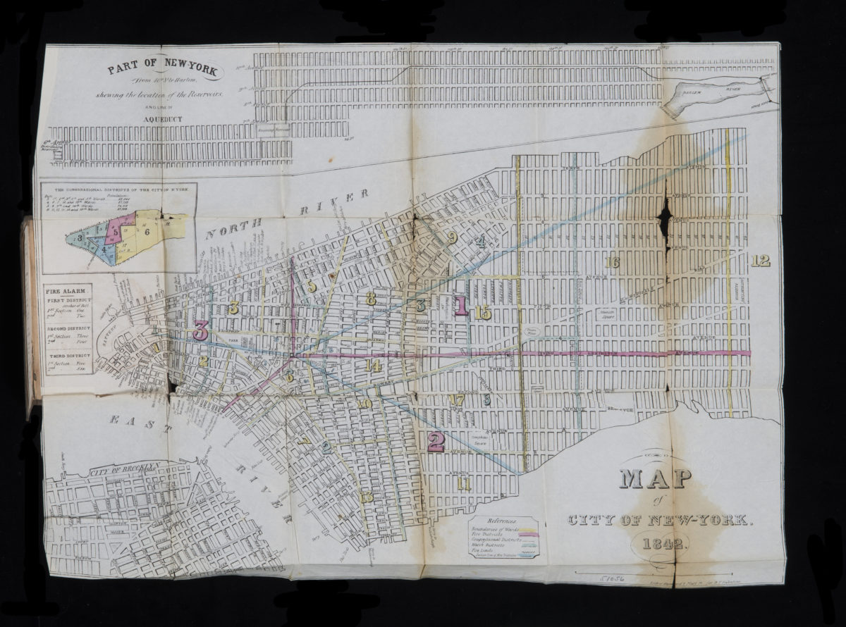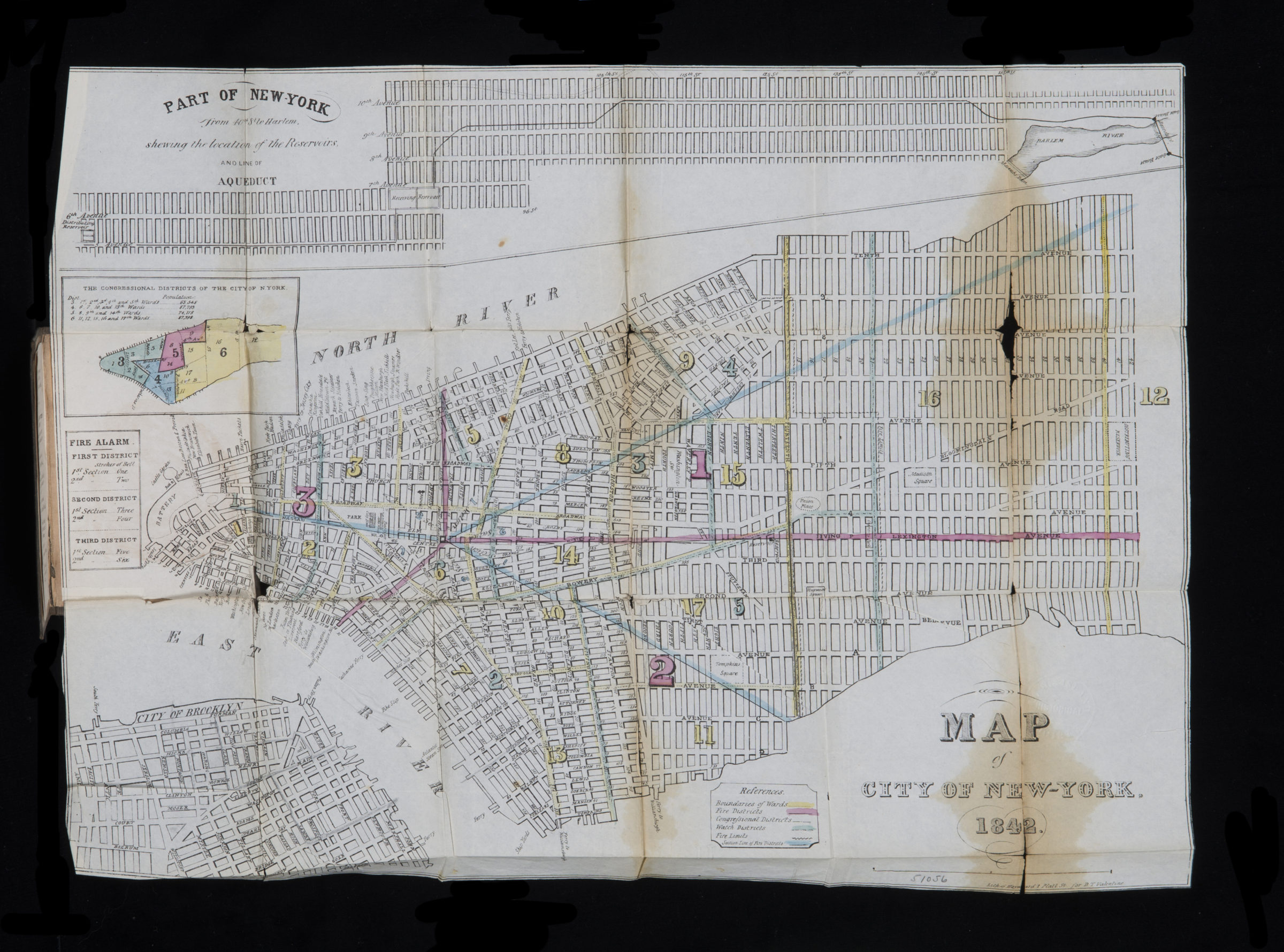
Map of city of New-York 1842
Map No. M-1842.Folded.RA
Covers Manhattan north from the Battery to 42nd St. also covers part of DUMBO and Brooklyn Heights. Shows wards, fire districts, congressional districts, watch districts, piers, and ferry slips. Oriented with north to the right. “Lith. by G. Hayward … for D.T. Valentine.” Inside cover: List of hotels — Hackney coaches and cabs — Rates and prices of fare of porters and handcartmen. Includes 2 insets, key, and description of fire alarms. Insets: The congressional districts of the city of N. York — Part of New York from 40th St. to Harlem, shewing the location of the reservoirs and line of aqueduct.
Map area shown
Genre
MapRelation
Full catalog recordSize
35 × 46 cmDownload
Low Resolution Image
Creator
Hayward, George,Publisher
Brooklyn Historical SocietyCitation
Map of city of New-York; 1842, Map Collection, M-1842.Folded.RA; Brooklyn Historical Society.Scale
Scale not givenLoading zoom image...