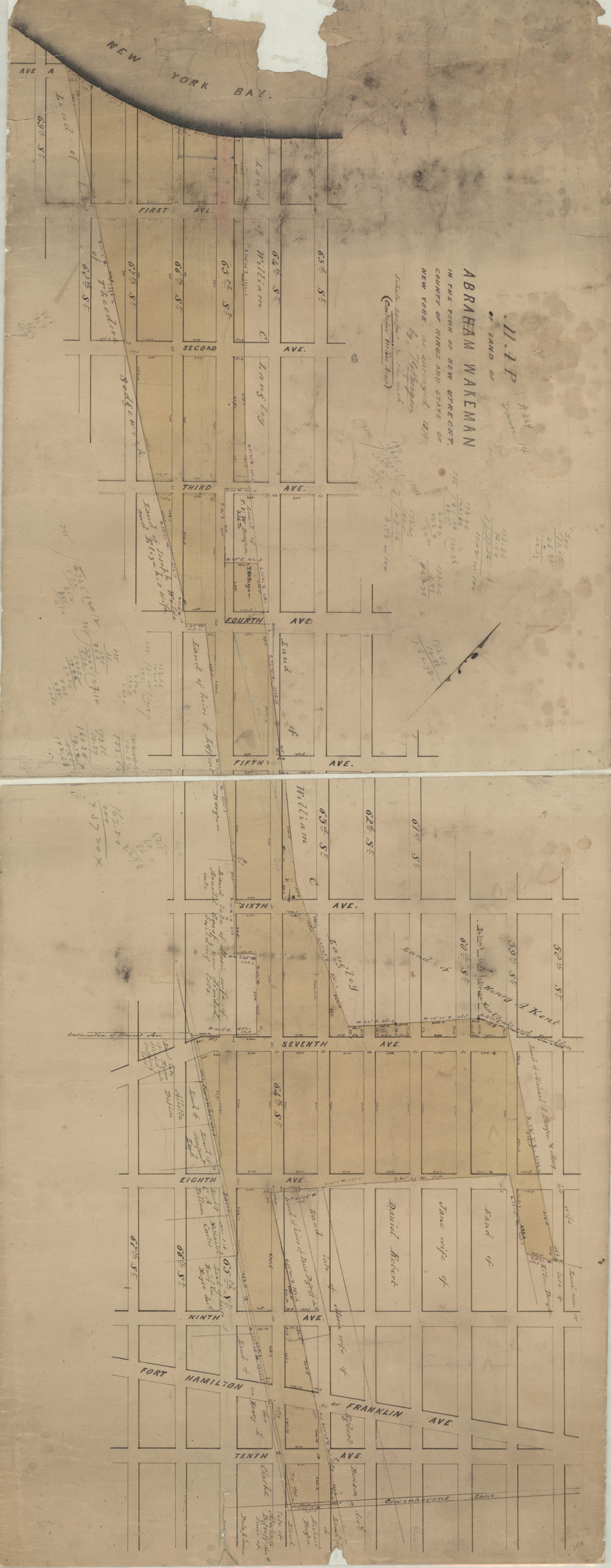
Map of land of Abraham Wakeman, in the town of New Utrecht, county of Kings, and state of New York: as surveyed by T.G. Bergen 1873
Map No. Bergen-1873.Fl
Cadastral map covering area north from 69th St. to 58th St. and east from New York Bay to 10th Ave. (modern-day Bay Ridge, Dyker Heights, and Sunset Park). Shows property (including lots), and names of landowners. Oriented with north to the upper left. Includes notes and calculations.
Subjects
Places
Map area shown
Relation
Full catalog recordSize
44 × 112 cmDownload
Low Resolution Image
Creator
Bergen, Teunis G.,Publisher
Brooklyn Historical SocietyCitation
Map of land of Abraham Wakeman, in the town of New Utrecht, county of Kings, and state of New York: as surveyed by T.G. Bergen; 1873, Map Collection, Bergen-1873.Fl; Brooklyn Historical Society.Scale
Scale [1:3,120] 1 in to 2Loading zoom image... 