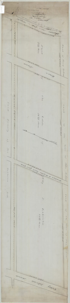
[Map of Ave. C between the Flatbush Main Rd. and Coney Island Ave.]: surveyed … [by] Charles Crooke, engineer & surveyor January 1891
Map No. B P-1891a.Fl.O
Cadastral map covering area in modern-day Kensington. Shows property (including acreages), and names of landowners. Title devised by cataloger. Oriented with north to the lower left.
Map area shown
Relation
Full catalog recordSize
29 × 130 cmDownload
Low Resolution ImageCreator
Crooke, Charles,Publisher
Brooklyn Historical SocietyCitation
[Map of Ave. C between the Flatbush Main Rd. and Coney Island Ave.]: surveyed … [by] Charles Crooke, engineer & surveyor; January 1891, Map Collection, B P-1891a.Fl.O; Brooklyn Historical Society.Scale
Scale [1:960] 1 in to 80Loading zoom image...