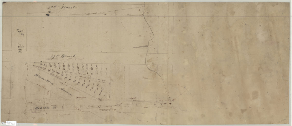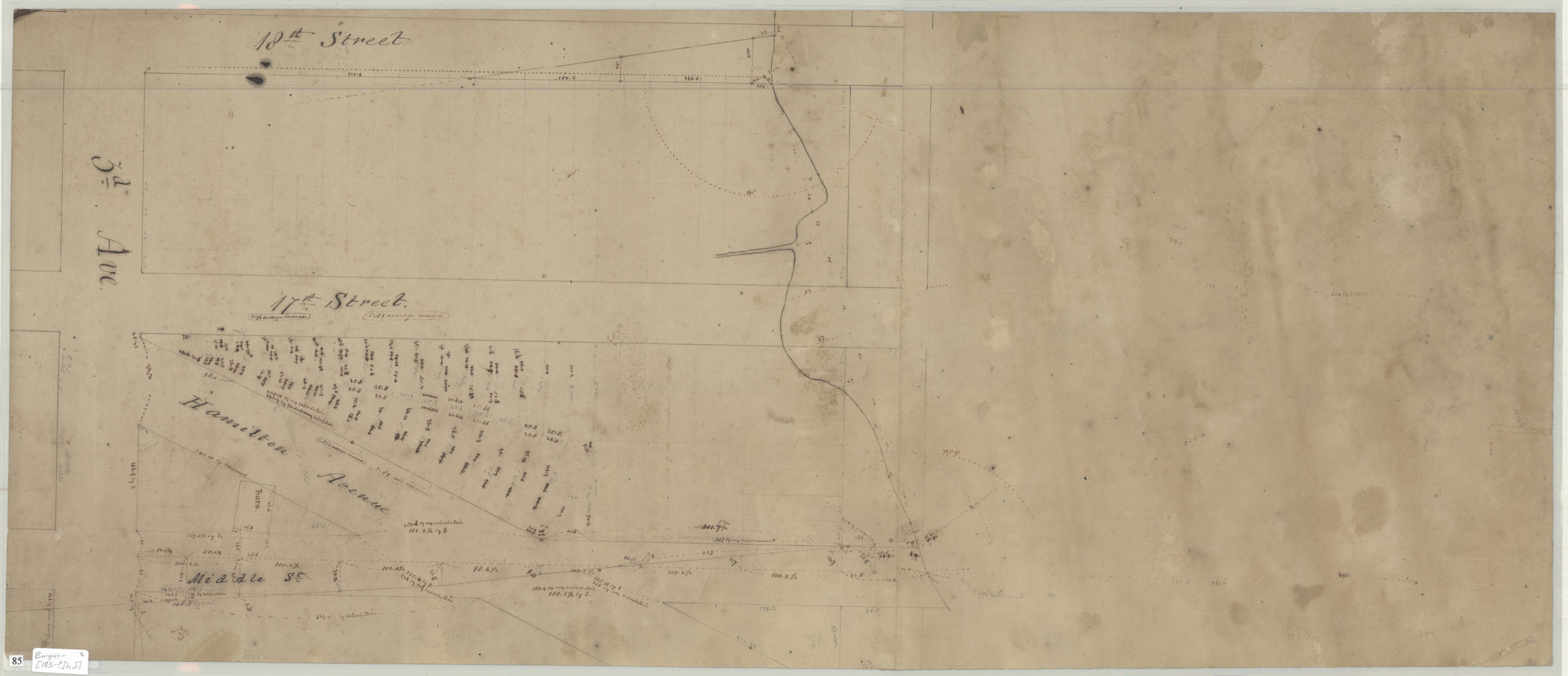
Map of r.rd. survey [189?]
Map No. Bergen-[185-?]h.Fl
Likely covers area in Brooklyn. Cataloger unable to determine modern geographic coverage no place or street names shown on map. Relief shown by shading. Oriented with north the upper right. Includes 3 profiles.
Map area shown
Relation
Full catalog recordSize
36 × 56 cmDownload
Low Resolution Image
Creator
Bergen, Van Brunt,Publisher
Brooklyn Historical SocietyCitation
Map of r.rd. survey; [189?], Map Collection, Bergen-[185-?]h.Fl; Brooklyn Historical Society.Scale
Scale not givenLoading zoom image...