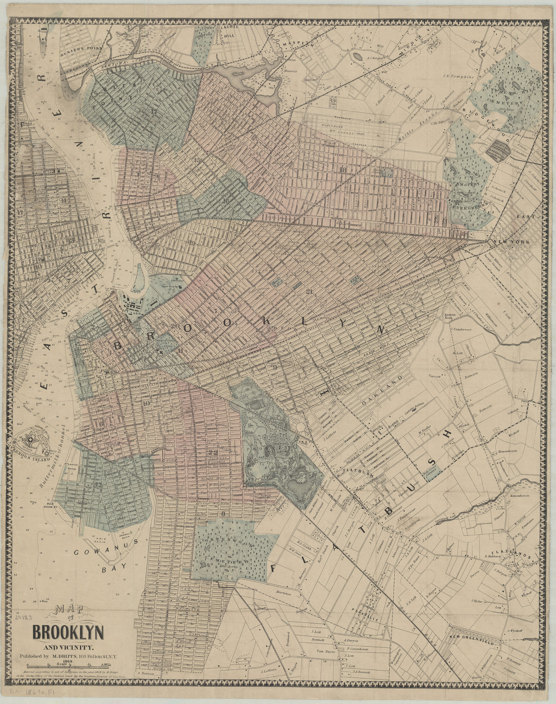
Map of Brooklyn and vicinity 1869
Map No. B A-1869a.Fl
Covers the city of Brooklyn north from 59th St. to Green Point, and east to the Cemetery of the Evergreens . Also covers portions of Lower Manhattan, Governor’s Island, Flatbush, East New York, and Queens. Shows wards and names of property owners. Depths shown by soundings and isolines. “Entered according to act of Congress, in the year 1869 by M. Dripps in the Clerks Office of the District Court for the Southern District of New York.”
Map area shown
Relation
Full catalog recordSize
58 × 47 cmDownload
Low Resolution Image
Creator
Dripps, M.,Publisher
Brooklyn Historical SocietyCitation
Map of Brooklyn and vicinity; 1869, Map Collection, B A-1869a.Fl; Brooklyn Historical Society.Scale
Scale [ca. 1:22,528]Loading zoom image... 