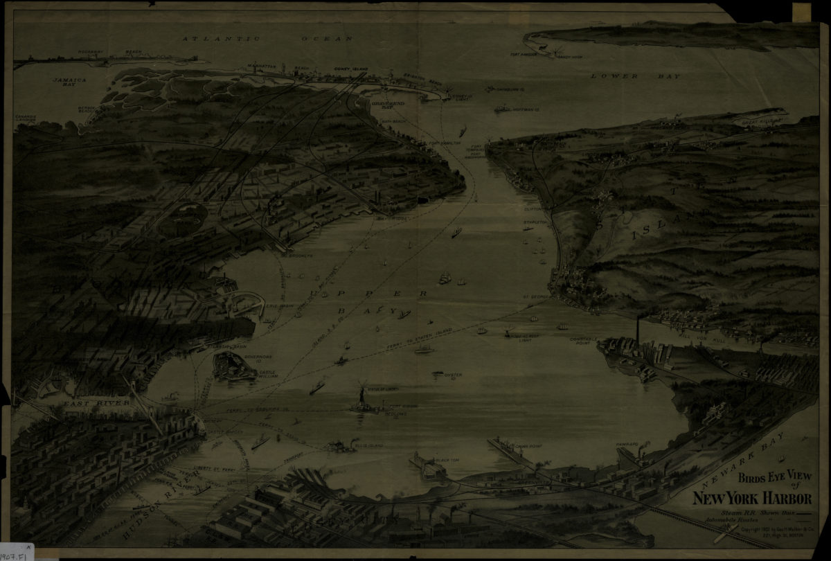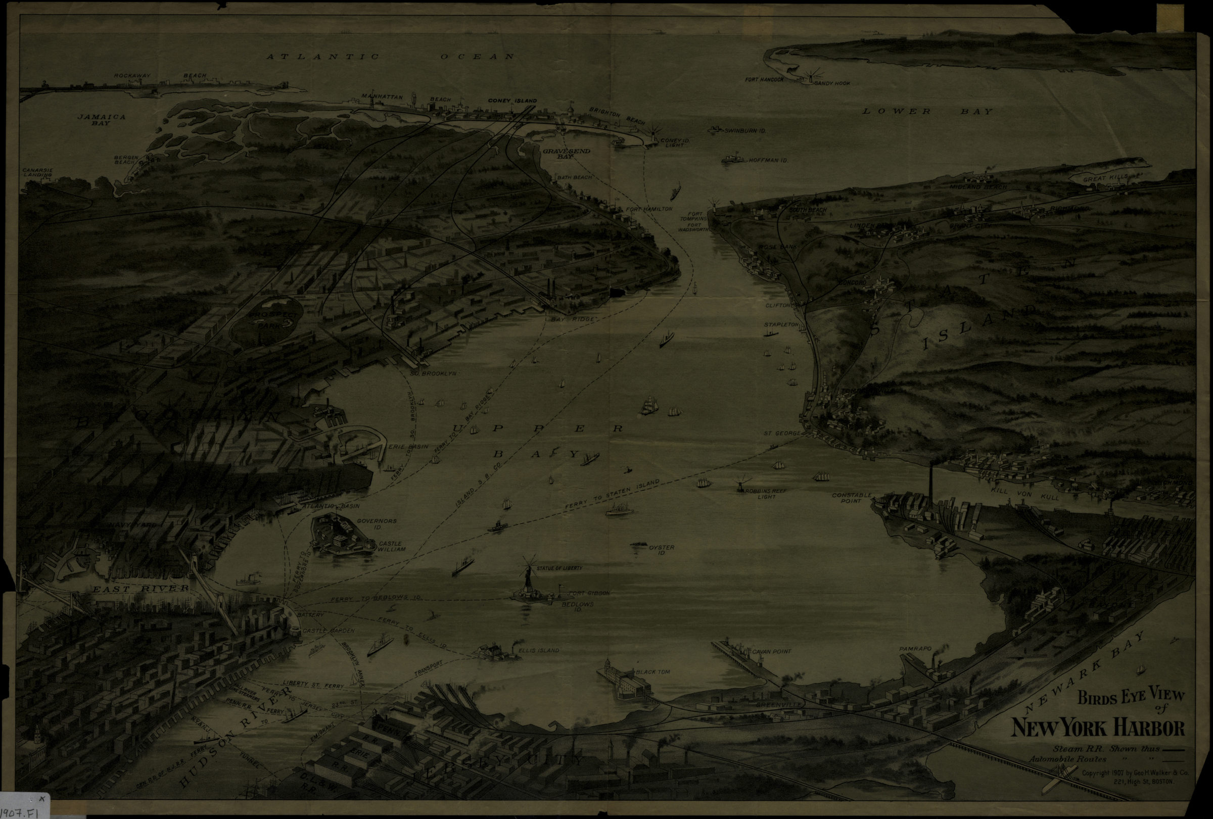
Birds eye view of New York Harbor [1907]
Map No. NYC-1907.Fl
Aerial view covering area surrounding New York Harbor, from Lower Manhattan through Jamaica Bay, Sandy Hook, Staten Island and part of Newark Bay in New Jersey. Shows ferry, railroad and automobile routes, some transportation terminals and islands. Relief shown pictorially.
Map area shown
Genre
Aerial viewsRelation
Full catalog recordSize
36 × 53 cmDownload
Low Resolution Image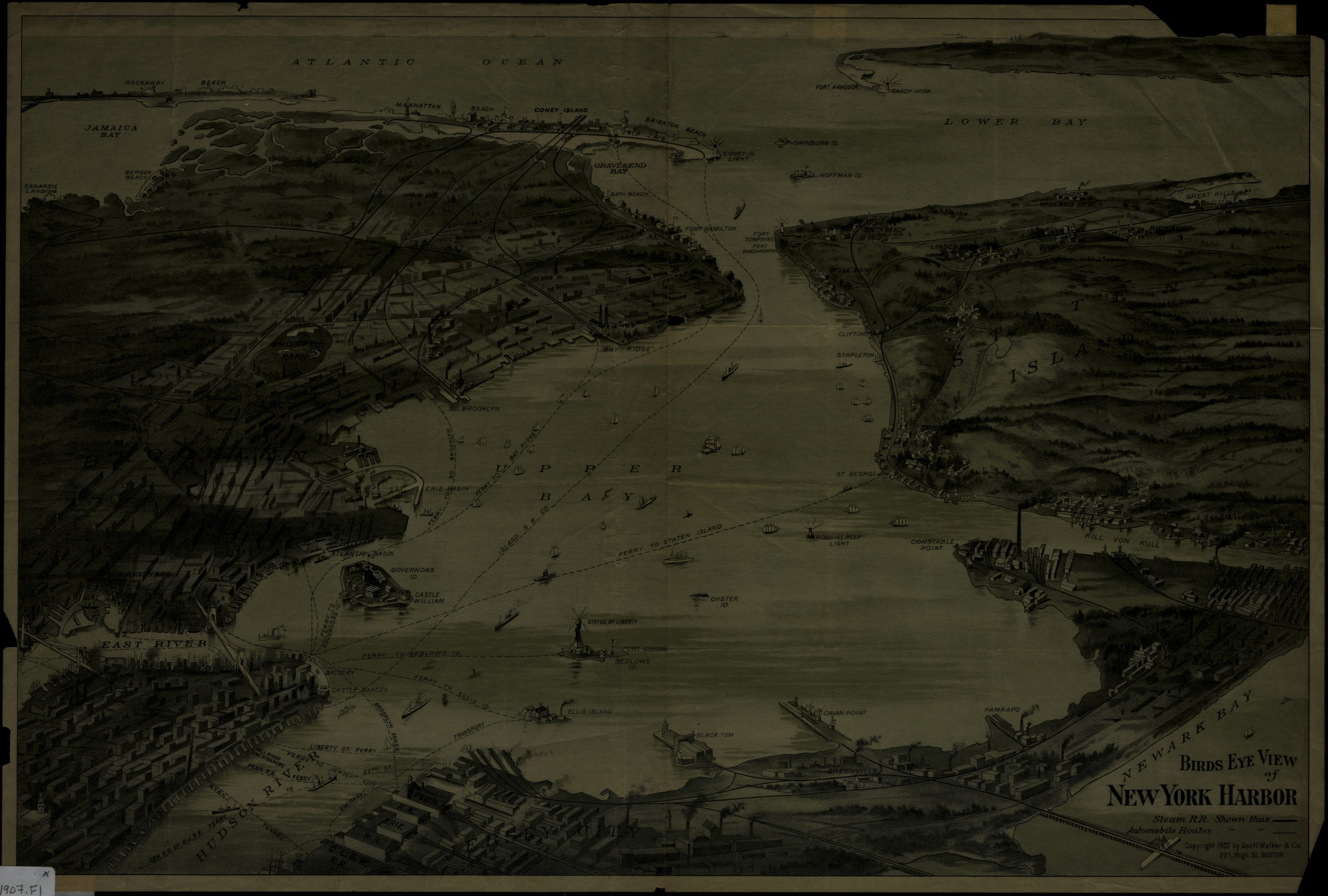
Creator
Geo. H. Walker & Co.,Publisher
Brooklyn Historical SocietyCitation
Birds eye view of New York Harbor; [1907], Map Collection, NYC-1907.Fl; Brooklyn Historical Society.Scale
Not drawn to scaleLoading zoom image...