Center for Brooklyn History
Map Collections
Search
About
Othmer Library & Archives
Submit search query
Refine 3 records
Clear filters
2
Location
Bay Ridge (New York, N.Y.)
108
Borough Park (New York, N.Y.)
23
Brooklyn (New York, N.Y.)
891
Brooklyn Heights (New York, N.Y.)
76
Downtown Brooklyn (New York, N.Y.)
29
Dyker Heights (New York, N.Y.)
23
Flatbush (New York, N.Y.)
35
Fort Hamilton (New York, N.Y.)
31
Kensington (New York, N.Y.)
11
Park Slope (New York, N.Y.)
16
Prospect Heights (New York, N.Y.)
16
Prospect Lefferts Gardens (Brooklyn, New York, N.Y.)
16
Sunset Park (New York, N.Y.)
53
Windsor Terrace (New York, N.Y.)
10
Subject
Election districts
36
Landowners
434
Real property
619
Date
20th Century
469
or enter range:
from
to
Genres
Cadastral maps
597
Pictorial maps
38
Zoning maps
55
Sort by:
Date (earliest)
Date (most recent)
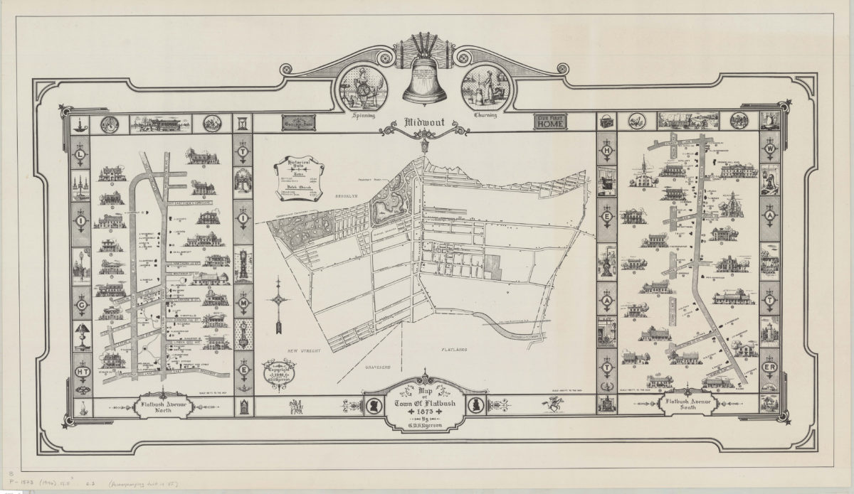
Map of town of Flatbush, 1873: by G.V.S. Ryerson
Map of town of Flatbush, 1873: by G.V.S. Ryerson
1946
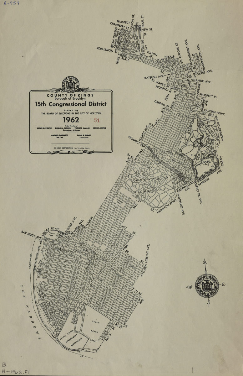
County of Kings, Borough of Brooklyn, 15th Congressional District: issued by the Board of Elections in the City of New York
County of Kings, Borough of Brooklyn, 15th Congressional District: issued by the Board of Elections in the City of New York
1962
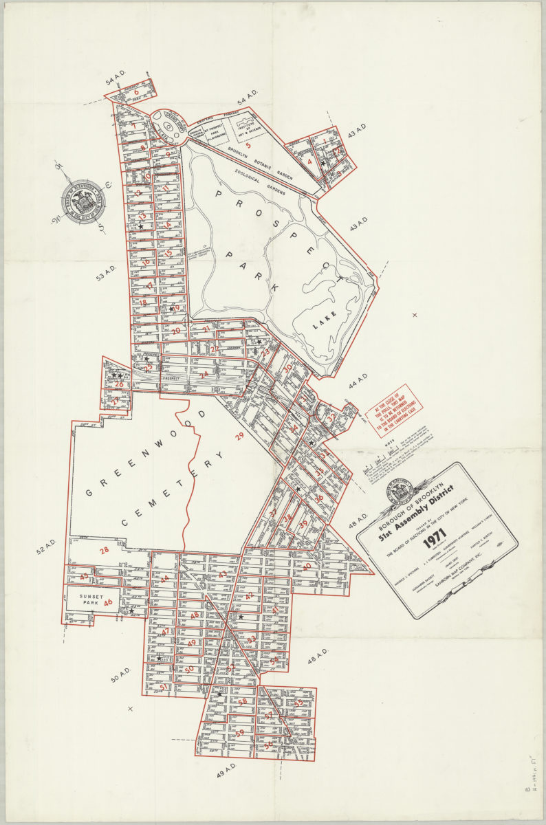
Borough of Brooklyn 51st Assembly District, 1971: issued by the Board of Elections in the City of New York
Borough of Brooklyn 51st Assembly District, 1971: issued by the Board of Elections in the City of New York
1971