Center for Brooklyn History
Map Collections
Search
About
Othmer Library & Archives
Submit search query
Refine 2 records
Clear filters
2
Location
Brooklyn (New York, N.Y.)
891
Coney Island (New York, N.Y.)
22
Gravesend (New York, N.Y.)
25
New Jersey
27
New York (N.Y.)
164
New York (State)
95
Subject
Date
19th Century
945
20th Century
469
or enter range:
from
to
Genres
Bathymetric maps
94
Sort by:
Date (earliest)
Date (most recent)
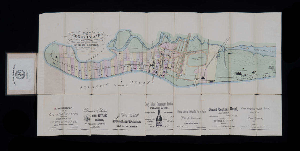
Map of Coney Island, town of Gravesend, Kings County, state of New York: made from actual surveys by William Kowalski, city surveyor
Map of Coney Island, town of Gravesend, Kings County, state of New York: made from actual surveys by William Kowalski, city surveyor
1879
Coney Island quadrangle, New York–New Jersey
Coney Island quadrangle, New York–New Jersey
[1969]