Center for Brooklyn History
Map Collections
Search
About
Othmer Library & Archives
Submit search query
Refine 54 records
Clear filters
2
Location
Bay Ridge (New York, N.Y.)
108
Bedford-Stuyvesant (New York, N.Y.)
67
Boerum Hill (New York, N.Y.)
6
Brooklyn (New York, N.Y.)
891
Brooklyn Heights (New York, N.Y.)
76
Canarsie (New York, N.Y.)
18
Carroll Gardens (New York, N.Y.)
21
Clinton Hill (New York, N.Y.)
10
Cobble Hill (New York, N.Y.)
7
Connecticut
7
Crown Heights (New York, N.Y.)
25
Downtown Brooklyn (New York, N.Y.)
29
East New York (New York, N.Y.)
16
Erie Basin (New York, N.Y.)
2
Fort Greene (New York, N.Y.)
22
Genesee County (N.Y.)
2
Grand Army Plaza (Brooklyn, New York, N.Y.)
1
Greenpoint (New York, N.Y.)
38
Holland Tunnel (Jersey City, N.J., and New York, N.Y.)
1
Ithaca, N.Y.
1
Jamaica Bay (N.Y.)
5
Lloyd Harbor (N.Y.)
1
Long Island (N.Y.)
197
Manhattan (New York, N.Y.)
120
New England
8
New Jersey
27
New York (N.Y.)
164
New York (State)
95
New York Metropolitan Area
40
Park Slope (New York, N.Y.)
16
Patchogue (N.Y.)
2
Pennsylvania
4
Prospect Heights (New York, N.Y.)
16
Prospect Park (New York, N.Y.)
25
Queens (New York, N.Y.)
83
Red Hook (New York, N.Y.)
19
Sleepy Hollow (N.Y.)
1
Staten Island (N.Y.)
10
Sunset Park (New York, N.Y.)
53
U.S.
1
Williamsburg (New York, N.Y.)
36
Show 21 more
Subject
Academic libraries
1
Aeronautical charts
1
Bays
5
Cemeteries
17
City planning
7
Counties
1
Election districts
36
Forest reserves
1
Historic buildings
3
Historic sites
3
Landowners
434
Marine terminals
2
Names, Geographical
1
Natural areas
1
Neighborhoods
3
Outdoor recreation
1
Parks
35
Parkways
1
Piers
25
Road maps
2
Roads
117
Streets
46
Subways
55
Topographic maps
1
Trees
1
Universities and colleges
1
Urban renewal
3
Waterworks
5
Wells
2
Show 9 more
Date
20th Century
469
or enter range:
from
to
Genres
Map
191
Sort by:
Date (earliest)
Date (most recent)
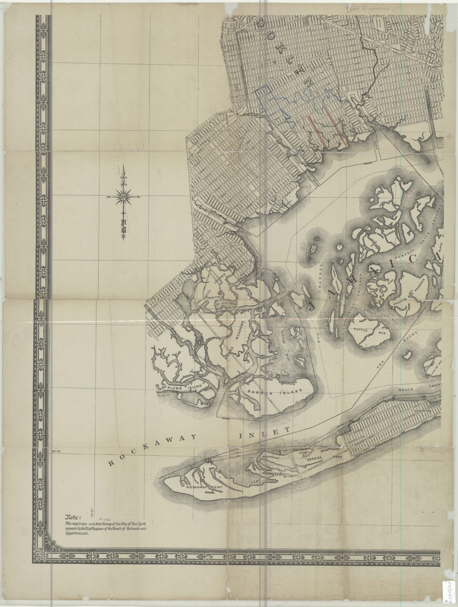
[Map of Jamaica Bay]
[Map of Jamaica Bay]
[19??]
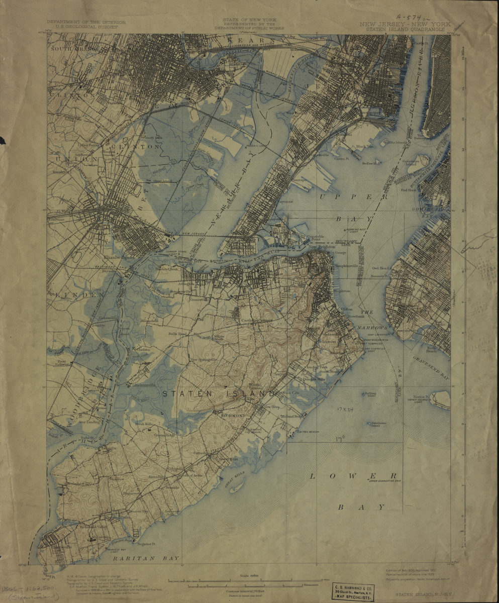
New Jersey- New York: Staten Island Quadrangle
New Jersey- New York: Staten Island Quadrangle
1900
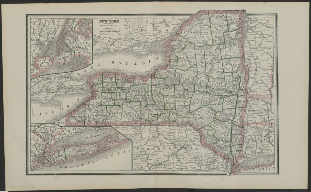
New York
New York
[19??]
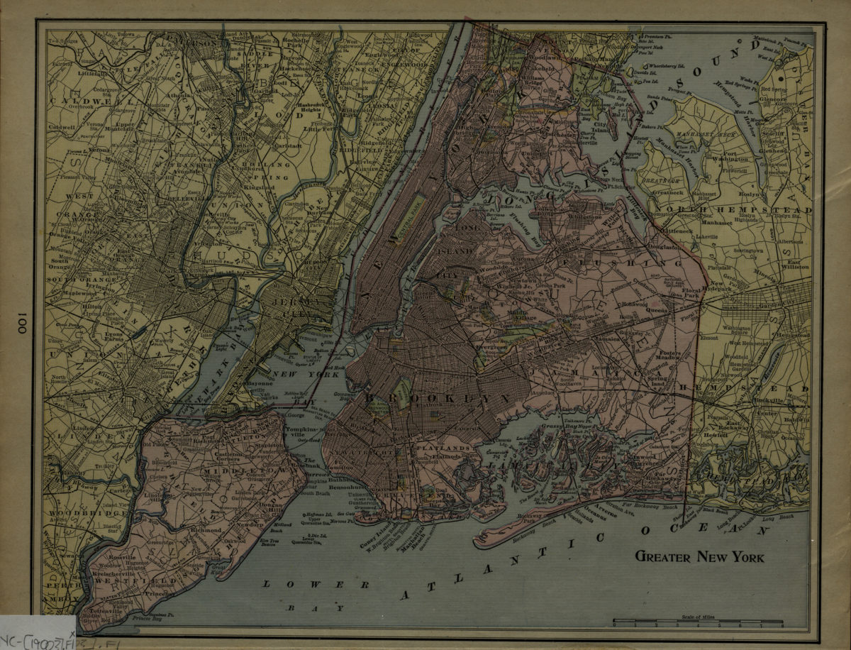
Greater New York
Greater New York
[1900]
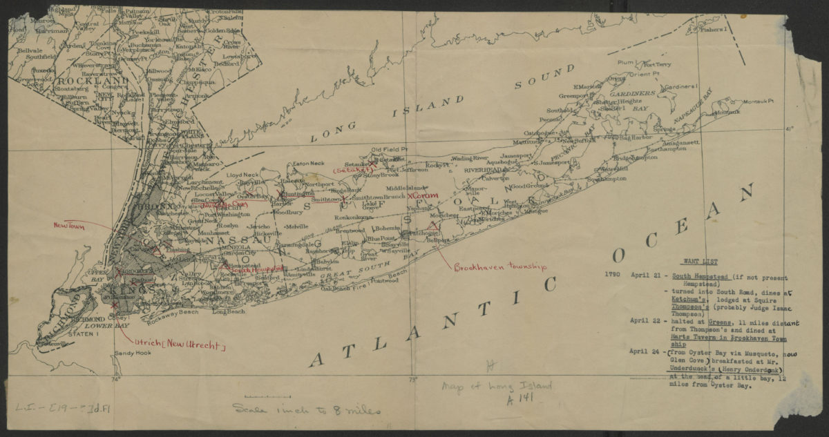
[Map of Long Island]
[Map of Long Island]
[19??]
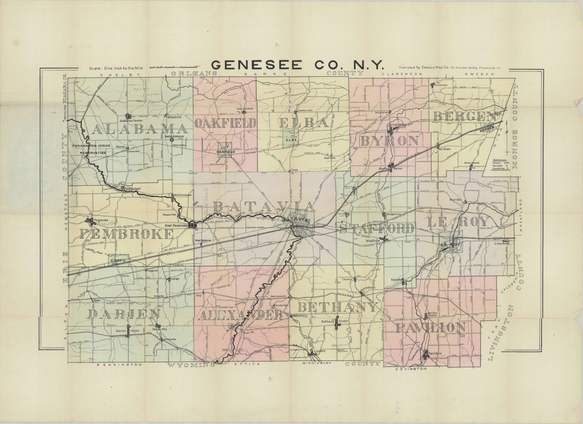
Genesee Co., N.Y.
Genesee Co., N.Y.
[19??]
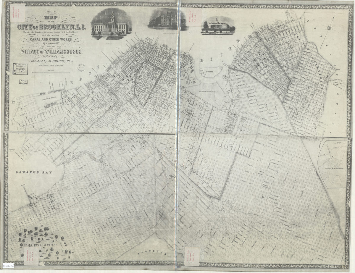
Map of the city of Brooklyn, L.I. : shewing the streets as at present existing, with the buildings, and the intended canal and other works … ; also the village of Williamsburgh
Map of the city of Brooklyn, L.I. : shewing the streets as at present existing, with the buildings, and the intended canal and other works … ; also the village of Williamsburgh
[19??]
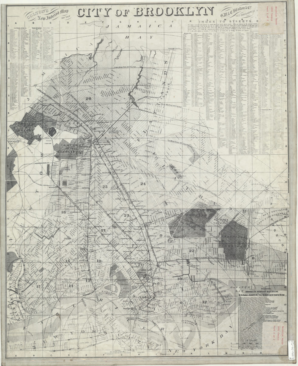
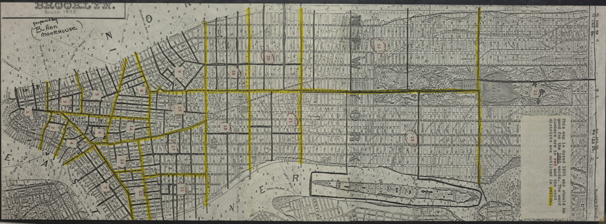
Colton’s new indexed map of the city of Brooklyn
Colton’s new indexed map of the city of Brooklyn
[19??]
Map of Brooklyn, Kings County, Long Island: from an entire new survey: by Alexr. Martin
Map of Brooklyn, Kings County, Long Island: from an entire new survey: by Alexr. Martin
[19??]
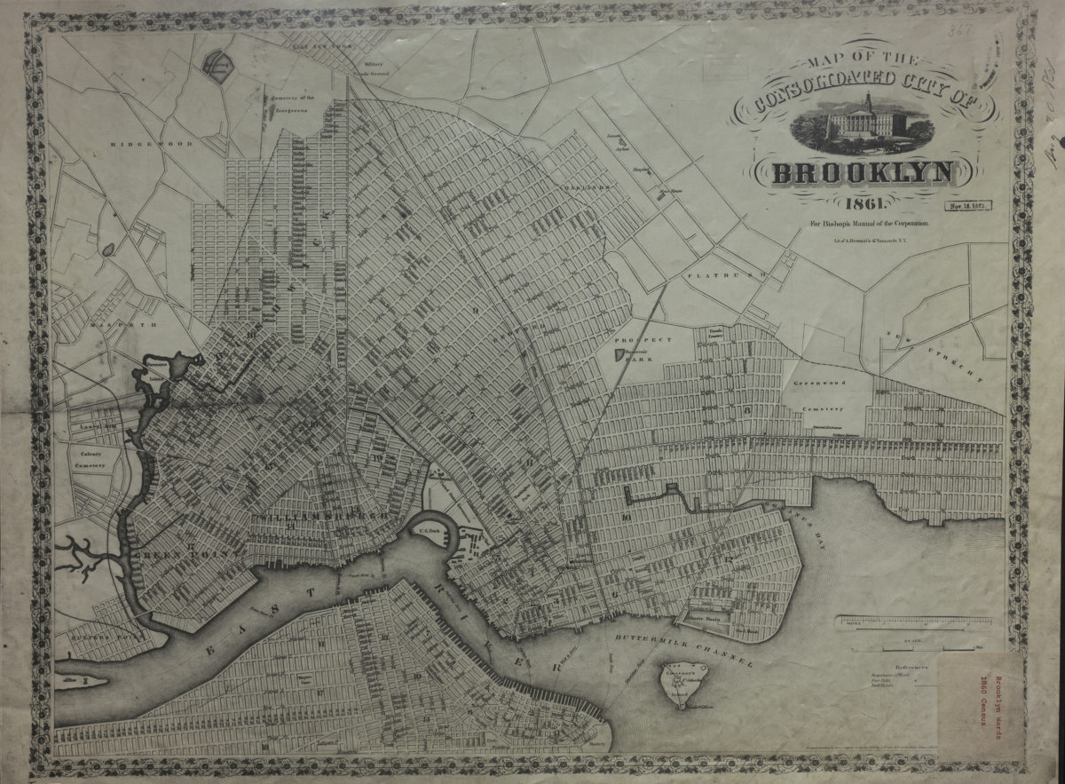
Map of the consolidated city of Brooklyn: for Bishop’s Manual of the Corporation
Map of the consolidated city of Brooklyn: for Bishop’s Manual of the Corporation
[19??]
[Map of Manhattan, from the Battery to 114th St.].
[Map of Manhattan, from the Battery to 114th St.].
[19??]
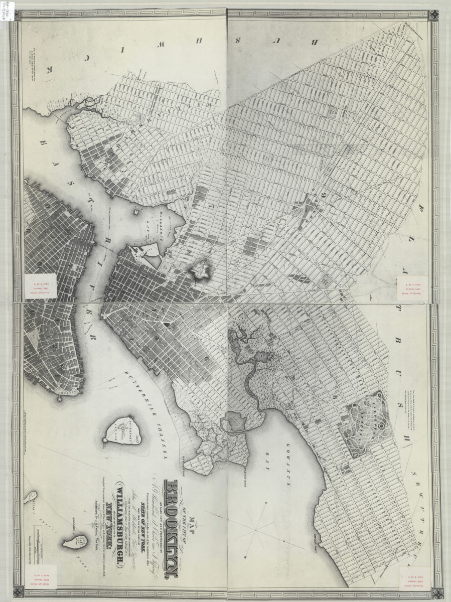
Map of the city of Brooklyn: as laid out and confirmed by A.G. Hammond, S. Cheever and J. Tiffany, commissioners appointed under an Act of the Legislature of the state of New York ; containing also a map of the village of Williamsburgh
Map of the city of Brooklyn: as laid out and confirmed by A.G. Hammond, S. Cheever and J. Tiffany, commissioners appointed under an Act of the Legislature of the state of New York ; containing also a map of the village of Williamsburgh
[19??]
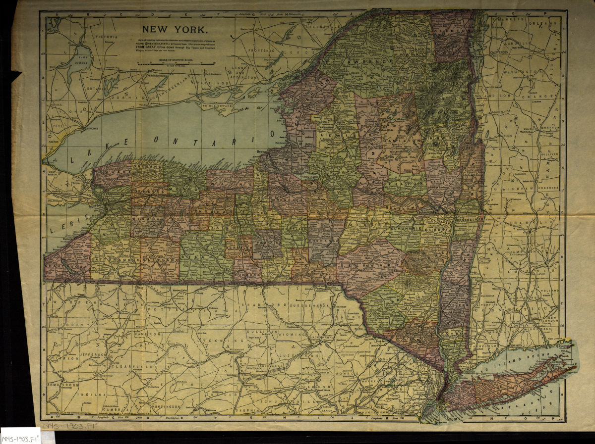
New York
New York
[1903; 1903]
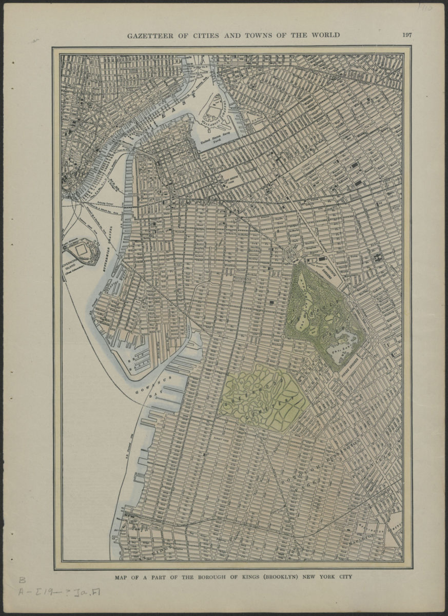
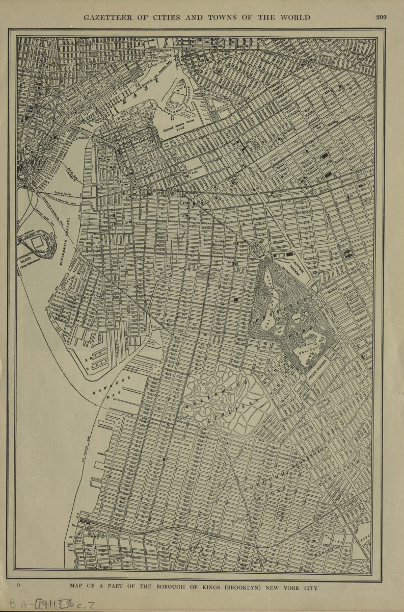
Map of a part of the borough of Kings (Brooklyn) New York City
Map of a part of the borough of Kings (Brooklyn) New York City
[1903-1909]
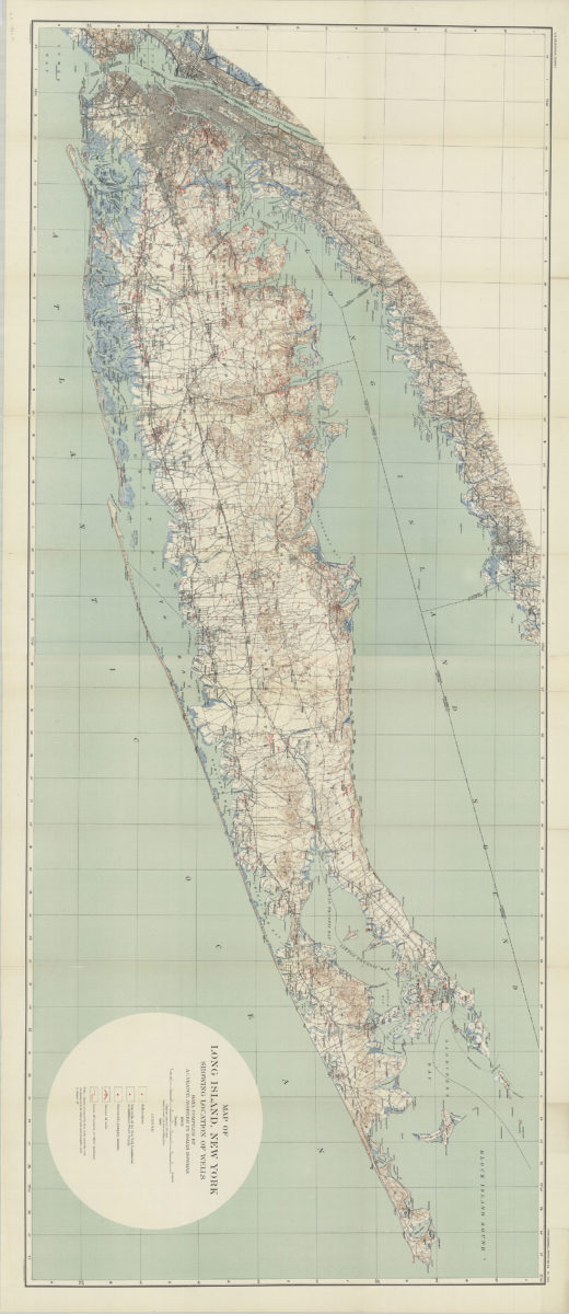
Map of Long Island, New York: showing location of wells: data compiled by A.C. Veatch, assisted by Isaiah Bowman
Map of Long Island, New York: showing location of wells: data compiled by A.C. Veatch, assisted by Isaiah Bowman
1904
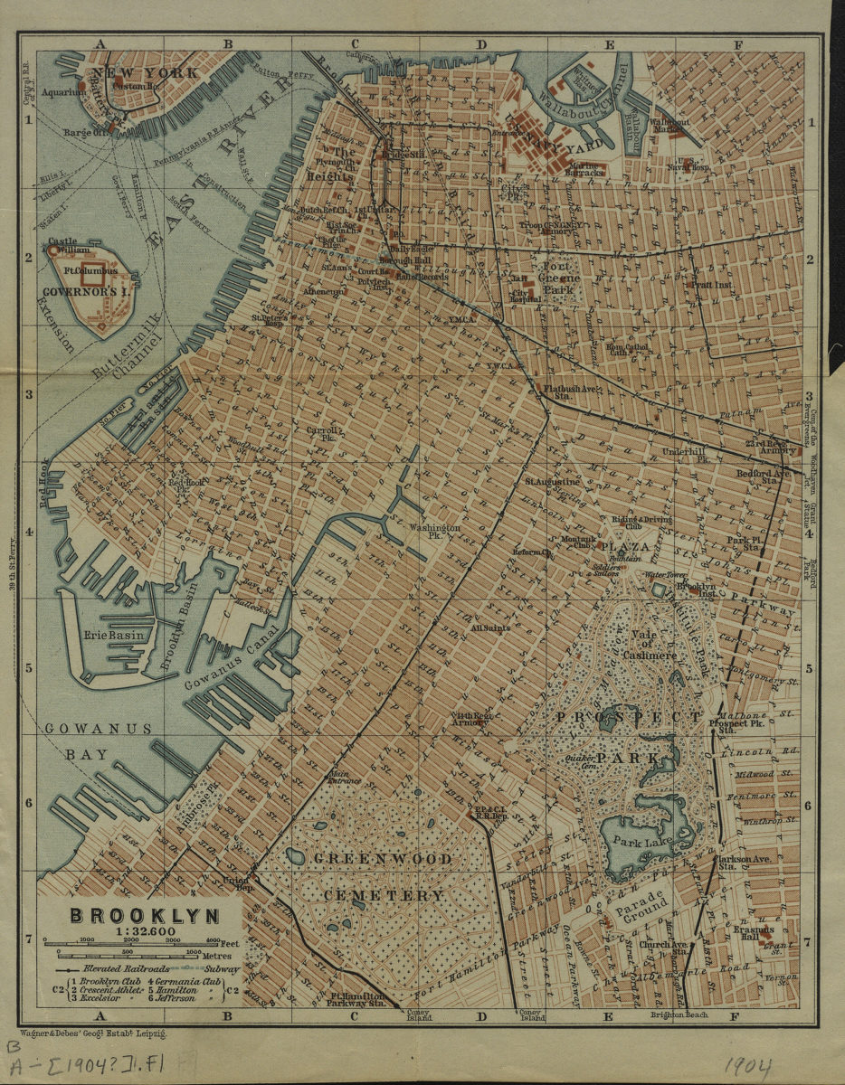
Brooklyn
Brooklyn
[1904]
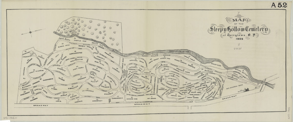
Map of the Sleepy Hollow Cemetery at Tarrytown, N.Y., 1905
Map of the Sleepy Hollow Cemetery at Tarrytown, N.Y., 1905
[ca. 1905]
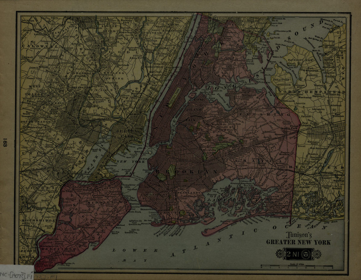
Tunison’s greater New York
Tunison’s greater New York
[1907]
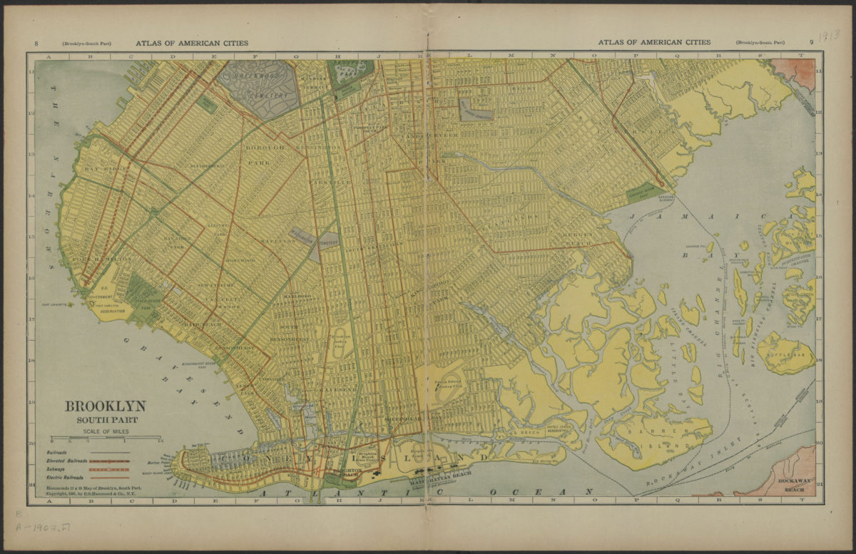
Brooklyn, south part
Brooklyn, south part
[1907]
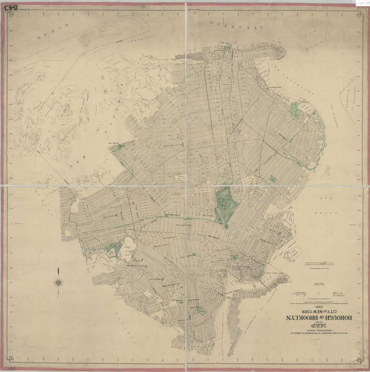
Map of the Borough of Brooklyn, City of New York, 1909: Office of the President of the Borough of Brooklyn, Topographical Bureau
Map of the Borough of Brooklyn, City of New York, 1909: Office of the President of the Borough of Brooklyn, Topographical Bureau
Oct-09
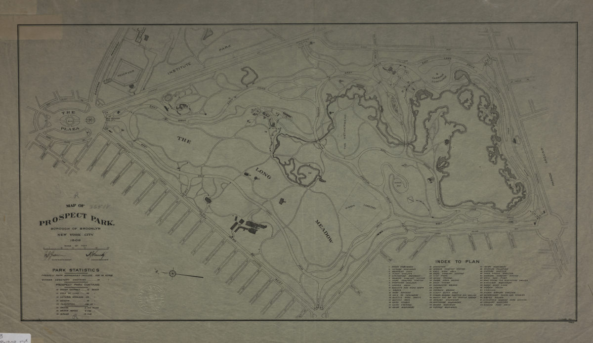
Map of Prospect Park, Borough of Brooklyn, New York City, 1909
Map of Prospect Park, Borough of Brooklyn, New York City, 1909
1909
Map of a part of the borough of Kings (Brooklyn) New York City
Map of a part of the borough of Kings (Brooklyn) New York City
[1911]
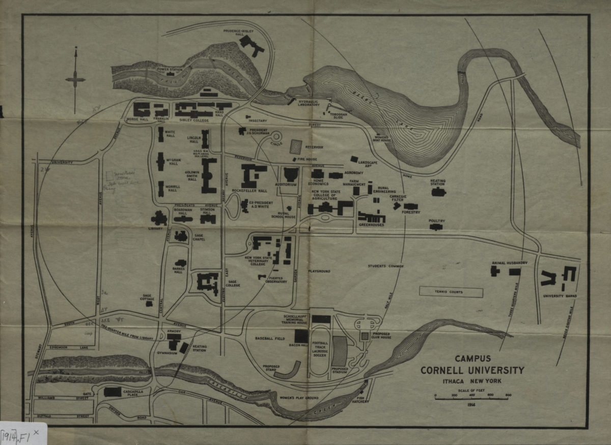
Campus, Cornell University, Ithaca New York
Campus, Cornell University, Ithaca New York
[1914]
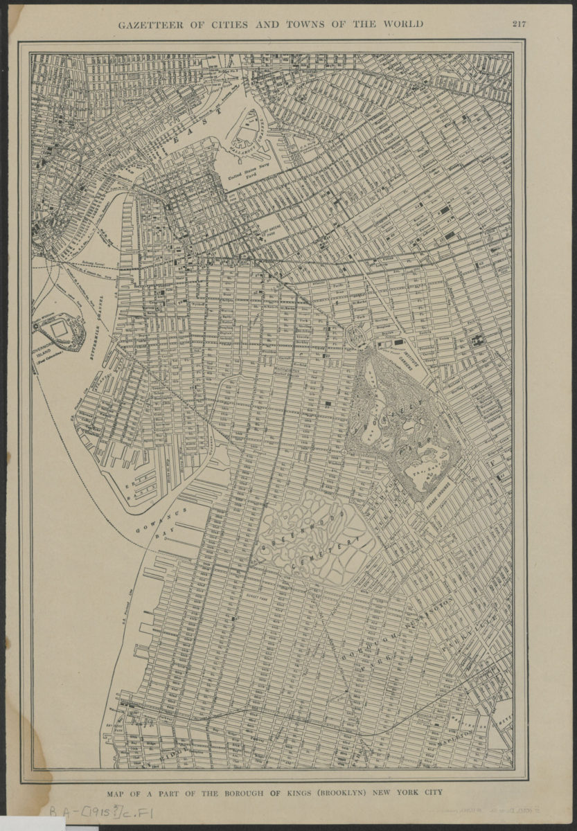
Map of a part of the borough of Kings (Brooklyn) New York City
Map of a part of the borough of Kings (Brooklyn) New York City
[1915]
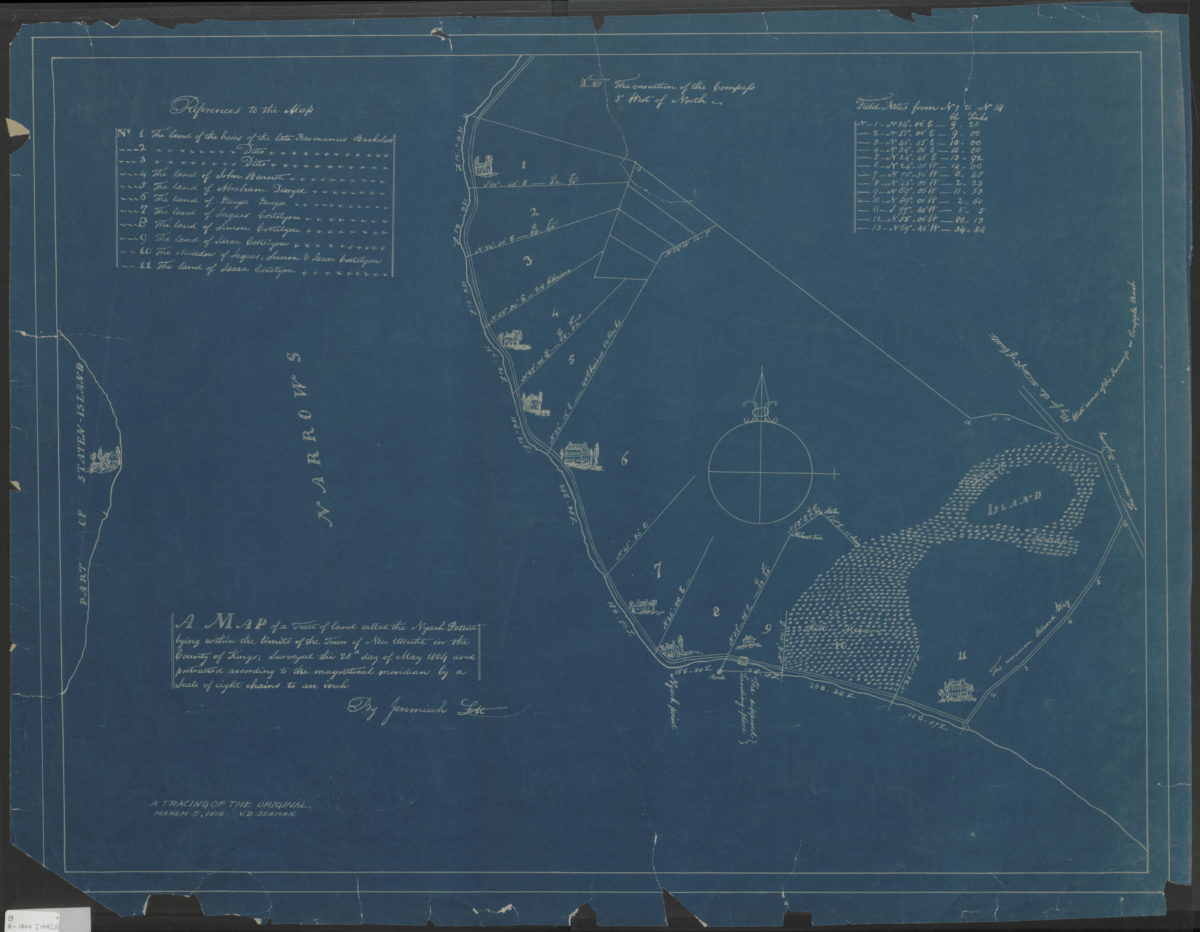
A map of a tract of land called the Nyash Patent, lying within the limits of the town of New Utrecht in the county of Kings, surveyed the 26th day of May 1804 and protracted according to the magnetical meridian by a scale of eight chains to an inch
A map of a tract of land called the Nyash Patent, lying within the limits of the town of New Utrecht in the county of Kings, surveyed the 26th day of May 1804 and protracted according to the magnetical meridian by a scale of eight chains to an inch
[1918]
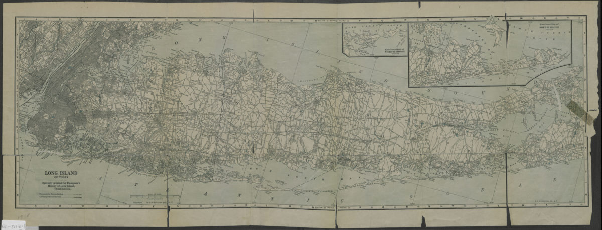
Long Island of today: C.S. Hammond & Co
Long Island of today: C.S. Hammond & Co
[1918]
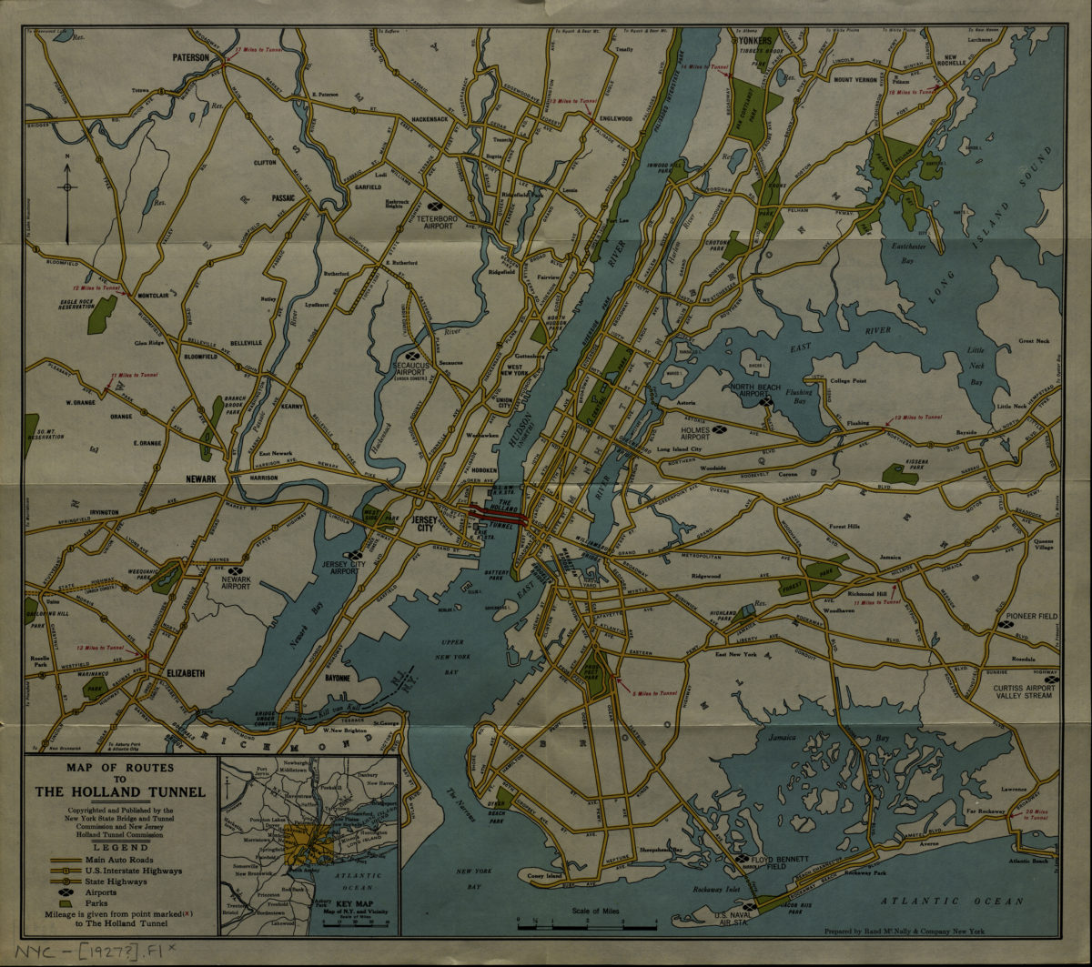
Map of routes to the Holland Tunnel: prepared by Rand McNally & Company, New York
Map of routes to the Holland Tunnel: prepared by Rand McNally & Company, New York
[192?]
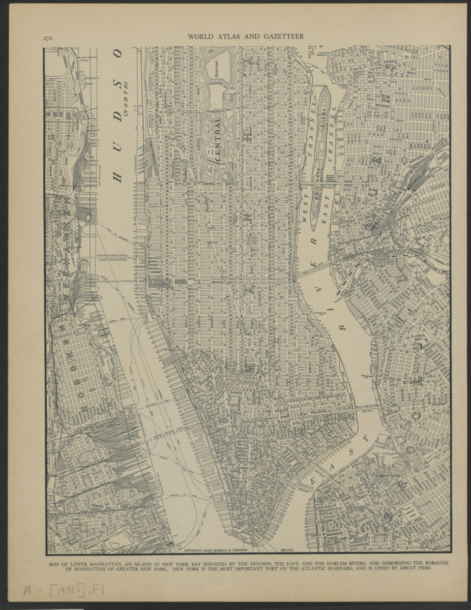
Map of lower Manhattan
Map of lower Manhattan
[ca. 1931]
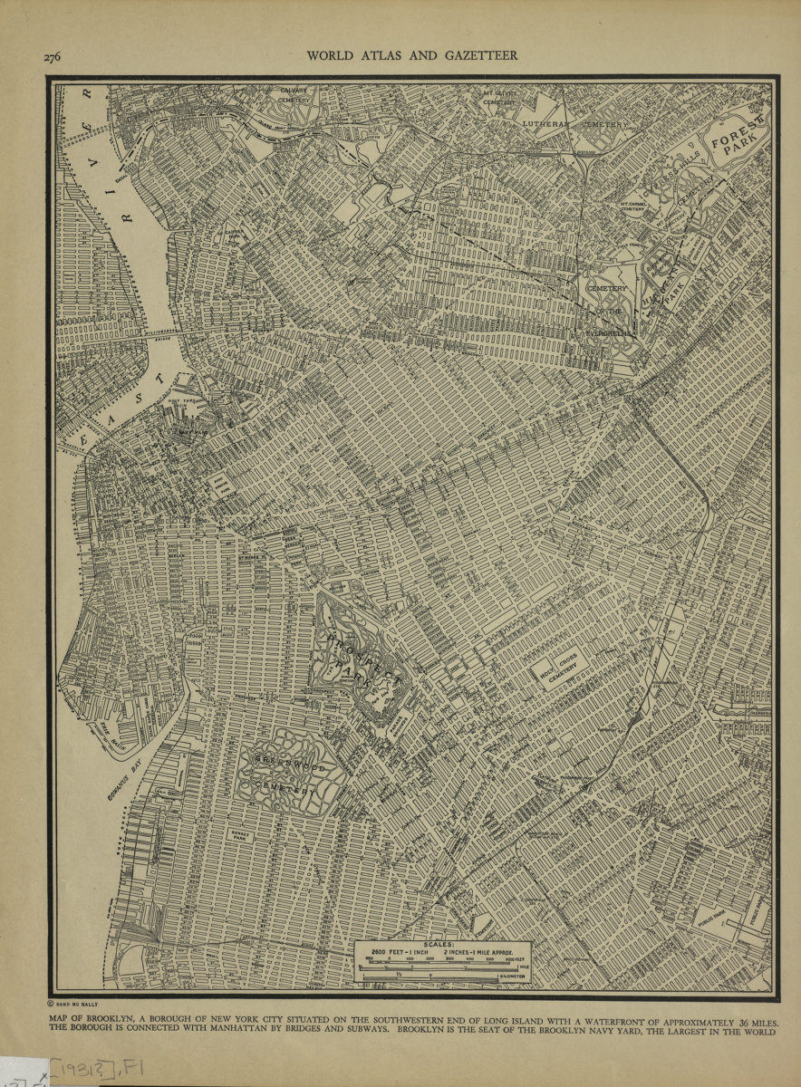
Map of Brooklyn
Map of Brooklyn
[1931]
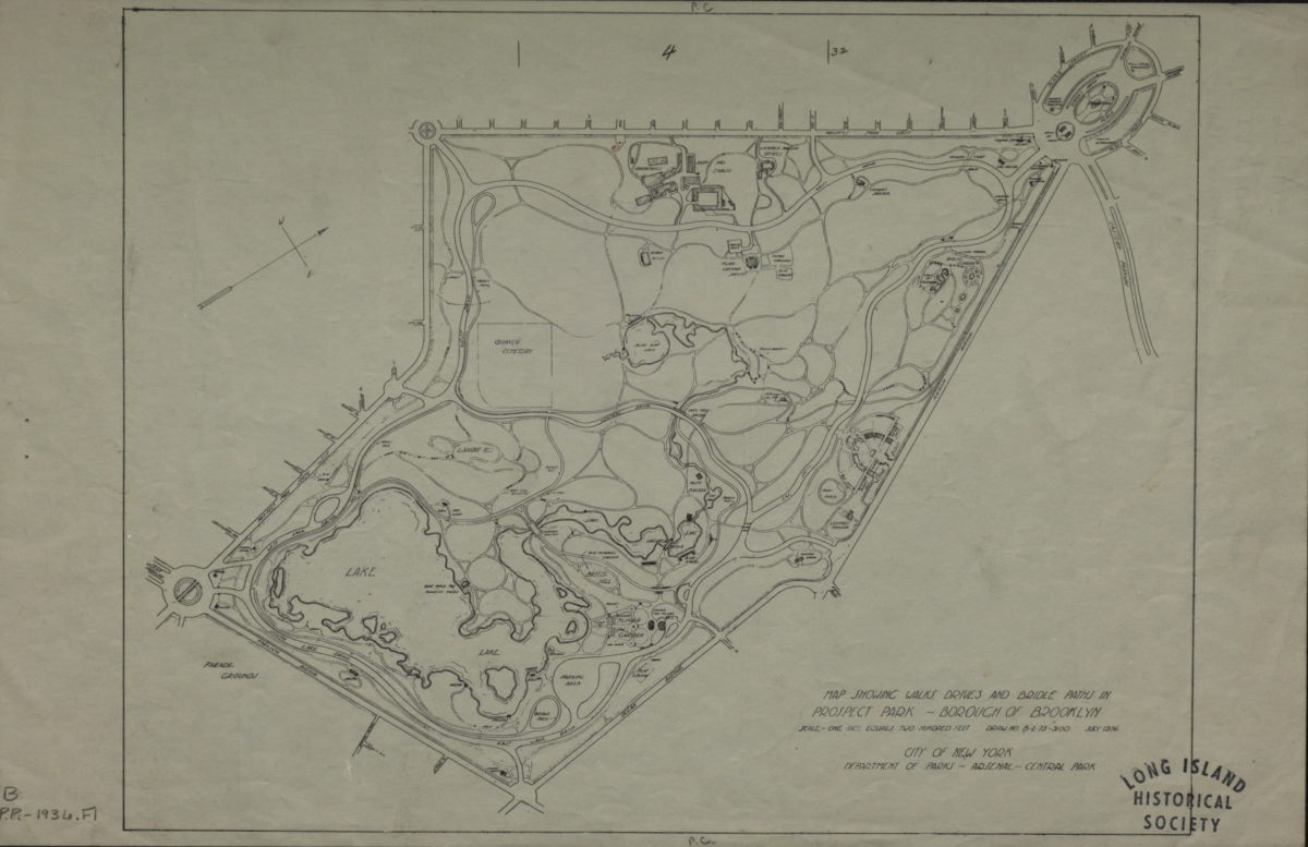
Map showing walks, drives and bridle paths in Prospect Park, Borough of Brooklyn
Map showing walks, drives and bridle paths in Prospect Park, Borough of Brooklyn
1936
Shell street guide and metropolitan map of Brooklyn, Queens and Long Island: the H.M. Gousha Company
Shell street guide and metropolitan map of Brooklyn, Queens and Long Island: the H.M. Gousha Company
[1939]
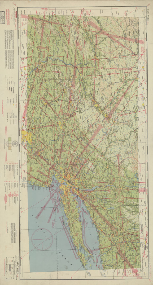
New York (U-9) sectional aeronautical chart: compiled and printed at Washington D.C. by the U.S. Coast and Geodetic Survey
New York (U-9) sectional aeronautical chart: compiled and printed at Washington D.C. by the U.S. Coast and Geodetic Survey
1940
[Map of village of Patchogue]
[Map of village of Patchogue]
[195?]
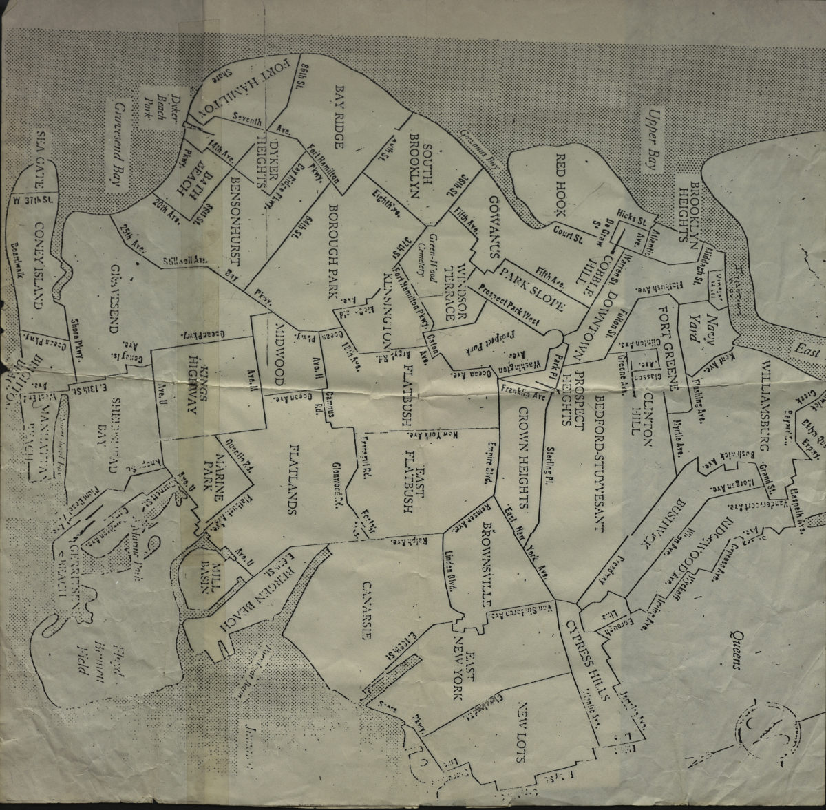
[Map of Brooklyn neighborhoods circa 1950]
[Map of Brooklyn neighborhoods circa 1950]
[1950-1960]
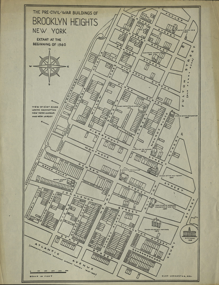
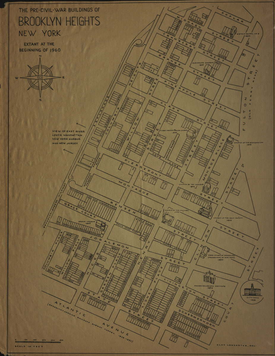
The pre-Civil-War buildings of Brooklyn Heights, New York, extant at the beginning of 1960: Clay Lancaster, del
The pre-Civil-War buildings of Brooklyn Heights, New York, extant at the beginning of 1960: Clay Lancaster, del
[1960]
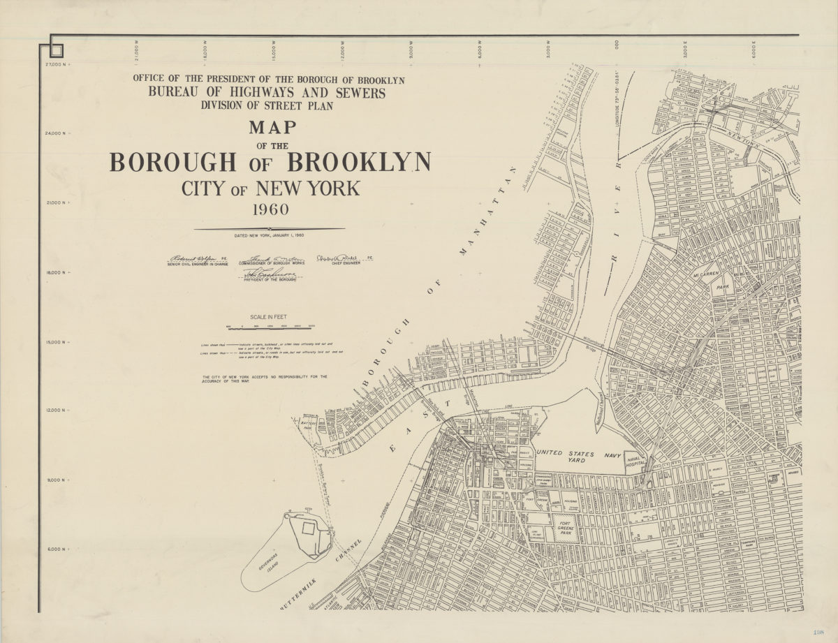
Map of the Borough of Brooklyn, City of New York, 1960
Map of the Borough of Brooklyn, City of New York, 1960
1960
The pre-Civil-War buildings of Brooklyn Heights, New York, extant at the beginning of 1960: Clay Lancaster, del
The pre-Civil-War buildings of Brooklyn Heights, New York, extant at the beginning of 1960: Clay Lancaster, del
[1961]
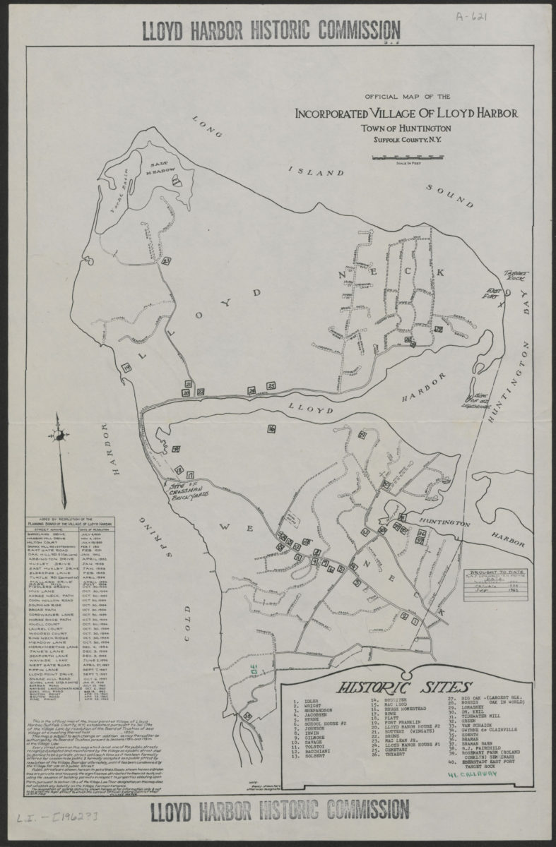
Official map of the Incorporated Village of Lloyd Harbor, Town of Huntington, Suffolk County, N.Y.
Official map of the Incorporated Village of Lloyd Harbor, Town of Huntington, Suffolk County, N.Y.
[1962]
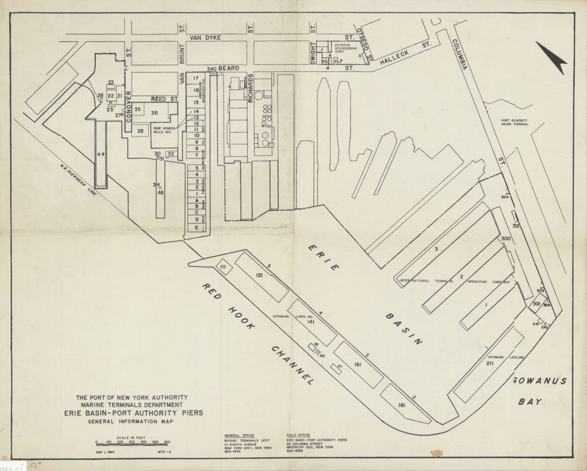
Erie Basin-Port Authority piers: general information map
Erie Basin-Port Authority piers: general information map
1964
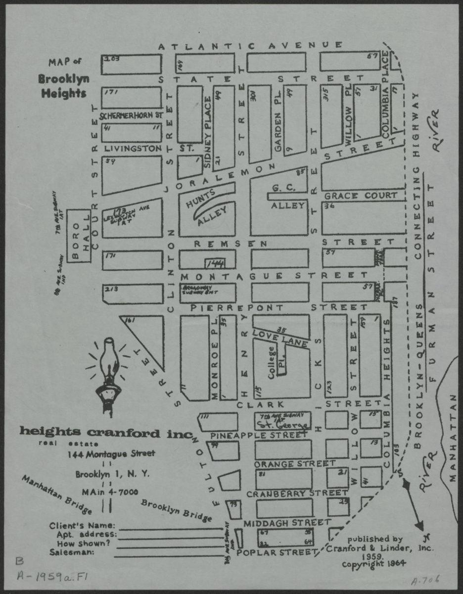
Map of Brooklyn Heights
Map of Brooklyn Heights
[1964; 1964]
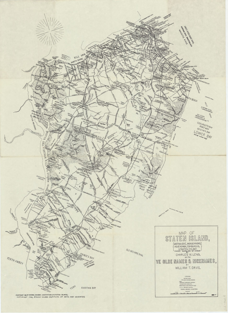
Map of Staten Island: Motanucke, Monocknong, Aquehonga, Eghquaous, Staaten Eylant, Cherry Island, Isle of Mines: by Charles W. Leng ; with ye olde names & nicknames by William T. Davis
Map of Staten Island: Motanucke, Monocknong, Aquehonga, Eghquaous, Staaten Eylant, Cherry Island, Isle of Mines: by Charles W. Leng ; with ye olde names & nicknames by William T. Davis
[ca. 1968]
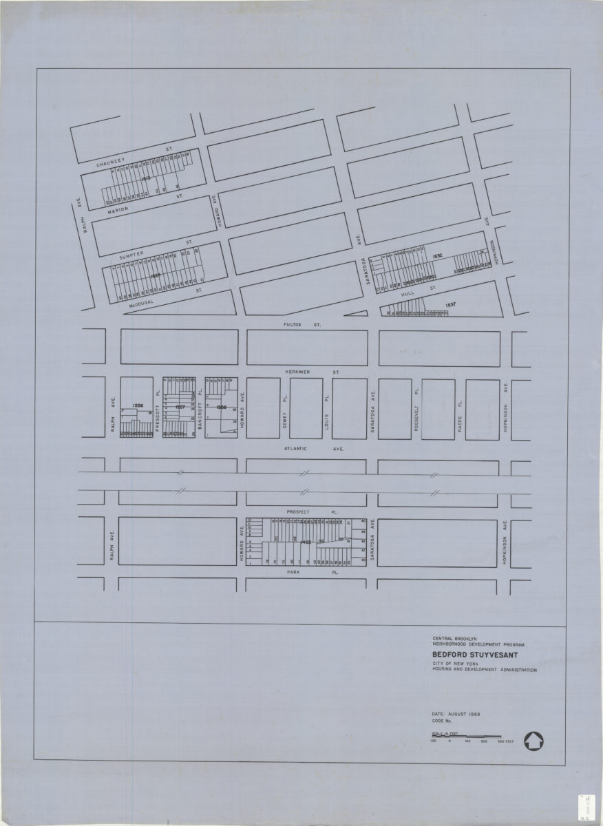
Central Brooklyn Neighborhood Development Program : Bedford Stuyvesant
Central Brooklyn Neighborhood Development Program : Bedford Stuyvesant
1969
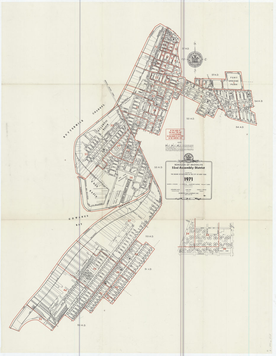
Borough of Brooklyn 52nd Assembly District, 1971: issued by the Board of Elections in the City of New York
Borough of Brooklyn 52nd Assembly District, 1971: issued by the Board of Elections in the City of New York
1971
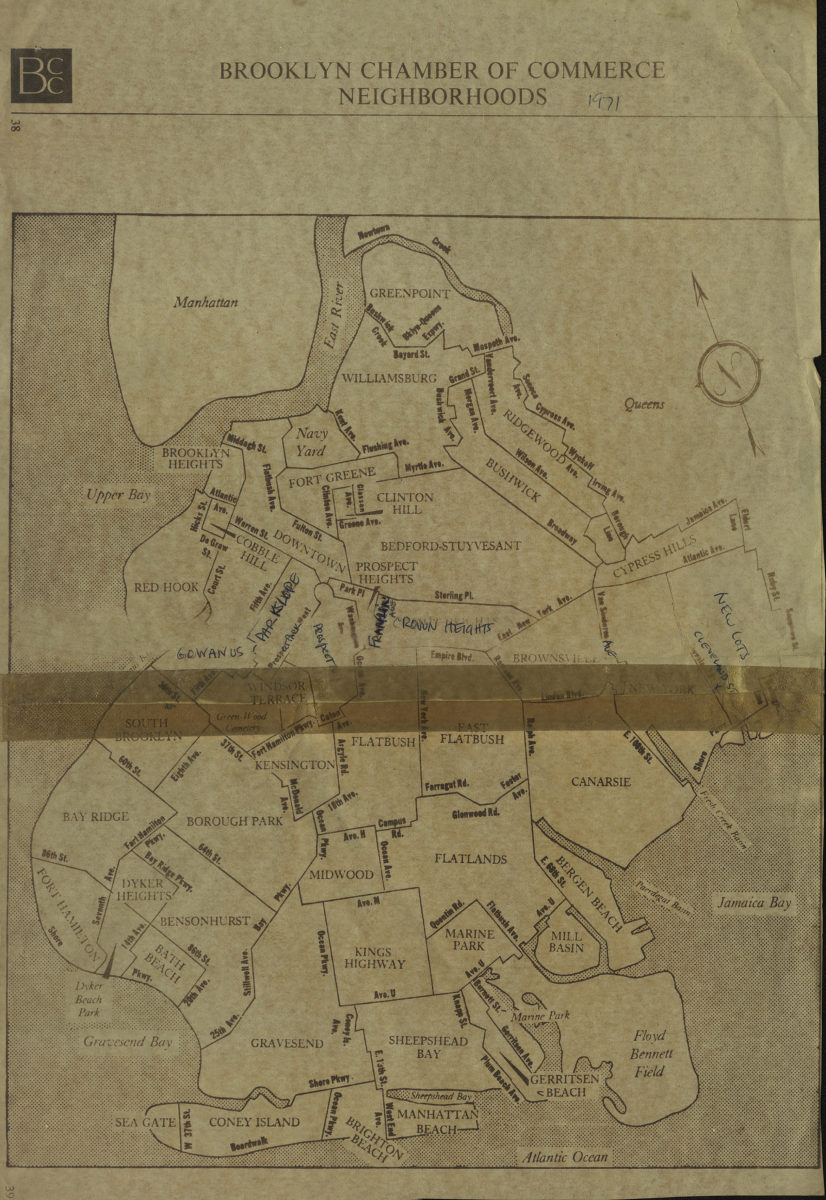
Brooklyn Chamber of Commerce neighborhoods
Brooklyn Chamber of Commerce neighborhoods
[1971]
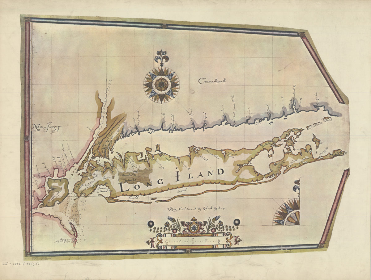
Long Island sirvaide: by Robartt Ryder
Long Island sirvaide: by Robartt Ryder
[ca. 1974]
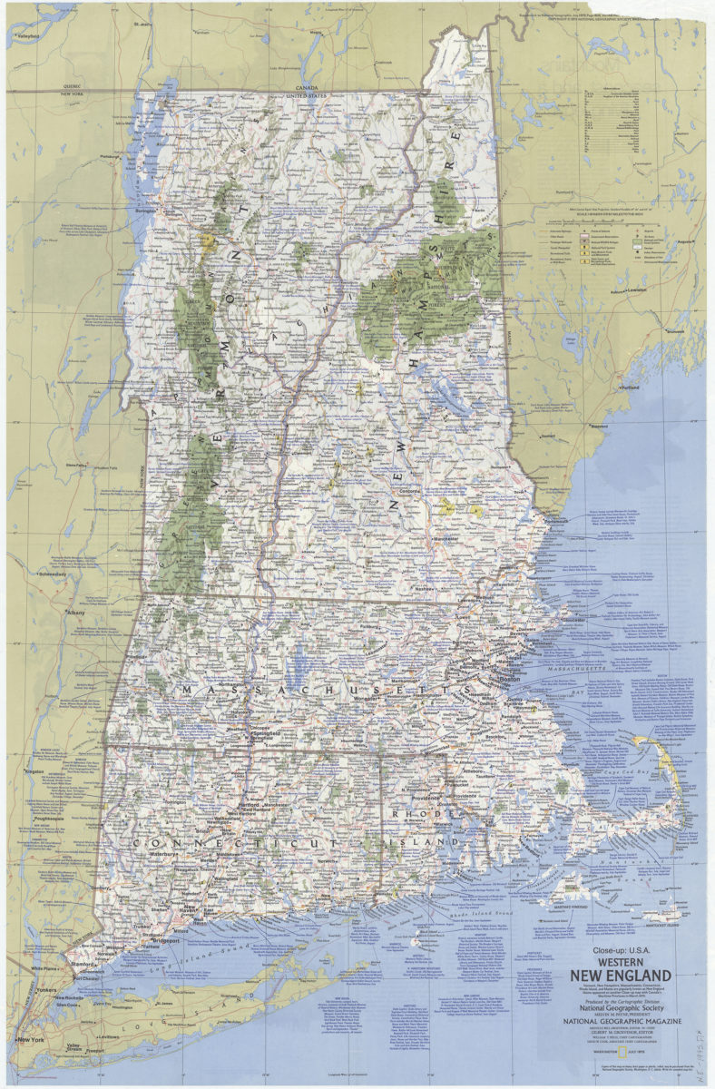
Close up: U.S.A., western New England: Produced by the Cartographic Division, National Geographic Society. William T. Peele, chief cartographer. David W. Cook, associate chief cartographer
Close up: U.S.A., western New England: Produced by the Cartographic Division, National Geographic Society. William T. Peele, chief cartographer. David W. Cook, associate chief cartographer
1975
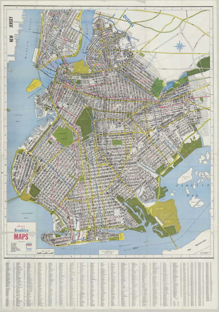
Nester’s Brooklyn maps: produced and designed by Lewis J. Nesterman
Nester’s Brooklyn maps: produced and designed by Lewis J. Nesterman
[1976]
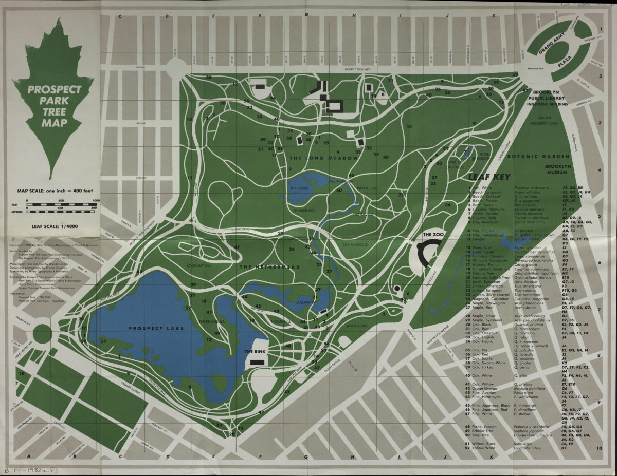
Prospect Park tree map: mapping of trees and tour by Brenda Corbin ; design and photography by Prisma Graphics
Prospect Park tree map: mapping of trees and tour by Brenda Corbin ; design and photography by Prisma Graphics
[1982]
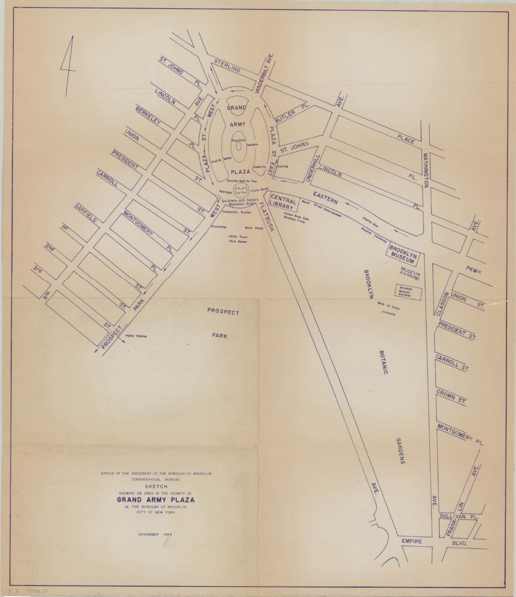
Sketch showing an area in the vicinity of Grand Army Plaza in the Borough of Brooklyn, City of New York
Sketch showing an area in the vicinity of Grand Army Plaza in the Borough of Brooklyn, City of New York
Nov-84
Bedford Stuyvesant I: urban renewal area : land use plan
Bedford Stuyvesant I: urban renewal area : land use plan
1988
1
2
Next