Center for Brooklyn History
Map Collections
Search
About
Othmer Library & Archives
Submit search query
Refine 15 records
Clear filters
2
Location
Atlantic Coast (North America)
6
Block Island (R.I. : Island)
2
Brooklyn (New York, N.Y.)
891
Connecticut River
1
Hempstead (N.Y.)
13
Huntington (N.Y.)
7
Jamaica Bay (N.Y.)
5
Long Island (N.Y.)
197
Long Island Sound (N.Y. and Conn.)
12
Napeague Bay (N.Y.)
1
New York (N.Y.)
164
New York (State)
95
New York Harbor (N.Y. and N.J.)
16
New York Region
5
Oyster Bay (N.Y.)
9
Queens (New York, N.Y.)
83
Raritan Bay (N.J. and N.Y.)
1
Rockaway (New York, N.Y.)
1
Suffolk County (N.Y.)
43
Subject
Coasts
4
Harbors
11
Lighthouses
1
Nautical charts
14
Piers
25
Date
19th Century
945
or enter range:
from
to
Genres
Bathymetric maps
94
Early maps
35
Manuscript maps
365
Nautical charts
30
Sort by:
Date (earliest)
Date (most recent)
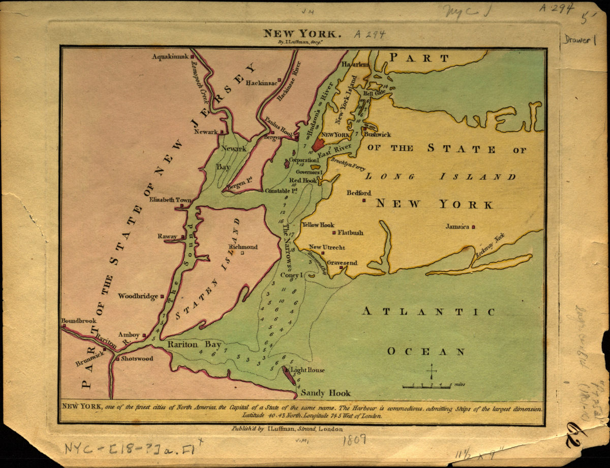
New York
New York
[1809]
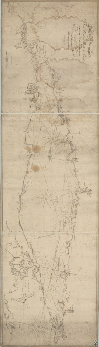
Long Island Sound from New York to Montock [i.e Montauk] Point: surveyed in the years 1828, 29, & 30 by Edmund Blunt ; writing by D.R. Harrison ; plan by W. Hooker
Long Island Sound from New York to Montock [i.e Montauk] Point: surveyed in the years 1828, 29, & 30 by Edmund Blunt ; writing by D.R. Harrison ; plan by W. Hooker
[ca. 1830]
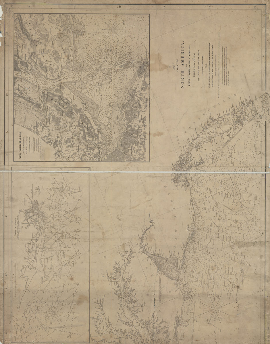
Coast of North America from Point Judith to St. Antonio (island of Cuba), including the Bahama Banks: drawn & engraved by Charles Copley
Coast of North America from Point Judith to St. Antonio (island of Cuba), including the Bahama Banks: drawn & engraved by Charles Copley
1848
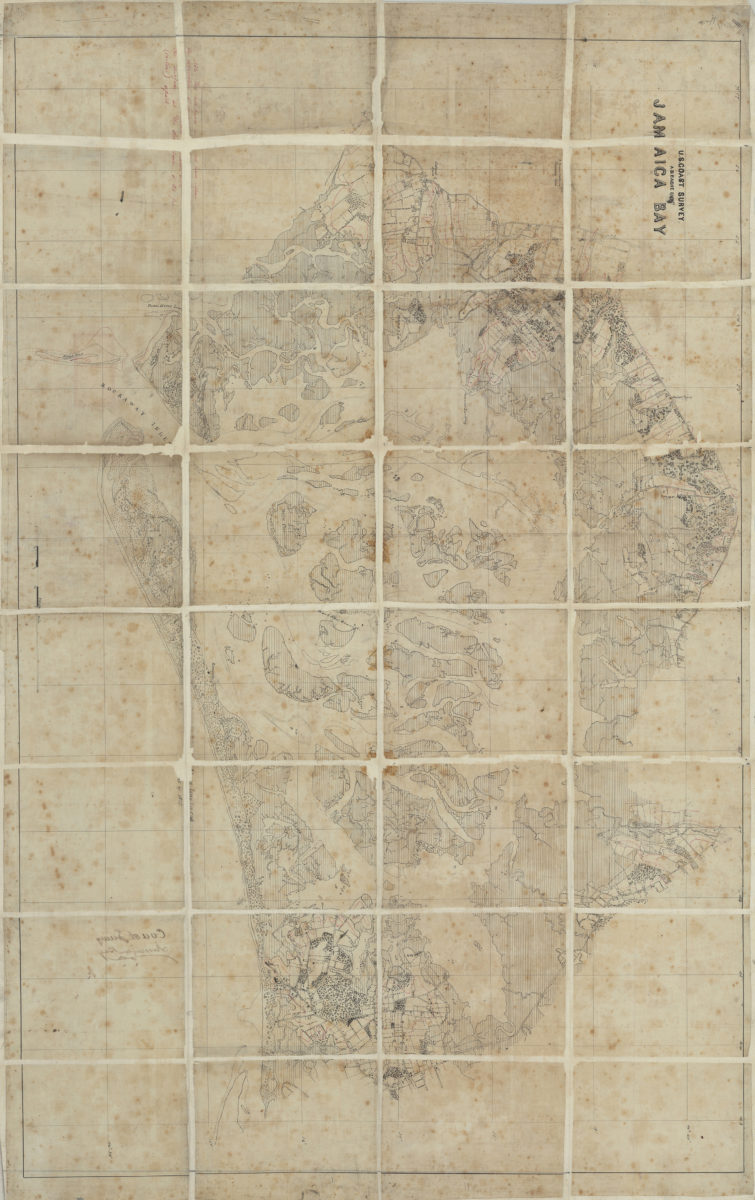
Jamaica Bay: U.S. Coast Survey, A.D. Bache, supt
Jamaica Bay: U.S. Coast Survey, A.D. Bache, supt
[185?]
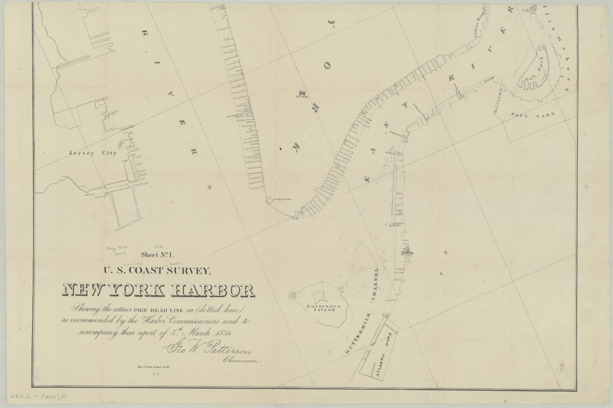
Sheet no. 1, U.S. Coast Survey, New York Harbor: showing the exterior pier head line in dotted line as recommended by the Harbor Commissioners and to accompany their report of 5th March 1856
Sheet no. 1, U.S. Coast Survey, New York Harbor: showing the exterior pier head line in dotted line as recommended by the Harbor Commissioners and to accompany their report of 5th March 1856
[1856]
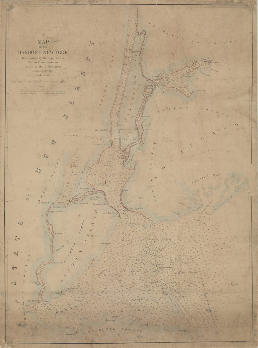
Map of the Harbor of New York: to accompany the report of the Harbor Commissioners made to the Legislature, January 27th, 1857
Map of the Harbor of New York: to accompany the report of the Harbor Commissioners made to the Legislature, January 27th, 1857
[1857]
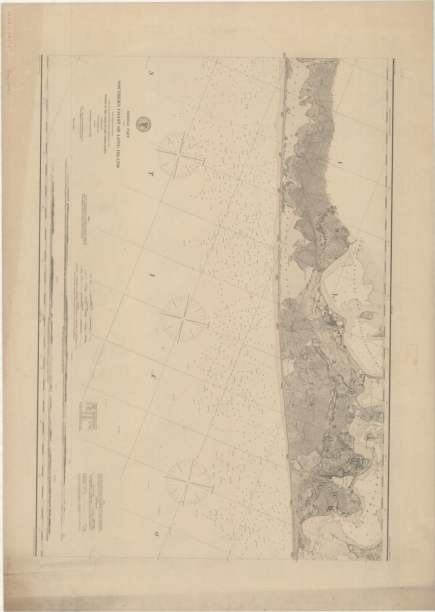
Middle part of the southern coast of Long Island: from a trigonometrical survey: under the direction of F.R. Hassler superintendent of the Survey of the Coast of the United States
Middle part of the southern coast of Long Island: from a trigonometrical survey: under the direction of F.R. Hassler superintendent of the Survey of the Coast of the United States
[1857]
Hempstead Harbor, Long Island: from a trigonometrical survey under the direction of F.R. Hassler and A.D. Bache, superintendents of the Survey of the Coast of the United States
Hempstead Harbor, Long Island: from a trigonometrical survey under the direction of F.R. Hassler and A.D. Bache, superintendents of the Survey of the Coast of the United States
1859
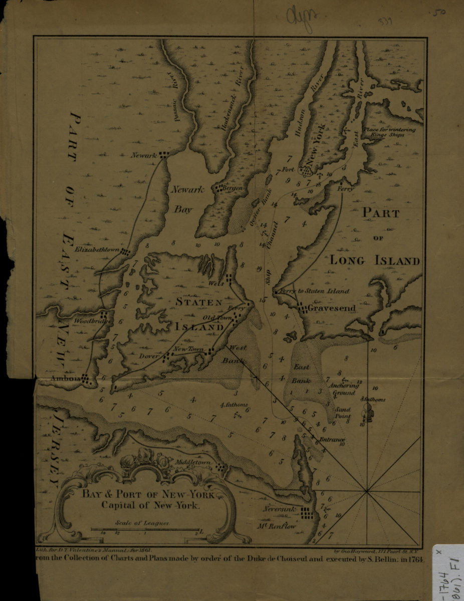
Bay & port of New-York, capital of New-York
Bay & port of New-York, capital of New-York
[1861]
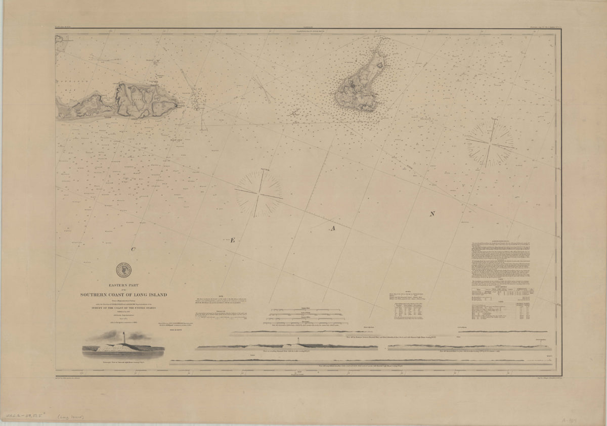
Eastern part of the southern coast of Long Island: from a trigonometrical survey under the direction of F.R. Hassler and A.D. Bache superintendent of the Survey of the Coast of the United States
Eastern part of the southern coast of Long Island: from a trigonometrical survey under the direction of F.R. Hassler and A.D. Bache superintendent of the Survey of the Coast of the United States
1878
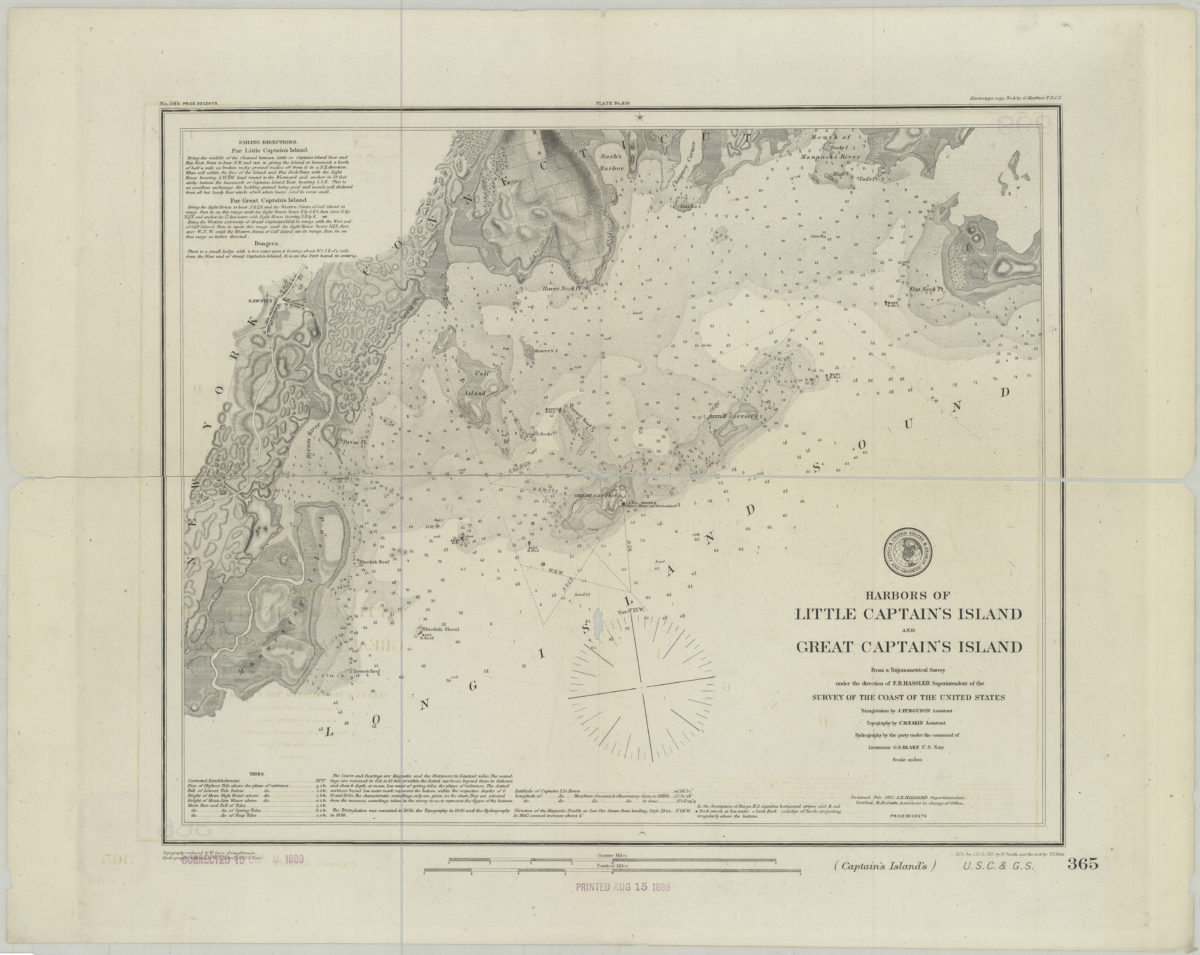
Harbors of Little Captain’s Island and Great Captain’s Island: from a trigonometrical survey under the direction of F.R. Hassler superintendent of the Survey of the Coast of the United States
Harbors of Little Captain’s Island and Great Captain’s Island: from a trigonometrical survey under the direction of F.R. Hassler superintendent of the Survey of the Coast of the United States
[1882]
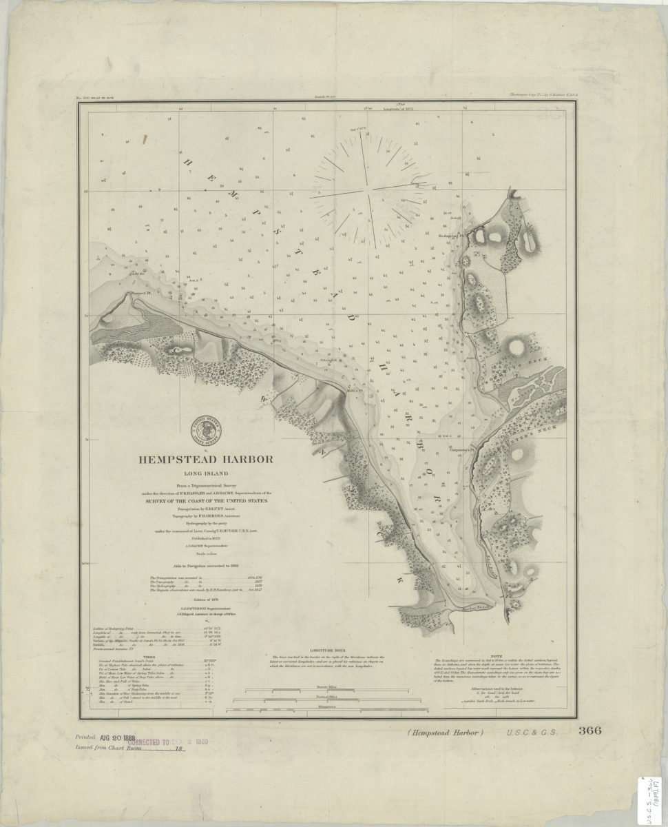
Hempstead Harbor, Long Island: from a trigonometrical survey under the direction of F.R. Hassler and A.D. Bache, superintendents of the Survey of the Coast of the United States
Hempstead Harbor, Long Island: from a trigonometrical survey under the direction of F.R. Hassler and A.D. Bache, superintendents of the Survey of the Coast of the United States
[1888]
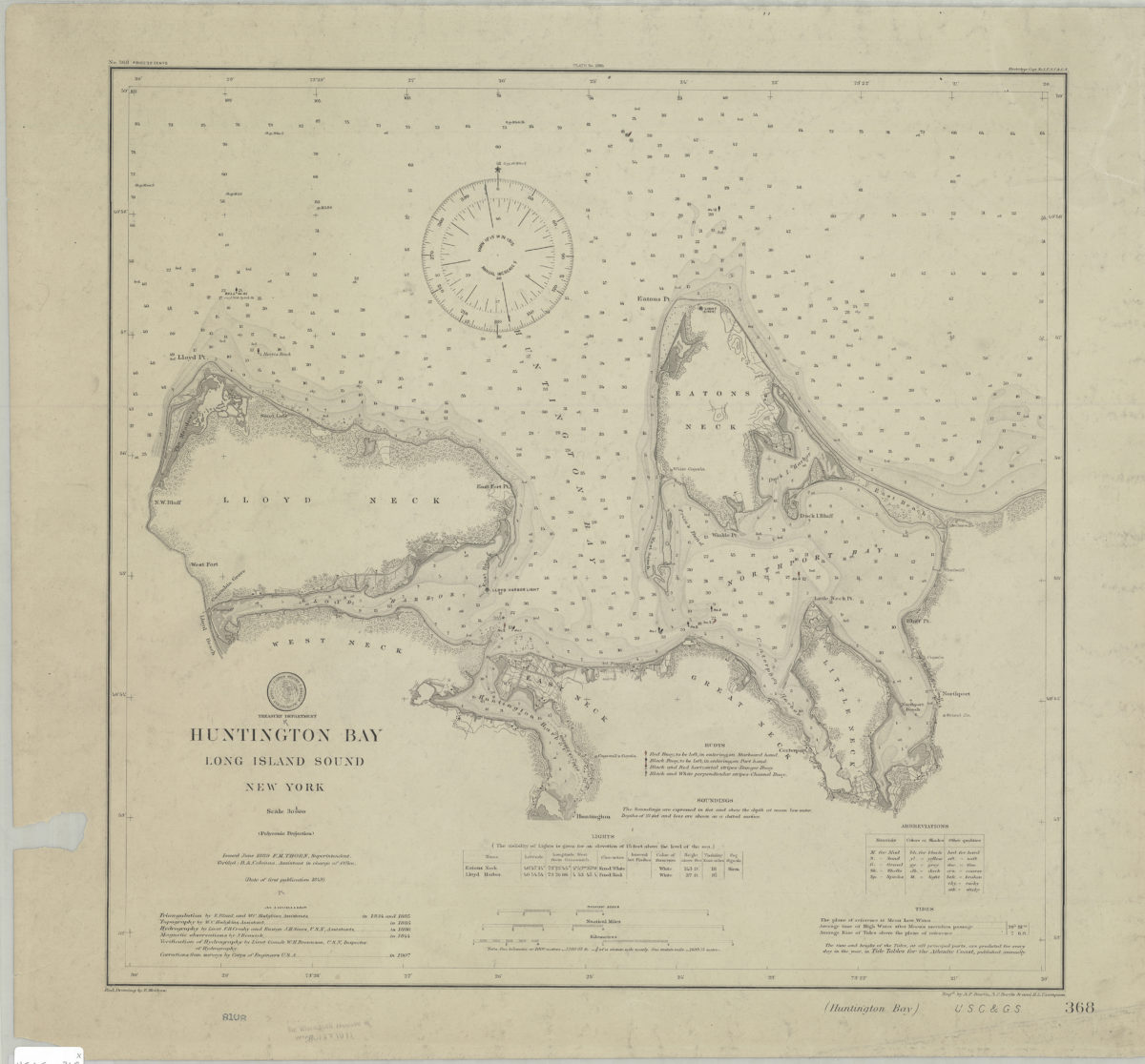
Huntington Bay, Long Island Sound, New York: U.S. Coast and Geodetic Survey ; red. drawing by E. Molkow
Huntington Bay, Long Island Sound, New York: U.S. Coast and Geodetic Survey ; red. drawing by E. Molkow
1889
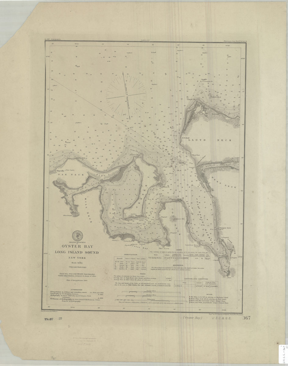
Oyster Bay, Long Island Sound, New York: U.S. Coast and Geodetic Survey ; red. drawing by E. Molkow
Oyster Bay, Long Island Sound, New York: U.S. Coast and Geodetic Survey ; red. drawing by E. Molkow
1889
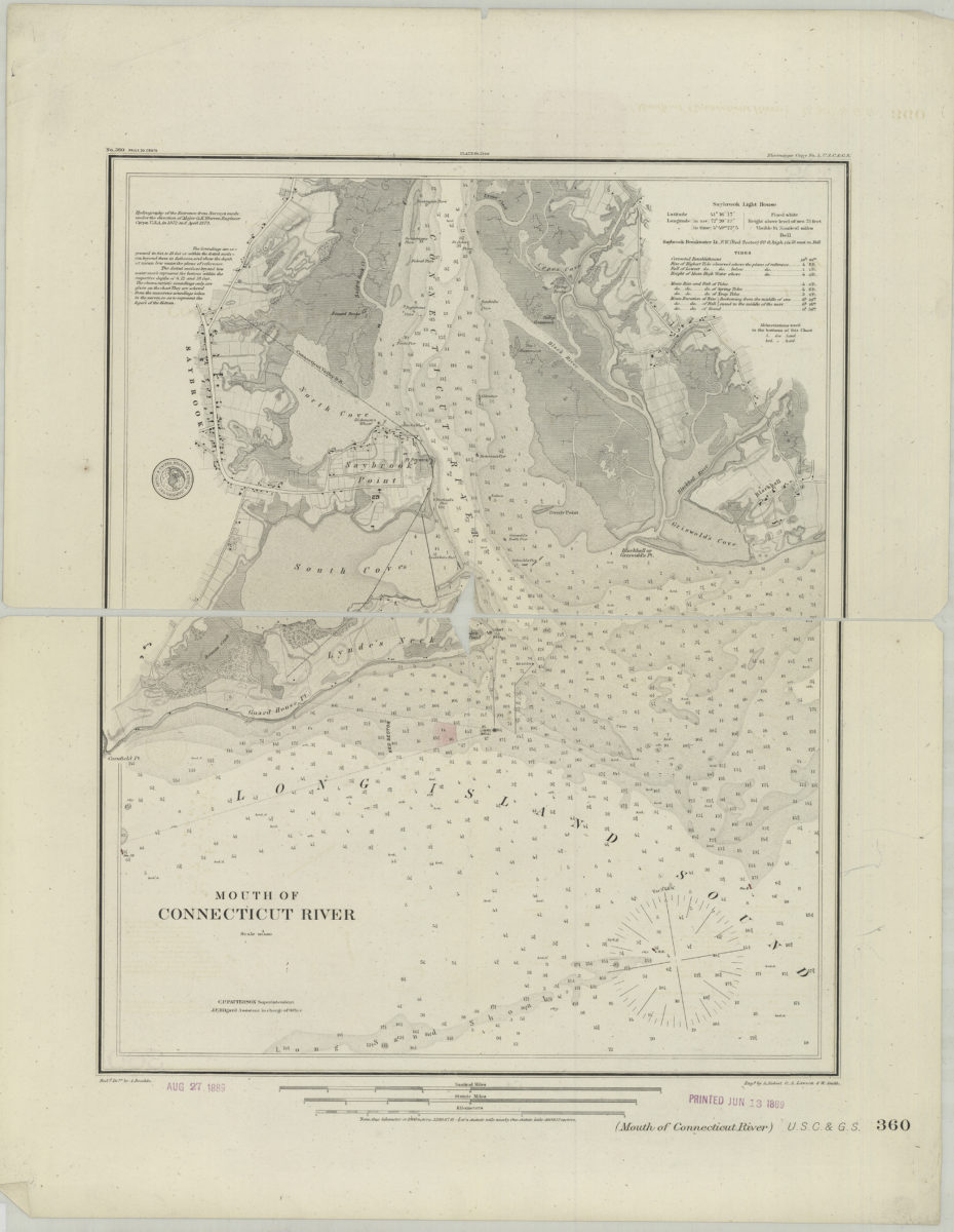
Mouth of Connecticut River
Mouth of Connecticut River
[1889]