Center for Brooklyn History
Map Collections
Search
About
Othmer Library & Archives
Submit search query
Refine 11 records
Clear filters
2
Location
Bay Ridge (New York, N.Y.)
108
Bensonhurst (New York, N.Y.)
17
Brooklyn (New York, N.Y.)
891
Brooklyn Heights (New York, N.Y.)
76
Downtown Brooklyn (New York, N.Y.)
29
Dyker Heights (New York, N.Y.)
23
Fort Hamilton (New York, N.Y.)
31
Park Slope (New York, N.Y.)
16
Prospect Heights (New York, N.Y.)
16
Sunset Park (New York, N.Y.)
53
Windsor Terrace (New York, N.Y.)
10
Subject
Election districts
36
Land use
5
Landforms
15
Landowners
434
Real property
619
Roads
117
Sewerage
7
Zoning
2
Date
20th Century
469
or enter range:
from
to
Genres
Cadastral maps
597
Manuscript maps
365
Map
191
Pictorial maps
38
Public utility maps
15
Zoning maps
55
Sort by:
Date (earliest)
Date (most recent)
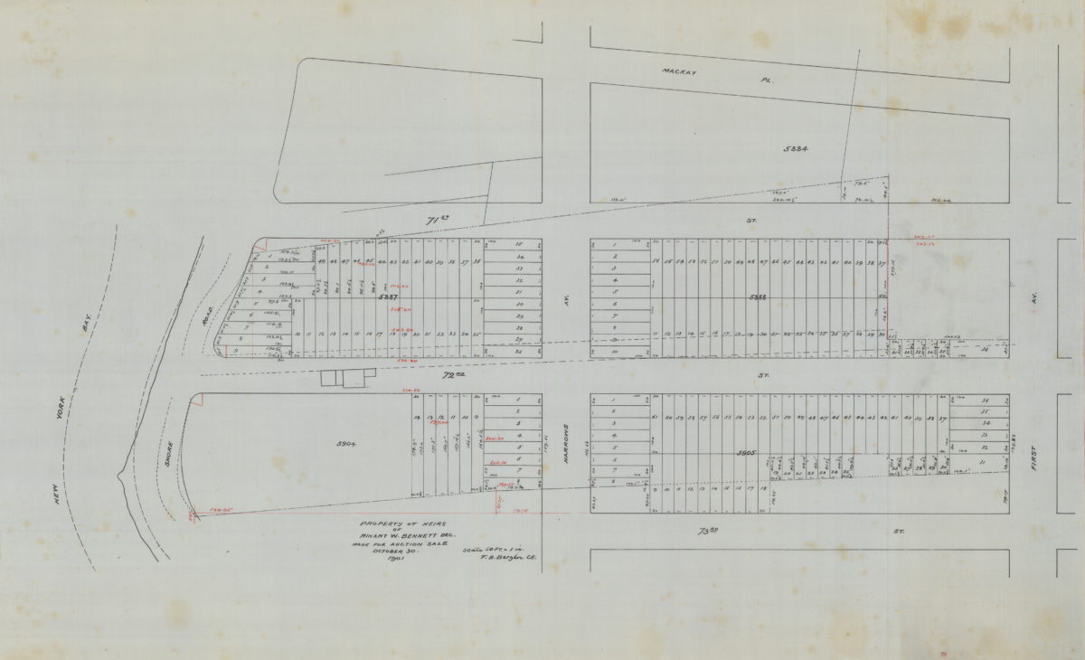
Property of heirs of Winant W. Bennett, dec., made for auction sale: V.B. Bergen, C.E.
Property of heirs of Winant W. Bennett, dec., made for auction sale: V.B. Bergen, C.E.
October 30 1901
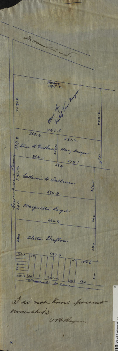
[Maps of Cowenhoven Lane and profile map of the grade of 2nd Avenue]
[Maps of Cowenhoven Lane and profile map of the grade of 2nd Avenue]
[ca. 1903]
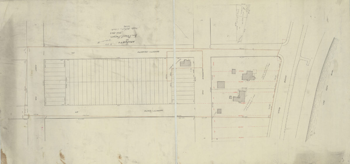
Property of Van Brunt Bergen
Property of Van Brunt Bergen
Feb-03
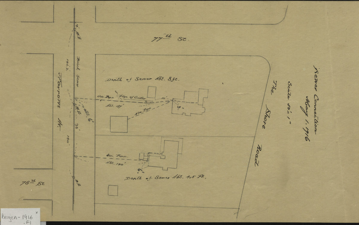
Sewer connection, May 1, 1916
Sewer connection, May 1, 1916
1916
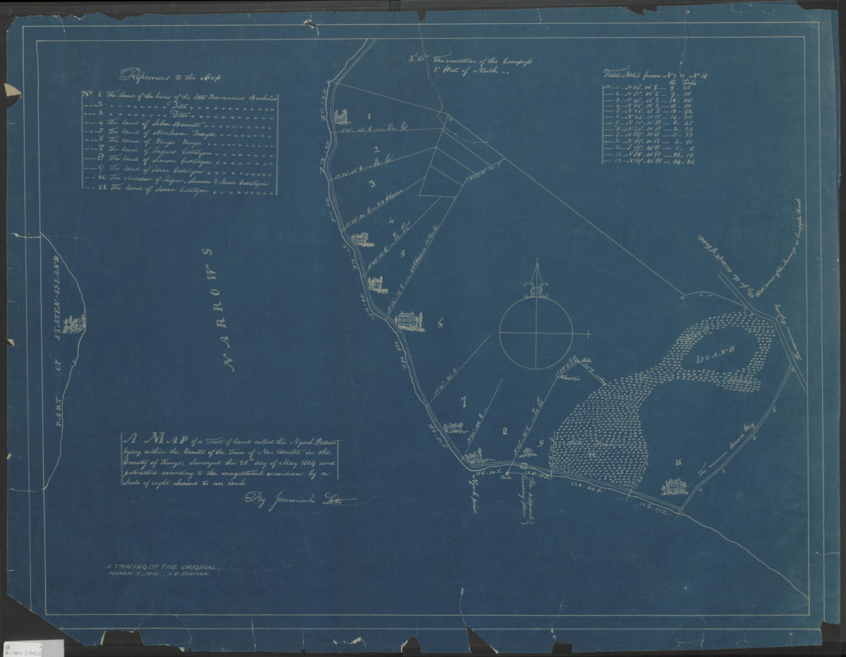
A map of a tract of land called the Nyash Patent, lying within the limits of the town of New Utrecht in the county of Kings, surveyed the 26th day of May 1804 and protracted according to the magnetical meridian by a scale of eight chains to an inch
A map of a tract of land called the Nyash Patent, lying within the limits of the town of New Utrecht in the county of Kings, surveyed the 26th day of May 1804 and protracted according to the magnetical meridian by a scale of eight chains to an inch
[1918]
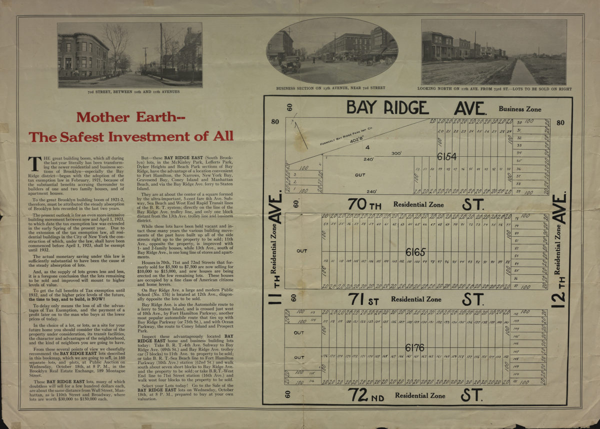
Absolute auction Bay Ridge east … 160 lots and plots on Bay Ridge Avenue, 11th and 12th Avenues, 70th, 71st and 72nd Street, Bay Ridge Ave., B[roo]klyn, Wednesday, Oct. 18th, 1922
Absolute auction Bay Ridge east … 160 lots and plots on Bay Ridge Avenue, 11th and 12th Avenues, 70th, 71st and 72nd Street, Bay Ridge Ave., B[roo]klyn, Wednesday, Oct. 18th, 1922
[1922]
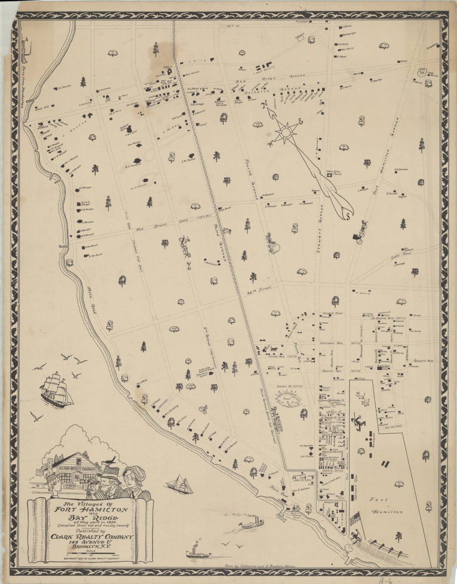
The villages of Fort Hamilton and Bay Ridge as they were in 1870: compiled from old and musty records: done by Catherine and E. Theodore Nelson
The villages of Fort Hamilton and Bay Ridge as they were in 1870: compiled from old and musty records: done by Catherine and E. Theodore Nelson
[ca. 1942]
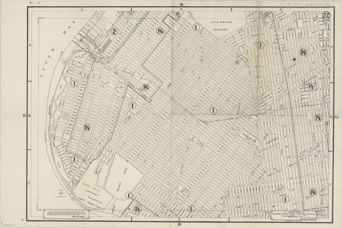
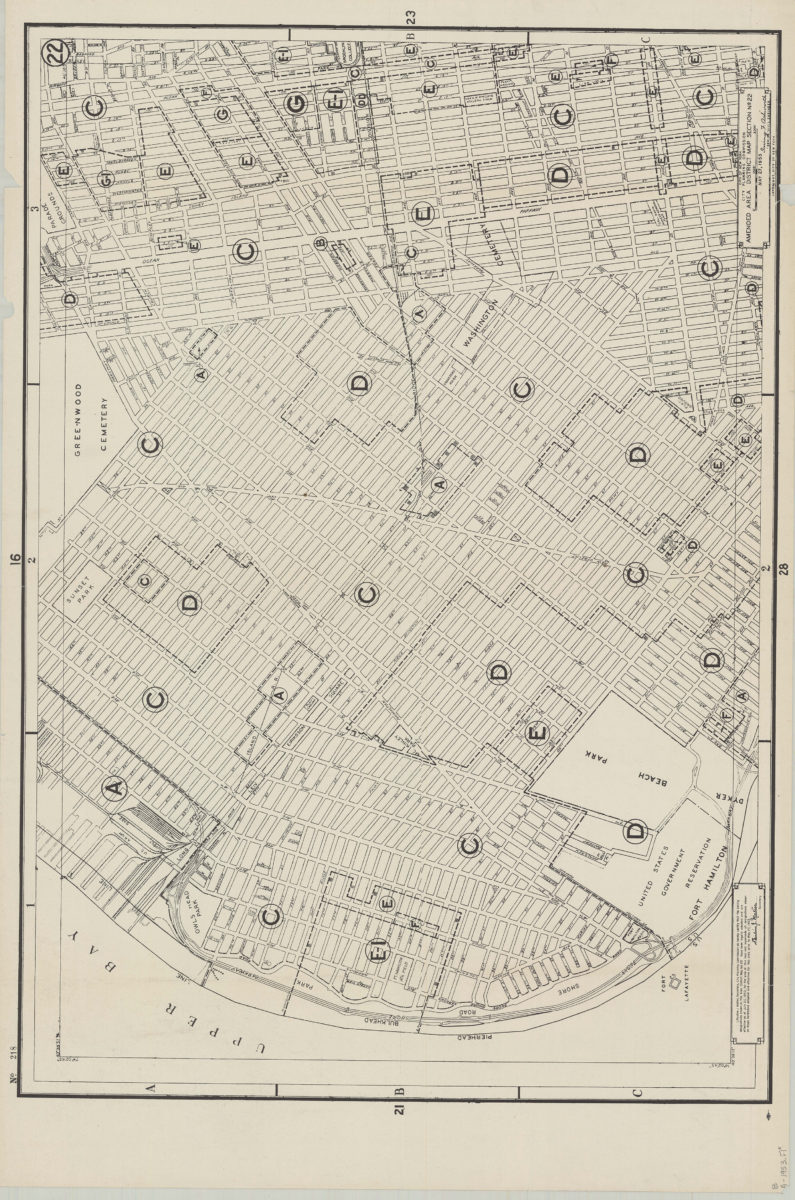
Amended use district map, section no. 22: City of New York, City Planning Commission, Irving F. Ashworth, senior civil engineer
Amended use district map, section no. 22: City of New York, City Planning Commission, Irving F. Ashworth, senior civil engineer
1953
Amended use district map, section no. 22: City of New York, City Planning Commission, Irving F. Ashworth, senior civil engineer
Amended use district map, section no. 22: City of New York, City Planning Commission, Irving F. Ashworth, senior civil engineer
1953
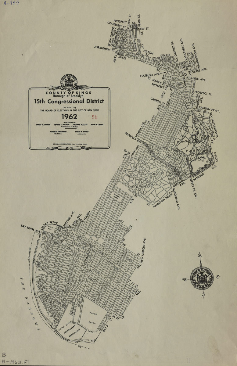
County of Kings, Borough of Brooklyn, 15th Congressional District: issued by the Board of Elections in the City of New York
County of Kings, Borough of Brooklyn, 15th Congressional District: issued by the Board of Elections in the City of New York
1962
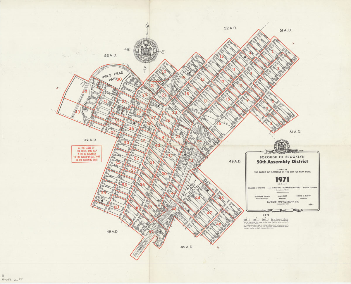
Borough of Brooklyn 50th Assembly District, 1971: issued by the Board of Elections in the City of New York
Borough of Brooklyn 50th Assembly District, 1971: issued by the Board of Elections in the City of New York
1971