Center for Brooklyn History
Map Collections
Search
About
Othmer Library & Archives
Submit search query
Refine 6 records
Clear filters
3
Location
Bath Beach (New York, N.Y.)
8
Bay Ridge (New York, N.Y.)
108
Bensonhurst (New York, N.Y.)
17
Borough Park (New York, N.Y.)
23
Brooklyn (New York, N.Y.)
891
Dyker Heights (New York, N.Y.)
23
Fort Hamilton (New York, N.Y.)
31
New Utrecht (New York, N.Y.)
9
Sunset Park (New York, N.Y.)
53
Subject
Landowners
434
Real property
619
Date
19th Century
945
20th Century
469
or enter range:
from
to
Genres
Cadastral maps
597
Manuscript maps
365
Sort by:
Date (earliest)
Date (most recent)
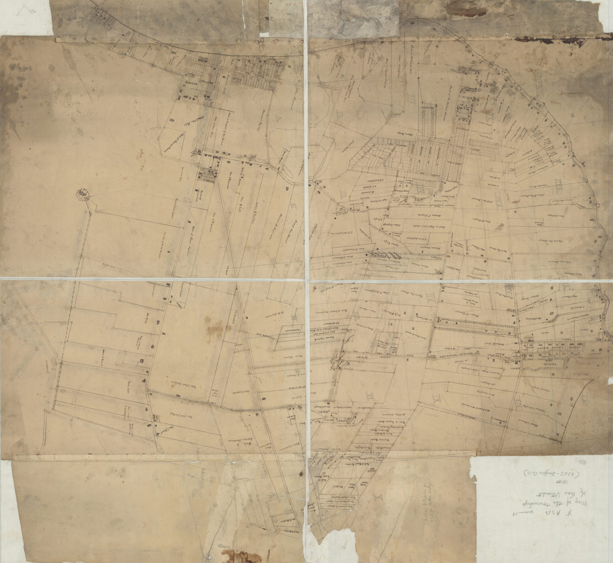
[Map of New Utrecht]
[Map of New Utrecht]
[18??]
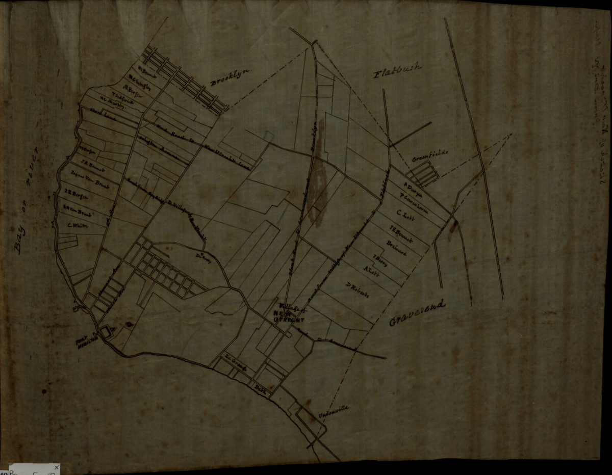
[Map of roads from Gravesend to Flatbush to Flatlands, New Utrecht and Flatbush]
[Map of roads from Gravesend to Flatbush to Flatlands, New Utrecht and Flatbush]
[18??]
Sketch of New Utrecht from Dripps map
Sketch of New Utrecht from Dripps map
[18??]
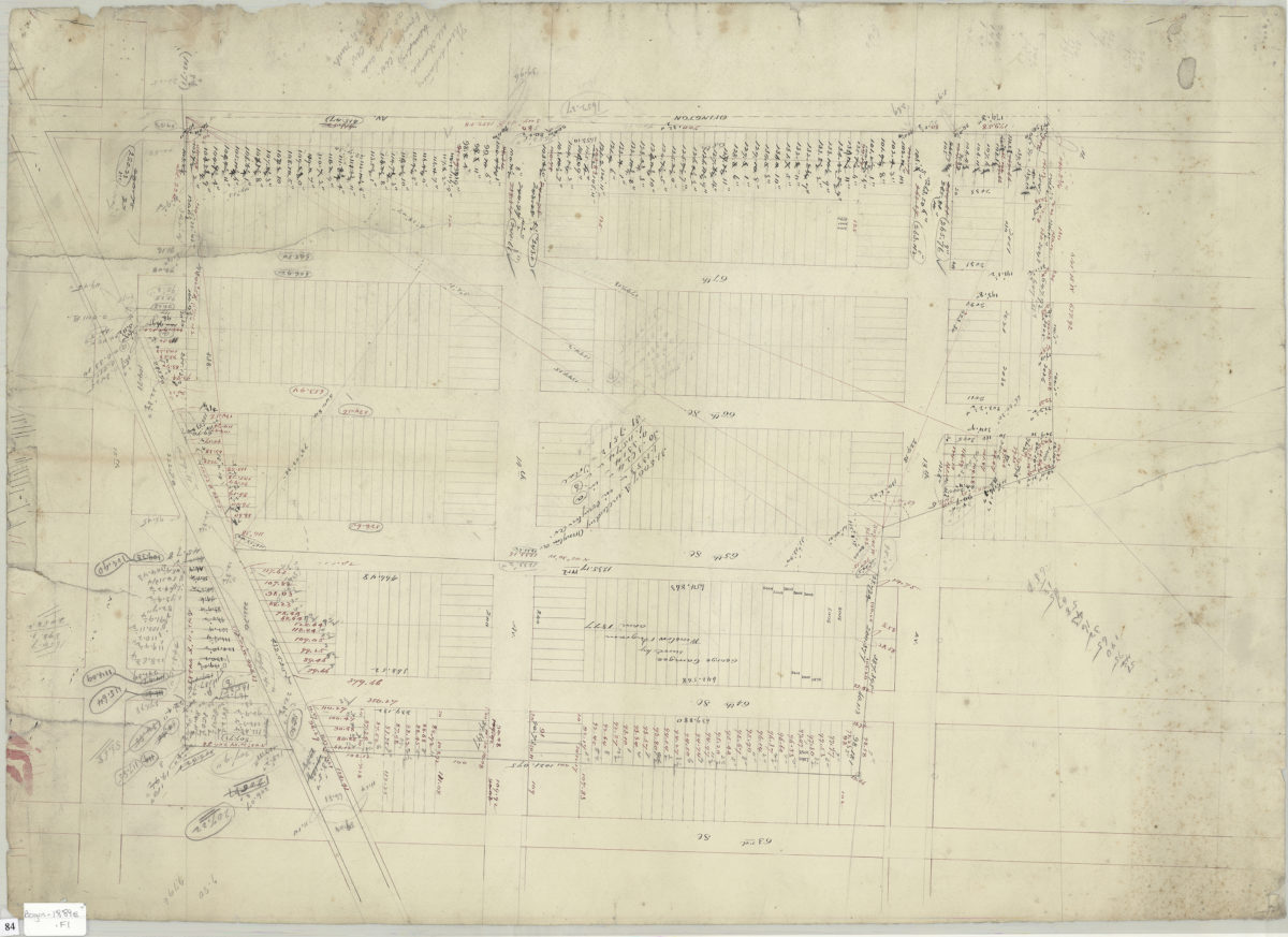
[Survey map of area bounded by 63rd Street, 15th Avenue, Ovington Avenue, and 12th Avenue]
[Survey map of area bounded by 63rd Street, 15th Avenue, Ovington Avenue, and 12th Avenue]
1889
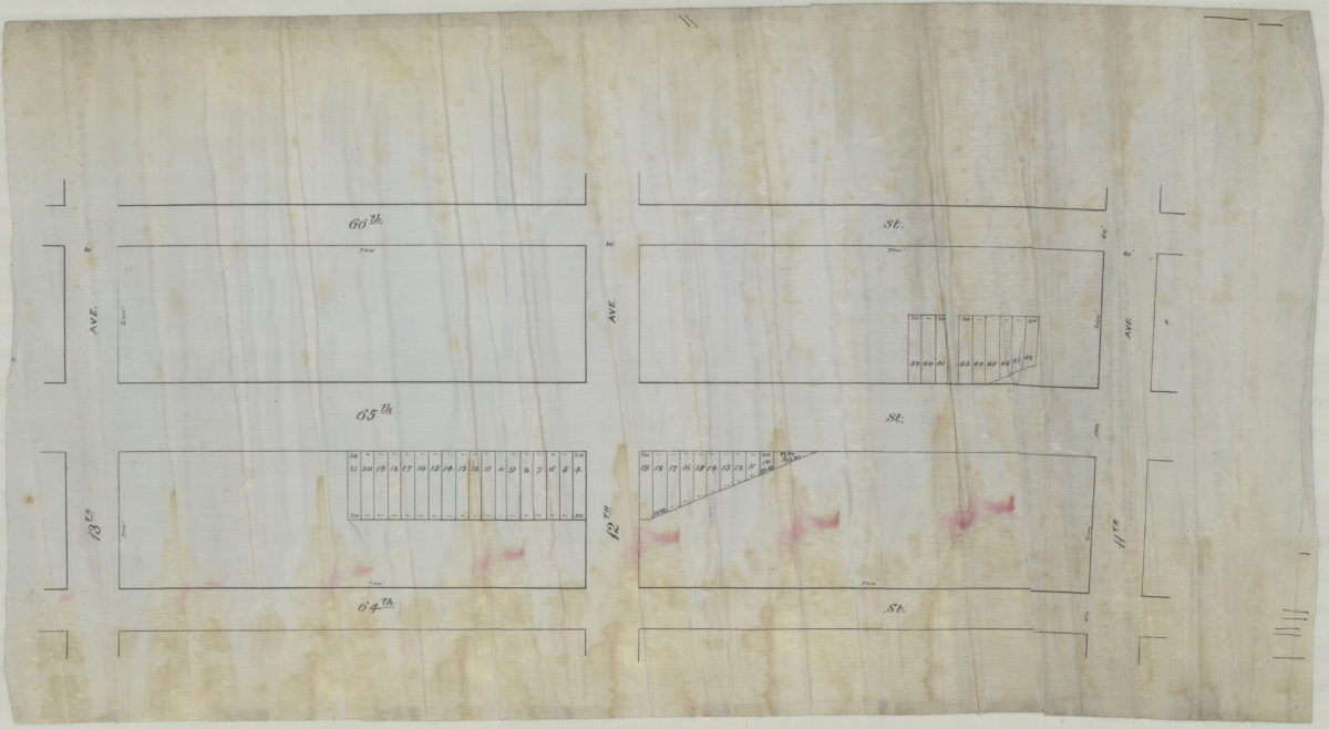
[Map of area bounded by 13th Ave., 64th St., 11th Ave., and 66th St.].
[Map of area bounded by 13th Ave., 64th St., 11th Ave., and 66th St.].
[189?]
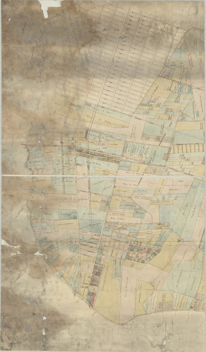
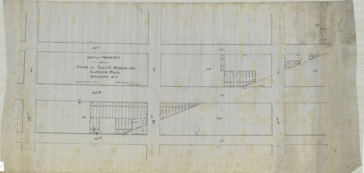
Map of property of heirs of Tunis G. Bergen, dec., Thirtieth Ward, Brooklyn, N.Y.: V.B. Bergen, C.E.
Map of property of heirs of Tunis G. Bergen, dec., Thirtieth Ward, Brooklyn, N.Y.: V.B. Bergen, C.E.
April 1907