Center for Brooklyn History
Map Collections
Search
About
Othmer Library & Archives
Submit search query
Refine 8 records
Clear filters
3
Location
Bronx (New York, N.Y.)
10
Brooklyn (New York, N.Y.)
891
Coney Island (New York, N.Y.)
22
Far Rockaway (New York, N.Y.)
2
Manhattan (New York, N.Y.)
120
New Jersey
27
New York (N.Y.)
164
New York (State)
95
Queens (New York, N.Y.)
83
Staten Island (N.Y.)
10
Wallabout Bay (New York, N.Y.)
6
Subject
Date
20th Century
469
or enter range:
from
to
Genres
Bathymetric maps
94
Topographic maps
70
Sort by:
Date (earliest)
Date (most recent)
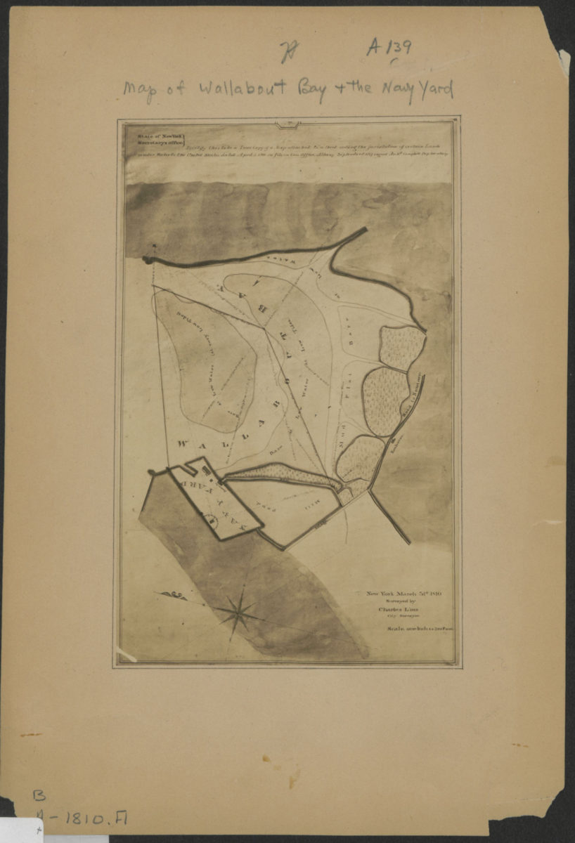
[Map of Wallabout Bay and the Brooklyn Navy Yard]: surveyed by Charles Loss, city surveyor, New York, March 31st, 1810
[Map of Wallabout Bay and the Brooklyn Navy Yard]: surveyed by Charles Loss, city surveyor, New York, March 31st, 1810
[19??]
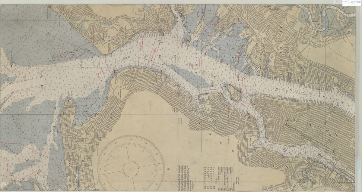
[Map of Mahattan south of Central Park, eastern edge of Brooklyn, southwest edge of New Jersey, and the nothwest edge of Staten Island]
[Map of Mahattan south of Central Park, eastern edge of Brooklyn, southwest edge of New Jersey, and the nothwest edge of Staten Island]
[19??]
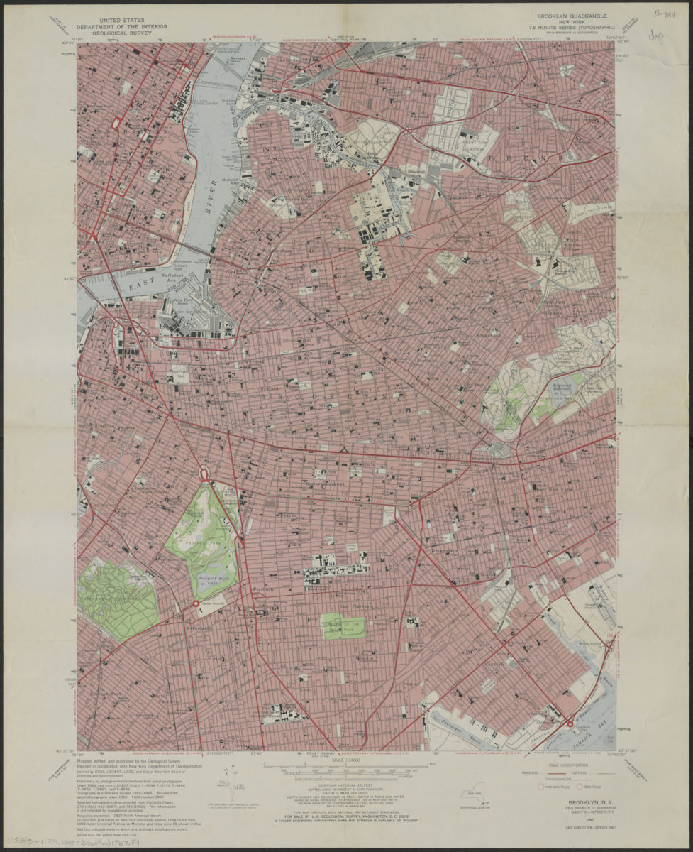
Brooklyn quadrangle, New York
Brooklyn quadrangle, New York
1967
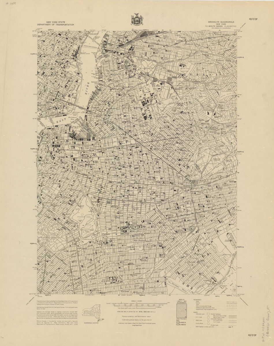
Brooklyn quadrangle, New York
Brooklyn quadrangle, New York
[1969]
Coney Island quadrangle, New York–New Jersey
Coney Island quadrangle, New York–New Jersey
[1969]
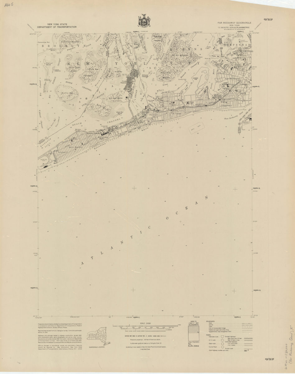
Far Rockaway quadrangle, New York
Far Rockaway quadrangle, New York
[1969]
Flushing quadrangle, New York
Flushing quadrangle, New York
[1969]
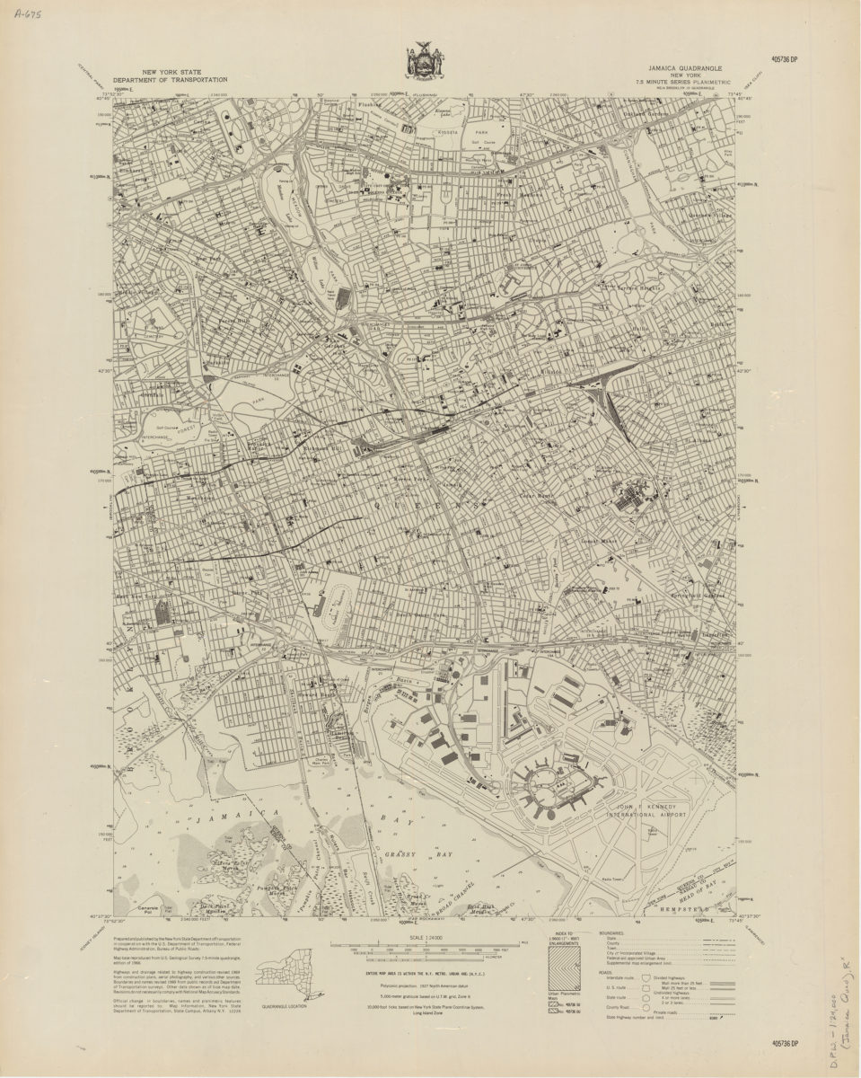
Jamaica quadrangle, New York
Jamaica quadrangle, New York
[1969]