Center for Brooklyn History
Map Collections
Search
About
Othmer Library & Archives
Submit search query
Refine 13 records
Clear filters
3
Location
Battery Park (New York, N.Y.)
3
Belt Parkway (New York, N.Y.)
1
Brooklyn (New York, N.Y.)
891
Brooklyn Heights (New York, N.Y.)
76
Brooklyn-Battery Bridge (New York, N.Y.)
1
Brooklyn-Queens Expressway (New York, N.Y.)
3
Carroll Gardens (New York, N.Y.)
21
Columbia Street Waterfront District (New York, N.Y.)
3
Downtown Brooklyn (New York, N.Y.)
29
New York (N.Y.)
164
Queens (New York, N.Y.)
83
Red Hook (New York, N.Y.)
19
Williamsburg (New York, N.Y.)
36
Subject
Bridges
13
Electric railroads
5
Express highways
3
Highway planning
2
Local transit
63
Postal codes
4
Railroads
72
Railroads, Elevated
24
Roads
117
Street addresses
11
Street railroads
8
Streets
46
Subways
55
Zip codes
4
Date
20th Century
469
or enter range:
from
to
Genres
Road maps
83
Transportation maps
120
Sort by:
Date (earliest)
Date (most recent)
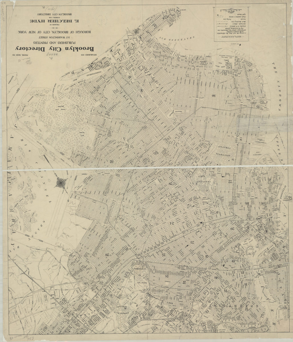
[Map of Brooklyn, circa 1914, from Brooklyn City Directory]
[Map of Brooklyn, circa 1914, from Brooklyn City Directory]
[1914]
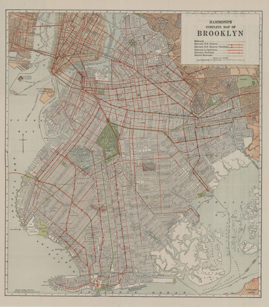
Hammond’s complete map of Brooklyn: copyright by C.S. Hammond Co
Hammond’s complete map of Brooklyn: copyright by C.S. Hammond Co
[192?]
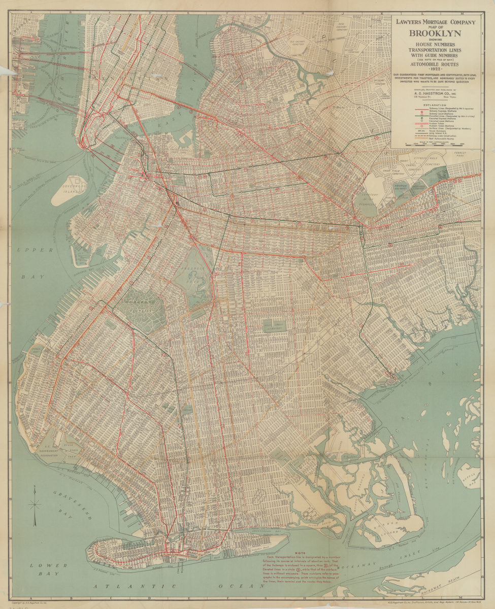
Lawyer’s Mortgage Company map of Brooklyn: showing house-numbers, transportation lines, with guide numbers … automobile routes, 1922: compiled, printed and published A.G. Hagstrom Co., Inc
Lawyer’s Mortgage Company map of Brooklyn: showing house-numbers, transportation lines, with guide numbers … automobile routes, 1922: compiled, printed and published A.G. Hagstrom Co., Inc
1922
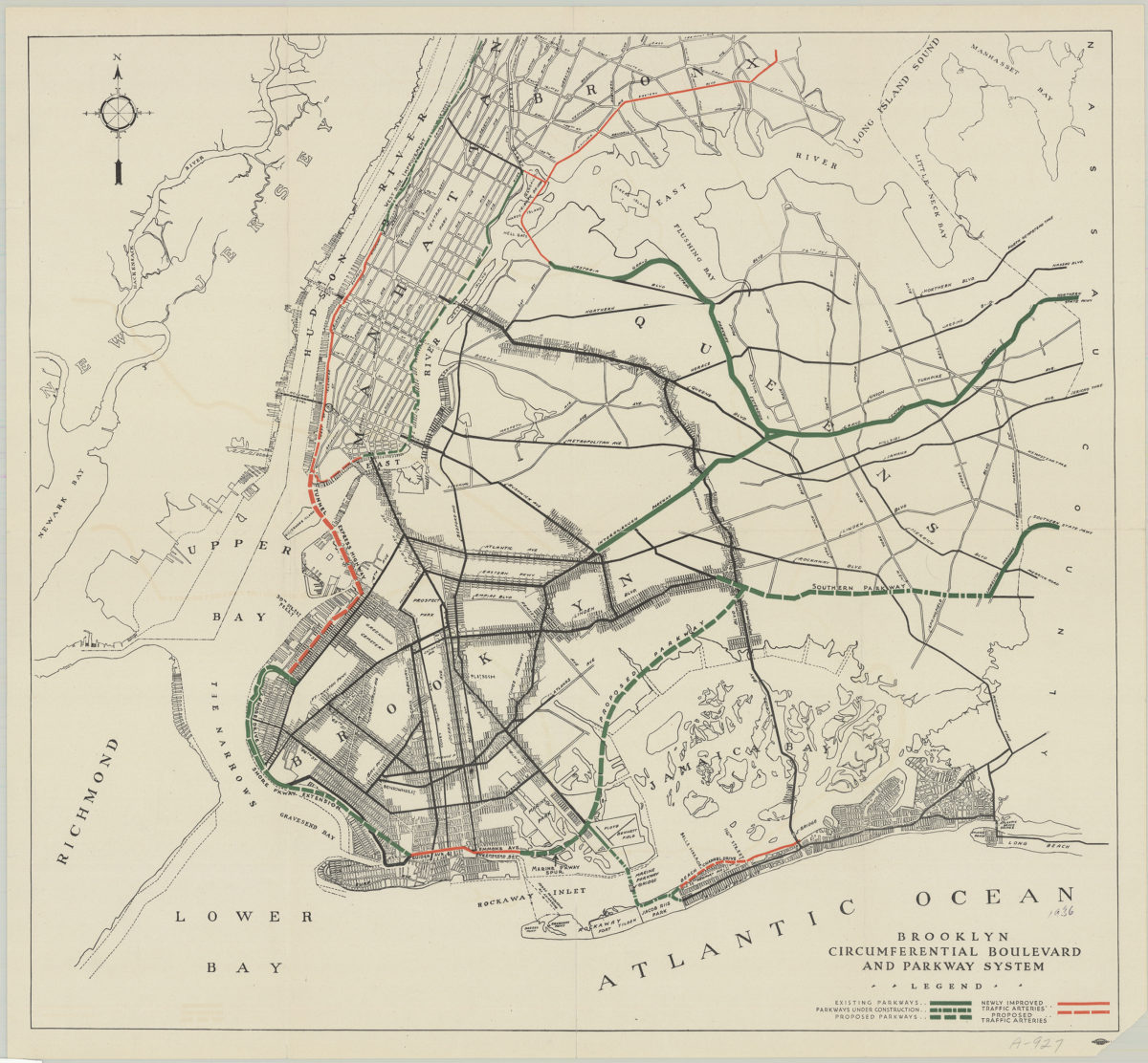
Brooklyn circumferential boulevard and parkway system
Brooklyn circumferential boulevard and parkway system
[193?]
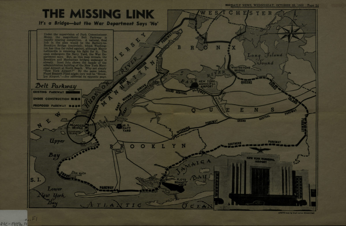
The missing link: it’s a bridge but the War Department says ‘no.’
The missing link: it’s a bridge but the War Department says ‘no.’
[1939]
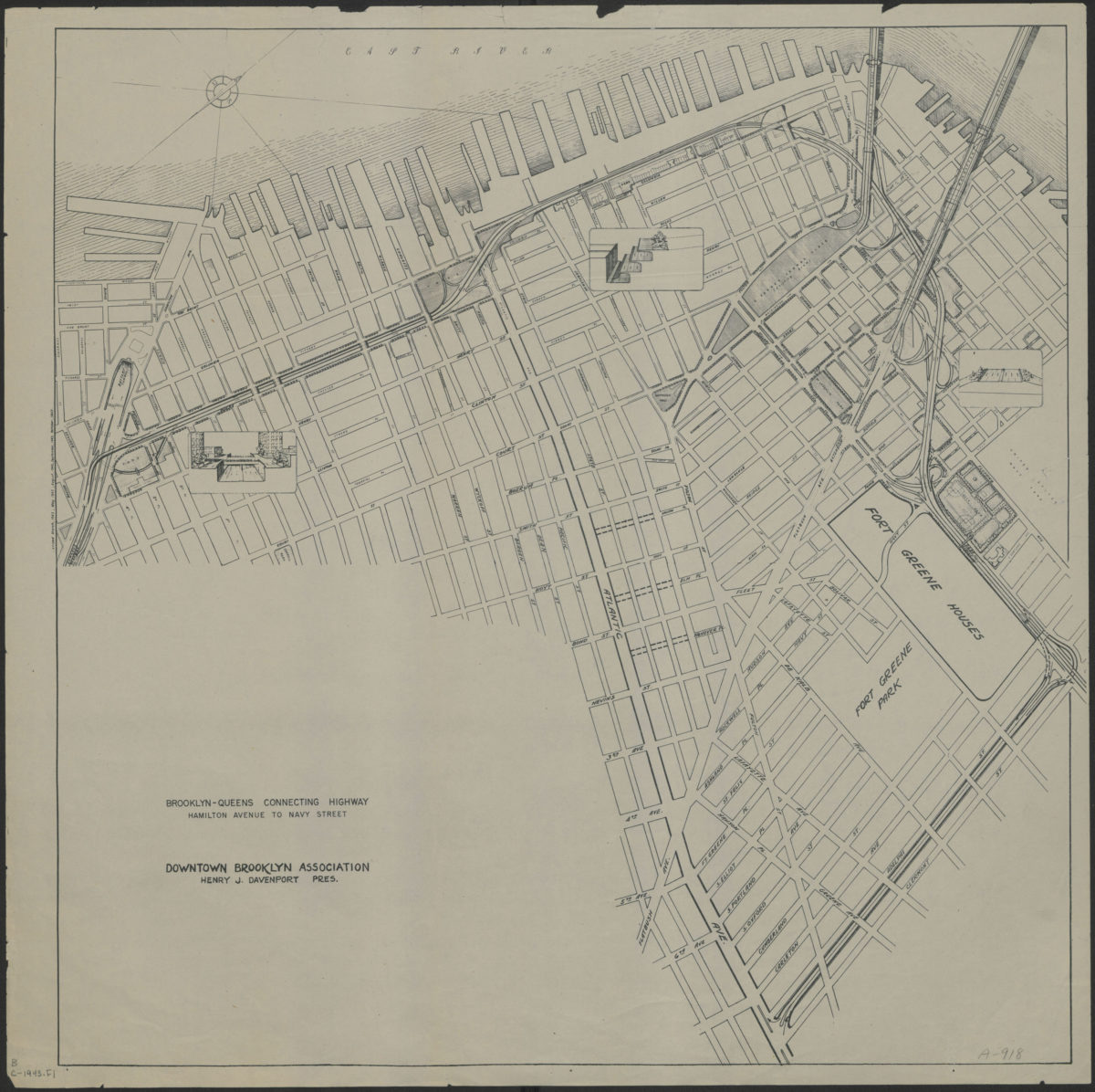
Brooklyn-Queens connecting highway: Hamilton Avenue to Navy Street: Downtown Brooklyn Association
Brooklyn-Queens connecting highway: Hamilton Avenue to Navy Street: Downtown Brooklyn Association
[1943]
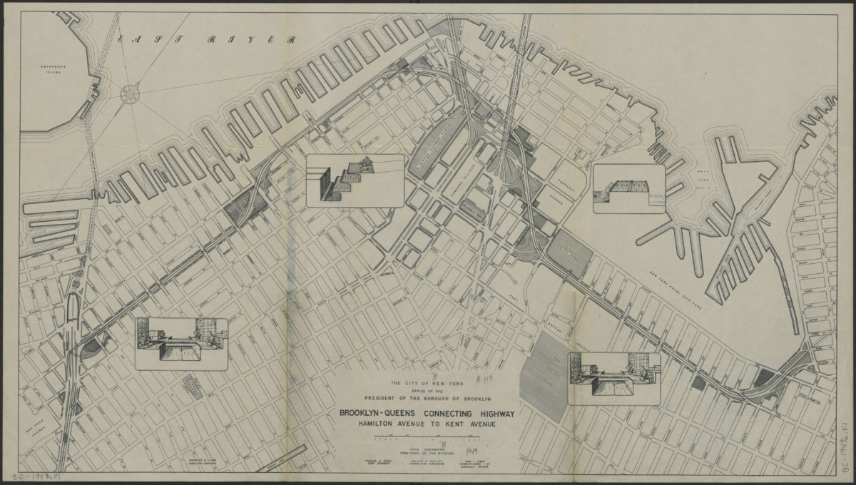
Brooklyn-Queens connecting highway: Hamilton Avenue to Kent Avenue
Brooklyn-Queens connecting highway: Hamilton Avenue to Kent Avenue
[1949]
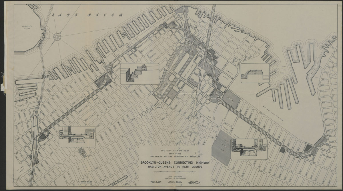
Brooklyn-Queens connecting highway: Hamilton Avenue to Kent Avenue
Brooklyn-Queens connecting highway: Hamilton Avenue to Kent Avenue
1949
Hagstrom’s map of Brooklyn, New York City: house number and transit guide: compiled, printed, and published by Hagstrom Company Incorporated
Hagstrom’s map of Brooklyn, New York City: house number and transit guide: compiled, printed, and published by Hagstrom Company Incorporated
[1950; 1947]
The complete map of Brooklyn (New York City): featuring house numbers, transit lines, playgrounds, wading pools, etc.: produced under the direction of Alexander Gross
The complete map of Brooklyn (New York City): featuring house numbers, transit lines, playgrounds, wading pools, etc.: produced under the direction of Alexander Gross
[195?]
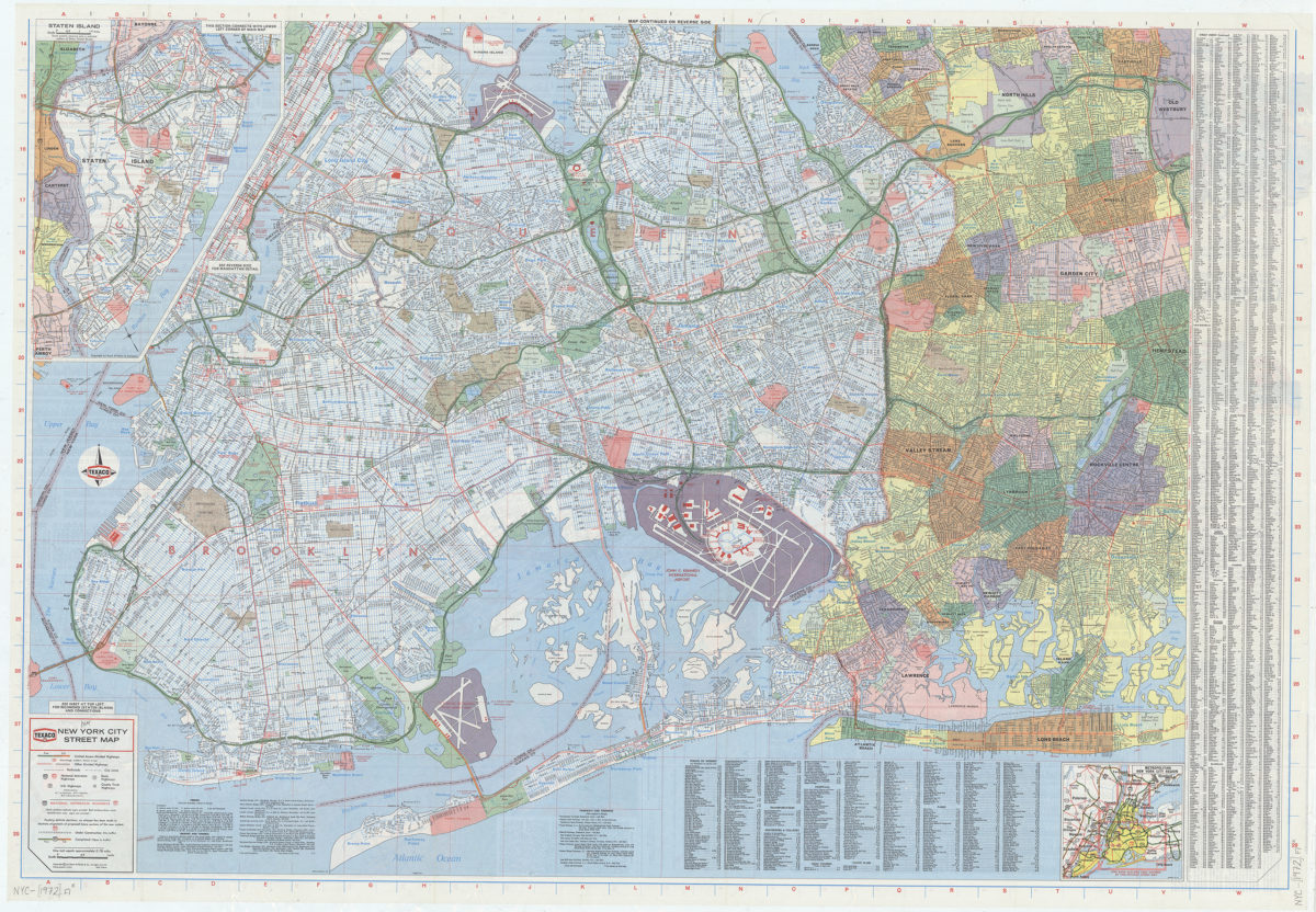
New York City street map: [prepared for] Texaco
New York City street map: [prepared for] Texaco
[1972]
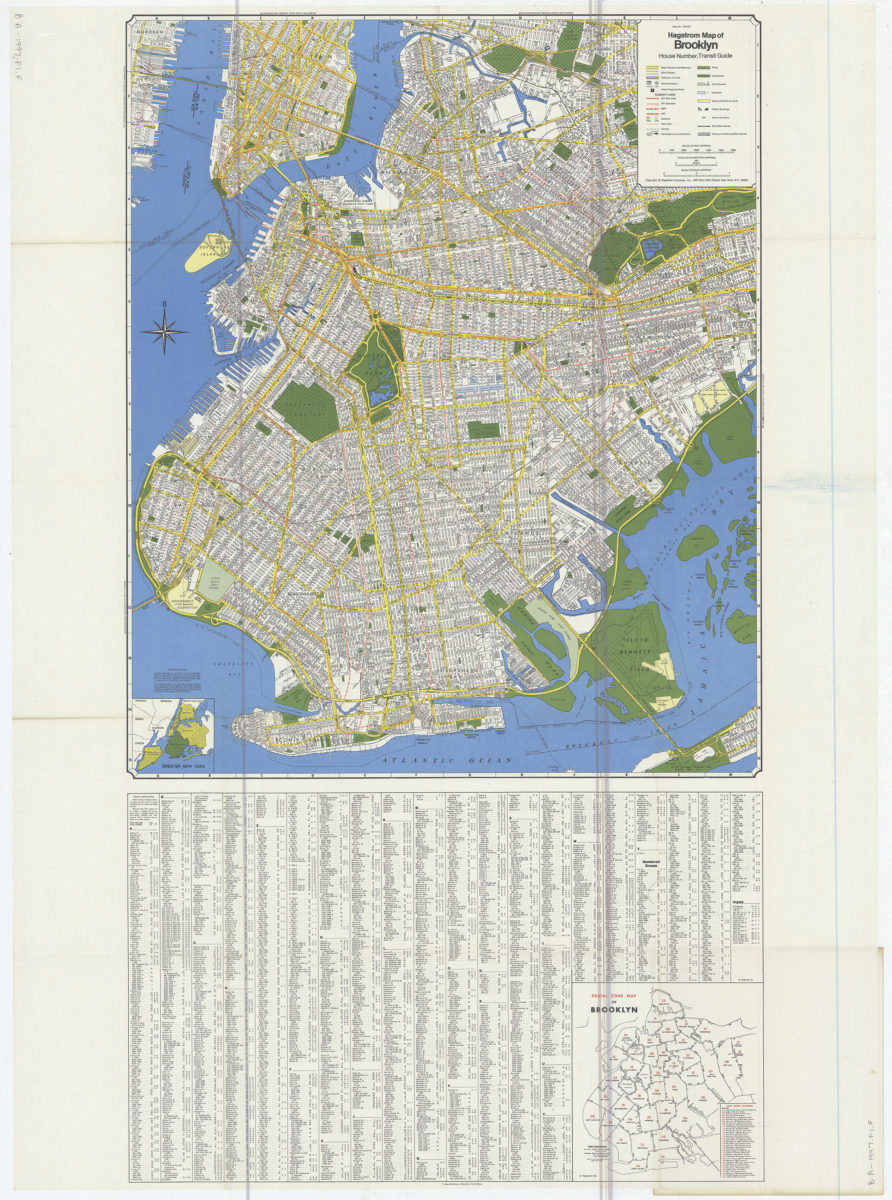
Hagstrom map of Brooklyn: house number, transit guide
Hagstrom map of Brooklyn: house number, transit guide
[1977]
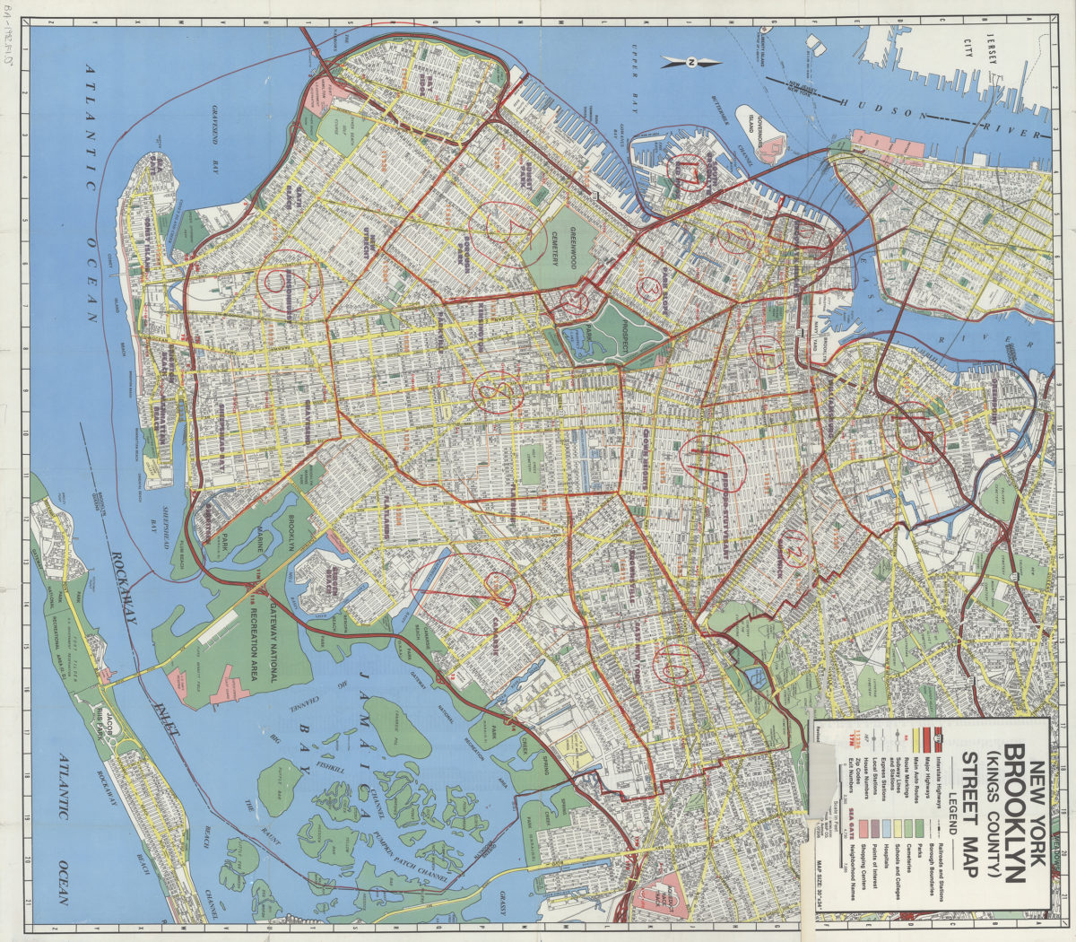
New York, Brooklyn (Kings County), street map: Geographia Map Co., Inc
New York, Brooklyn (Kings County), street map: Geographia Map Co., Inc
[ca. 1982]