Center for Brooklyn History
Map Collections
Search
About
Othmer Library & Archives
Submit search query
Refine 5 records
Clear filters
3
Location
Bay Ridge (New York, N.Y.)
108
Bedford-Stuyvesant (New York, N.Y.)
67
Bensonhurst (New York, N.Y.)
17
Brooklyn (New York, N.Y.)
891
Brownsville (New York, N.Y.)
10
Dyker Heights (New York, N.Y.)
23
Fort Hamilton (New York, N.Y.)
31
Sunset Park (New York, N.Y.)
53
Subject
Central business districts
10
City planning
7
Community development
2
Land use
5
Zoning
2
Date
20th Century
469
or enter range:
from
to
Genres
Thematic maps
60
Transportation maps
120
Zoning maps
55
Sort by:
Date (earliest)
Date (most recent)
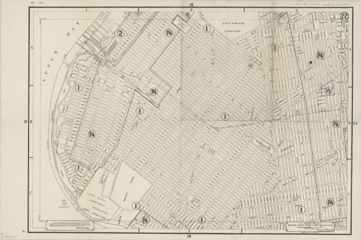
Amended use district map, section no. 22: City of New York, City Planning Commission, Irving F. Ashworth, senior civil engineer
Amended use district map, section no. 22: City of New York, City Planning Commission, Irving F. Ashworth, senior civil engineer
1953
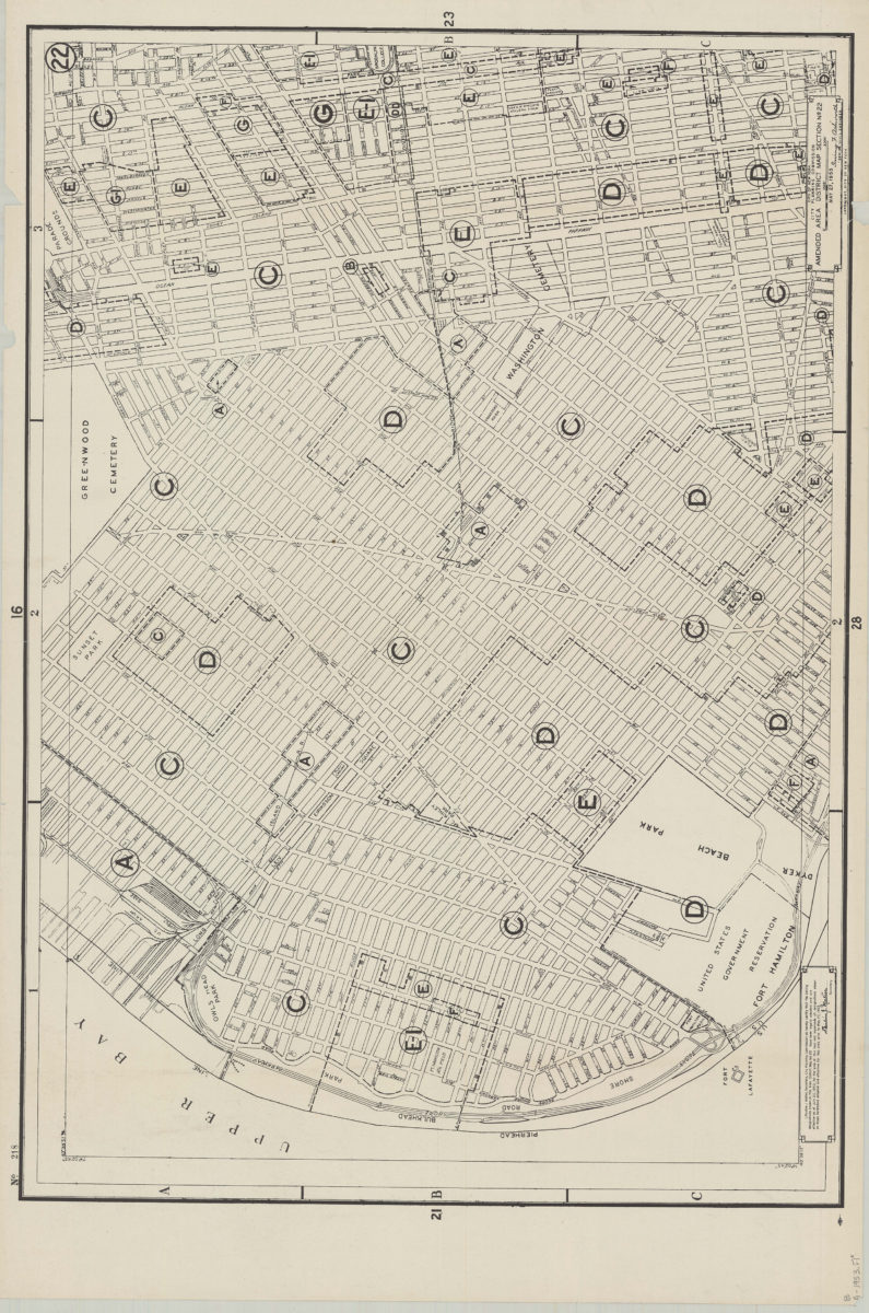
Amended use district map, section no. 22: City of New York, City Planning Commission, Irving F. Ashworth, senior civil engineer
Amended use district map, section no. 22: City of New York, City Planning Commission, Irving F. Ashworth, senior civil engineer
1953
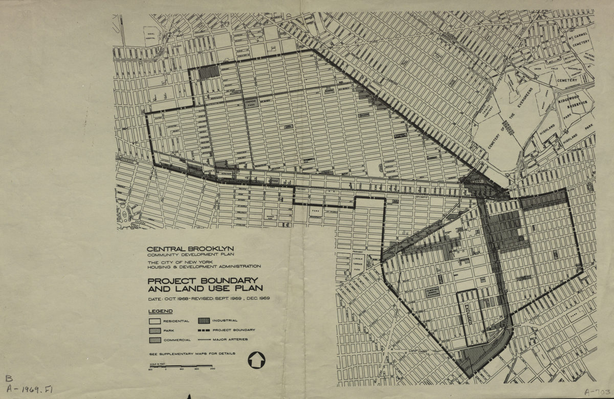
Central Brooklyn community development plan: project boundary and land use plan: the City of New York Housing & Development Administration
Central Brooklyn community development plan: project boundary and land use plan: the City of New York Housing & Development Administration
1969
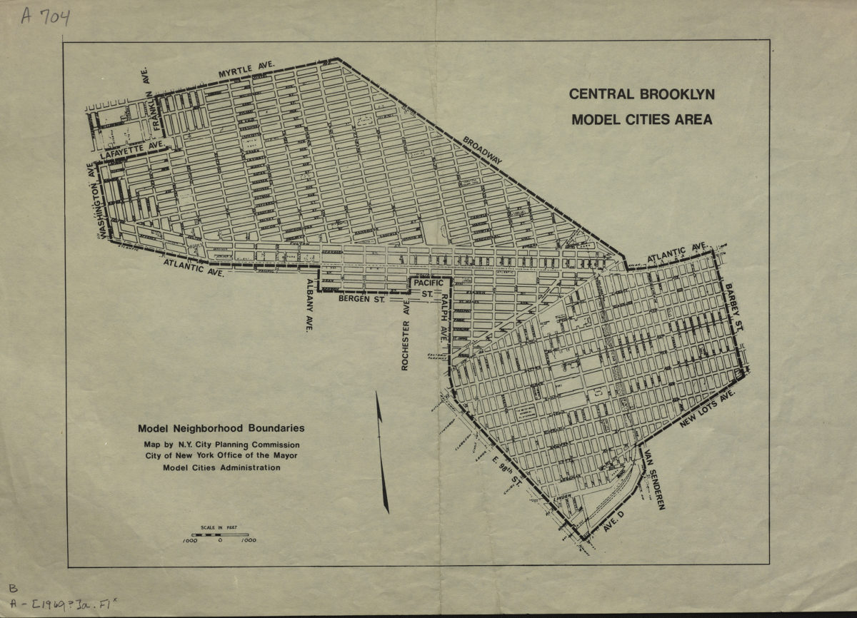
Central Brooklyn model cities area: model neighborhood boundaries: map by N.Y. City Planning Commission, City of New York Office of the Mayor Model Cities Administration
Central Brooklyn model cities area: model neighborhood boundaries: map by N.Y. City Planning Commission, City of New York Office of the Mayor Model Cities Administration
1969
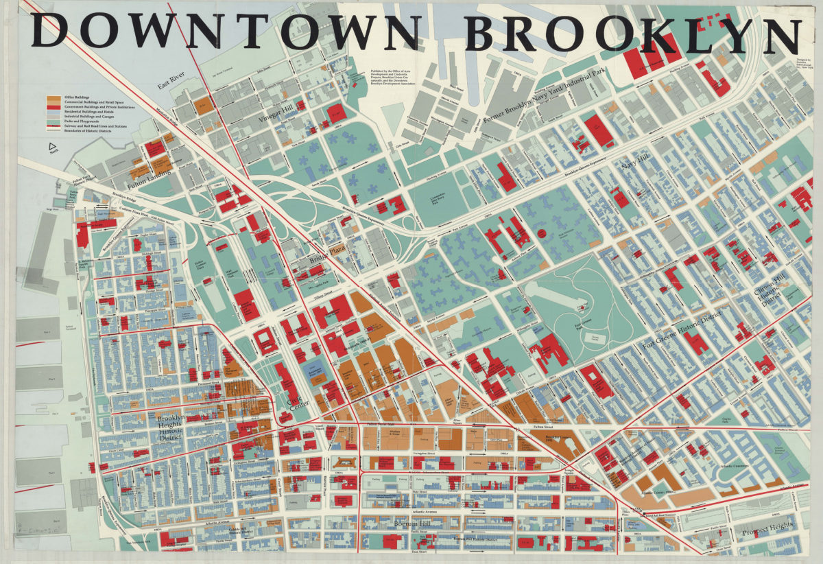
Downtown Brooklyn: designed by Incentra International, Inc
Downtown Brooklyn: designed by Incentra International, Inc
[1990]