Center for Brooklyn History
Map Collections
Search
About
Othmer Library & Archives
Submit search query
Refine 28 records
Clear filters
3
Location
Bay Ridge (New York, N.Y.)
108
Borough Park (New York, N.Y.)
23
Brooklyn (New York, N.Y.)
891
Brooklyn Heights (New York, N.Y.)
76
Bushwick (New York, N.Y.)
20
Canarsie (New York, N.Y.)
18
Coney Island (New York, N.Y.)
22
Downtown Brooklyn (New York, N.Y.)
29
Dyker Heights (New York, N.Y.)
23
East Flatbush (New York, N.Y.)
23
East New York (New York, N.Y.)
16
Flatbush (New York, N.Y.)
35
Flatlands (New York, N.Y.)
19
Fort Hamilton (New York, N.Y.)
31
Gravesend (New York, N.Y.)
25
Greenpoint (New York, N.Y.)
38
Jamaica Bay (N.Y.)
5
Kings County (New York, N.Y.)
8
Prospect Lefferts Gardens (Brooklyn, New York, N.Y.)
16
Prospect Park South (New York, N.Y.)
8
Sea Gate (New York, N.Y.)
7
Williamsburg (New York, N.Y.)
36
Windsor Terrace (New York, N.Y.)
10
Show 3 more
Subject
Auctions
32
Central business districts
10
Landforms
15
Landowners
434
Piers
25
Real property
619
Roads
117
Sewerage
7
Waterfronts
5
Date
20th Century
469
or enter range:
from
to
Genres
Aerial views
15
Cadastral maps
597
Manuscript maps
365
Pictorial maps
38
Public utility maps
15
Sort by:
Date (earliest)
Date (most recent)
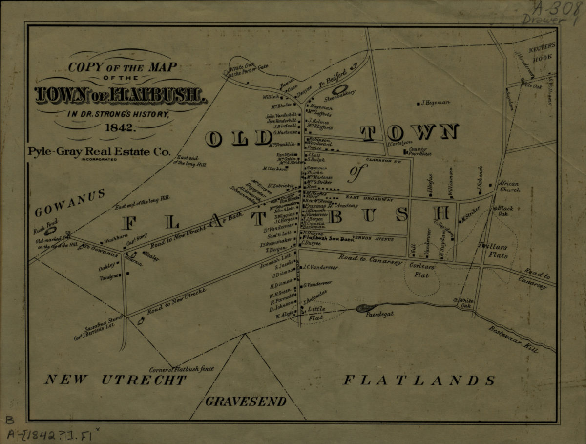
Copy of the map of the town of Flatbush in Dr. Strong’s history, 1842
Copy of the map of the town of Flatbush in Dr. Strong’s history, 1842
[19??]
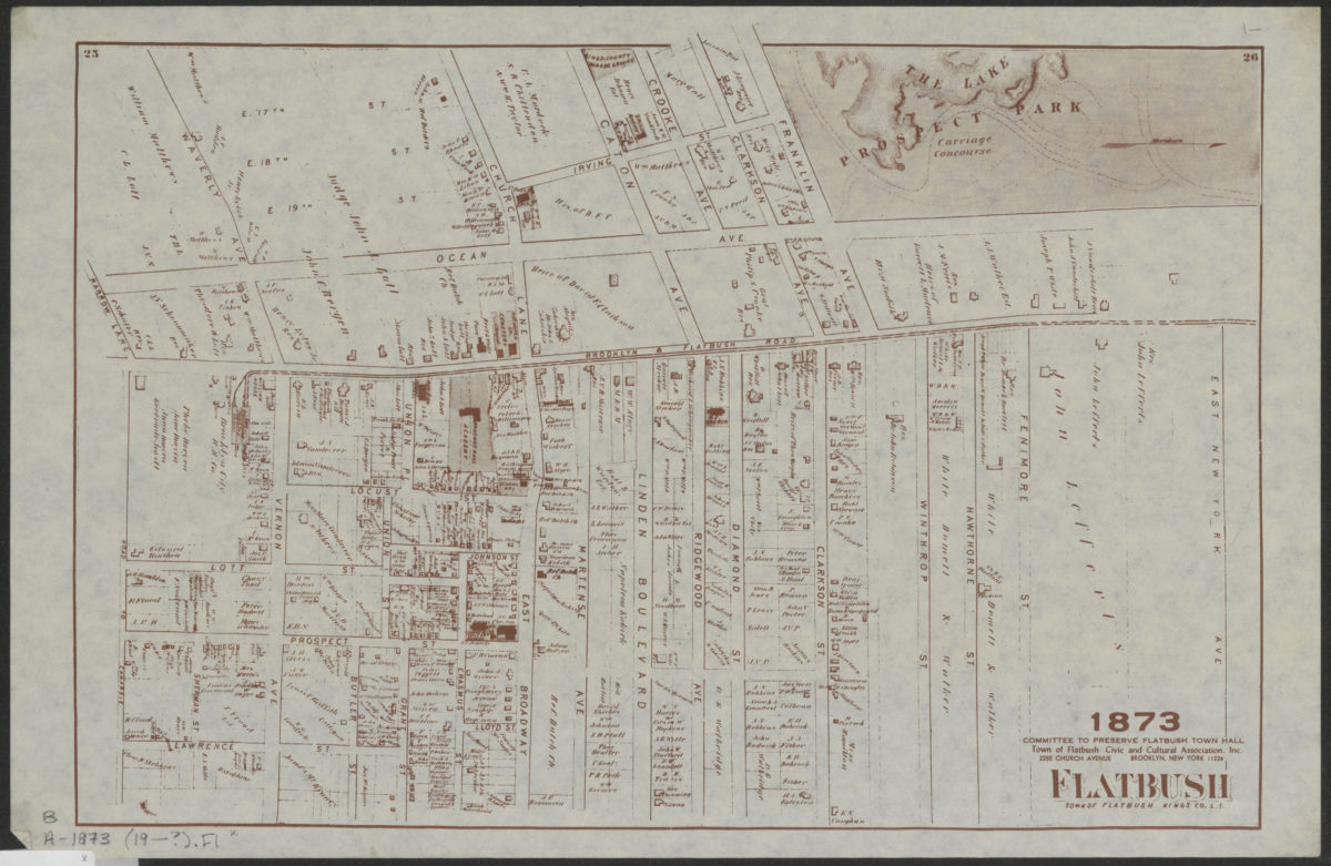
Flatbush, town of Flatbush, Kings Co., L.I.
Flatbush, town of Flatbush, Kings Co., L.I.
[19??]
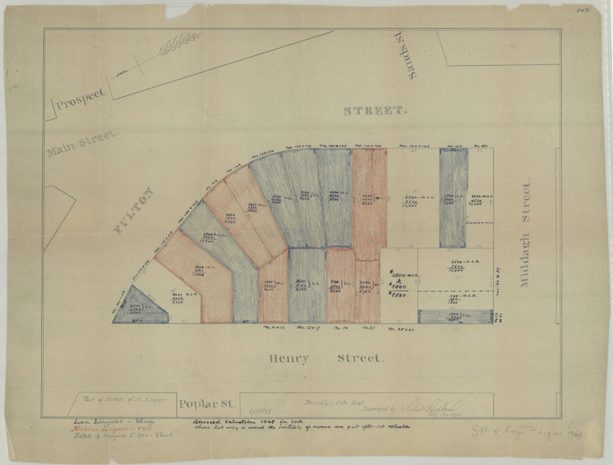
[Map of area bounded by Fulton St., Henry St., and Middagh St.]: surveyed by Silas Ludlam, city surveyor
[Map of area bounded by Fulton St., Henry St., and Middagh St.]: surveyed by Silas Ludlam, city surveyor
[19??]
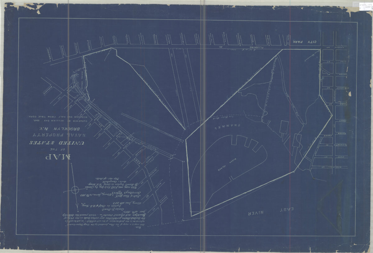
Map of the United States Naval Property, Brooklyn, N.Y.: surveyed by William Day, 1849
Map of the United States Naval Property, Brooklyn, N.Y.: surveyed by William Day, 1849
[19??]
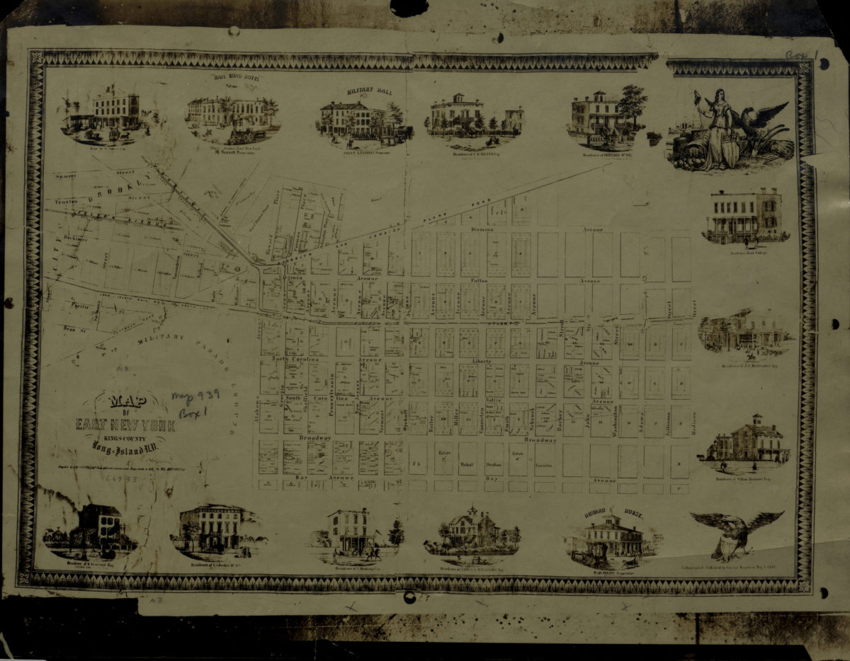
Map of East New York, Kings County, Long Island, N.Y.: compiled by C.W. Heftkamp from different surveys and maps made … by M.G. Johnson, Esqr
Map of East New York, Kings County, Long Island, N.Y.: compiled by C.W. Heftkamp from different surveys and maps made … by M.G. Johnson, Esqr
[19??]
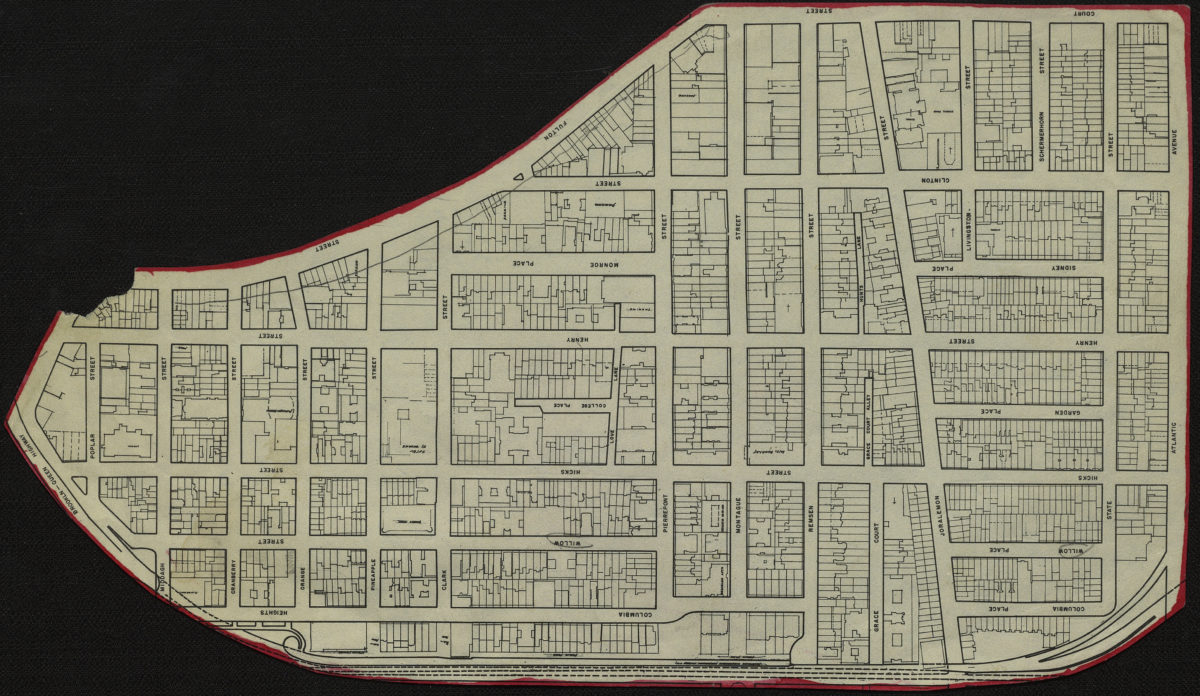
[Map of Brooklyn Heights]
[Map of Brooklyn Heights]
[19??]
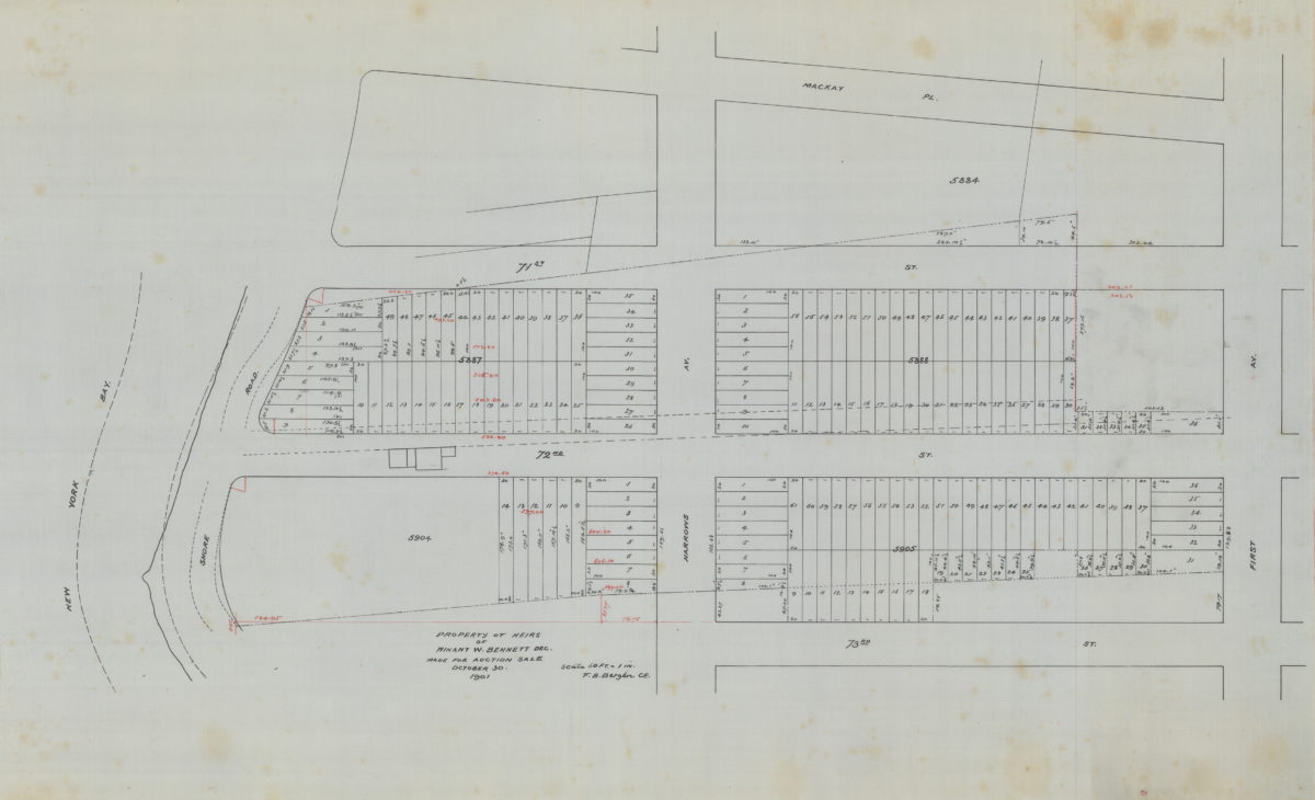
Property of heirs of Winant W. Bennett, dec., made for auction sale: V.B. Bergen, C.E.
Property of heirs of Winant W. Bennett, dec., made for auction sale: V.B. Bergen, C.E.
October 30 1901
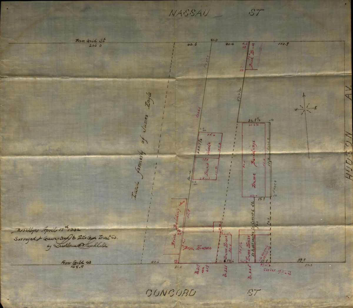
[Map of Hudson Avenue at Nassau Street and Concord Street]
[Map of Hudson Avenue at Nassau Street and Concord Street]
1902
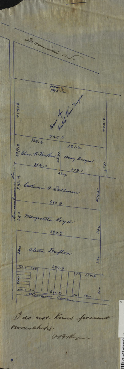
[Maps of Cowenhoven Lane and profile map of the grade of 2nd Avenue]
[Maps of Cowenhoven Lane and profile map of the grade of 2nd Avenue]
[ca. 1903]
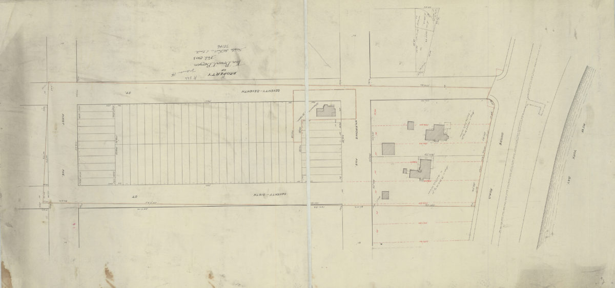
Property of Van Brunt Bergen
Property of Van Brunt Bergen
Feb-03
Executor’s sale to close estate of Teunis Bergen, deceased, Wednesday, June 19, 1907 at 12 o’clock noon in The Brooklyn Real Estate Exchange 189 Montague St. Brooklyn-New York, 55 valuable lots as the diagram on 65th and 66th Sts
Executor’s sale to close estate of Teunis Bergen, deceased, Wednesday, June 19, 1907 at 12 o’clock noon in The Brooklyn Real Estate Exchange 189 Montague St. Brooklyn-New York, 55 valuable lots as the diagram on 65th and 66th Sts
1907
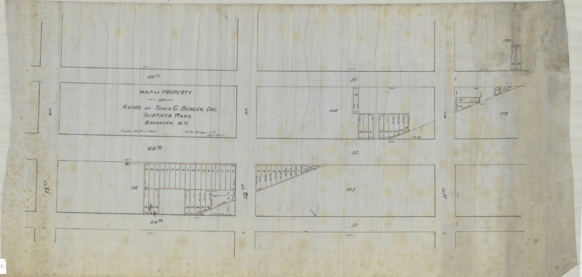
Map of property of heirs of Tunis G. Bergen, dec., Thirtieth Ward, Brooklyn, N.Y.: V.B. Bergen, C.E.
Map of property of heirs of Tunis G. Bergen, dec., Thirtieth Ward, Brooklyn, N.Y.: V.B. Bergen, C.E.
April 1907
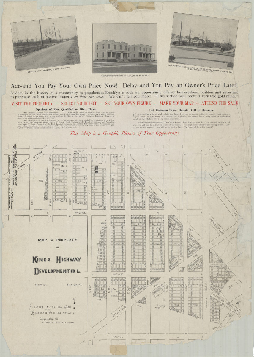
Map of property of Kings Highway Developmental Co. Inc.: situated in the 32nd Ward of the Borough of Brooklyn, N.Y. City: computed Sept. 1915 by Francis P. Murphy, City Surveyor
Map of property of Kings Highway Developmental Co. Inc.: situated in the 32nd Ward of the Borough of Brooklyn, N.Y. City: computed Sept. 1915 by Francis P. Murphy, City Surveyor
1915
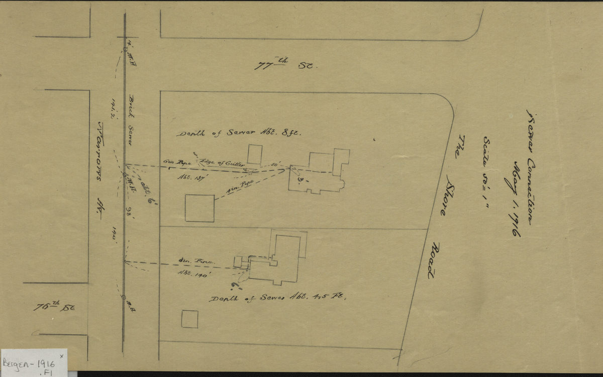
Sewer connection, May 1, 1916
Sewer connection, May 1, 1916
1916
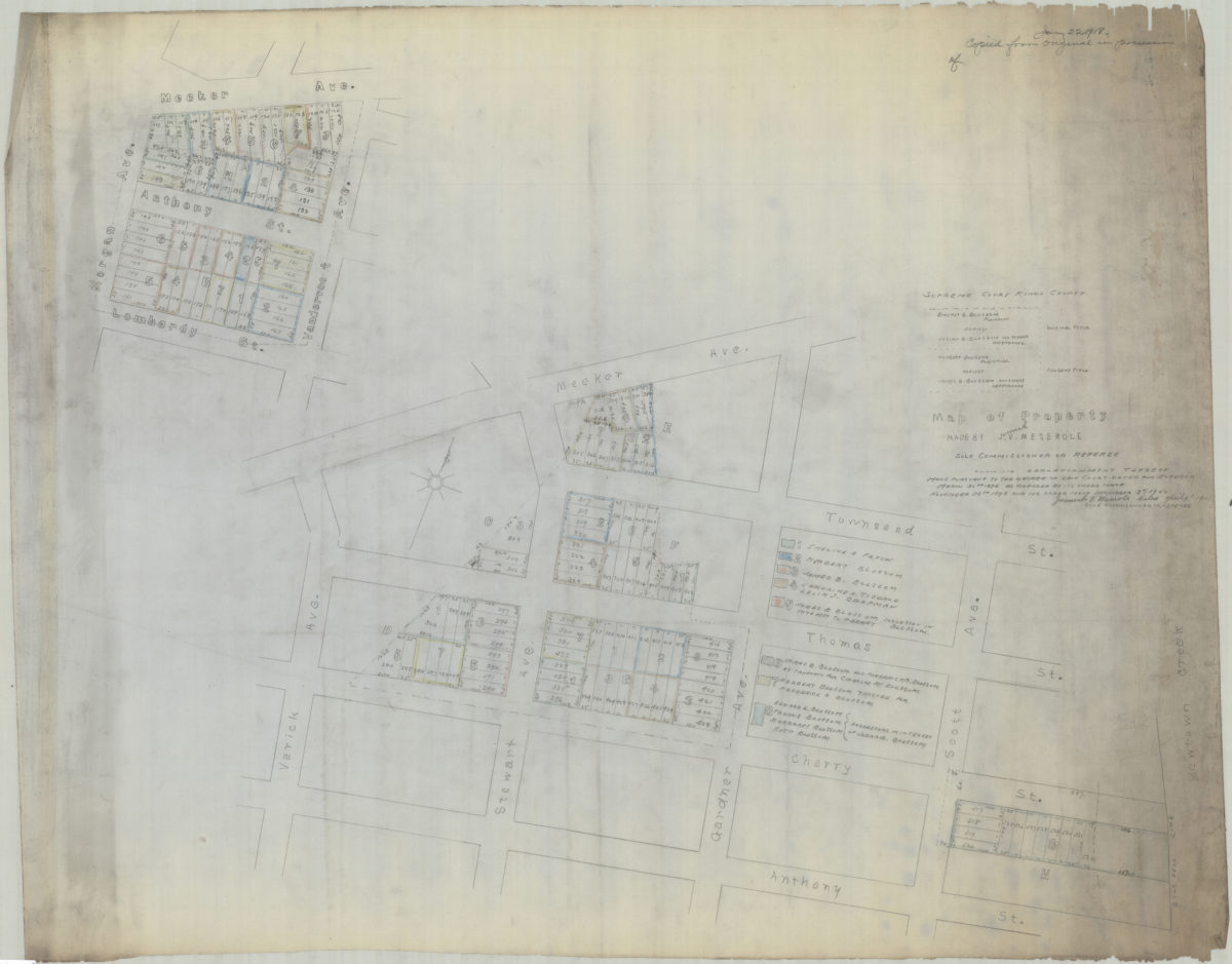
[Copy of] map of property made by J[eremiah] V. Meserole, sole commissioner or referee: showing apportionment thereof made pursuant to the decree of said court, dated and entered March 30th 1896 as amended by its order made of November 25th 1898
[Copy of] map of property made by J[eremiah] V. Meserole, sole commissioner or referee: showing apportionment thereof made pursuant to the decree of said court, dated and entered March 30th 1896 as amended by its order made of November 25th 1898
1918
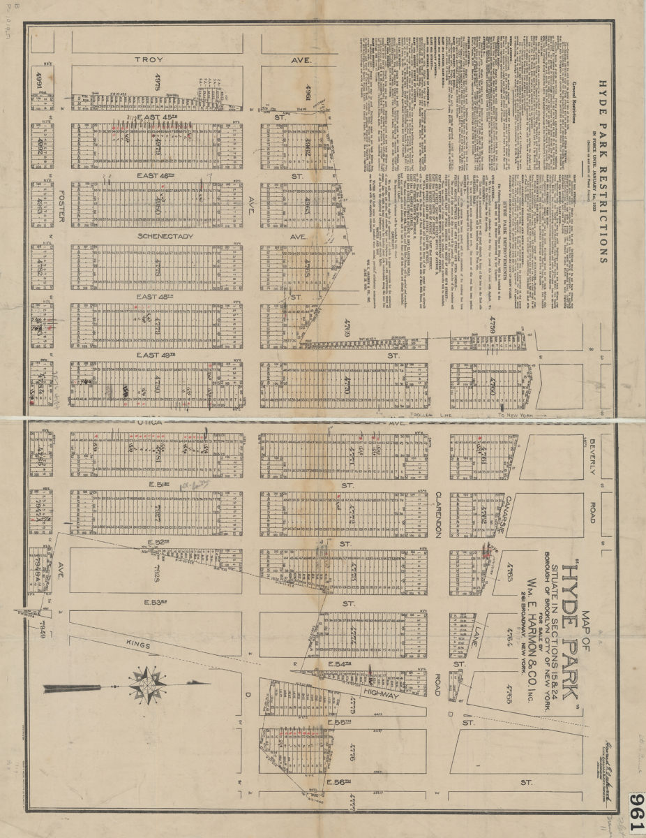
Map of Hyde Park situate[d] in sections 15 & 24, Borough of Brooklyn, City of New York: for sale by Wm. E. Harmon & Co
Map of Hyde Park situate[d] in sections 15 & 24, Borough of Brooklyn, City of New York: for sale by Wm. E. Harmon & Co
1919
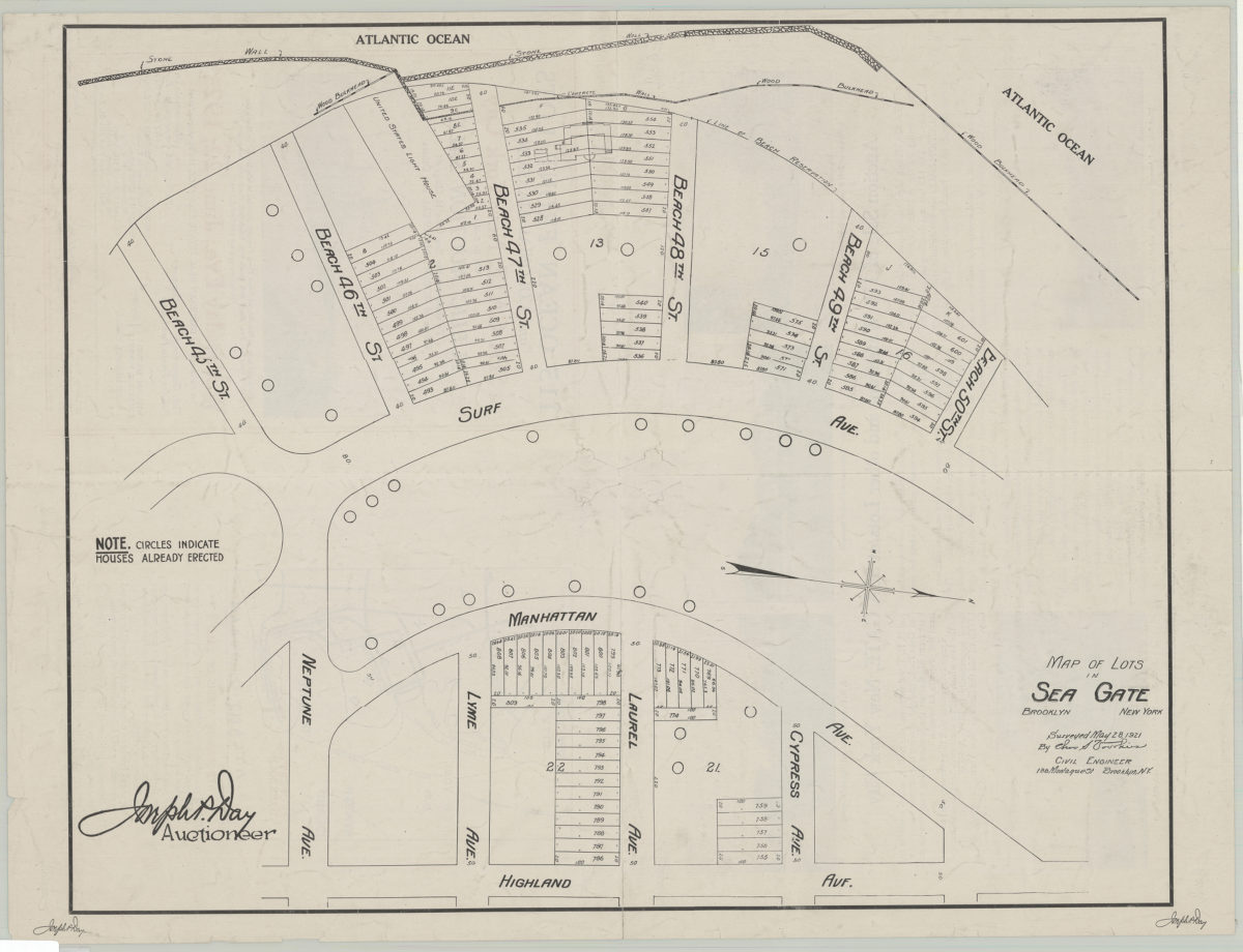
Map of lots in Sea Gate: surveyed May 28, 1921 by Cha[rle]s S. Voorhies
Map of lots in Sea Gate: surveyed May 28, 1921 by Cha[rle]s S. Voorhies
1921
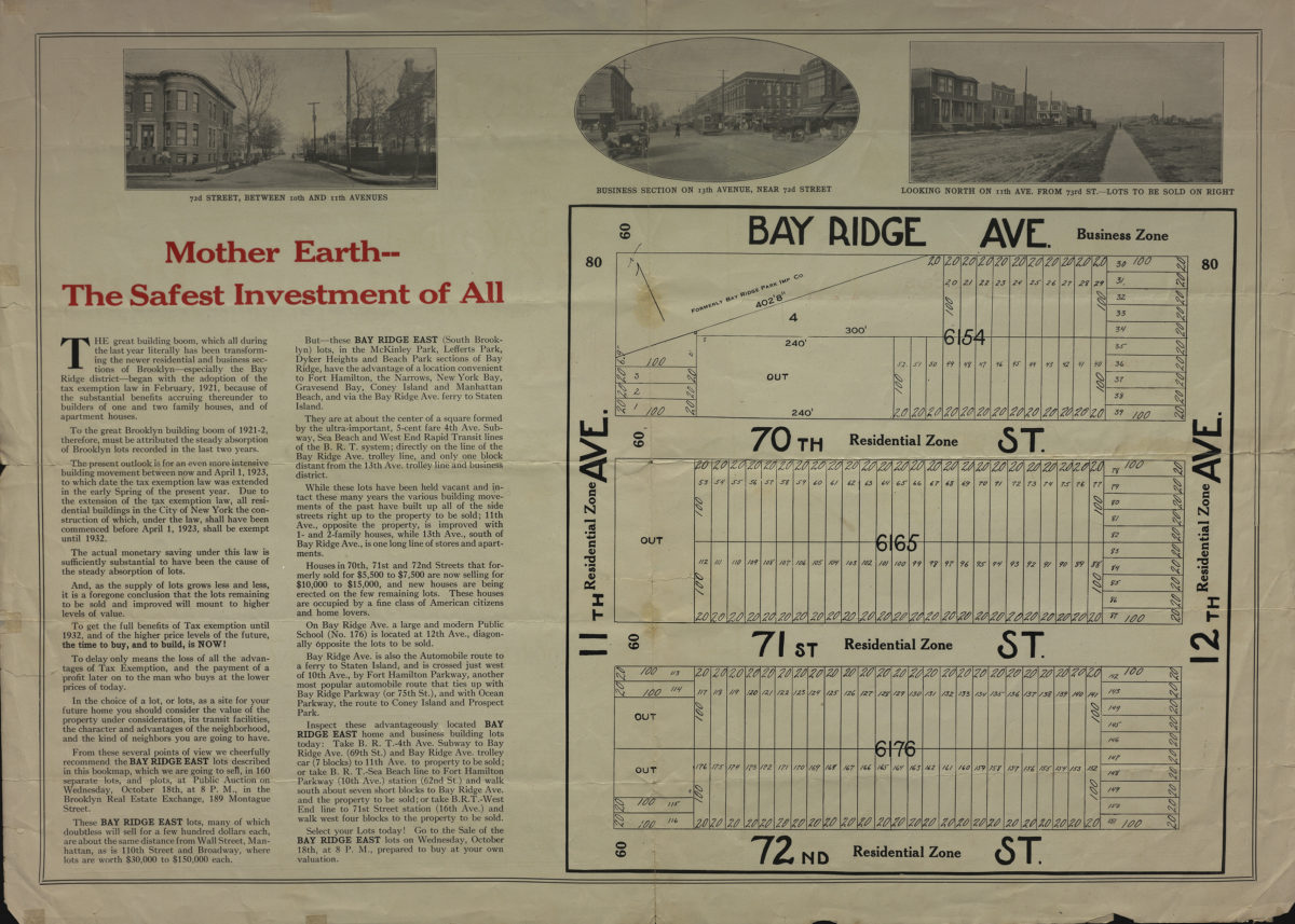
Absolute auction Bay Ridge east … 160 lots and plots on Bay Ridge Avenue, 11th and 12th Avenues, 70th, 71st and 72nd Street, Bay Ridge Ave., B[roo]klyn, Wednesday, Oct. 18th, 1922
Absolute auction Bay Ridge east … 160 lots and plots on Bay Ridge Avenue, 11th and 12th Avenues, 70th, 71st and 72nd Street, Bay Ridge Ave., B[roo]klyn, Wednesday, Oct. 18th, 1922
[1922]
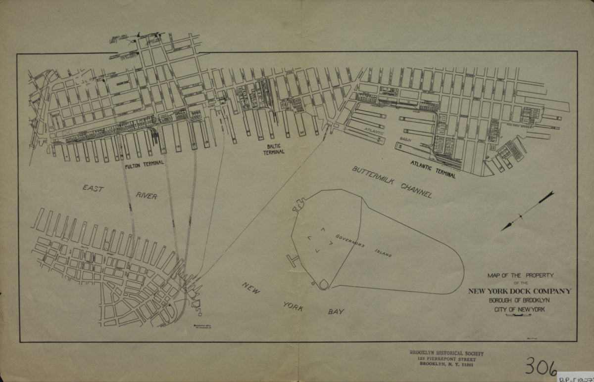
Map of the property of the New York Dock Company, Borough of Brooklyn, City of New York
Map of the property of the New York Dock Company, Borough of Brooklyn, City of New York
[1927]
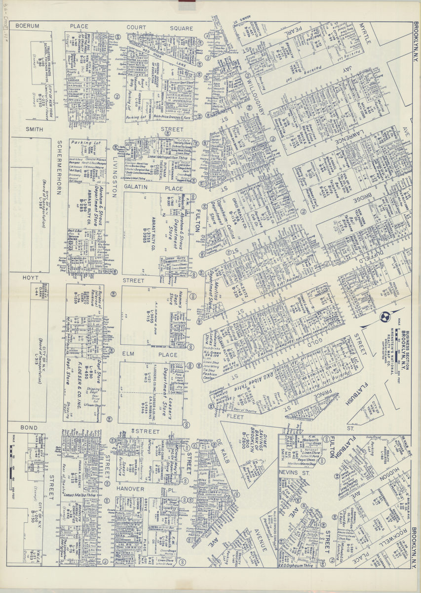
Business section, Brooklyn, N.Y.: Nirenstein’s National Realty Map Co
Business section, Brooklyn, N.Y.: Nirenstein’s National Realty Map Co
[1937]
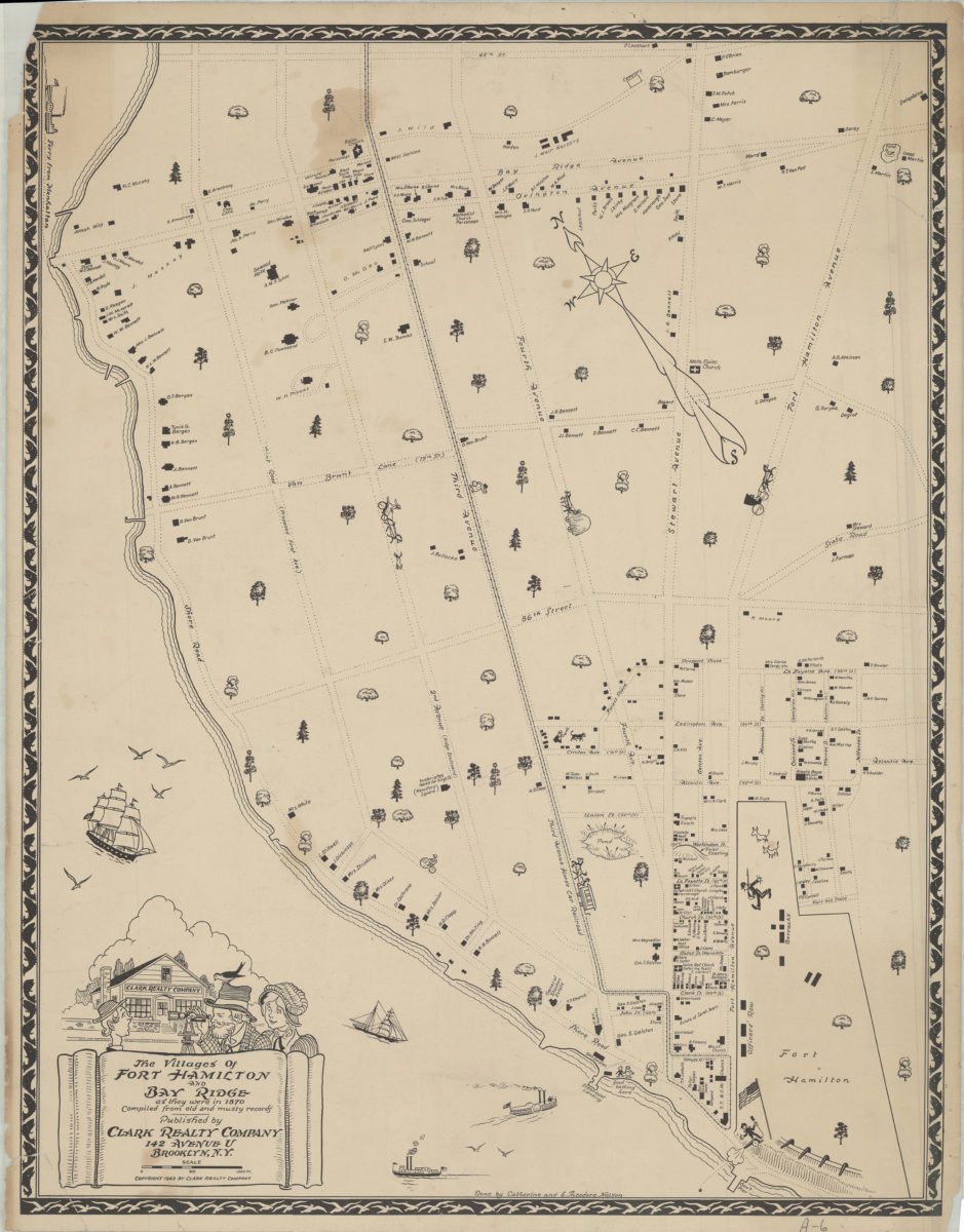
The villages of Fort Hamilton and Bay Ridge as they were in 1870: compiled from old and musty records: done by Catherine and E. Theodore Nelson
The villages of Fort Hamilton and Bay Ridge as they were in 1870: compiled from old and musty records: done by Catherine and E. Theodore Nelson
[ca. 1942]
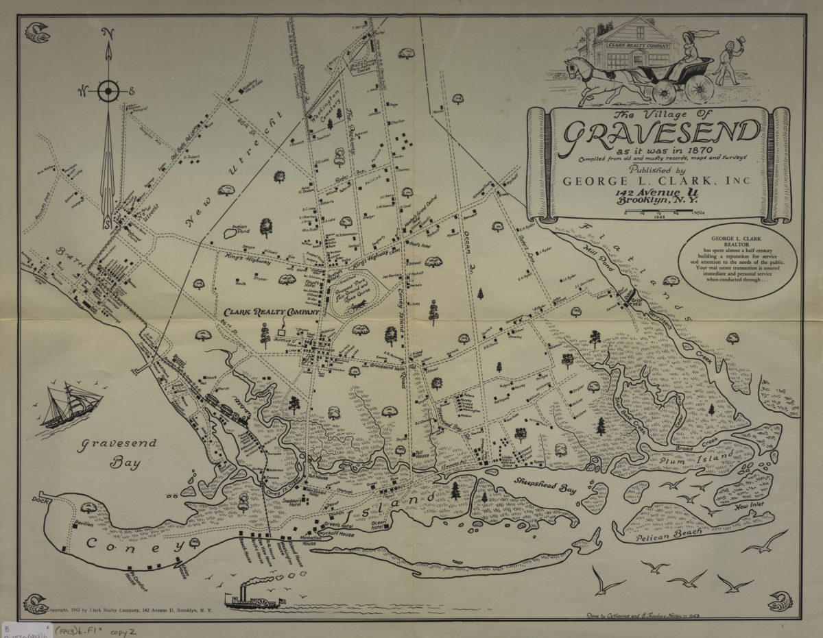
The village of Gravesend as it was in 1870: compiled from old and musty records, maps and surveys: done by Catherine and E. Theodore Nelson in 1943
The village of Gravesend as it was in 1870: compiled from old and musty records, maps and surveys: done by Catherine and E. Theodore Nelson in 1943
[ca. 1943]
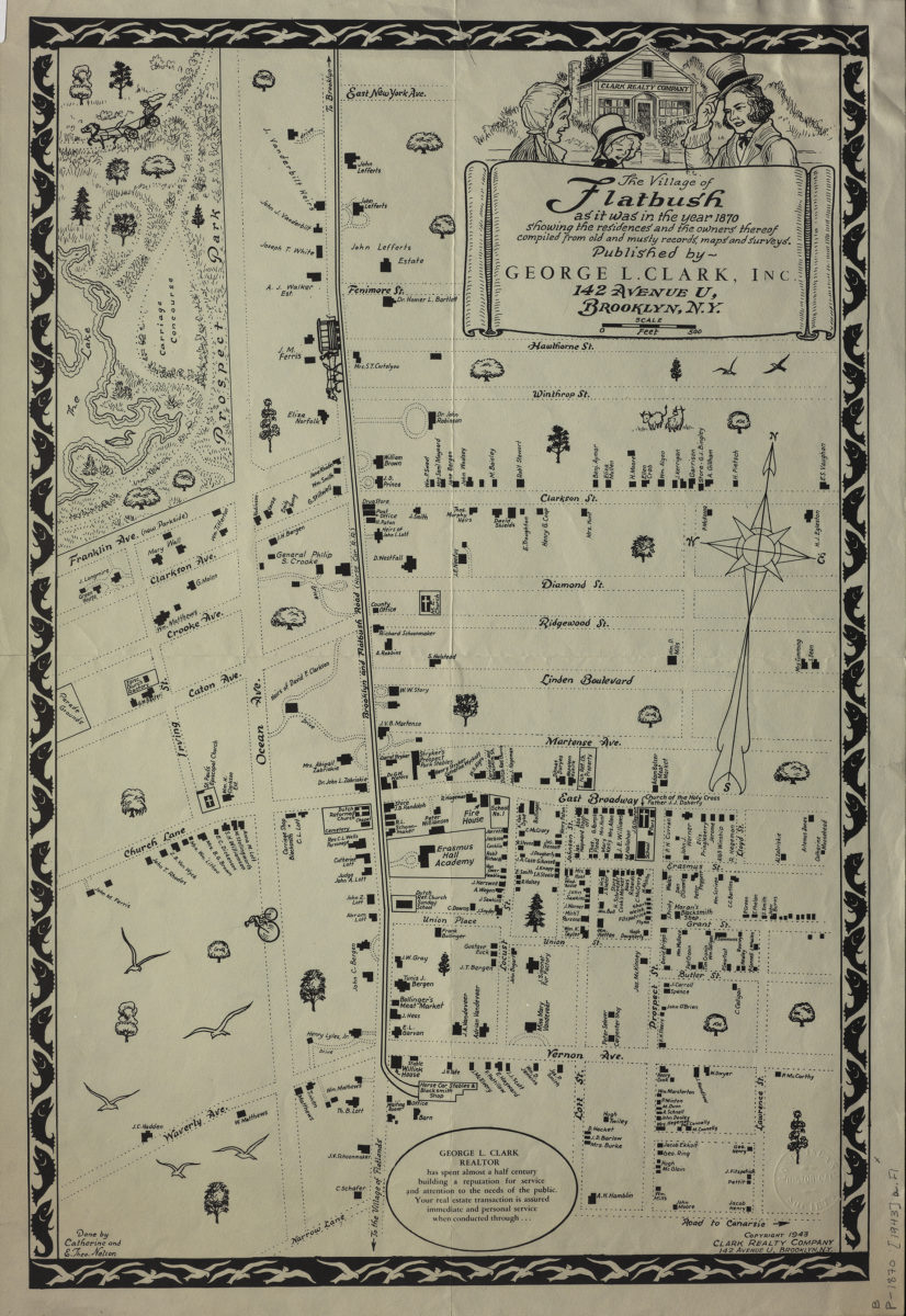
The village of Flatbush as it was in the year 1870: showing the residences and the owners thereof : compiled from old and musty records, maps and surveys: done by Catherine and E. Theo. Nelson
The village of Flatbush as it was in the year 1870: showing the residences and the owners thereof : compiled from old and musty records, maps and surveys: done by Catherine and E. Theo. Nelson
[ca. 1943]
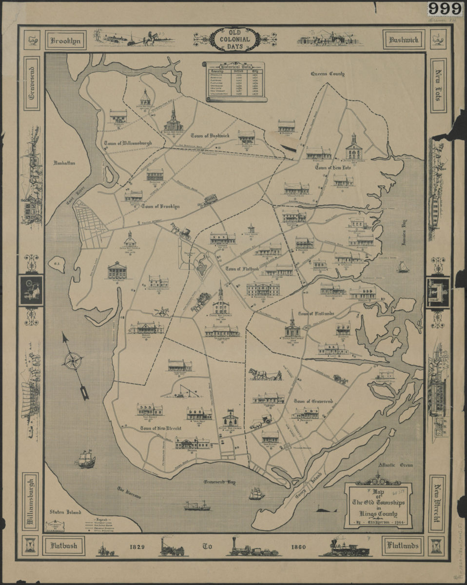
Map of the old townships in Kings County: by G.V.S. Ryerson
Map of the old townships in Kings County: by G.V.S. Ryerson
1944
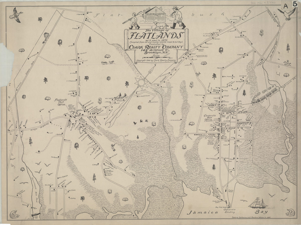
The village of Flatlands as it was in 1870: compiled from old and musty records, maps, & surveys: done by Catherine and E. Theodore Nelson
The village of Flatlands as it was in 1870: compiled from old and musty records, maps, & surveys: done by Catherine and E. Theodore Nelson
[ca. 1944]
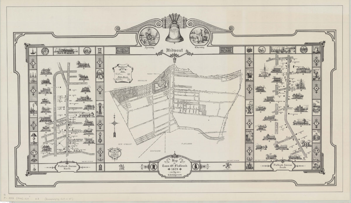
Map of town of Flatbush, 1873: by G.V.S. Ryerson
Map of town of Flatbush, 1873: by G.V.S. Ryerson
1946
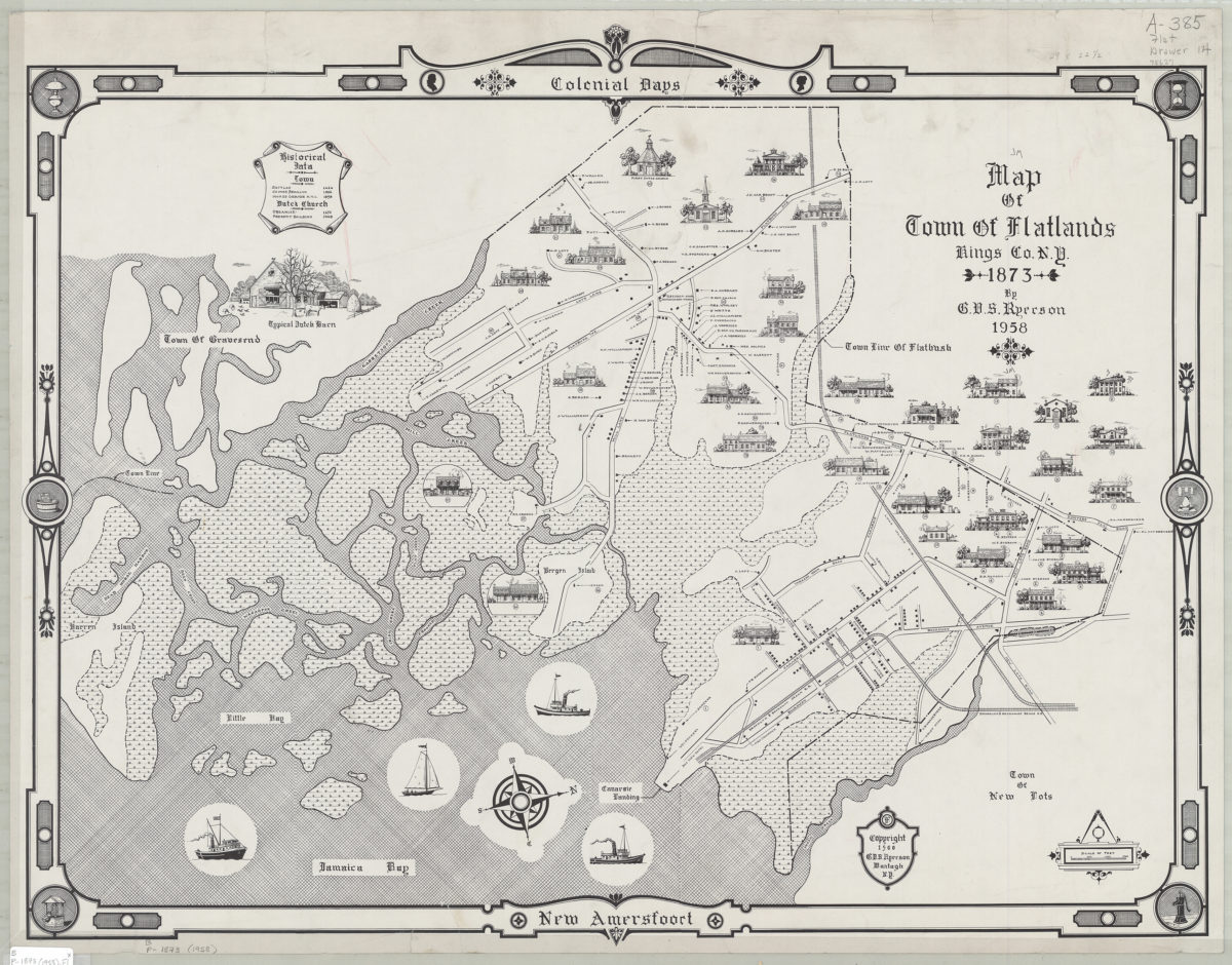
Map of town of Flatlands, Kings Co., N.Y. 1873: by G.V.S. Ryerson
Map of town of Flatlands, Kings Co., N.Y. 1873: by G.V.S. Ryerson
1958; [ca. 1960]
538 desirable lots, together with the farm house and barn thereon, belonging to the estate of George White, deceased, finely situated in the 18th Ward, Brooklyn
538 desirable lots, together with the farm house and barn thereon, belonging to the estate of George White, deceased, finely situated in the 18th Ward, Brooklyn
[1995; ca. 1991]