Center for Brooklyn History
Map Collections
Search
About
Othmer Library & Archives
Submit search query
Refine 3 records
Clear filters
5
Location
Brooklyn (New York, N.Y.)
891
Coney Island (New York, N.Y.)
22
Gravesend (New York, N.Y.)
25
Subject
Landowners
434
Real property
619
Date
19th Century
945
or enter range:
from
to
Genres
Cadastral maps
597
Early maps
35
Manuscript maps
365
Sort by:
Date (earliest)
Date (most recent)
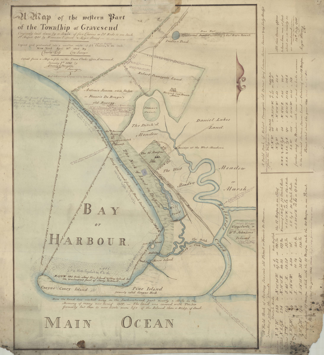
Map of the western part of the Township of Gravesend originally laid down by a scale of five chains or 20 rods to an inch, 8th August 1788 by Herman Lefford & Roger Strong:New York City, April 16th 1806
Map of the western part of the Township of Gravesend originally laid down by a scale of five chains or 20 rods to an inch, 8th August 1788 by Herman Lefford & Roger Strong:New York City, April 16th 1806
[18??]
Map of the western part of the Township of Gravesend originally laid down by a scale of five chains or 20 rods to an inch, 8th August 1788 by Herman Lefford & Roger Strong: April 16th 1806
Map of the western part of the Township of Gravesend originally laid down by a scale of five chains or 20 rods to an inch, 8th August 1788 by Herman Lefford & Roger Strong: April 16th 1806
[18??]
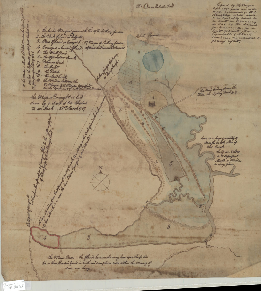
[Map of Gravesend and Coney Island]
[Map of Gravesend and Coney Island]
Sept. 1861