Center for Brooklyn History
Map Collections
Search
About
Othmer Library & Archives
Submit search query
Refine 11 records
Clear filters
3
Location
Brooklyn (New York, N.Y.)
891
Brooklyn Heights (New York, N.Y.)
76
Hudson County (N.J.)
3
Jamaica Bay (N.Y.)
5
Jersey City (N.J.)
4
Manhattan (New York, N.Y.)
120
New Jersey
27
New York (N.Y.)
164
Queens (New York, N.Y.)
83
Staten Island (N.Y.)
10
Subject
Local transit
63
Roads
117
Street railroads
8
Subways
55
Date
20th Century
469
or enter range:
from
to
Genres
Aerial views
15
Bathymetric maps
94
Historical maps
53
Military maps
23
Topographic maps
70
Transportation maps
120
Sort by:
Date (earliest)
Date (most recent)
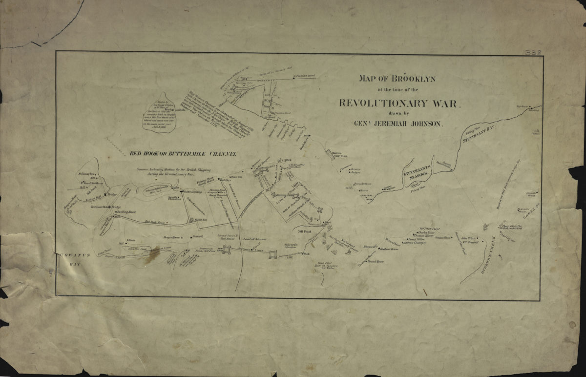
Map of Brooklyn at the time of the Revolutionary War: drawn by Genl. Jeremiah Johnson
Map of Brooklyn at the time of the Revolutionary War: drawn by Genl. Jeremiah Johnson
[19??]
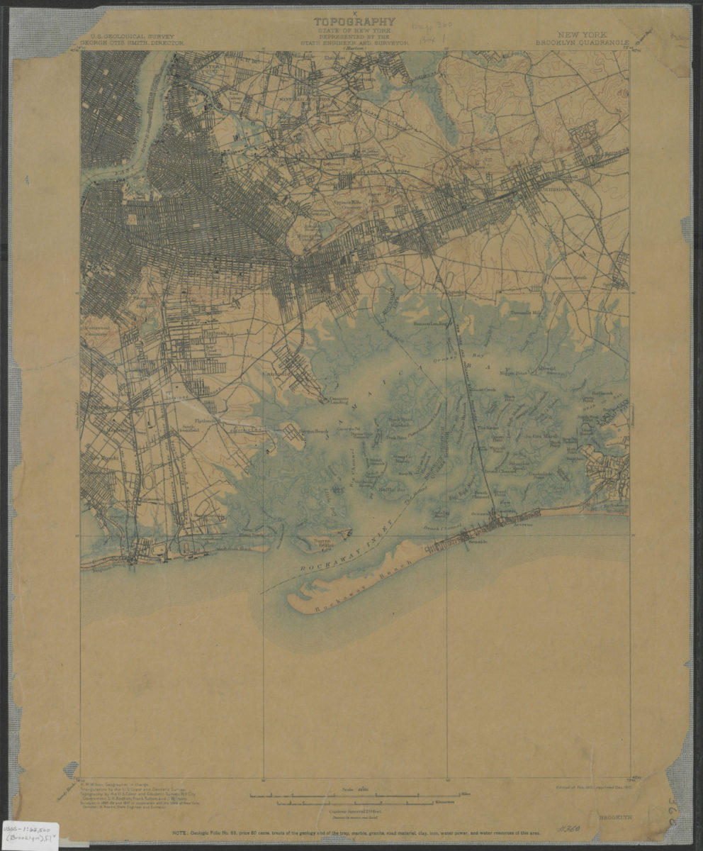
Brooklyn quadrangle, New York: U.S. Geological Survey
Brooklyn quadrangle, New York: U.S. Geological Survey
1900; 1910
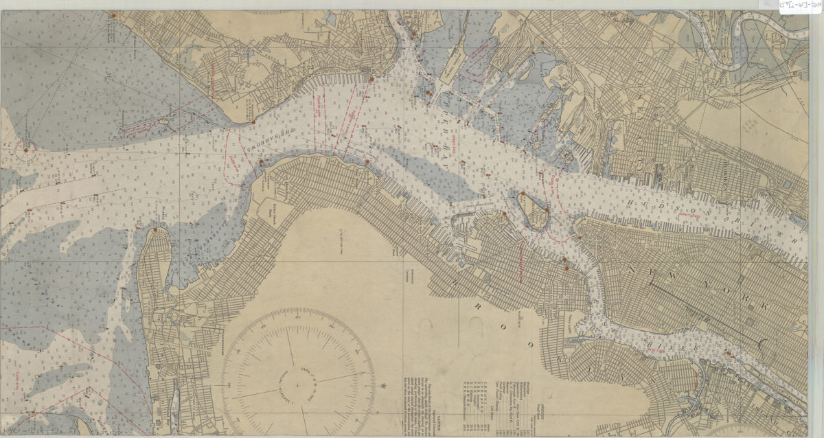
[Map of Mahattan south of Central Park, eastern edge of Brooklyn, southwest edge of New Jersey, and the nothwest edge of Staten Island]
[Map of Mahattan south of Central Park, eastern edge of Brooklyn, southwest edge of New Jersey, and the nothwest edge of Staten Island]
[19??]
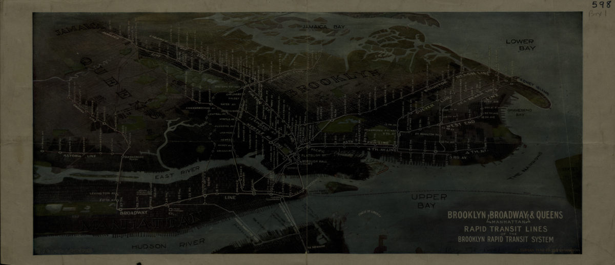
Brooklyn, Broadway (Manhattan), Queens rapid transit lines of the Brooklyn Rapid Transit System: Harry A. Chandler
Brooklyn, Broadway (Manhattan), Queens rapid transit lines of the Brooklyn Rapid Transit System: Harry A. Chandler
[1916-1924]
Map showing Brooklyn automobile routes and car lines approved by the Borough President, July 1919
Map showing Brooklyn automobile routes and car lines approved by the Borough President, July 1919
[1919]
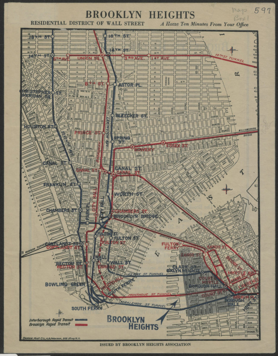
Brooklyn Heights, residential district of Wall Street: a home ten minutes from your office
Brooklyn Heights, residential district of Wall Street: a home ten minutes from your office
[1921]
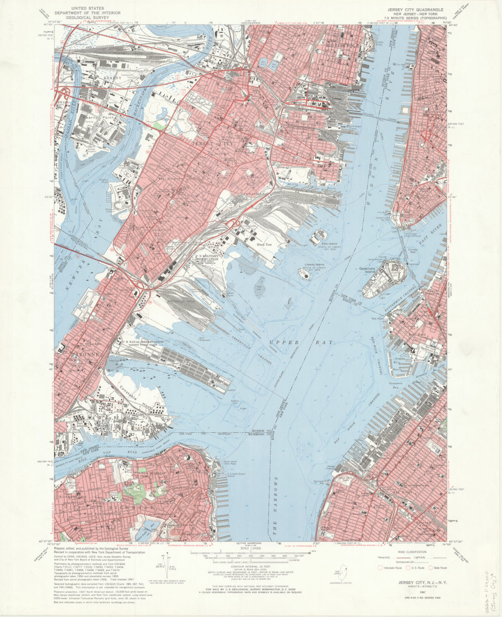
Jersey City quadrangle, New Jersey – New York: mapped, edited, and published by the Geological Survey ; revised in cooperation with New York Dept. of Transportation
Jersey City quadrangle, New Jersey – New York: mapped, edited, and published by the Geological Survey ; revised in cooperation with New York Dept. of Transportation
1967
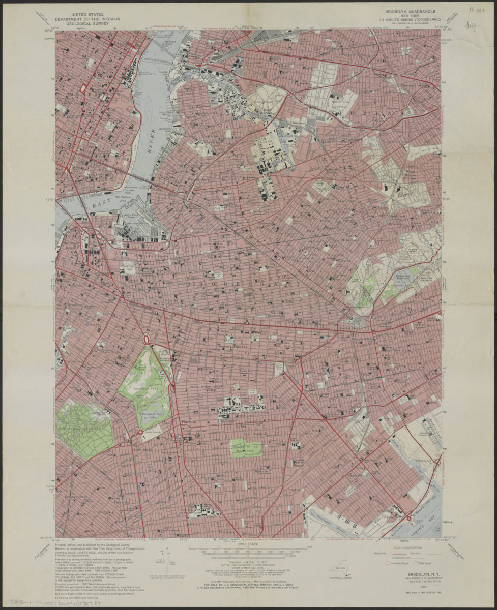
Brooklyn quadrangle, New York
Brooklyn quadrangle, New York
1967
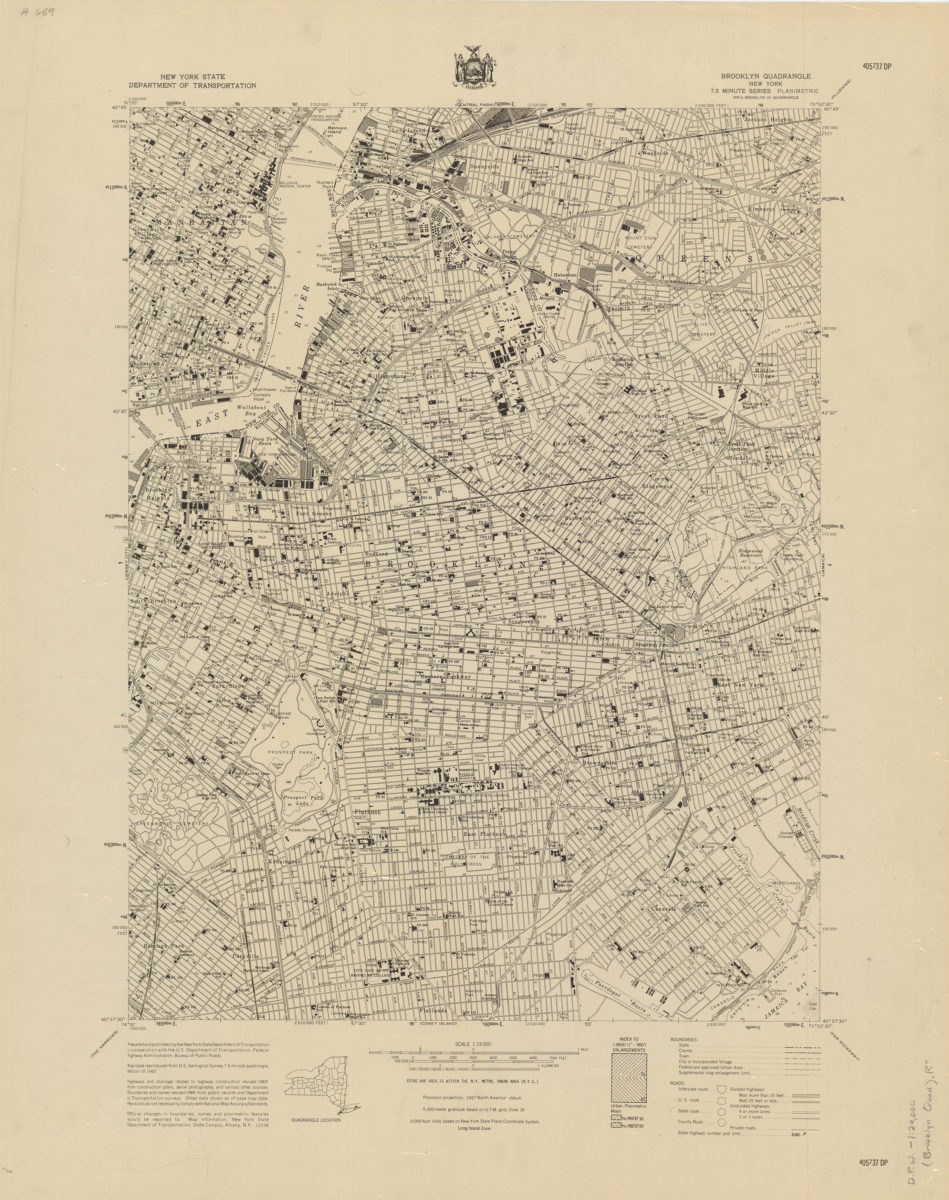
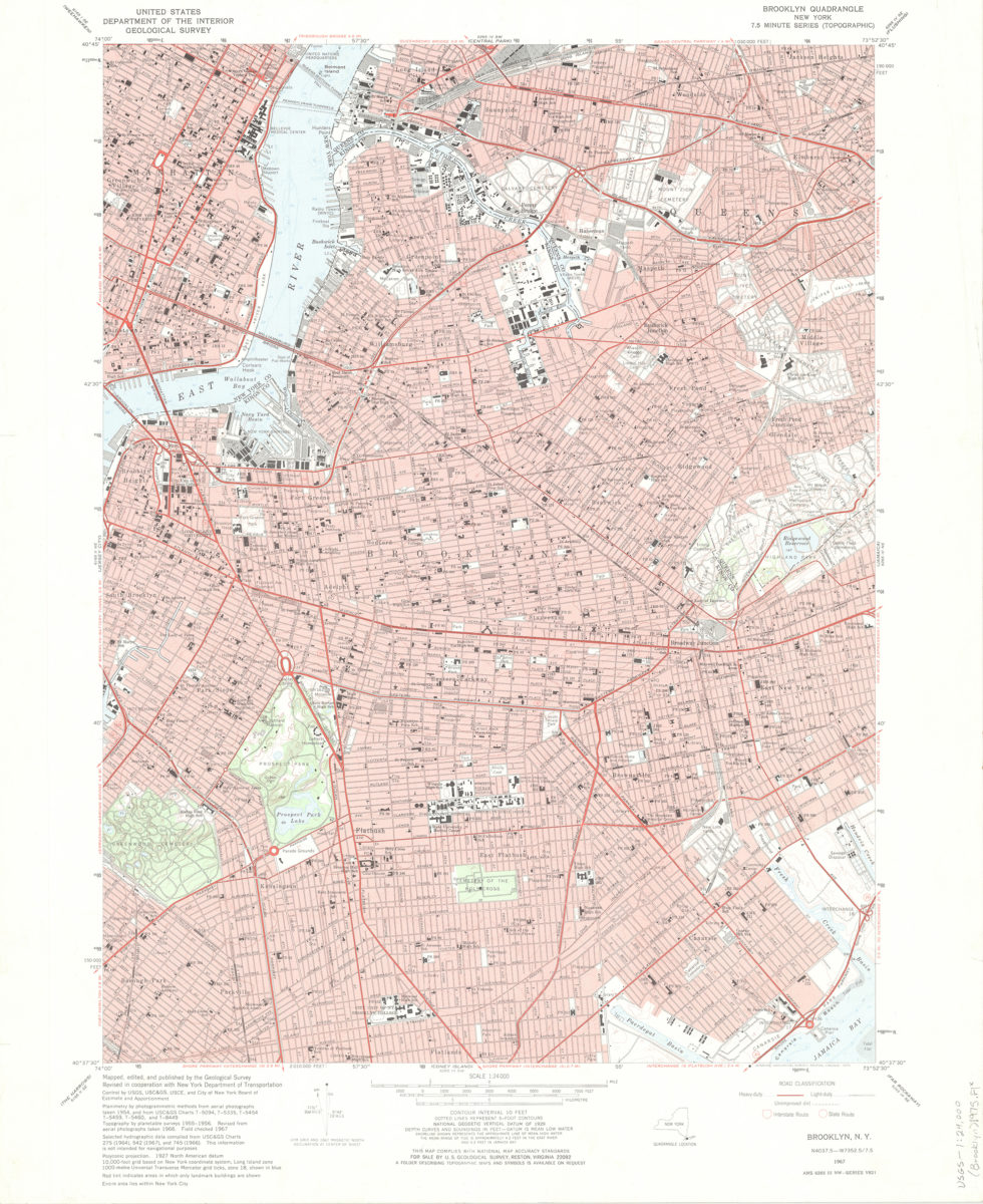
Brooklyn quadrangle, New York
Brooklyn quadrangle, New York
[1969]
Brooklyn quadrangle, New York: mapped, edited, and published by the Geological Survey ; revised in cooperation with New York Department of Transportation
Brooklyn quadrangle, New York: mapped, edited, and published by the Geological Survey ; revised in cooperation with New York Department of Transportation
1975
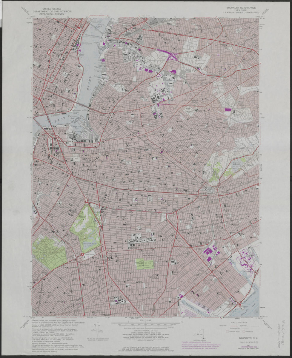
Brooklyn quadrangle, New York: mapped, edited, and published by the Geological Survey ; revised in cooperation with New York Department of Transportation
Brooklyn quadrangle, New York: mapped, edited, and published by the Geological Survey ; revised in cooperation with New York Department of Transportation
1979