Center for Brooklyn History
Map Collections
Search
About
Othmer Library & Archives
Submit search query
Refine 20 records
Clear filters
3
Location
Battery Park (New York, N.Y.)
3
Belt Parkway (New York, N.Y.)
1
Brooklyn (New York, N.Y.)
891
Brooklyn-Battery Bridge (New York, N.Y.)
1
Coney Island (New York, N.Y.)
22
Hudson County (N.J.)
3
Jamaica Bay (N.Y.)
5
Jersey City (N.J.)
4
Manhattan (New York, N.Y.)
120
New Jersey
27
New York (N.Y.)
164
New York (State)
95
Queens (New York, N.Y.)
83
Stapleton (New York, N.Y.)
1
Staten Island (N.Y.)
10
Subject
Bridges
13
Ethnology
3
Highway planning
2
Local transit
63
Long Island, Battle of, New York, N.Y. , 1776
7
Railroads, Elevated
24
Roads
117
Streets
46
Subways
55
Date
20th Century
469
or enter range:
from
to
Genres
Bathymetric maps
94
Historical maps
53
Manuscript maps
365
Military maps
23
Road maps
83
Thematic maps
60
Topographic maps
70
Transportation maps
120
Sort by:
Date (earliest)
Date (most recent)
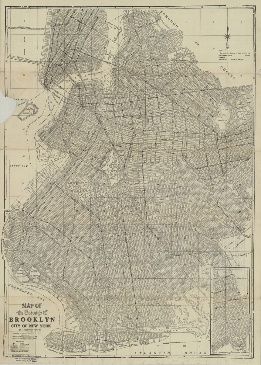
Map of the Borough of Brooklyn, City of New York
Map of the Borough of Brooklyn, City of New York
[19??]
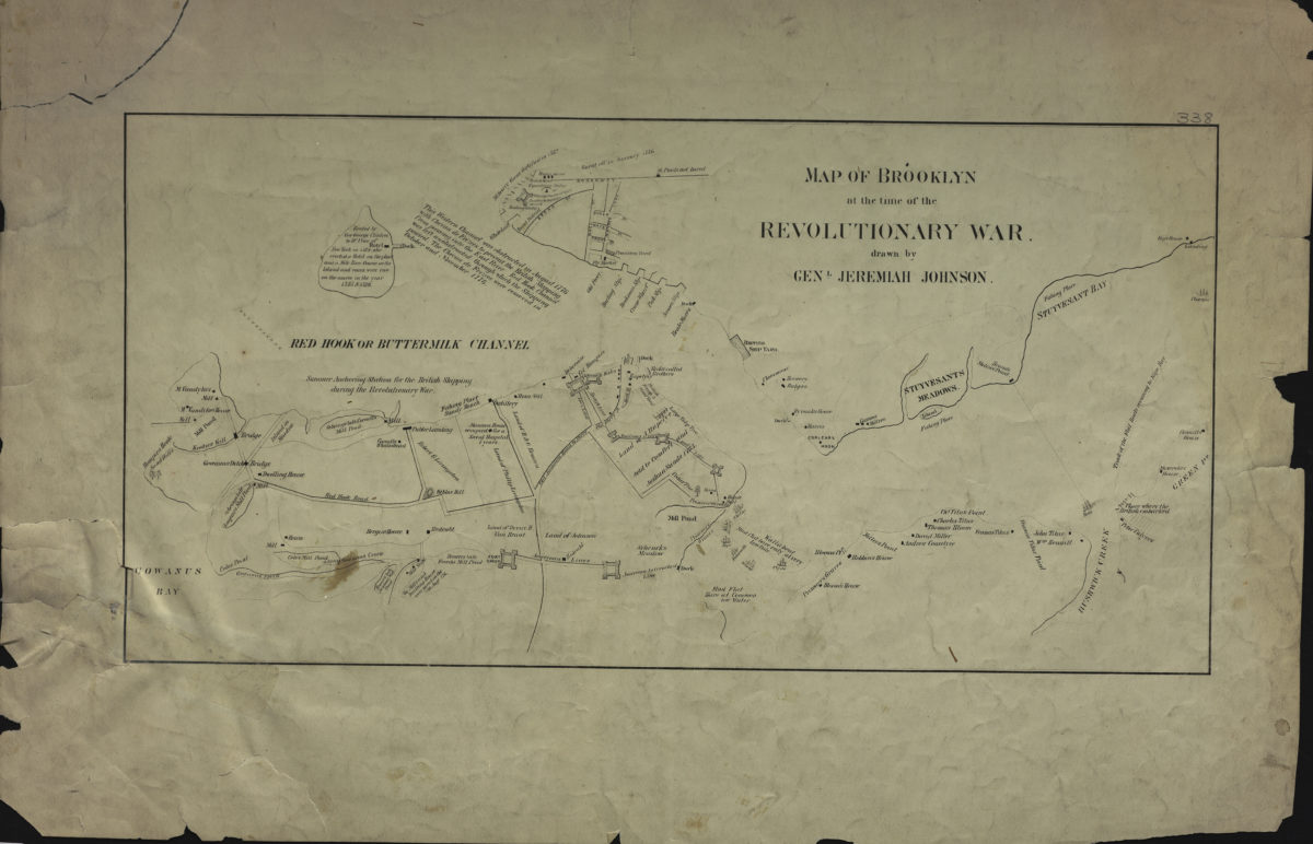
Map of Brooklyn at the time of the Revolutionary War: drawn by Genl. Jeremiah Johnson
Map of Brooklyn at the time of the Revolutionary War: drawn by Genl. Jeremiah Johnson
[19??]
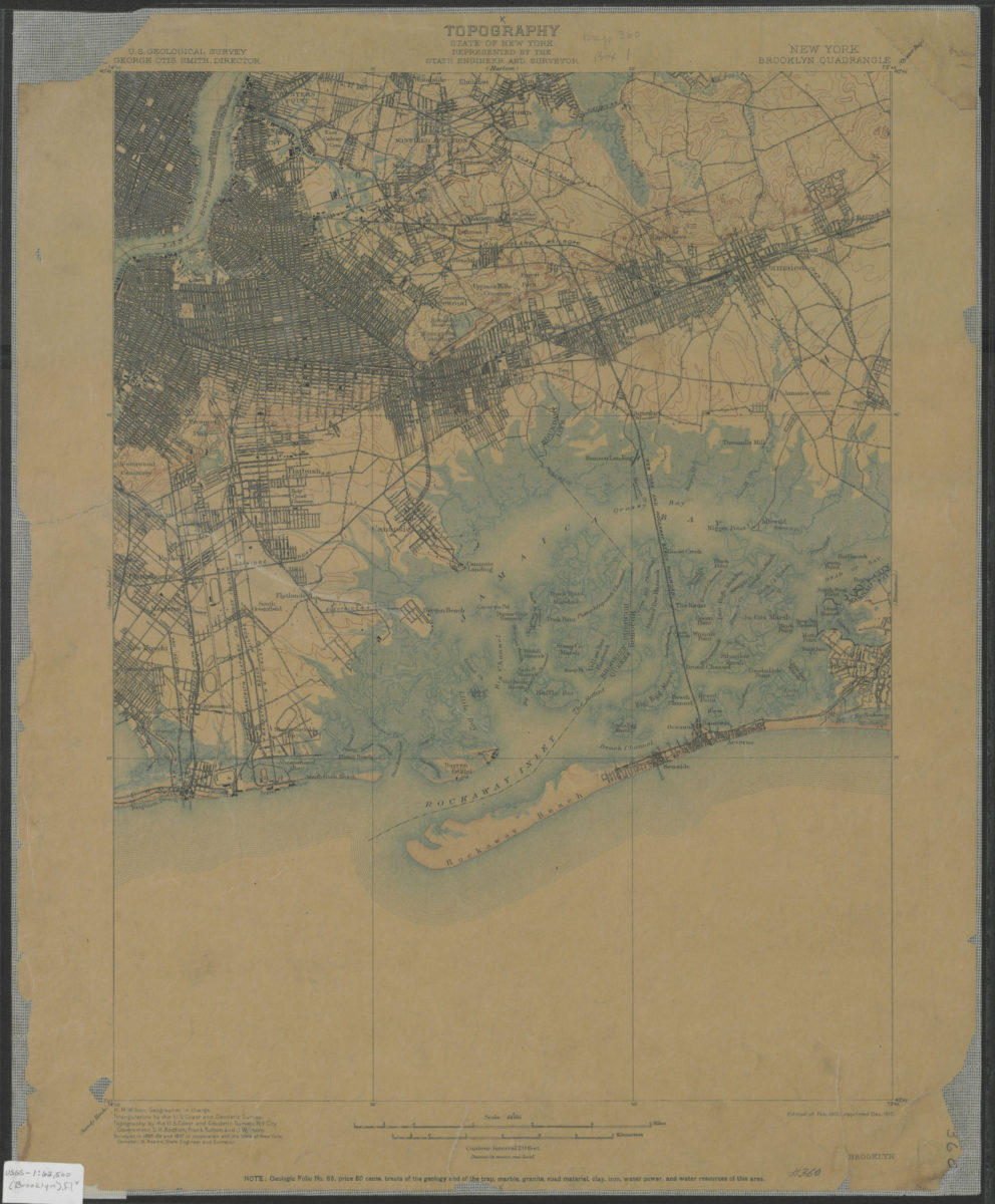
Brooklyn quadrangle, New York: U.S. Geological Survey
Brooklyn quadrangle, New York: U.S. Geological Survey
1900; 1910
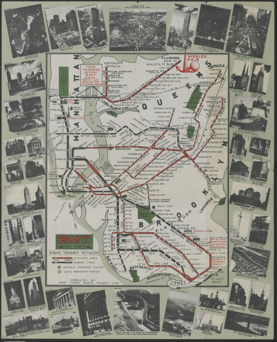
BMT Lines Rapid Transit Division
BMT Lines Rapid Transit Division
[1939]
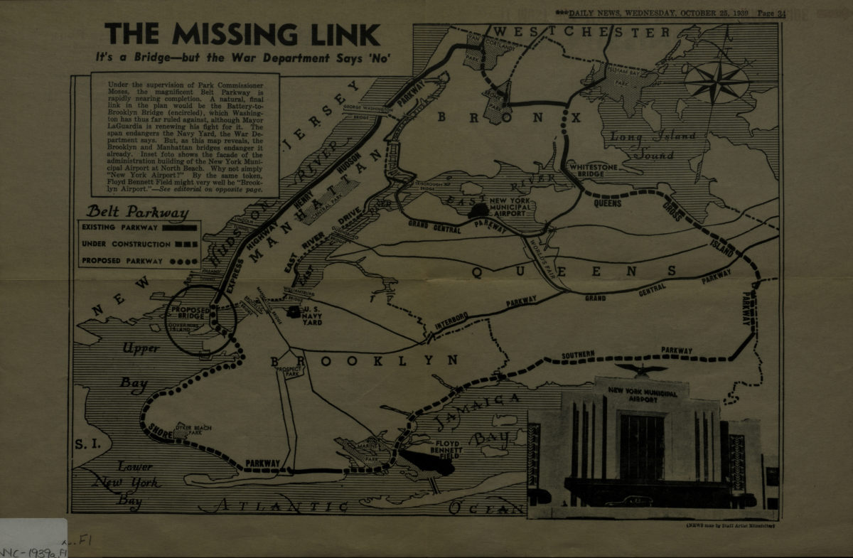
The missing link: it’s a bridge but the War Department says ‘no.’
The missing link: it’s a bridge but the War Department says ‘no.’
[1939]
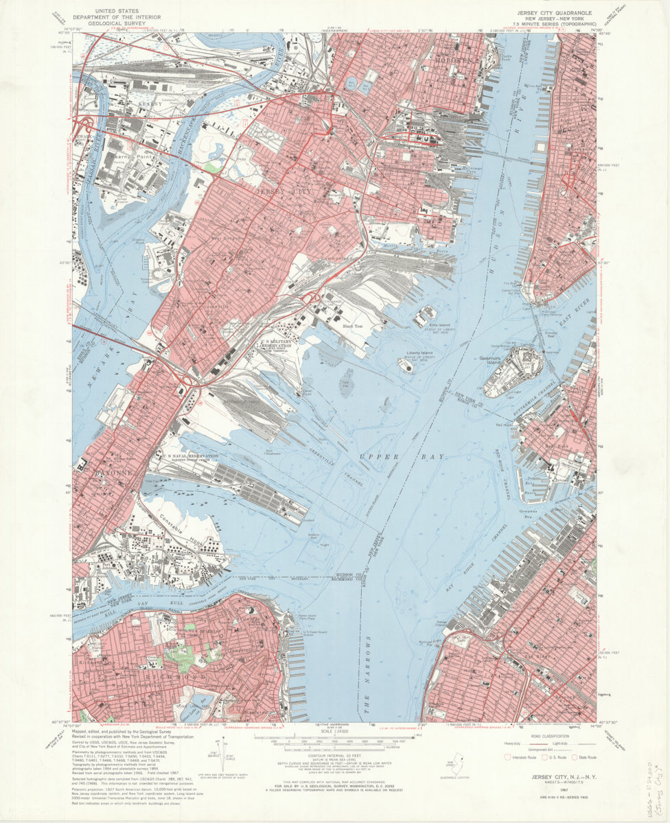
Jersey City quadrangle, New Jersey – New York: mapped, edited, and published by the Geological Survey ; revised in cooperation with New York Dept. of Transportation
Jersey City quadrangle, New Jersey – New York: mapped, edited, and published by the Geological Survey ; revised in cooperation with New York Dept. of Transportation
1967
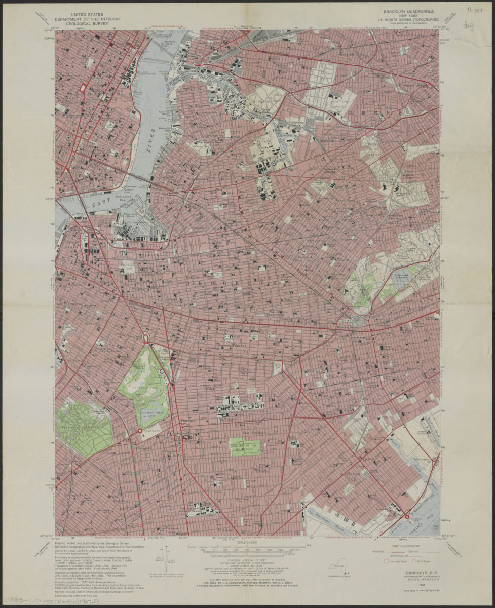
Brooklyn quadrangle, New York
Brooklyn quadrangle, New York
1967
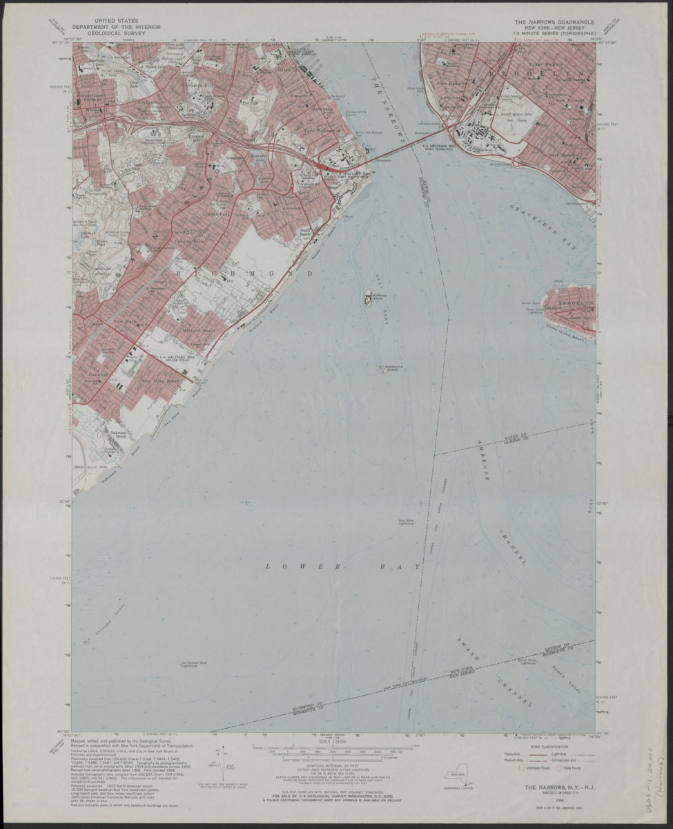
The Narrows quadrangle, New York–New Jersey: 7.5 minute series (topographic): mapped, edited, and published by the Geological Survey ; revised in cooperation with New York Department of Transportation
The Narrows quadrangle, New York–New Jersey: 7.5 minute series (topographic): mapped, edited, and published by the Geological Survey ; revised in cooperation with New York Department of Transportation
1968
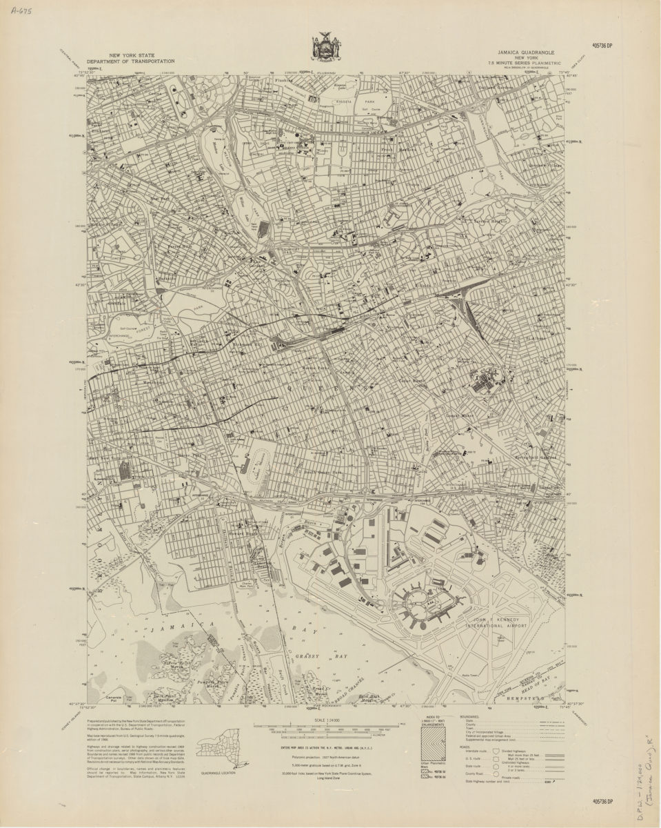
Jamaica quadrangle, New York
Jamaica quadrangle, New York
[1969]
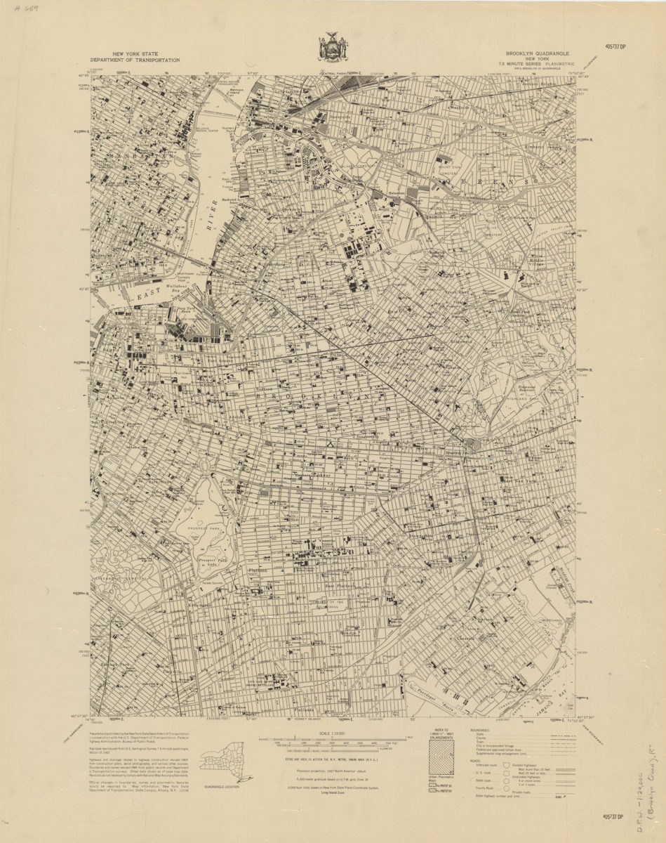
Brooklyn quadrangle, New York
Brooklyn quadrangle, New York
[1969]
Coney Island quadrangle, New York–New Jersey
Coney Island quadrangle, New York–New Jersey
[1969]
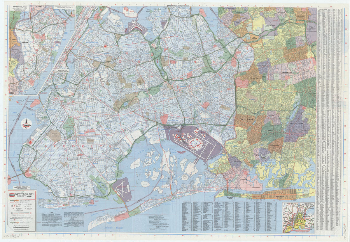
New York City street map: [prepared for] Texaco
New York City street map: [prepared for] Texaco
[1972]
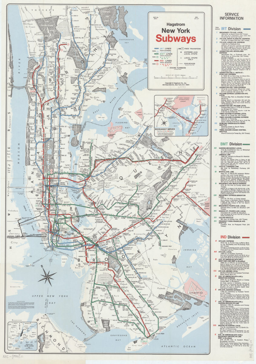
New York subways: Hagstrom
New York subways: Hagstrom
[1974]
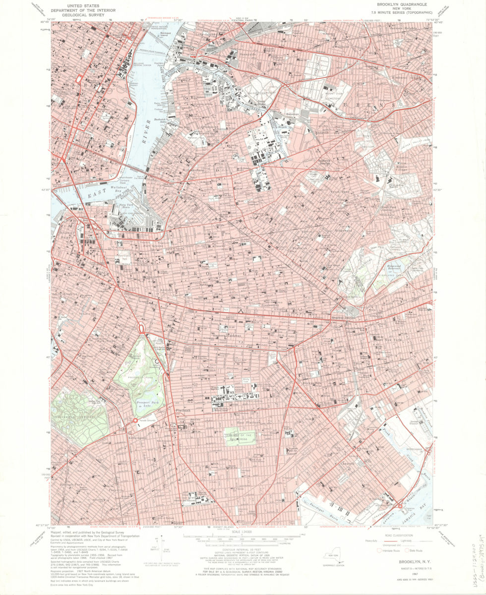
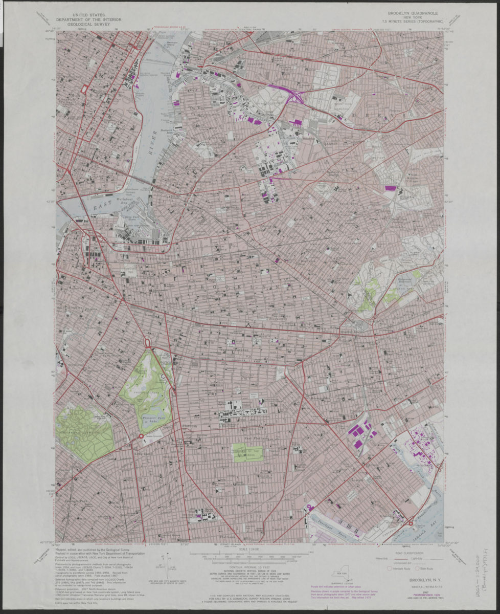
Brooklyn quadrangle, New York: mapped, edited, and published by the Geological Survey ; revised in cooperation with New York Department of Transportation
Brooklyn quadrangle, New York: mapped, edited, and published by the Geological Survey ; revised in cooperation with New York Department of Transportation
1975
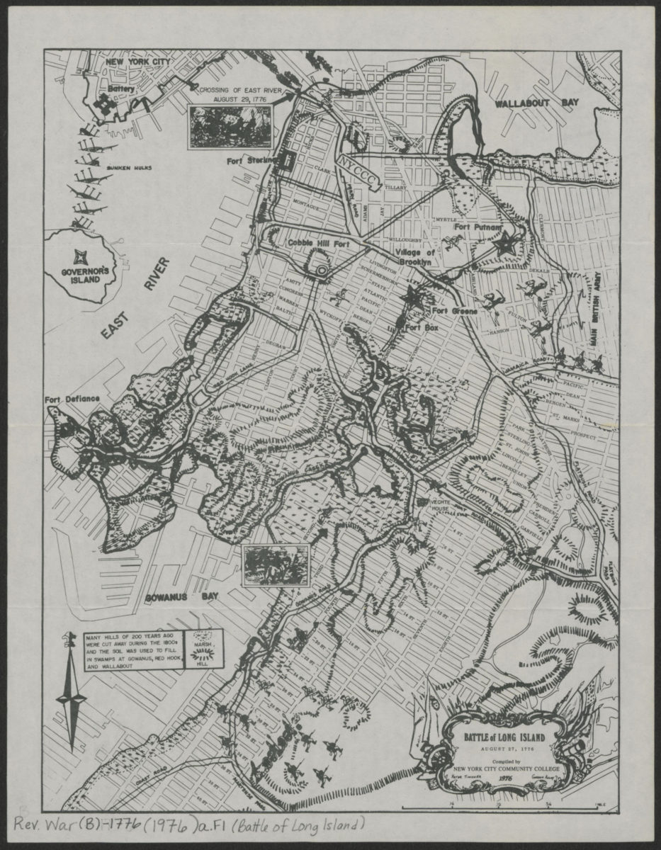
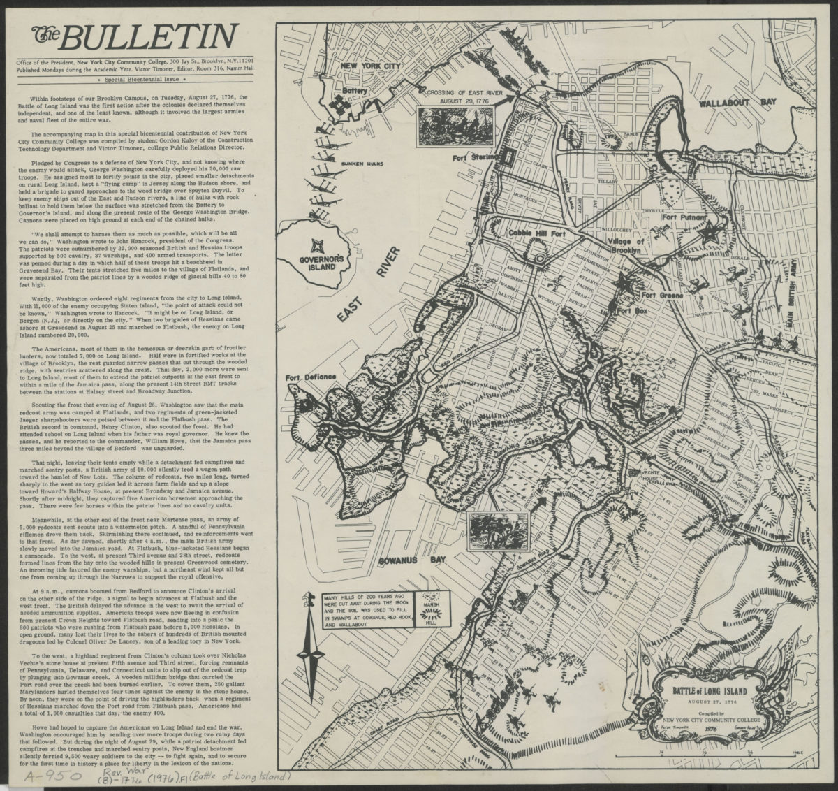
Battle of Long Island, August 27, 1776: compiled by New York City Community College
Battle of Long Island, August 27, 1776: compiled by New York City Community College
[1976]
Battle of Long Island, August 27, 1776: compiled by New York City Community College
Battle of Long Island, August 27, 1776: compiled by New York City Community College
1976
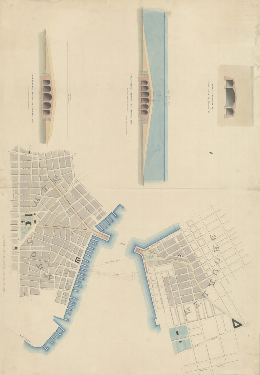
[Watercolor plan for proposed tunnel between Brooklyn and Manhattan connecting Fulton Street in Brooklyn and South Street in Manhattan]
[Watercolor plan for proposed tunnel between Brooklyn and Manhattan connecting Fulton Street in Brooklyn and South Street in Manhattan]
1978
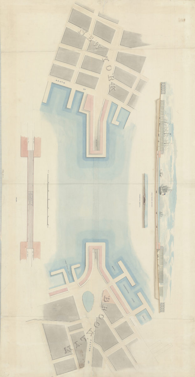
[Watercolor plan for proposed tunnel between Manhattan and Brooklyn on Poplar Street connecting Hicks Street and Furman Street]
[Watercolor plan for proposed tunnel between Manhattan and Brooklyn on Poplar Street connecting Hicks Street and Furman Street]
1978
Brooklyn quadrangle, New York: mapped, edited, and published by the Geological Survey ; revised in cooperation with New York Department of Transportation
Brooklyn quadrangle, New York: mapped, edited, and published by the Geological Survey ; revised in cooperation with New York Department of Transportation
1979
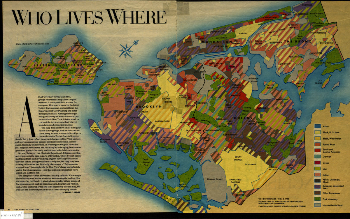
Who lives where: cartography by Guenter Vollath & George Colbert ; [text by] Richard F. Shepard
Who lives where: cartography by Guenter Vollath & George Colbert ; [text by] Richard F. Shepard
1985