Center for Brooklyn History
Map Collections
Search
About
Othmer Library & Archives
Submit search query
Refine 4 records
Clear filters
3
Location
Brooklyn (New York, N.Y.)
891
Kings County (New York, N.Y.)
8
New York (N.Y.)
164
Subject
Local transit
63
Railroads, Elevated
24
Streets
46
Subways
55
Date
19th Century
945
20th Century
469
or enter range:
from
to
Genres
Statistical maps
8
Transportation maps
120
Sort by:
Date (earliest)
Date (most recent)
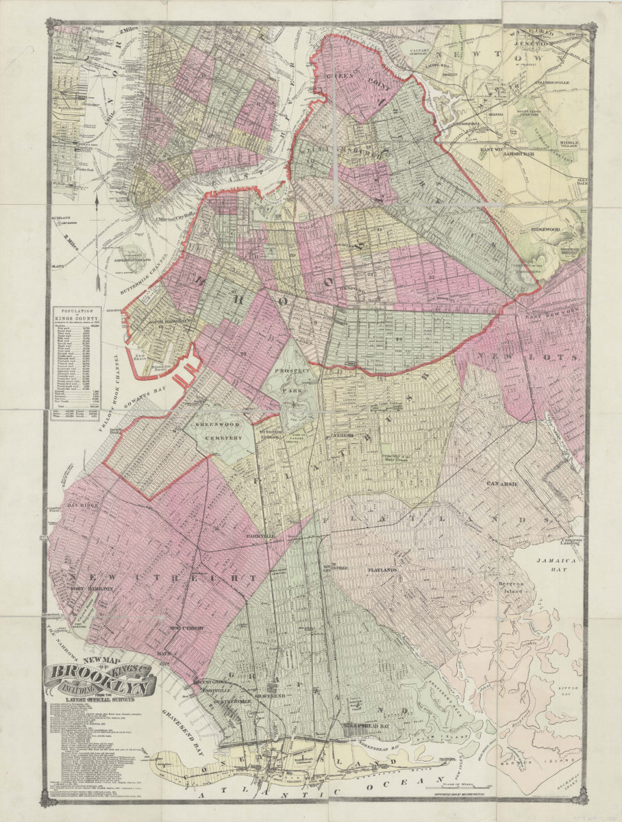
New map of Brooklyn including Kings Co., from the latest official surveys
New map of Brooklyn including Kings Co., from the latest official surveys
[ca. 1884]
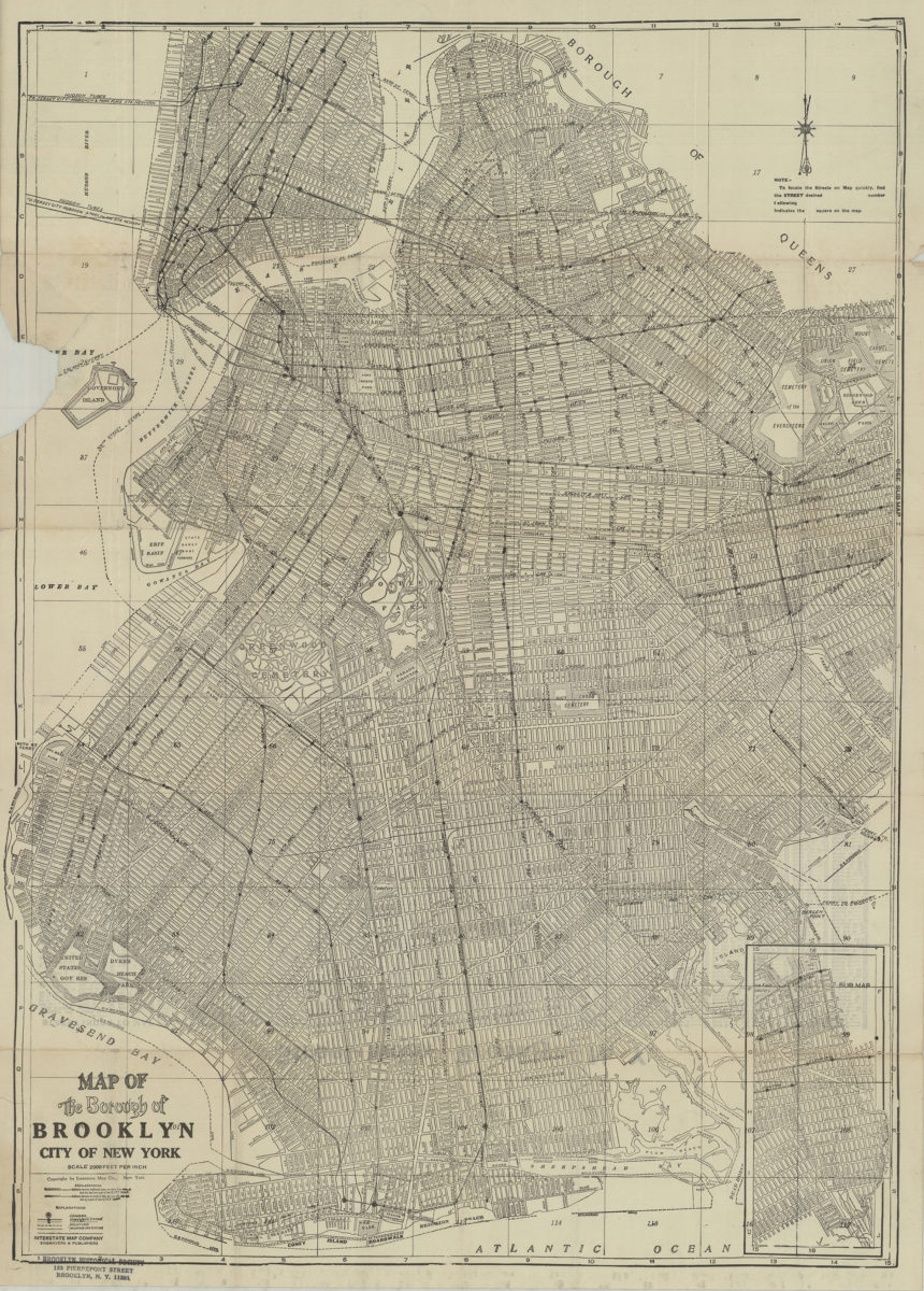
Map of the Borough of Brooklyn, City of New York
Map of the Borough of Brooklyn, City of New York
[19??]
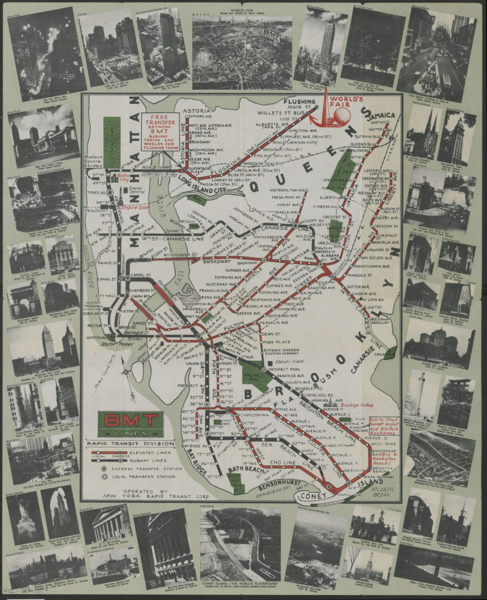
BMT Lines Rapid Transit Division
BMT Lines Rapid Transit Division
[1939]
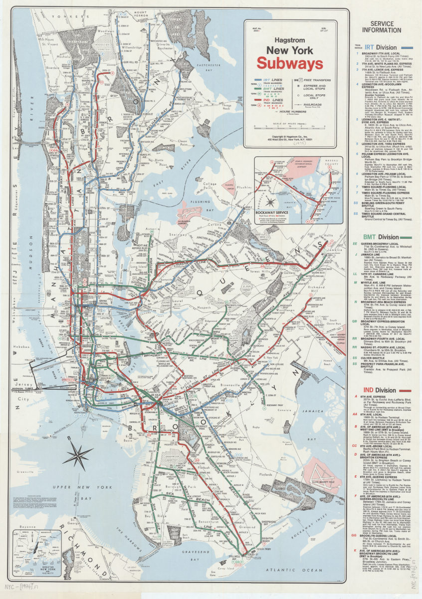
New York subways: Hagstrom
New York subways: Hagstrom
[1974]