Center for Brooklyn History
Map Collections
Search
About
Othmer Library & Archives
Submit search query
Refine 17 records
Clear filters
3
Location
Bronx (New York, N.Y.)
10
Brooklyn (New York, N.Y.)
891
Cypress Hills (New York, N.Y.)
8
Downtown Brooklyn (New York, N.Y.)
29
Far Rockaway (New York, N.Y.)
2
Jamaica Bay (N.Y.)
5
Long Island (N.Y.)
197
Manhattan (New York, N.Y.)
120
New Jersey
27
New York (N.Y.)
164
New York (State)
95
New York Metropolitan Area
40
Queens (New York, N.Y.)
83
Stapleton (New York, N.Y.)
1
Staten Island (N.Y.)
10
Subject
Cemeteries
17
Local transit
63
Roads
117
Street railroads
8
Streets
46
Subways
55
Date
20th Century
469
or enter range:
from
to
Genres
Aerial views
15
Bathymetric maps
94
Index maps
1
Map
191
Road maps
83
Thematic maps
60
Topographic maps
70
Tourist maps
55
Transportation maps
120
Sort by:
Date (earliest)
Date (most recent)
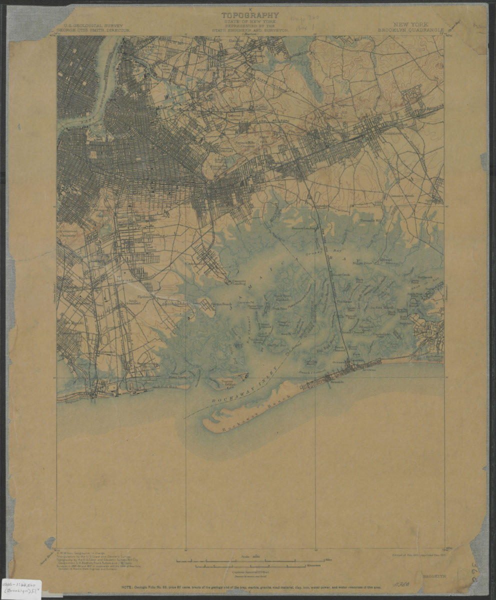
Brooklyn quadrangle, New York: U.S. Geological Survey
Brooklyn quadrangle, New York: U.S. Geological Survey
1900; 1910
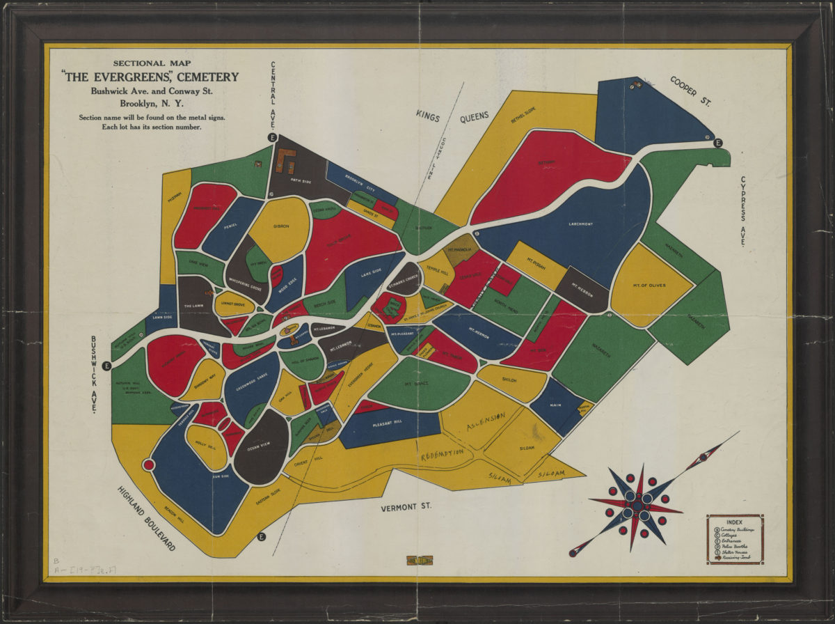
Sectional map: “The Evergreens Cemetery” : Bushwick Ave. and Conway Street, Brooklyn, N.Y.
Sectional map: “The Evergreens Cemetery” : Bushwick Ave. and Conway Street, Brooklyn, N.Y.
[1900-1999]
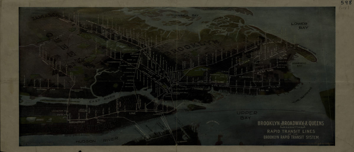
Brooklyn, Broadway (Manhattan), Queens rapid transit lines of the Brooklyn Rapid Transit System: Harry A. Chandler
Brooklyn, Broadway (Manhattan), Queens rapid transit lines of the Brooklyn Rapid Transit System: Harry A. Chandler
[1916-1924]
Map showing Brooklyn automobile routes and car lines approved by the Borough President, July 1919
Map showing Brooklyn automobile routes and car lines approved by the Borough President, July 1919
[1919]
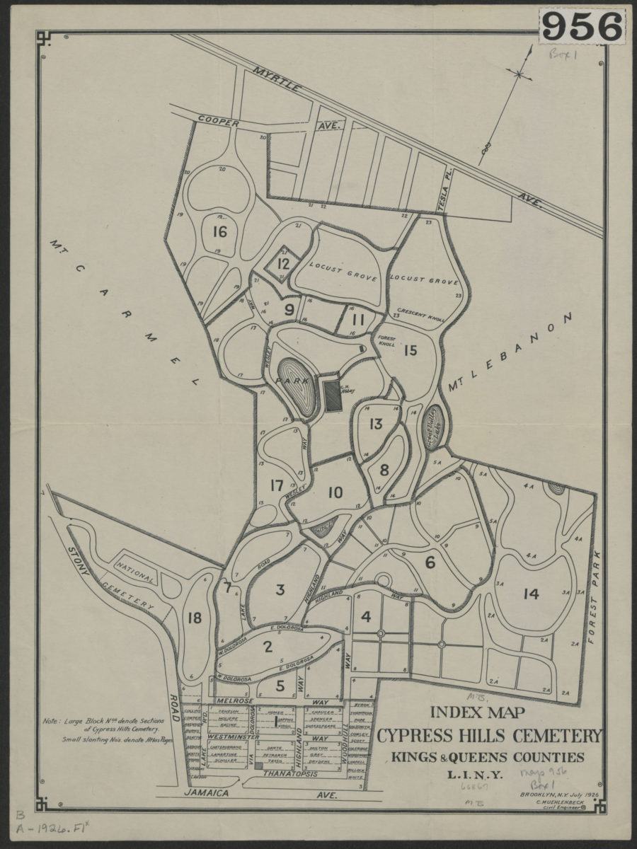
Index map, Cypress Hills Cemetery: Kings & Queens Counties, L.I., N.Y.
Index map, Cypress Hills Cemetery: Kings & Queens Counties, L.I., N.Y.
Jul-26
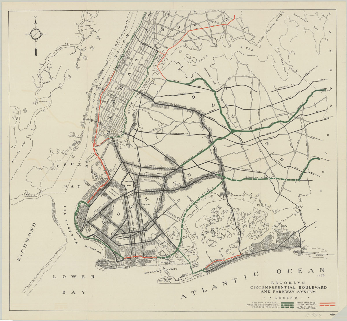
Brooklyn circumferential boulevard and parkway system
Brooklyn circumferential boulevard and parkway system
[193?]
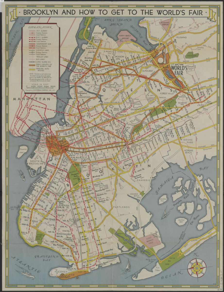
How to get to the New York World’s Fair, and The heart of Brooklyn: issued by the Downtown Brooklyn Association, Inc
How to get to the New York World’s Fair, and The heart of Brooklyn: issued by the Downtown Brooklyn Association, Inc
[1939]
Shell street guide and metropolitan map of Brooklyn, Queens and Long Island: the H.M. Gousha Company
Shell street guide and metropolitan map of Brooklyn, Queens and Long Island: the H.M. Gousha Company
[1939]
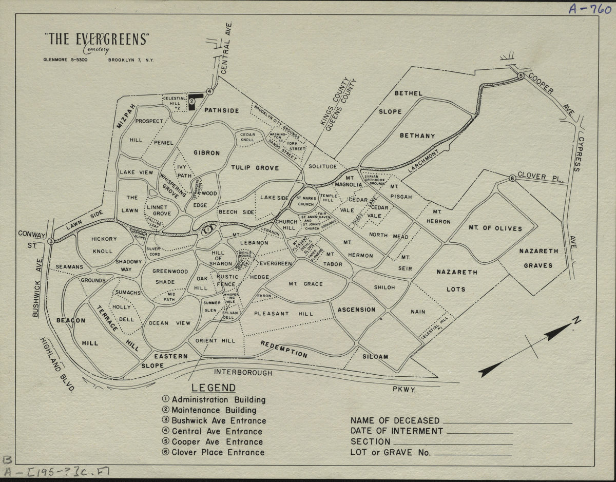
“The Evergreens” cemetery, Brooklyn-New York
“The Evergreens” cemetery, Brooklyn-New York
[195?]
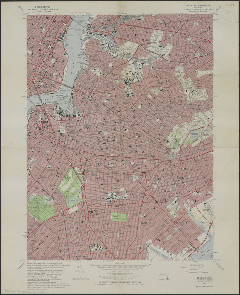
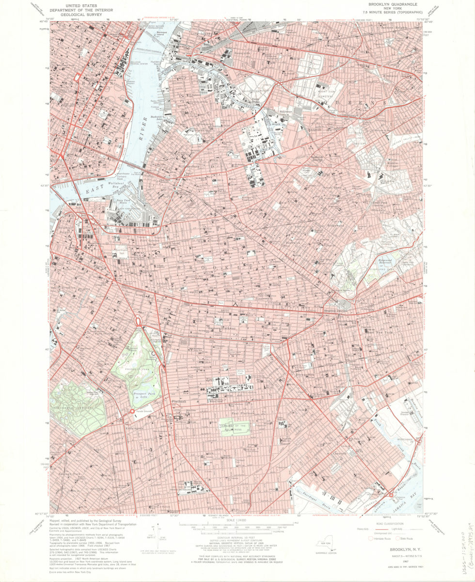
Brooklyn quadrangle, New York
Brooklyn quadrangle, New York
1967
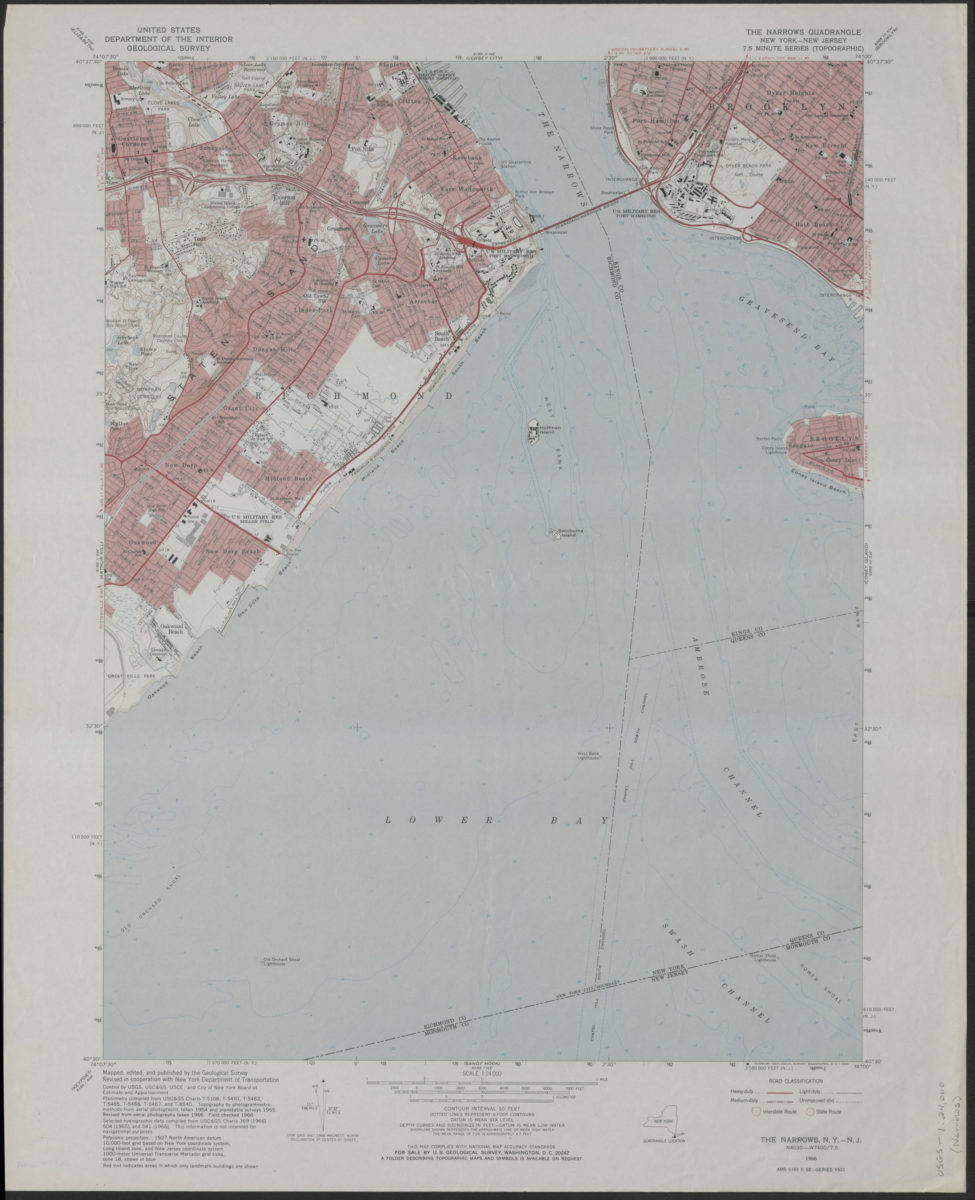
The Narrows quadrangle, New York–New Jersey: 7.5 minute series (topographic): mapped, edited, and published by the Geological Survey ; revised in cooperation with New York Department of Transportation
The Narrows quadrangle, New York–New Jersey: 7.5 minute series (topographic): mapped, edited, and published by the Geological Survey ; revised in cooperation with New York Department of Transportation
1968
Brooklyn quadrangle, New York
Brooklyn quadrangle, New York
[1969]
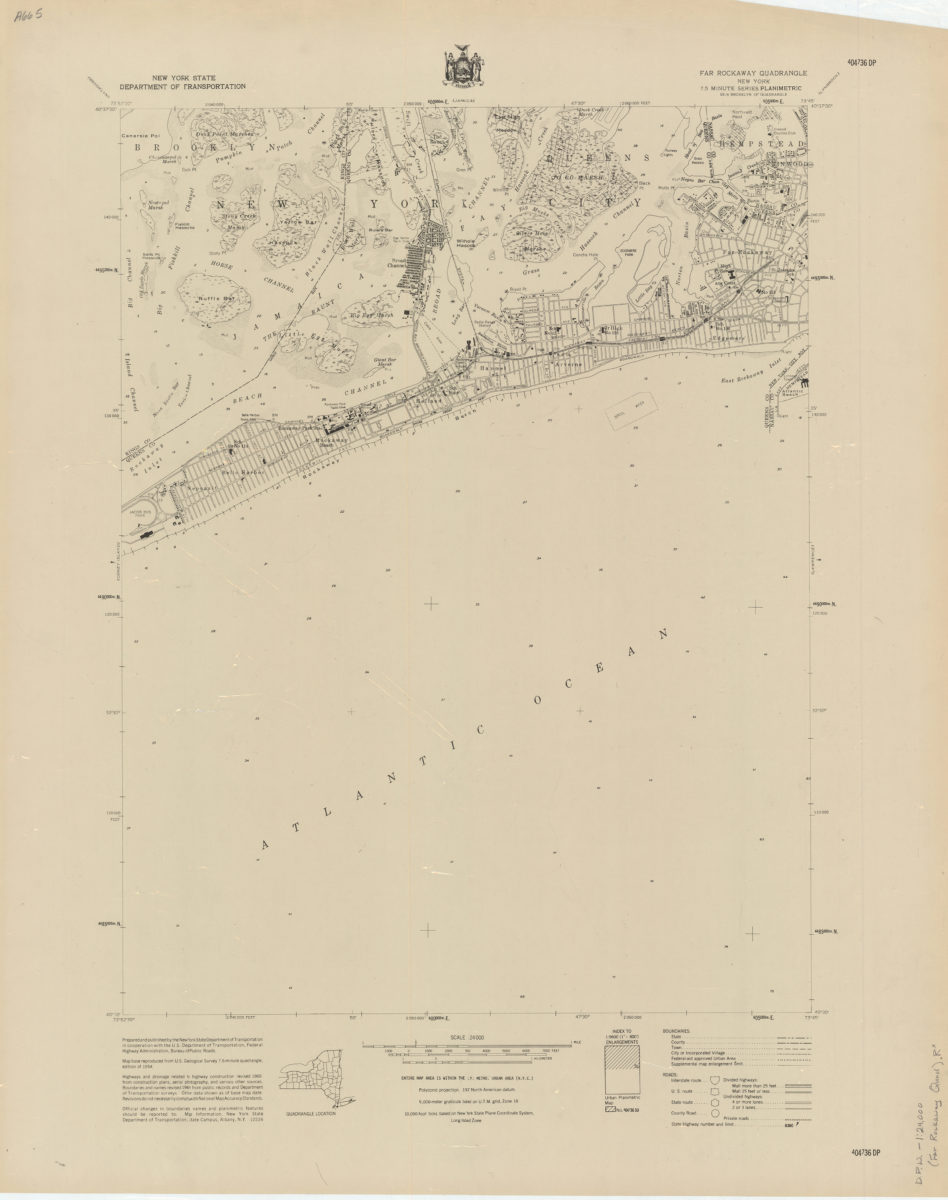
Far Rockaway quadrangle, New York
Far Rockaway quadrangle, New York
[1969]
Flushing quadrangle, New York
Flushing quadrangle, New York
[1969]
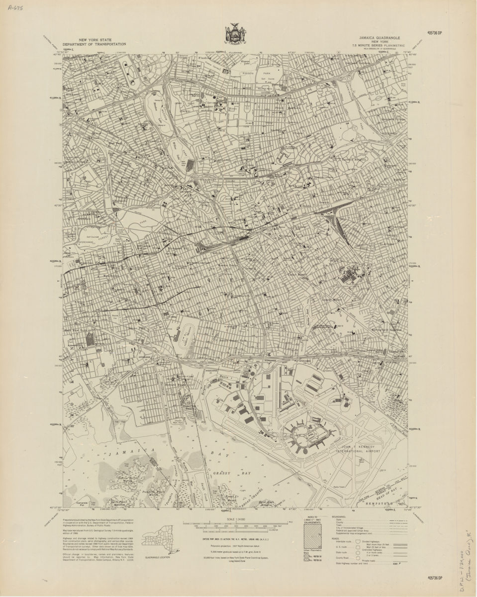
Jamaica quadrangle, New York
Jamaica quadrangle, New York
[1969]
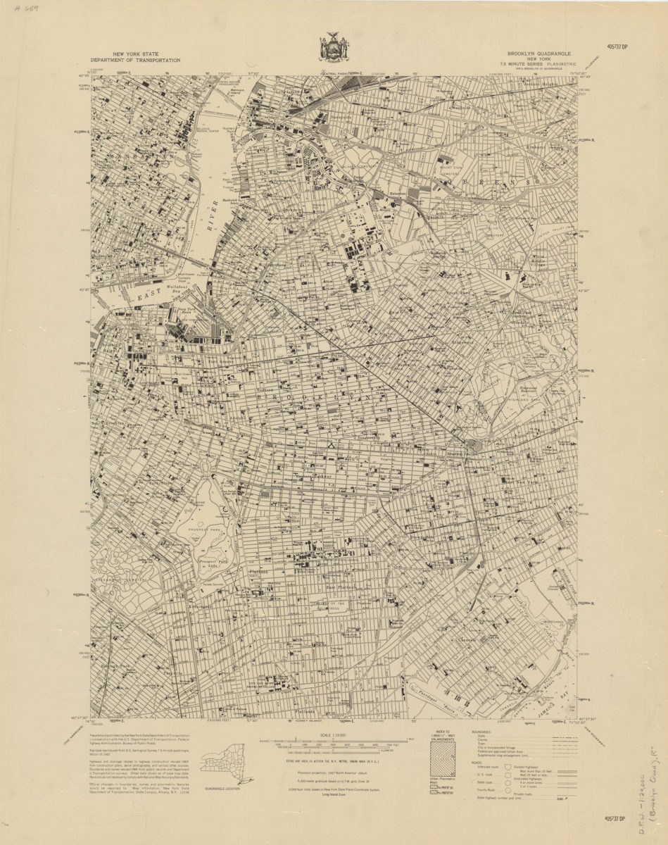
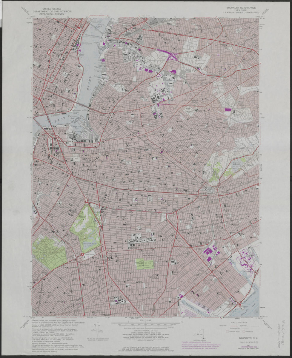
Brooklyn quadrangle, New York: mapped, edited, and published by the Geological Survey ; revised in cooperation with New York Department of Transportation
Brooklyn quadrangle, New York: mapped, edited, and published by the Geological Survey ; revised in cooperation with New York Department of Transportation
1975
Brooklyn quadrangle, New York: mapped, edited, and published by the Geological Survey ; revised in cooperation with New York Department of Transportation
Brooklyn quadrangle, New York: mapped, edited, and published by the Geological Survey ; revised in cooperation with New York Department of Transportation
1979