Center for Brooklyn History
Map Collections
Search
About
Othmer Library & Archives
Submit search query
Refine 4 records
Clear filters
5
Location
Brooklyn (New York, N.Y.)
891
Bushwick (New York, N.Y.)
20
Williamsburg (New York, N.Y.)
36
Subject
Landowners
434
Real property
619
Date
19th Century
945
20th Century
469
or enter range:
from
to
Genres
Cadastral maps
597
Manuscript maps
365
Sort by:
Date (earliest)
Date (most recent)
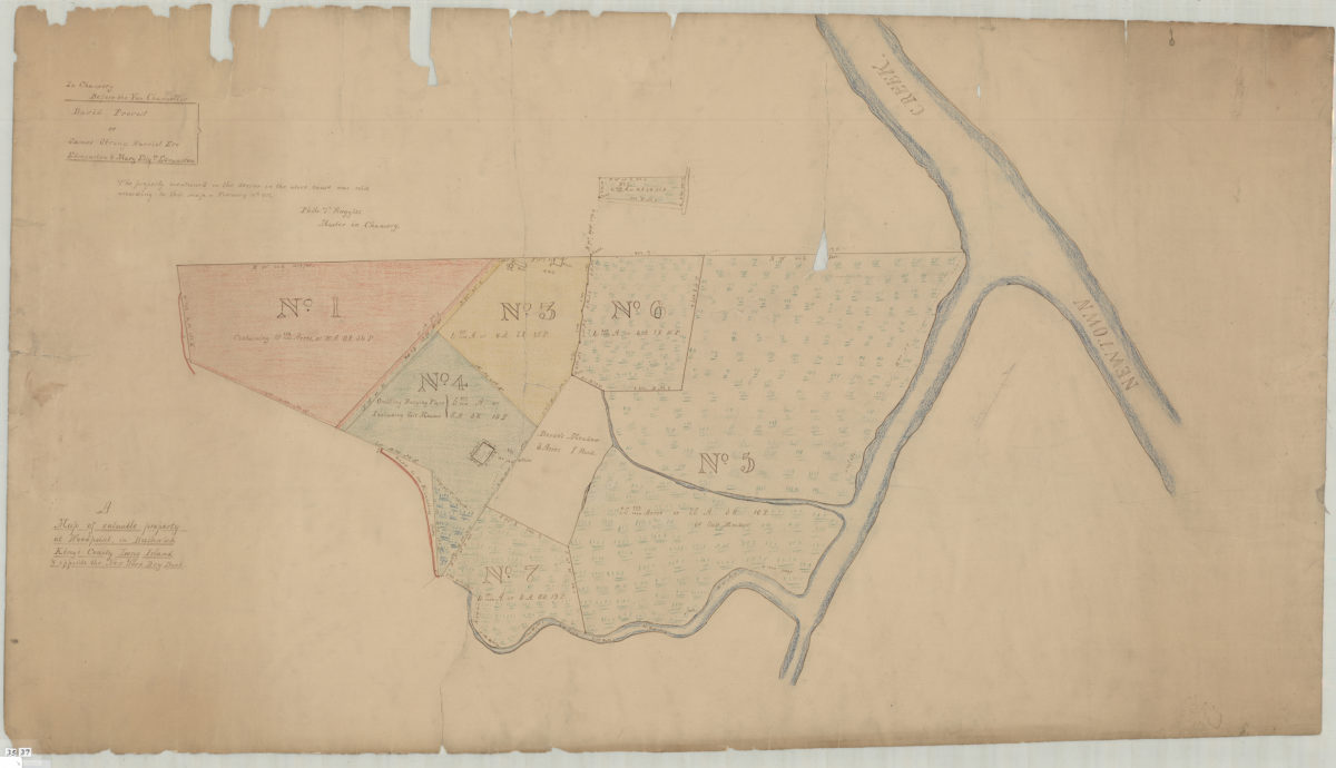
A map of valuable property at Woodpoint, in Bushwick, Kings County, Long Island & opposite the New York Dry Dock
A map of valuable property at Woodpoint, in Bushwick, Kings County, Long Island & opposite the New York Dry Dock
[1836]
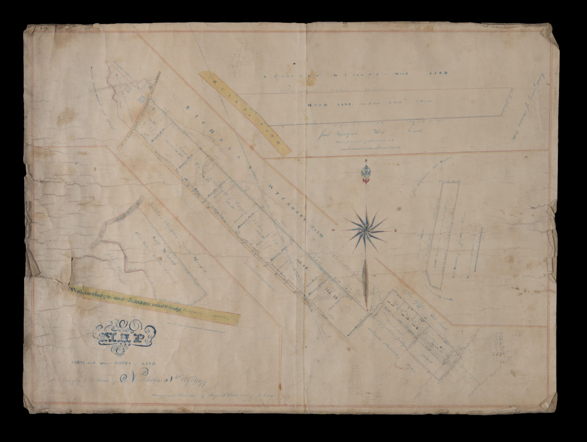
Map of farm and other pieces of land belonging to the estate of Nicholas N. Wyckoff: surveyed and delineated by Benjamn. F. Willets, Flushings [sic], L.I. surveyor
Map of farm and other pieces of land belonging to the estate of Nicholas N. Wyckoff: surveyed and delineated by Benjamn. F. Willets, Flushings [sic], L.I. surveyor
December 1847
Map of part of the Suydam Farm belonging to William Coit, situated in the 18th Ward of the city of Brooklyn: John L. Nostrand, city surveyor, Brooklyn, Feb. 1857
Map of part of the Suydam Farm belonging to William Coit, situated in the 18th Ward of the city of Brooklyn: John L. Nostrand, city surveyor, Brooklyn, Feb. 1857
[1857]
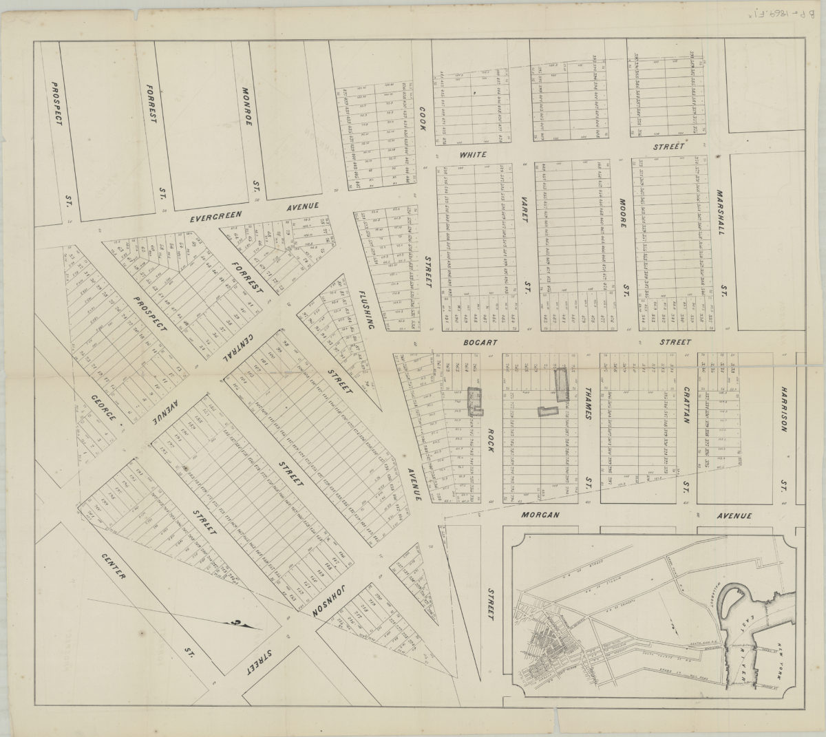
538 desirable lots, together with the farm house and barn thereon, belonging to the estate of George White, deceased, finely situated in the 18th Ward, Brooklyn
538 desirable lots, together with the farm house and barn thereon, belonging to the estate of George White, deceased, finely situated in the 18th Ward, Brooklyn
[1995; ca. 1991]