Center for Brooklyn History
Map Collections
Search
About
Othmer Library & Archives
Submit search query
Refine 2 records
Clear filters
2
Location
Brooklyn (New York, N.Y.)
891
Brownsville (New York, N.Y.)
10
East Flatbush (New York, N.Y.)
23
East New York (New York, N.Y.)
16
Flatlands (New York, N.Y.)
19
Gravesend (New York, N.Y.)
25
Kings Highway (New York, N.Y.)
1
Midwood (New York, N.Y.)
9
New Utrecht (New York, N.Y.)
9
Sheepshead Bay (New York, N.Y.)
13
Subject
Highway planning
2
Landowners
434
Real property
619
Roads
117
Date
19th Century
945
20th Century
469
or enter range:
from
to
Genres
Cadastral maps
597
Thematic maps
60
Sort by:
Date (earliest)
Date (most recent)
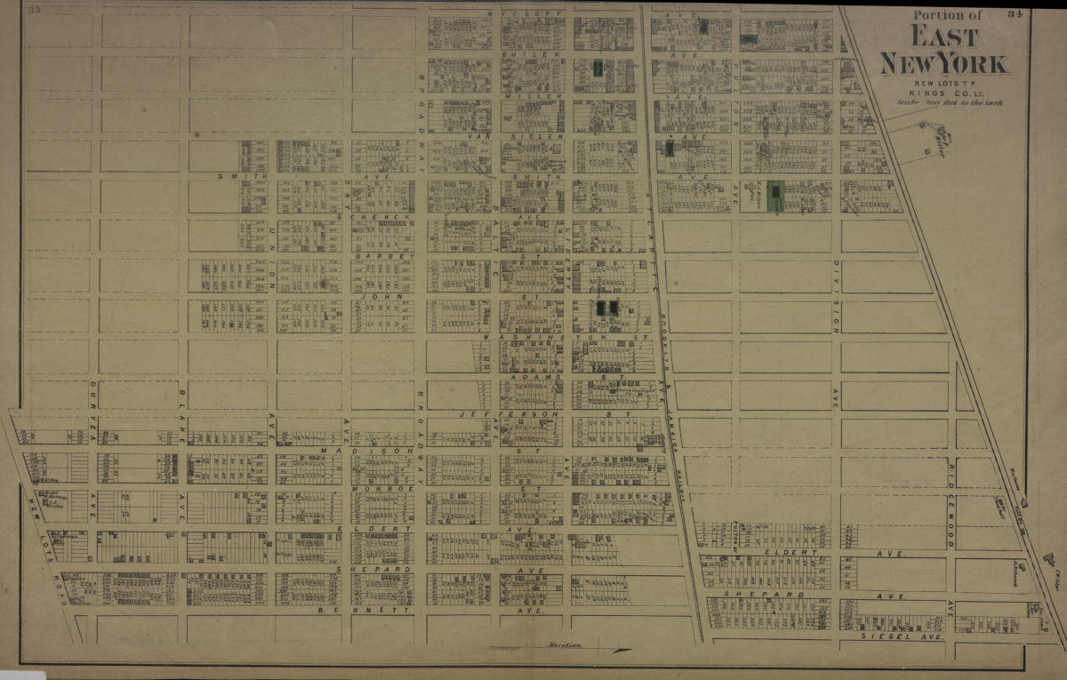
Portion of East New York, New Lots Tn., Kings Co., L.I.
Portion of East New York, New Lots Tn., Kings Co., L.I.
[1873]
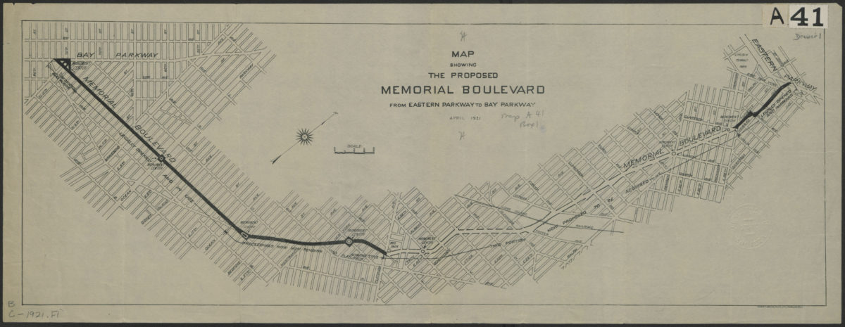
Map showing the proposed Memorial Boulevard from Eastern Parkway to Bay Parkway, April 1921
Map showing the proposed Memorial Boulevard from Eastern Parkway to Bay Parkway, April 1921
[1921]