Center for Brooklyn History
Map Collections
Search
About
Othmer Library & Archives
Submit search query
Refine 3 records
Clear filters
2
Location
East River (N.Y.)
3
Fort Montgomery State Historic Site (Highlands, N.Y.)
1
Hudson Highlands (N.Y.)
1
Hudson River (N.Y. and N.J.)
7
Subject
Historic buildings
3
Historic sites
3
Date
20th Century
469
or enter range:
from
to
Genres
Bathymetric maps
94
Early works
3
Nautical charts
30
Pictorial maps
38
Sort by:
Date (earliest)
Date (most recent)
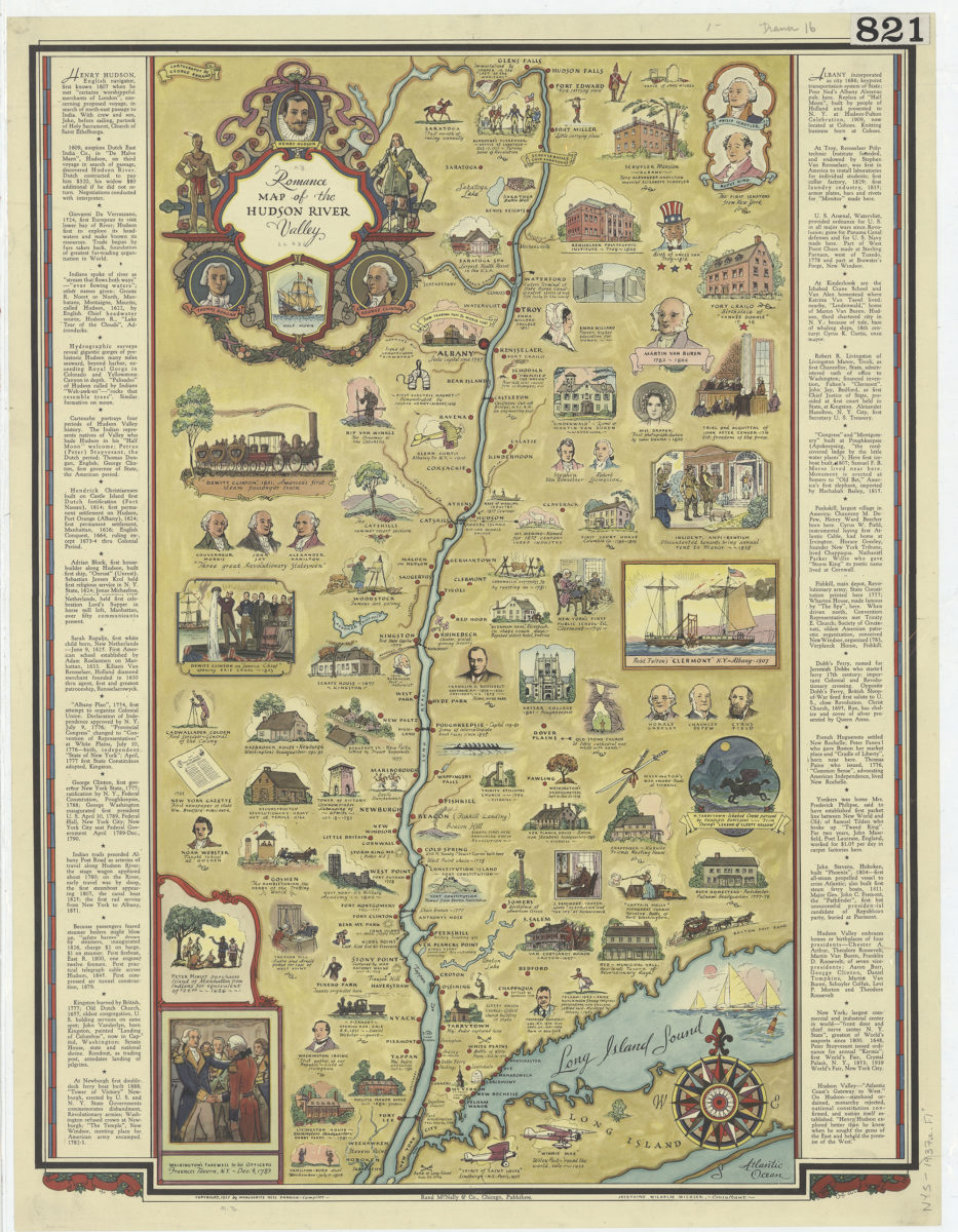
Romance map of the Hudson River Valley: Marguerite Hess Parrish, compiler ; Josephine Wilhelm Wickser, consultant ; cartography by George Annand
Romance map of the Hudson River Valley: Marguerite Hess Parrish, compiler ; Josephine Wilhelm Wickser, consultant ; cartography by George Annand
[ca. 1937]
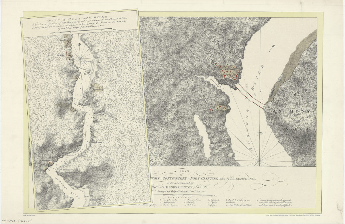
A plan of Fort Montgomery & Fort Clinton, taken by His Majesty’s forces, under the command of Maj. Genl. Sir Henry Clinton, K: B: survey’d by Major Holland, Survr. Genl. &c
A plan of Fort Montgomery & Fort Clinton, taken by His Majesty’s forces, under the command of Maj. Genl. Sir Henry Clinton, K: B: survey’d by Major Holland, Survr. Genl. &c
[1968]
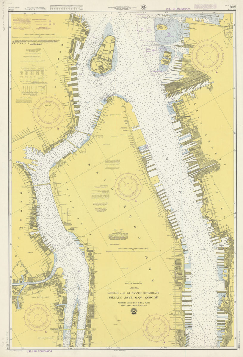
United States–east coast, New York and New Jersey, Hudson and East Rivers, Governors Island to 67th Street: National Ocean Survey
United States–east coast, New York and New Jersey, Hudson and East Rivers, Governors Island to 67th Street: National Ocean Survey
1974