Center for Brooklyn History
Map Collections
Search
About
Othmer Library & Archives
Submit search query
Refine 3 records
Clear filters
2
Location
Brightwaters (N.Y.)
1
Brookhaven (N.Y. : Town)
3
Islip (N.Y.)
5
Long Island (N.Y.)
197
Ocean Beach (N.Y.)
1
Saltaire (N.Y.)
1
Smithtown (N.Y. : Town)
4
Suffolk County (N.Y.)
43
Subject
Roads
117
Streets
46
Date
20th Century
469
or enter range:
from
to
Genres
Road maps
83
Topographic maps
70
Sort by:
Date (earliest)
Date (most recent)
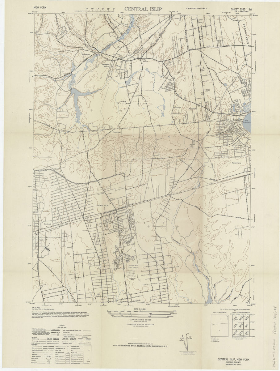
Central Islip/: prepared under the direction of the Chief of Engineers by the Army Map Service (AM)
Central Islip/: prepared under the direction of the Chief of Engineers by the Army Map Service (AM)
1947
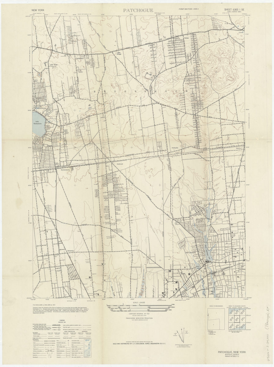
Patchogue: prepared under the direction of the Chief of Engineers by the Army Map Service (AM)
Patchogue: prepared under the direction of the Chief of Engineers by the Army Map Service (AM)
1947
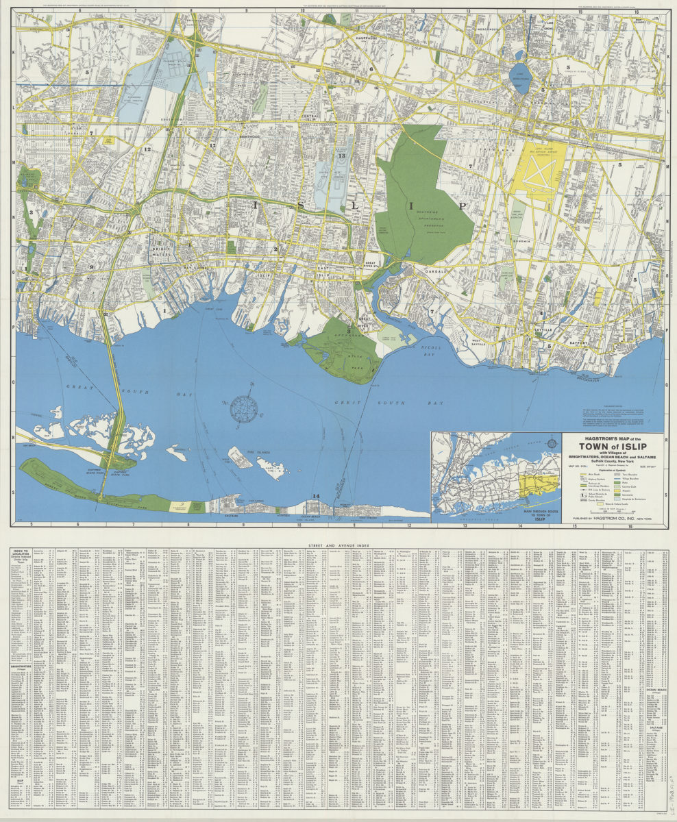
Hagstrom’s map of the Town of Islip: with the villages of Brightwaters, Ocean Beach and Saltaire, Suffolk County, New York
Hagstrom’s map of the Town of Islip: with the villages of Brightwaters, Ocean Beach and Saltaire, Suffolk County, New York
1968