Center for Brooklyn History
Map Collections
Search
About
Othmer Library & Archives
Submit search query
Refine 39 records
Clear filters
3
Location
Babylon (N.Y. : Town)
2
Bridgehampton (N.Y.)
1
Brookhaven (N.Y. : Town)
3
Brookhaven (N.Y.)
2
East Patchogue (N.Y.)
1
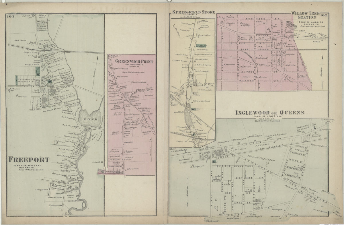
Freeport (N.Y.)
1
Glen Cove (N.Y.)
1
Great Neck (N.Y.)
3
Greenport (N.Y.)
1
Hempstead (N.Y.)
13
Hicksville (N.Y.)
1
Huntington (N.Y.)
7
Islip (N.Y.)
5
Jamaica (New York, N.Y.)
8
Lakeland (N.Y.)
1
Long Island (N.Y.)
197
Mattituck (N.Y.)
1
Miller Place (N.Y.)
1
Mineola (N.Y.)
1
Montauk (N.Y.)
4
North Hempstead (N.Y. : Town)
4
Northport Bay (N.Y. : Bay)
1
Oyster Bay (N.Y.)
9
Patchogue (N.Y.)
2
Pearsalls (N.Y.)
1
Port Jefferson (N.Y.)
1
Queens (New York, N.Y.)
83
Quiogue (N.Y.)
1
Riverhead (N.Y.)
3
Rockville Centre (N.Y.)
2
Rosevale (N.Y.)
2
Roslyn (N.Y.)
3
Roslyn Harbor (N.Y.)
1
Roslyn Highlands (N.Y.)
1
Sag Harbor (N.Y.)
2
Sayville (N.Y.)
1
Sea Cliff (N.Y.)
1
Shelter Island (N.Y.)
2
Smithtown (N.Y. : Town)
4
Southampton (N.Y.)
5
Southold (N.Y.)
4
Stony Brook (N.Y.)
1
Suffolk (N.Y.)
1
Suffolk County (N.Y.)
43
United States
10
Westhampton Beach (N.Y.)
1
Woodhaven (New York, N.Y.)
1
Yaphank (N.Y.)
1
Show 28 more
Subject
Auctions
32
Land titles
1
Landowners
434
Real property
619
Riparian rights
13
Submerged lands
17
Date
19th Century
945
or enter range:
from
to
Genres
Advertisements
30
Bathymetric maps
94
Broadsides
33
Cadastral maps
597
Historical maps
53
Manuscript maps
365
Pictorial maps
38
Sort by:
Date (earliest)
Date (most recent)
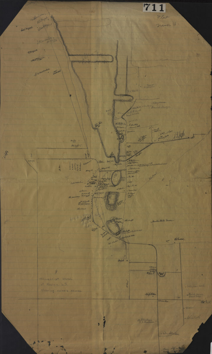
Manuscript sketch of Roslyn L.I. showing owners names
Manuscript sketch of Roslyn L.I. showing owners names
[18??]
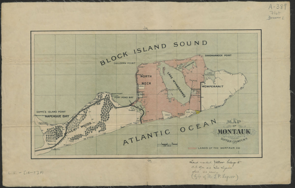
Map of Montauk, Suffolk County, N.Y.
Map of Montauk, Suffolk County, N.Y.
[18??]
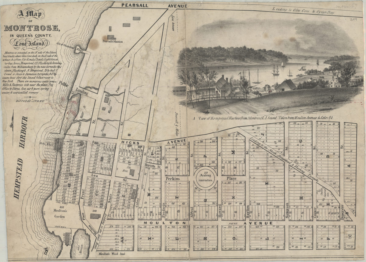
Map of Montrose in Queen’s County, Long Island
Map of Montrose in Queen’s County, Long Island
[184?]
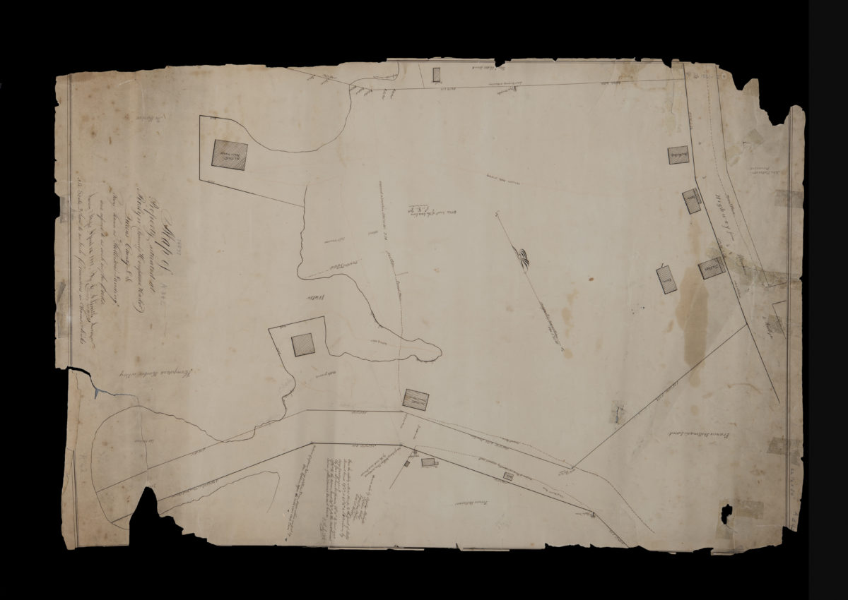
Map of property situated at Roslyn (formerly Hempstead Harbor), Queens County, L.I., being known as “Patterson’s Landing” and referred to as such in the deeds: by G.A. Smith, surveyor
Map of property situated at Roslyn (formerly Hempstead Harbor), Queens County, L.I., being known as “Patterson’s Landing” and referred to as such in the deeds: by G.A. Smith, surveyor
September 27, 1851
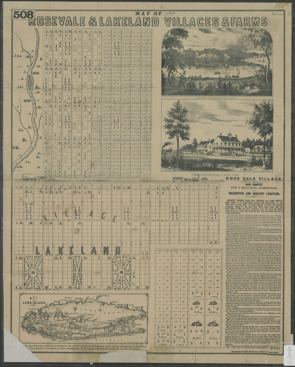
Map of Rosevale & Lakeland villages & farms
Map of Rosevale & Lakeland villages & farms
[1853]
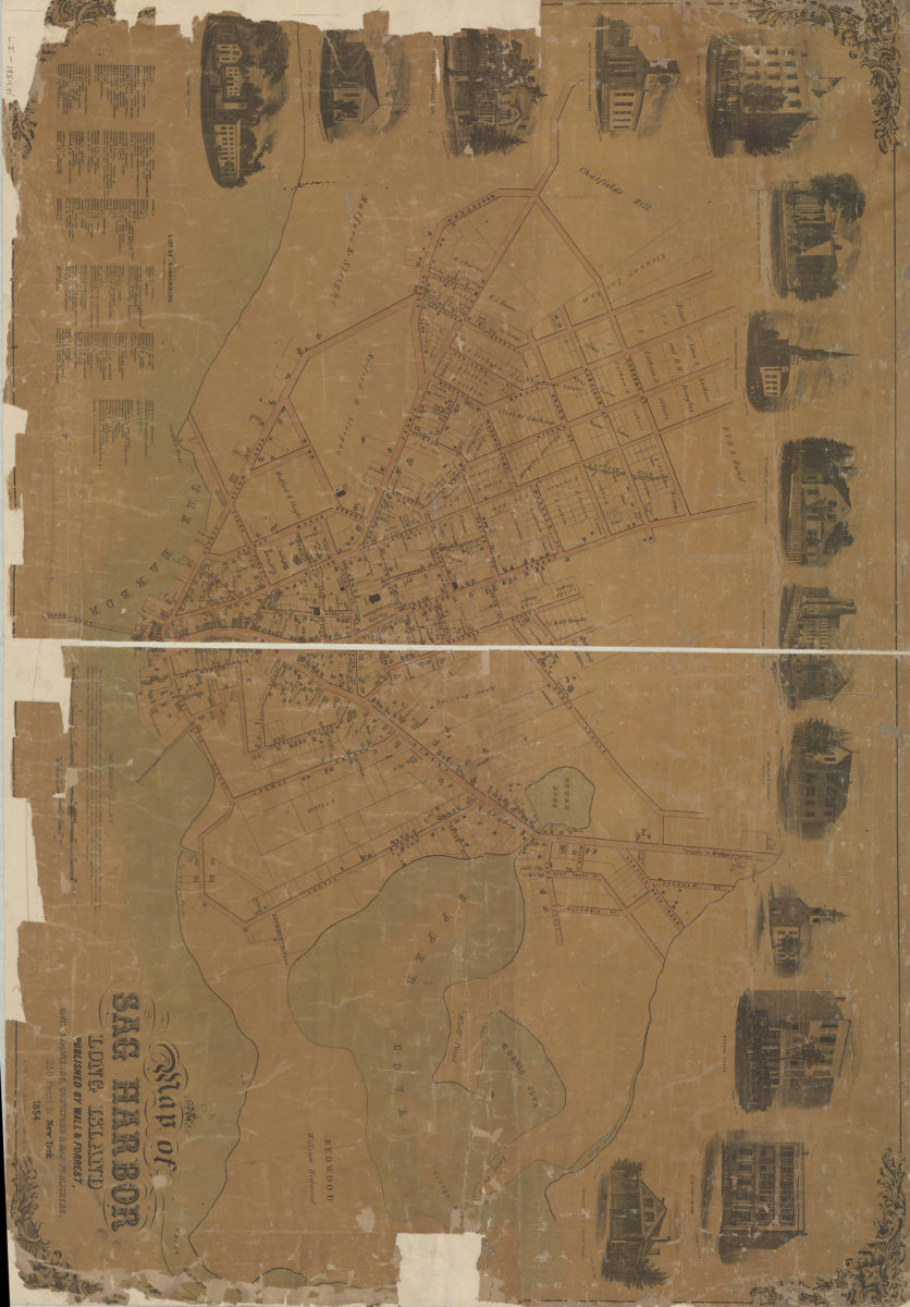
Map of Sag Harbor, Long Island
Map of Sag Harbor, Long Island
1854
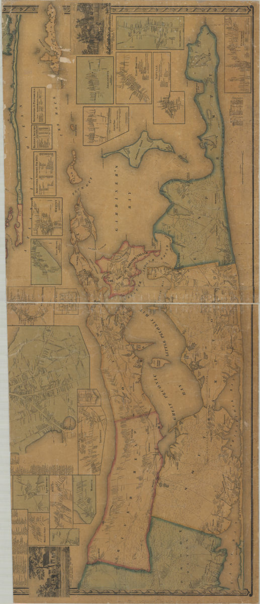
Map of Suffolk Co., L.I., New York: from actual surveys: by J. Chace Junr
Map of Suffolk Co., L.I., New York: from actual surveys: by J. Chace Junr
[1858]
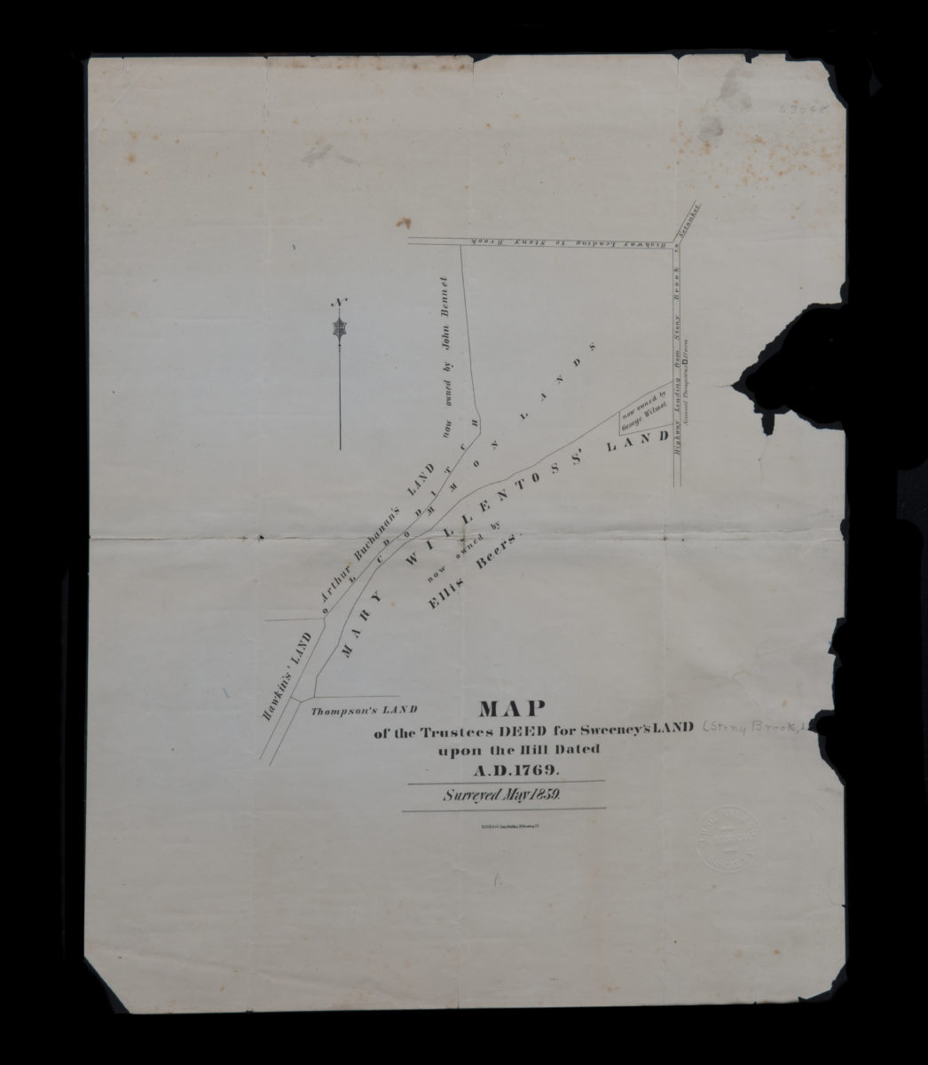
Map of the trustees deed for Sweeney’s land upon the hill dated A.D. 1769
Map of the trustees deed for Sweeney’s land upon the hill dated A.D. 1769
[1859]
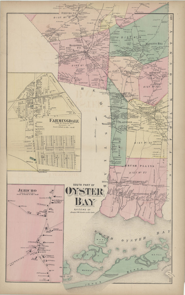
South part of Oyster Bay, Queens Co
South part of Oyster Bay, Queens Co
[1873]
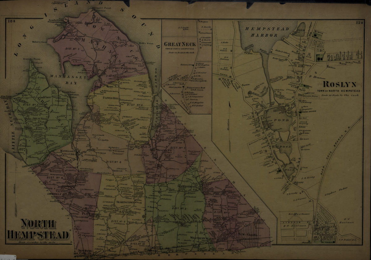
North Hempstead ; Roslyn, town of North Hempstead
North Hempstead ; Roslyn, town of North Hempstead
[1873]
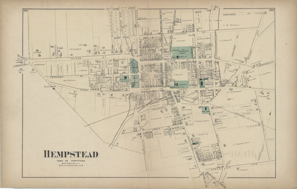
Hempstead, town of Hempstead, Queens Co., L.I.
Hempstead, town of Hempstead, Queens Co., L.I.
[1873]
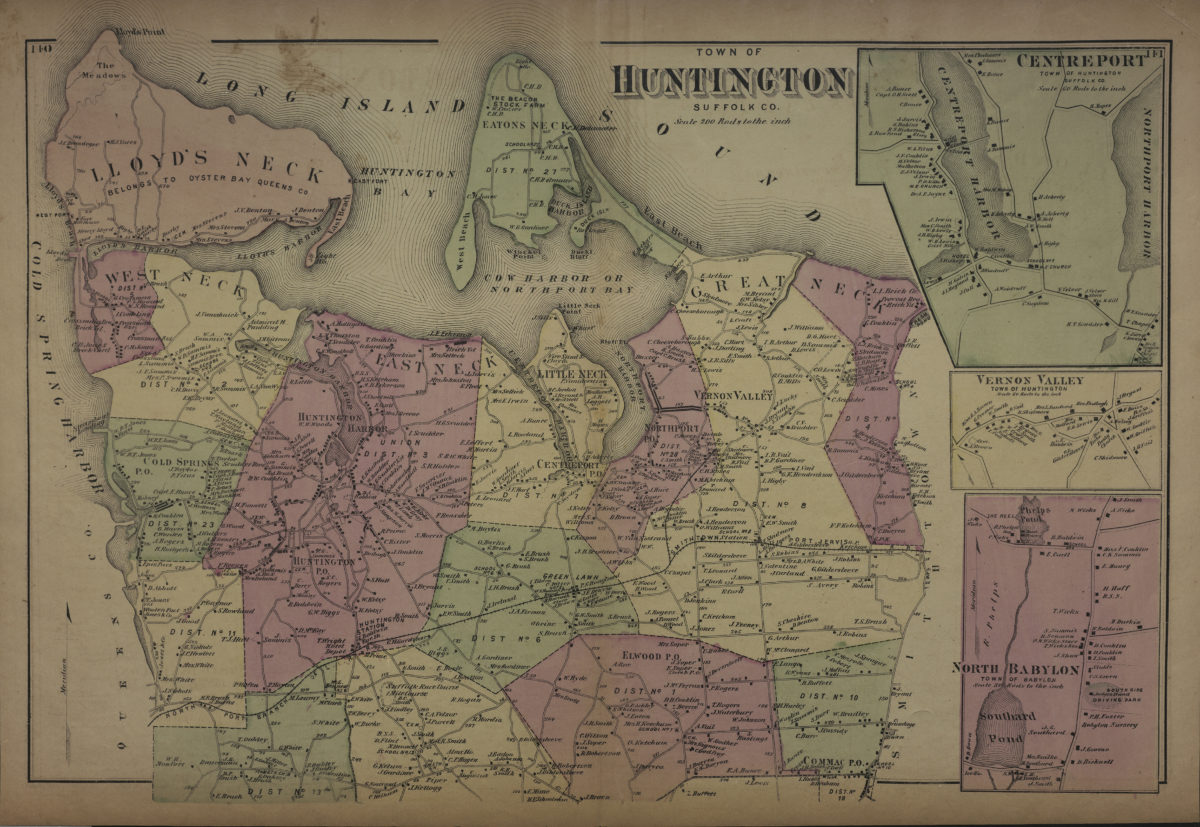
Town of Huntington, Suffolk Co
Town of Huntington, Suffolk Co
[1873]
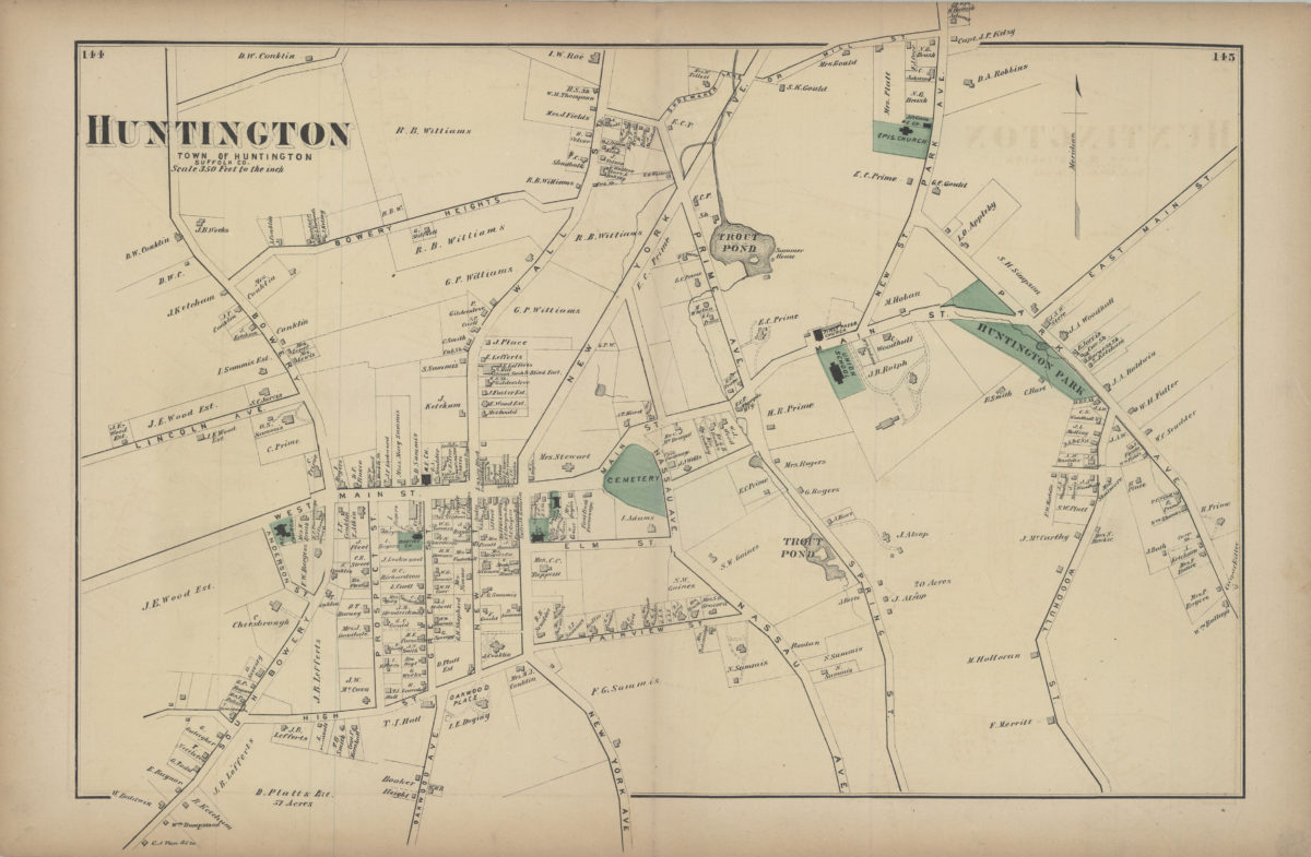
Huntington, town of Huntington, Suffolk Co
Huntington, town of Huntington, Suffolk Co
[1873]
Woodhaven, town of Jamaica, Queens Co
Woodhaven, town of Jamaica, Queens Co
[1873]
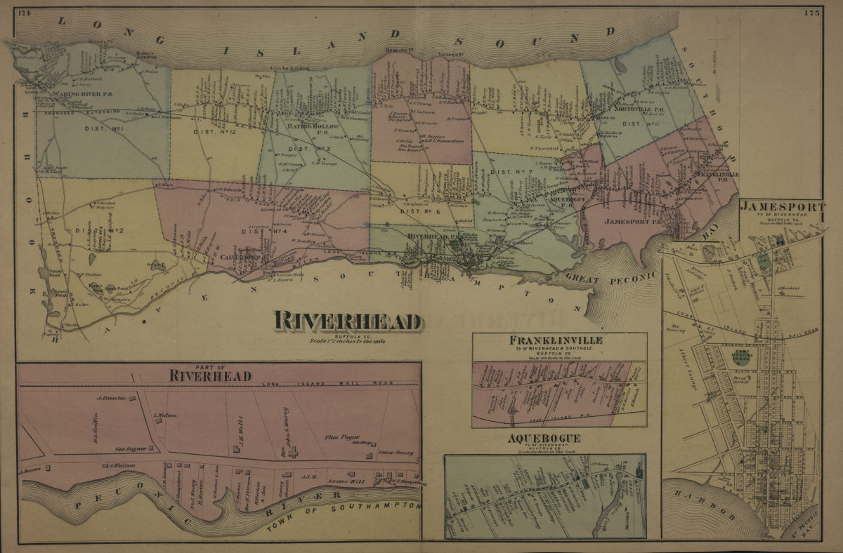
Riverhead, Suffolk Co
Riverhead, Suffolk Co
[1873]
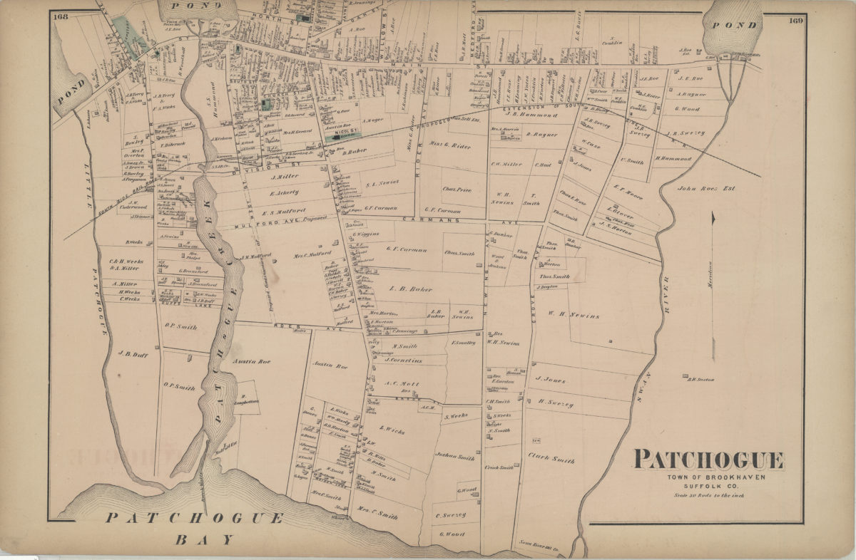
Patchogue, town of Brookhaven, Suffolk Co
Patchogue, town of Brookhaven, Suffolk Co
[1873]
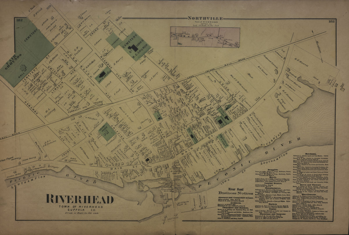
Riverhead, town of Riverhead, Suffolk Co
Riverhead, town of Riverhead, Suffolk Co
[1873]
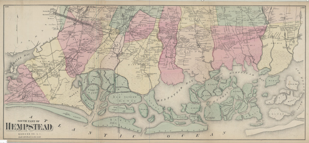
South part of Hempstead, Queens Co., L.I.
South part of Hempstead, Queens Co., L.I.
[1873]
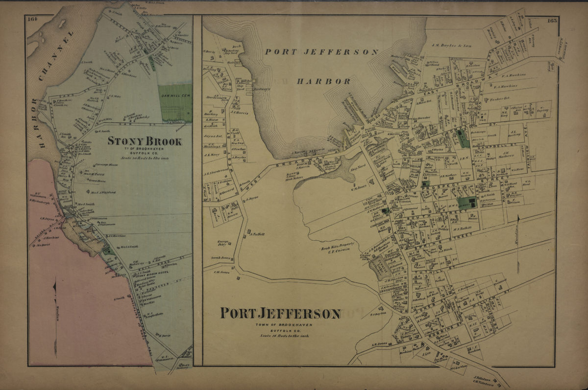
Port Jefferson, town of Brookhaven, Suffolk Co. ; Stony Brook, tn. of Brookhaven, Suffolk Co
Port Jefferson, town of Brookhaven, Suffolk Co. ; Stony Brook, tn. of Brookhaven, Suffolk Co
[1873]
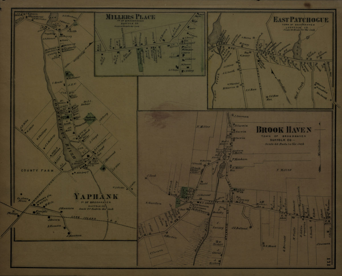
Brookhaven, town of Brookhaven, Suffolk Co. ; Yaphank, tn. of Brookhaven, Suffolk Co. ; Millers [i.e. Miller] Place, tn. of Brookhaven, Suffolk Co. ; East Patchogue, town of Brookhaven, Suffolk Co
Brookhaven, town of Brookhaven, Suffolk Co. ; Yaphank, tn. of Brookhaven, Suffolk Co. ; Millers [i.e. Miller] Place, tn. of Brookhaven, Suffolk Co. ; East Patchogue, town of Brookhaven, Suffolk Co
[1873]
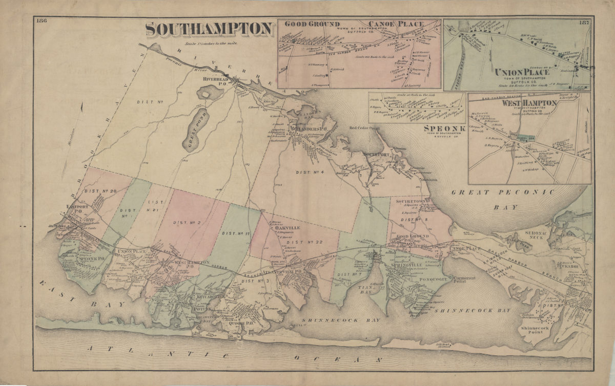
Southampton
Southampton
[1873]
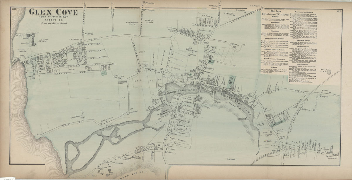
Glen Cove, town of Oyster Bay, Queen’s Co
Glen Cove, town of Oyster Bay, Queen’s Co
[1873]
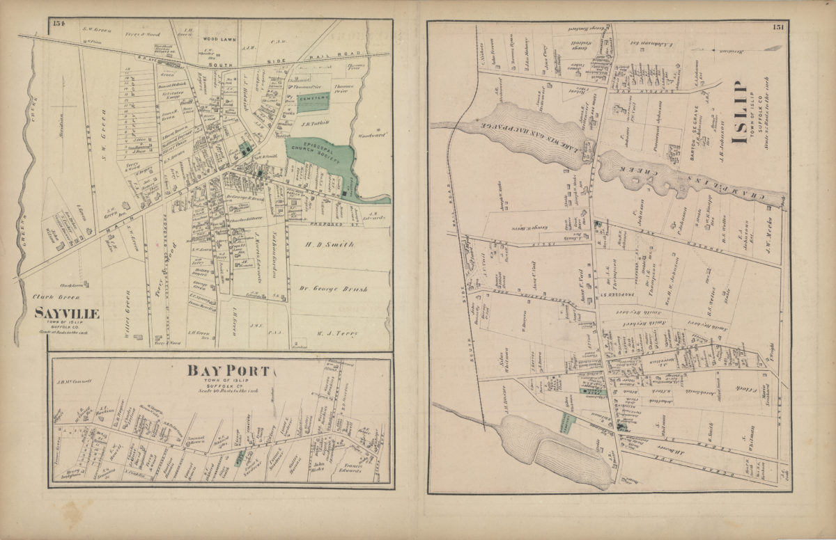
Islip, Suffolk County
Islip, Suffolk County
[1873]
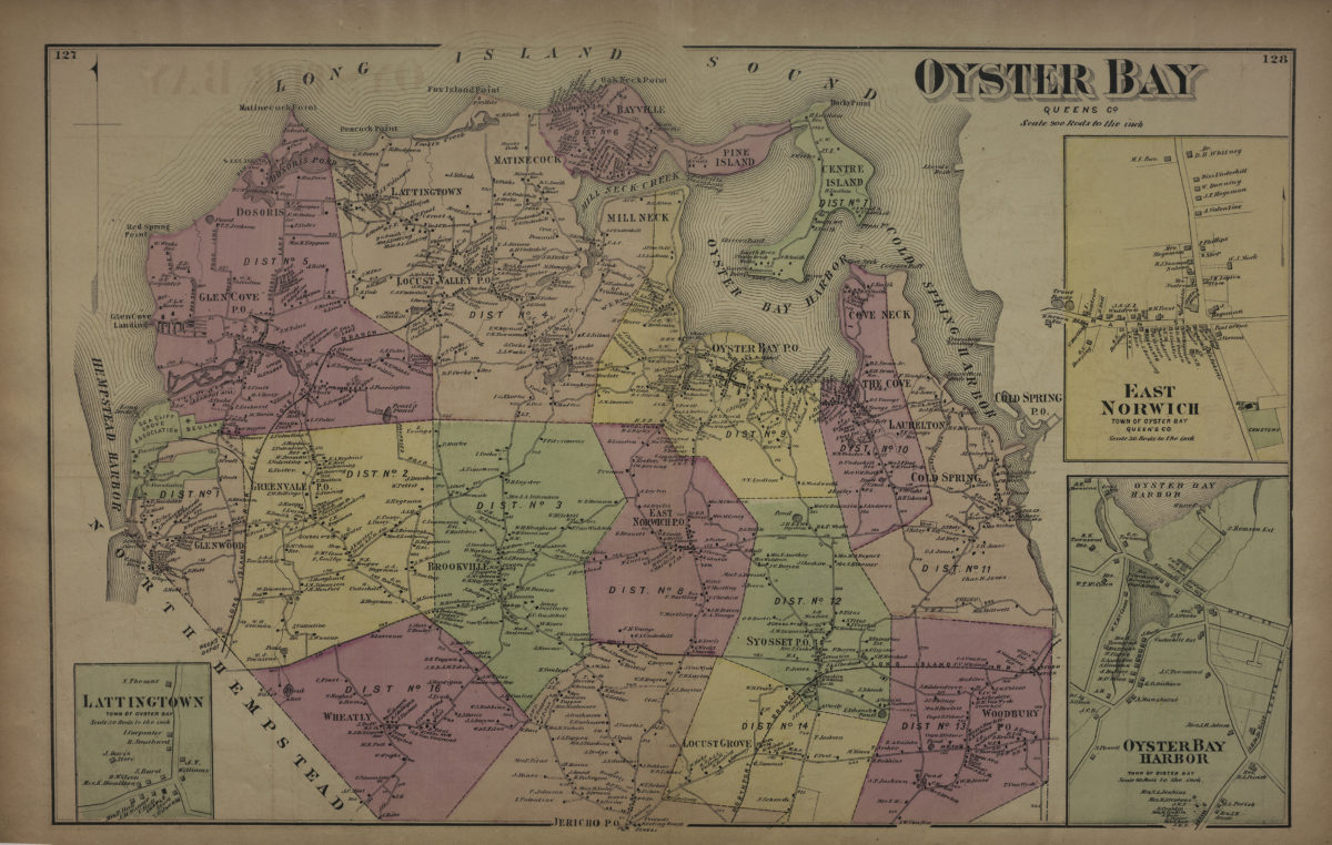
Oyster Bay, Queens Co
Oyster Bay, Queens Co
[1873]
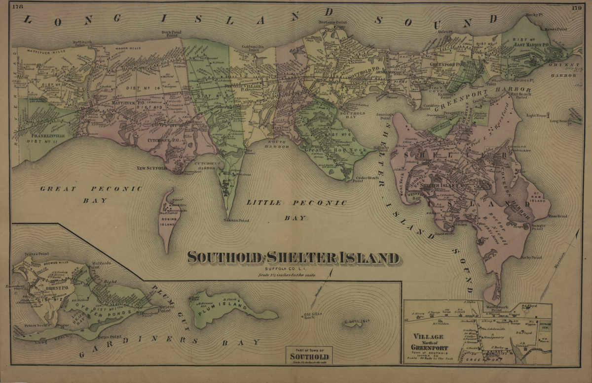
Southold and Shelter Island, Suffolk Co., L.I.
Southold and Shelter Island, Suffolk Co., L.I.
[1873]
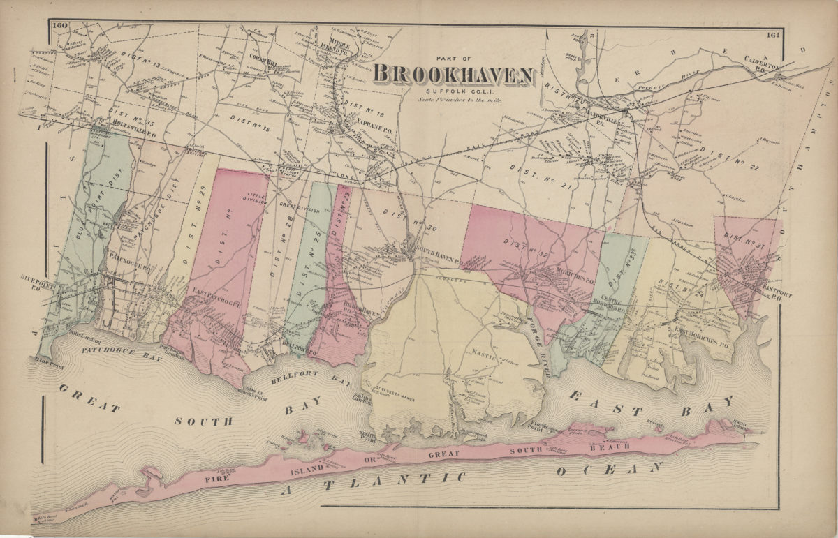
Part of Brookhaven, Suffolk Co., L.I.
Part of Brookhaven, Suffolk Co., L.I.
[1873]
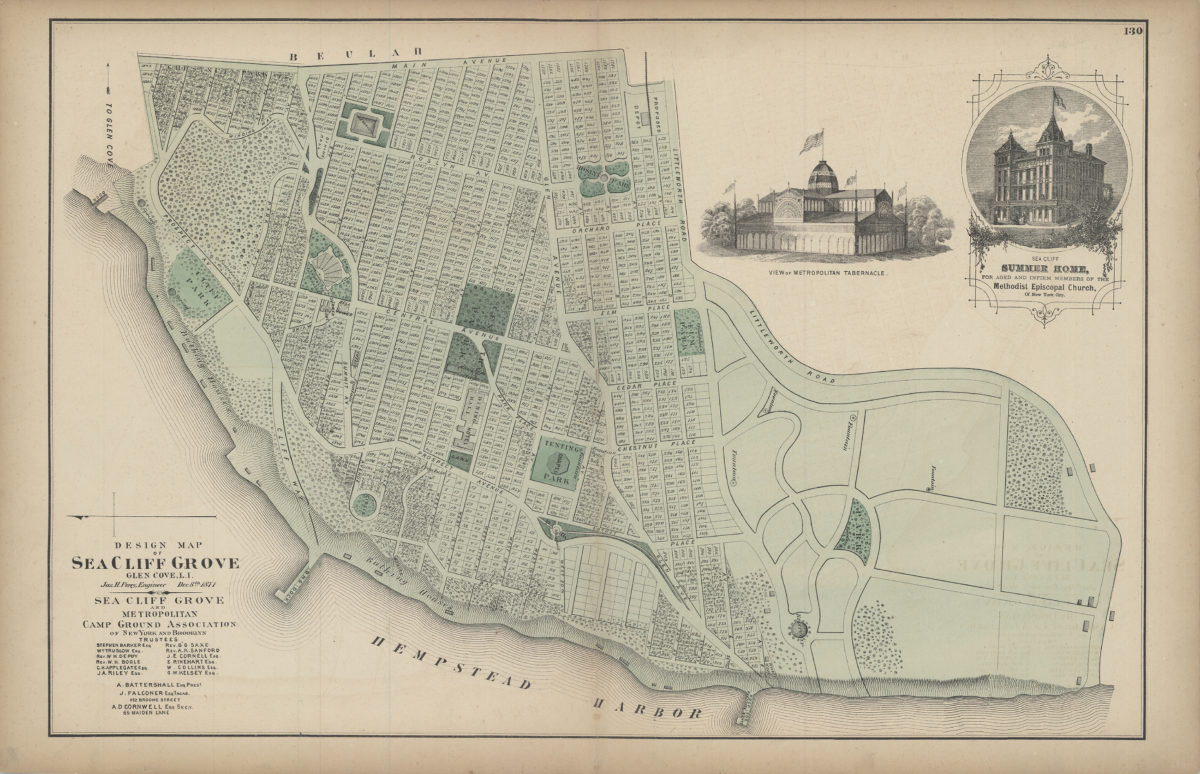
Design map of Sea Cliff Grove, Glen Cove, L.I.: Jas. H. Perry, Dec. 8th, 1871
Design map of Sea Cliff Grove, Glen Cove, L.I.: Jas. H. Perry, Dec. 8th, 1871
[1873]
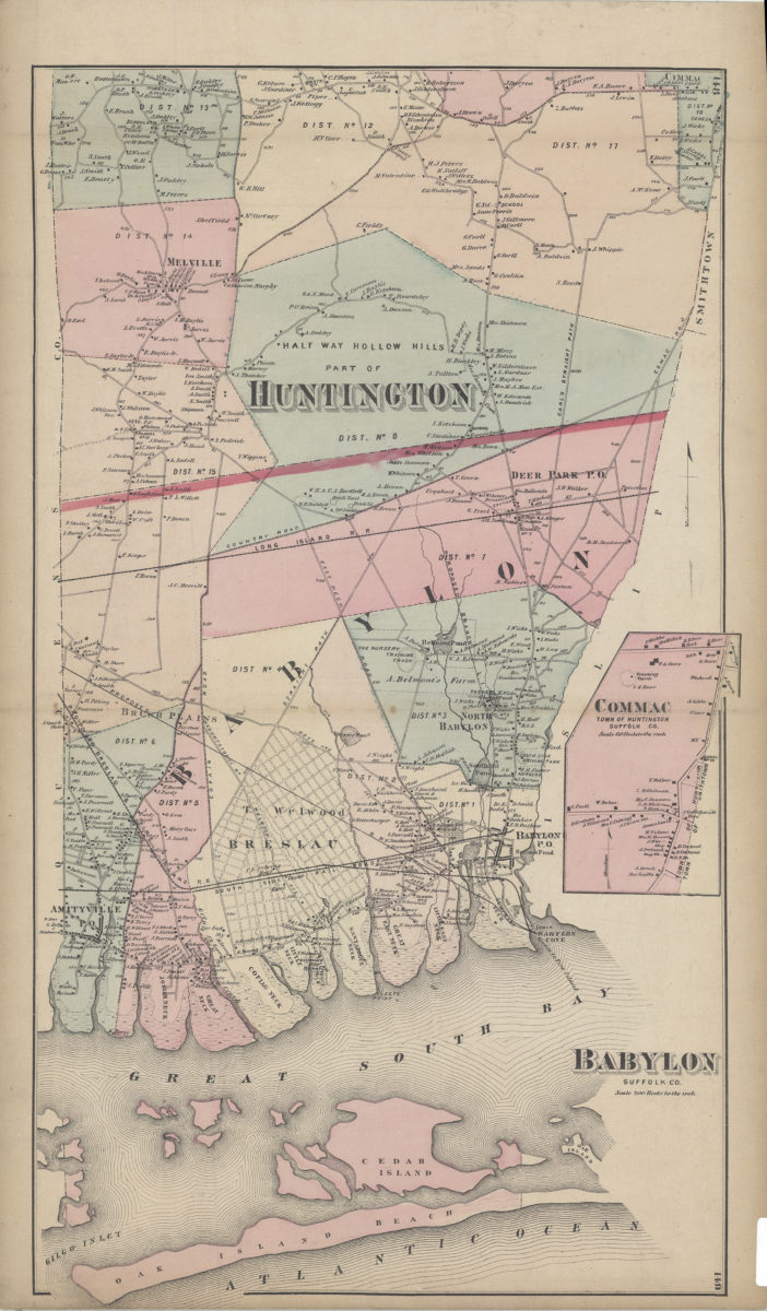
Babylon, Suffolk Co
Babylon, Suffolk Co
[1873]
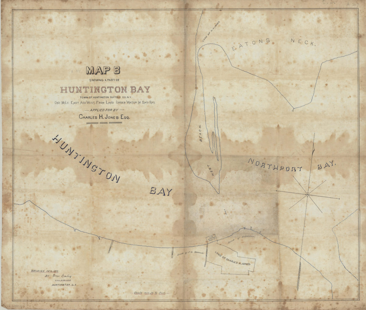
Map B showing a part of Huntington Bay: town of Huntington, Suffolk Co., N.Y., one mile east and west from land under water in said bay, applied for by Charles H. Jones, Esq.: surveyed Dec. 1877 by Oscar Darling, civil engineer, Huntington L.I.
Map B showing a part of Huntington Bay: town of Huntington, Suffolk Co., N.Y., one mile east and west from land under water in said bay, applied for by Charles H. Jones, Esq.: surveyed Dec. 1877 by Oscar Darling, civil engineer, Huntington L.I.
December 1877
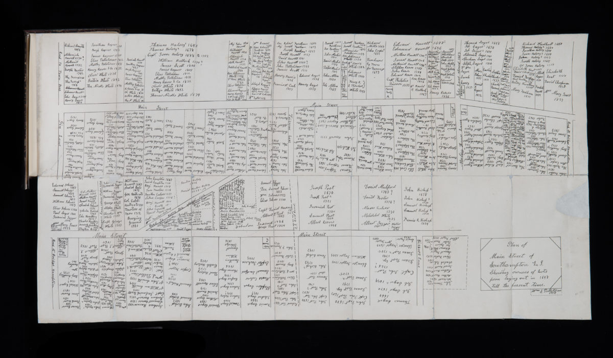
Plan of Main Street of Southampton, L.I., showing owners of lots from laying out in 1648 till the present time: by William S. Pelletreau
Plan of Main Street of Southampton, L.I., showing owners of lots from laying out in 1648 till the present time: by William S. Pelletreau
1878
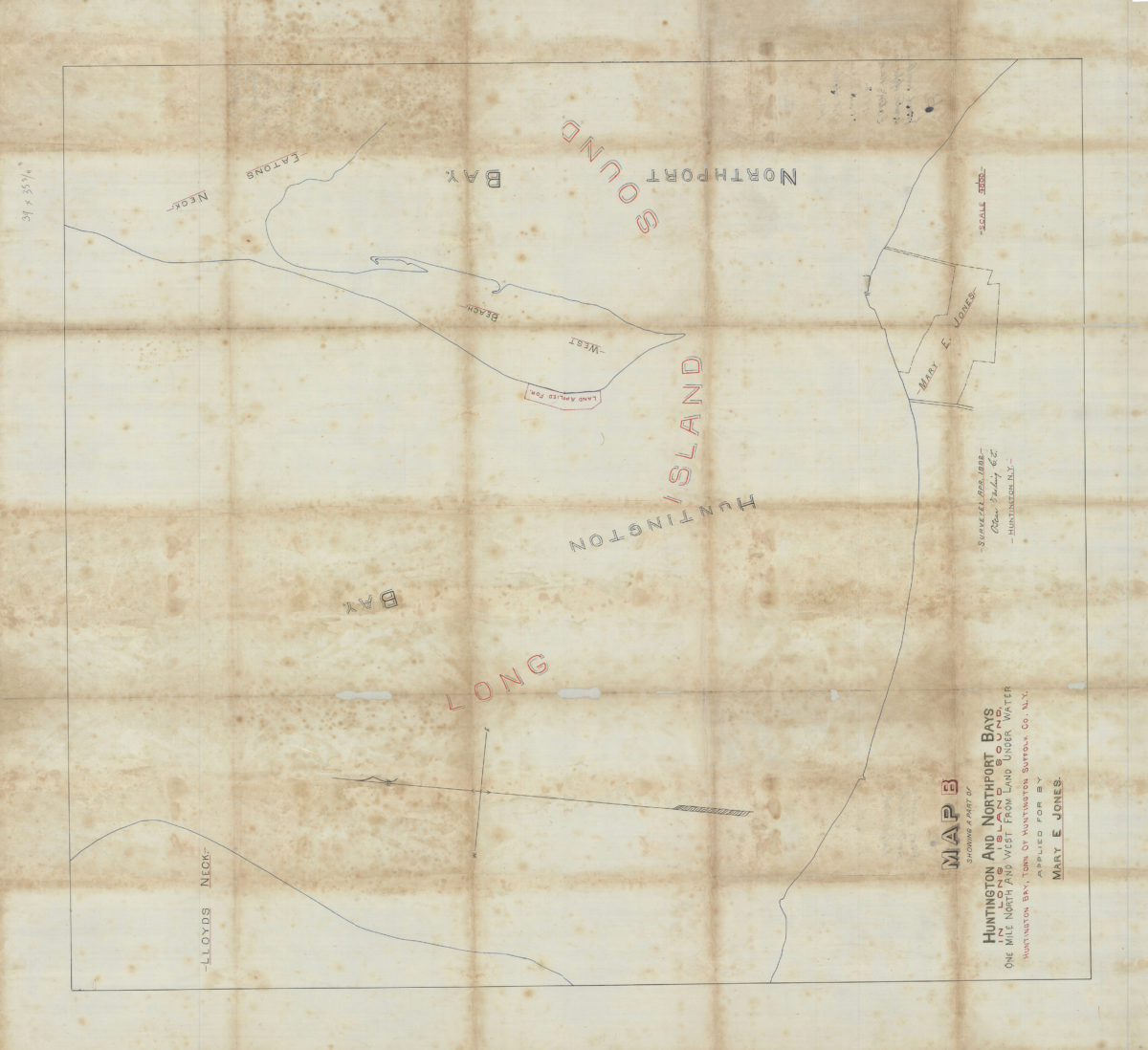
Map B showing a part of Huntington and Northport Bays in Long Island Sound, one mile north and west from land under water, Huntington Bay, town of Huntington, Suffolk Co., N.Y., applied for by Mary E. Jones: Oscar Darling, C.E.
Map B showing a part of Huntington and Northport Bays in Long Island Sound, one mile north and west from land under water, Huntington Bay, town of Huntington, Suffolk Co., N.Y., applied for by Mary E. Jones: Oscar Darling, C.E.
April 1882
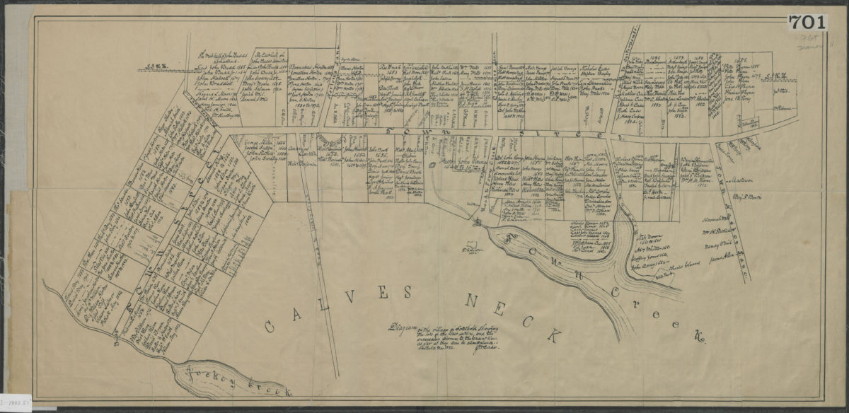
Diagram of the village of Southold showing the lots of the first settlers, and the succeeding owners, to the present times, as far as they can be ascertained: J.M. Case
Diagram of the village of Southold showing the lots of the first settlers, and the succeeding owners, to the present times, as far as they can be ascertained: J.M. Case
March 1882
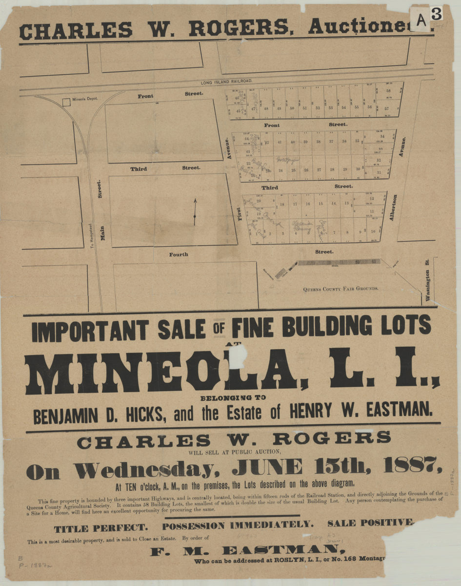
Important sale of fine building lots at Mineola, L.I., belonging to Benjamin D. Hicks, and the estate of Henry W. Eastman
Important sale of fine building lots at Mineola, L.I., belonging to Benjamin D. Hicks, and the estate of Henry W. Eastman
[1887]
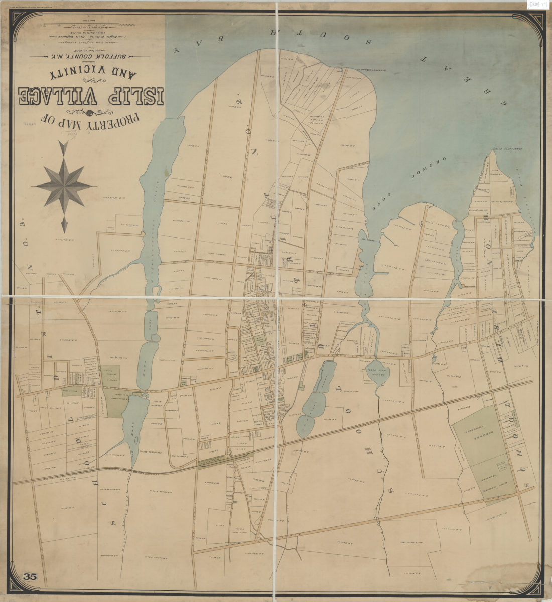
Property map of Islip Village and vicinity: Suffolk County, N.Y.: made from original surveys by Eugene R. Smith, civil engineer, Islip, Suffolk Co. N.Y.
Property map of Islip Village and vicinity: Suffolk County, N.Y.: made from original surveys by Eugene R. Smith, civil engineer, Islip, Suffolk Co. N.Y.
[1887]
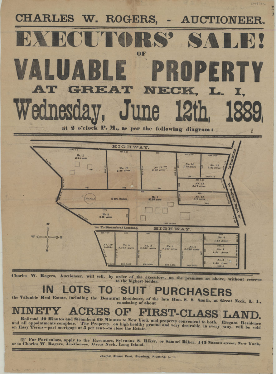
Executors’ sale of valuable property at Great Neck, L.I., Wednesday, June 12th, 1889, at 2 o’clock P.M. as per the following diagram
Executors’ sale of valuable property at Great Neck, L.I., Wednesday, June 12th, 1889, at 2 o’clock P.M. as per the following diagram
[1889]
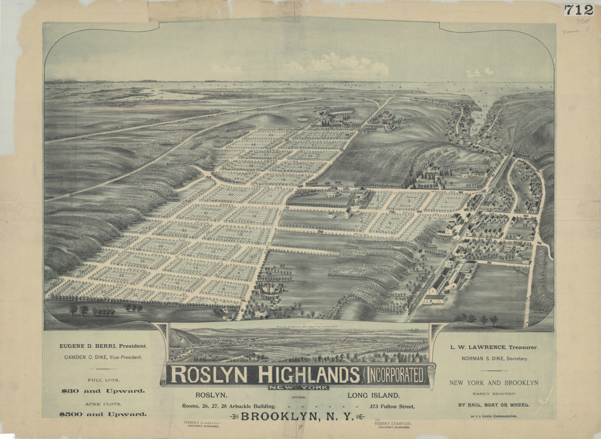
Roslyn Highlands (Incorporated), New York
Roslyn Highlands (Incorporated), New York
[189?]
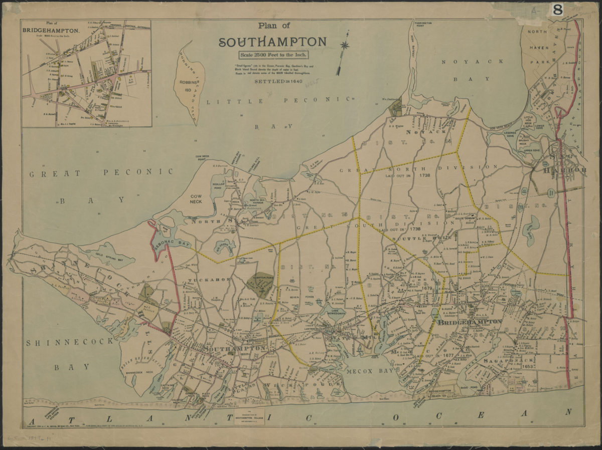
Plan of Southampton
Plan of Southampton
[ca. 1894]
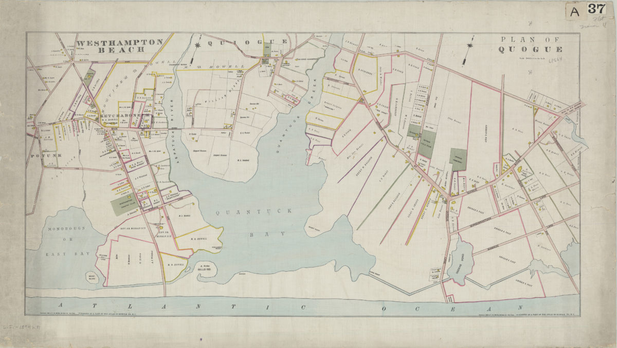
Westhampton Beach: plan of Quogue
Westhampton Beach: plan of Quogue
[ca. 1894]
Plan of Southampton
Plan of Southampton
[ca. 1894]