Center for Brooklyn History
Map Collections
Search
About
Othmer Library & Archives
Submit search query
Refine 9 records
Clear filters
2
Location
Brooklyn (New York, N.Y.)
891
Hempstead (N.Y.)
13
Huntington (N.Y.)
7
Long Island (N.Y.)
197
Manhattan (New York, N.Y.)
120
New York (N.Y.)
164
North Hempstead (N.Y. : Town)
4
Northport Bay (N.Y. : Bay)
1
Roslyn (N.Y.)
3
Southold (N.Y.)
4
Subject
Bays
5
Landowners
434
Names, Personal
1
Parishes
1
Real property
619
Riparian rights
13
Submerged lands
17
Date
19th Century
945
20th Century
469
or enter range:
from
to
Genres
Cadastral maps
597
Historical maps
53
Manuscript maps
365
Sort by:
Date (earliest)
Date (most recent)
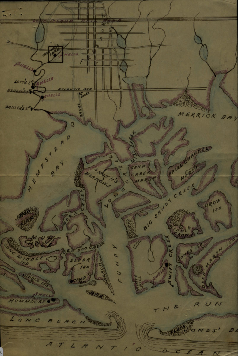
[Map of Hempstead Bay]
[Map of Hempstead Bay]
[18??]
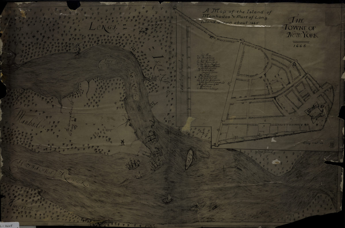
A map of the island of Manhados and part of Long Island, drawn about 1665
A map of the island of Manhados and part of Long Island, drawn about 1665
[18??]
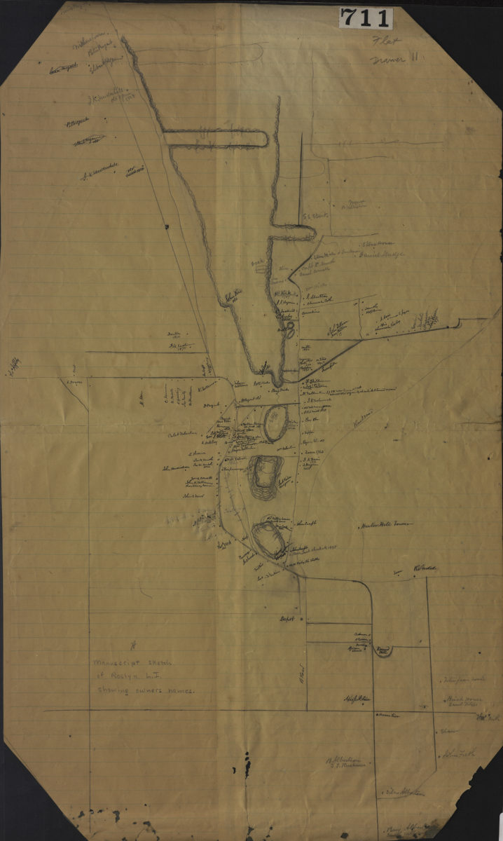
Manuscript sketch of Roslyn L.I. showing owners names
Manuscript sketch of Roslyn L.I. showing owners names
[18??]
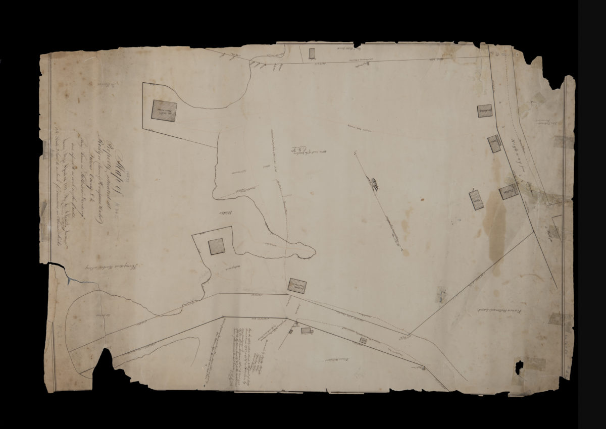
Map of property situated at Roslyn (formerly Hempstead Harbor), Queens County, L.I., being known as “Patterson’s Landing” and referred to as such in the deeds: by G.A. Smith, surveyor
Map of property situated at Roslyn (formerly Hempstead Harbor), Queens County, L.I., being known as “Patterson’s Landing” and referred to as such in the deeds: by G.A. Smith, surveyor
September 27, 1851
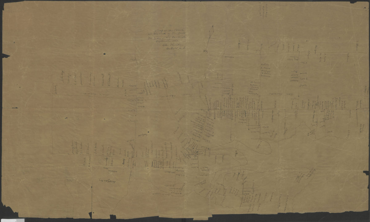
Map of the parish at the end of the first ten years of my pastorate: Epher Whitaker, Southold, L.I.
Map of the parish at the end of the first ten years of my pastorate: Epher Whitaker, Southold, L.I.
September 1861
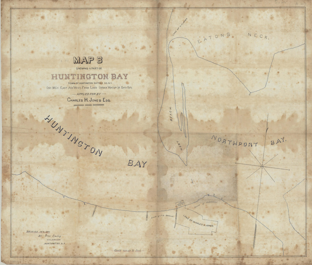
Map B showing a part of Huntington Bay: town of Huntington, Suffolk Co., N.Y., one mile east and west from land under water in said bay, applied for by Charles H. Jones, Esq.: surveyed Dec. 1877 by Oscar Darling, civil engineer, Huntington L.I.
Map B showing a part of Huntington Bay: town of Huntington, Suffolk Co., N.Y., one mile east and west from land under water in said bay, applied for by Charles H. Jones, Esq.: surveyed Dec. 1877 by Oscar Darling, civil engineer, Huntington L.I.
December 1877
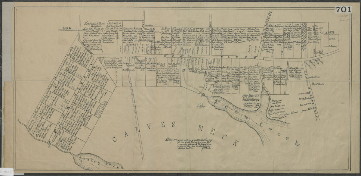
Diagram of the village of Southold showing the lots of the first settlers, and the succeeding owners, to the present times, as far as they can be ascertained: J.M. Case
Diagram of the village of Southold showing the lots of the first settlers, and the succeeding owners, to the present times, as far as they can be ascertained: J.M. Case
March 1882
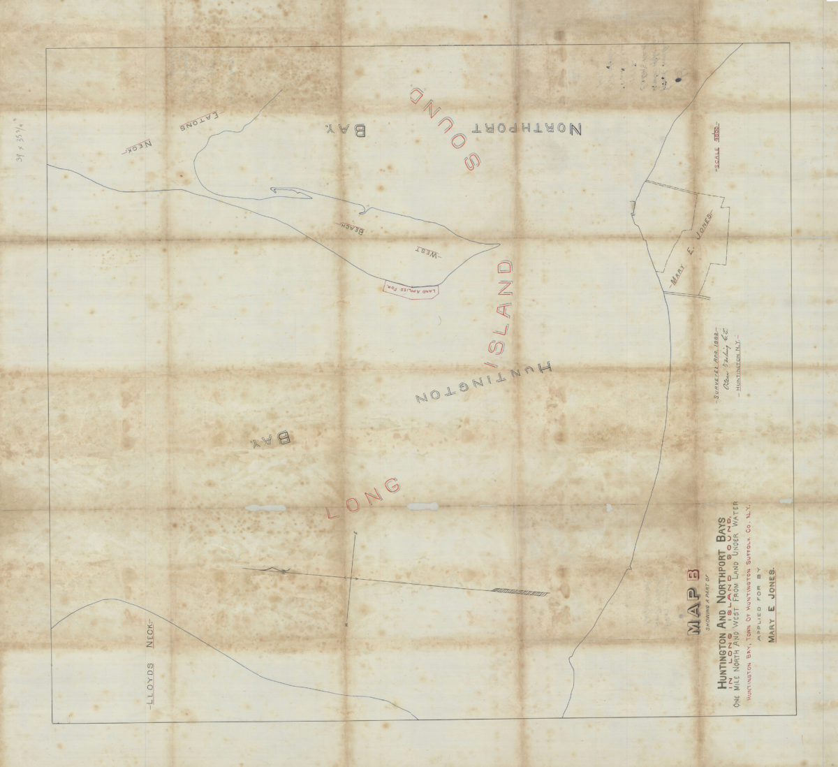
Map B showing a part of Huntington and Northport Bays in Long Island Sound, one mile north and west from land under water, Huntington Bay, town of Huntington, Suffolk Co., N.Y., applied for by Mary E. Jones: Oscar Darling, C.E.
Map B showing a part of Huntington and Northport Bays in Long Island Sound, one mile north and west from land under water, Huntington Bay, town of Huntington, Suffolk Co., N.Y., applied for by Mary E. Jones: Oscar Darling, C.E.
April 1882
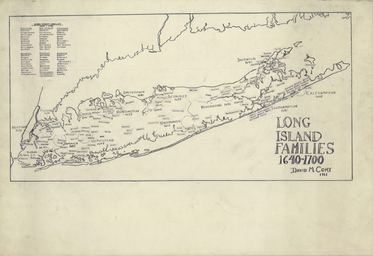
Long Island families, 1640-1700
Long Island families, 1640-1700
1961