Center for Brooklyn History
Map Collections
Search
About
Othmer Library & Archives
Submit search query
Refine 7 records
Clear filters
3
Location
Great Neck (N.Y.)
3
Long Island (N.Y.)
197
Montauk (N.Y.)
4
Nassau County (N.Y.)
24
North Hempstead (N.Y. : Town)
4
Noyack (N.Y.)
1
Oyster Bay (N.Y.)
9
Riverhead (N.Y.)
3
Subject
Landowners
434
Real property
619
Date
20th Century
469
or enter range:
from
to
Genres
Cadastral maps
597
Historical maps
53
Pictorial maps
38
Zoning maps
55
Sort by:
Date (earliest)
Date (most recent)
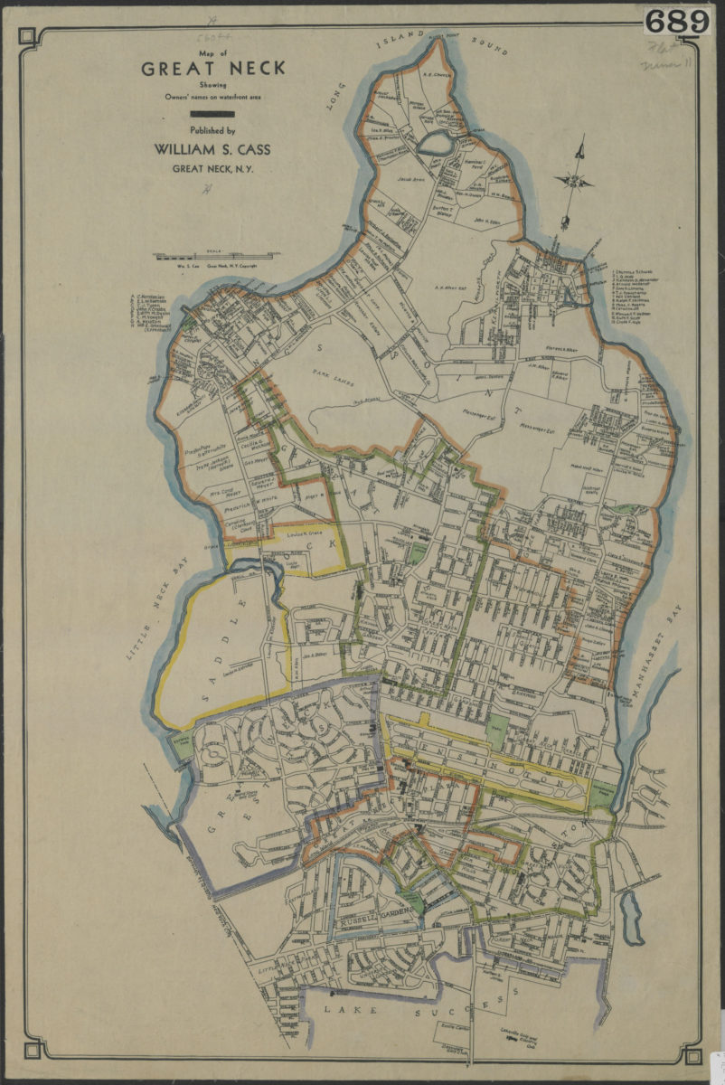
Map of Great Neck: showing owners’ names on waterfront area: published by William S. Cass, Great Neck, N.Y.
Map of Great Neck: showing owners’ names on waterfront area: published by William S. Cass, Great Neck, N.Y.
[19??]
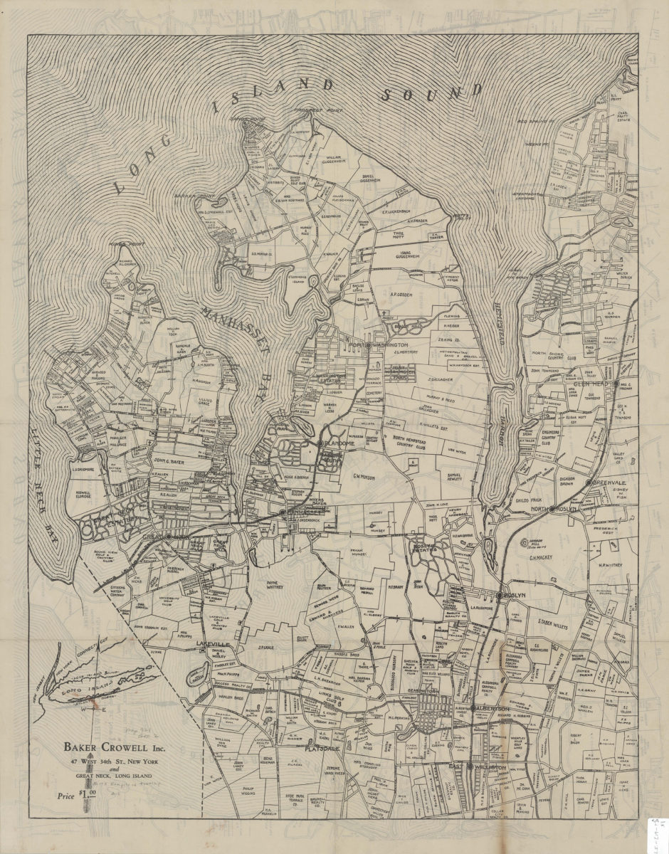
[Property maps of North Hempstead and Oyster Bay Townships, Nassau County, N.Y.]
[Property maps of North Hempstead and Oyster Bay Townships, Nassau County, N.Y.]
[19??]
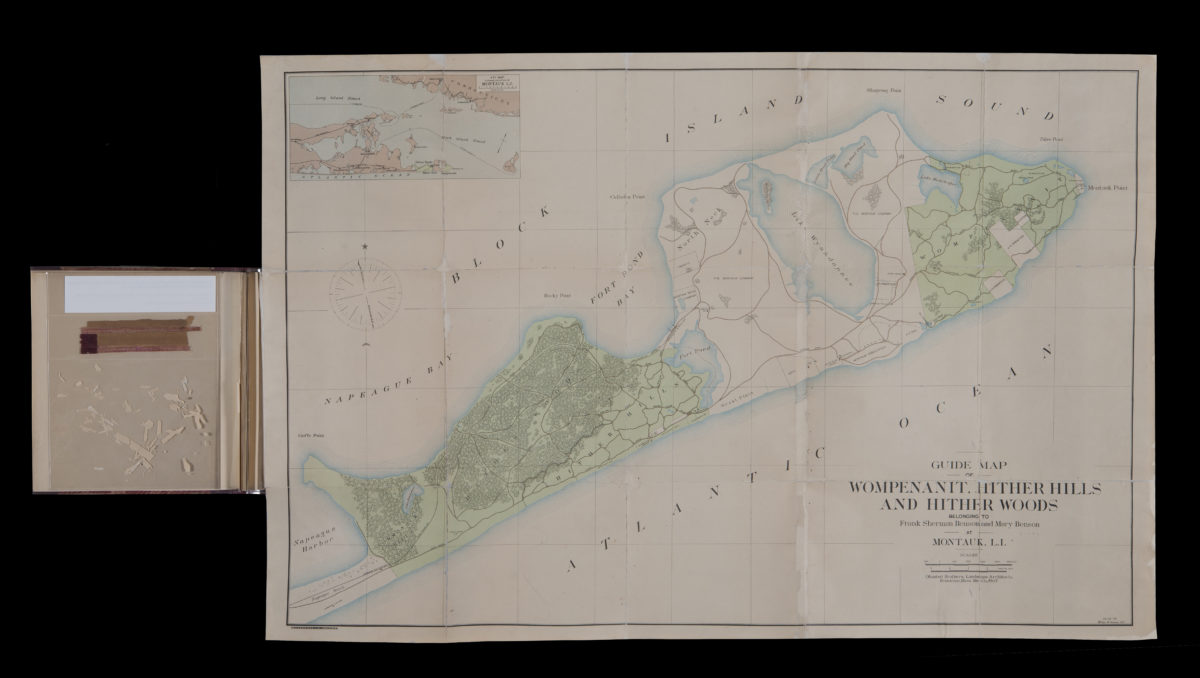
Guide map of Wompenanit, Hither Hills, and Hither Woods, belonging to Frank Sherman Benson and Mary Benson at Montauk, L.I.: Olmsted Brothers; William M. Humans, del
Guide map of Wompenanit, Hither Hills, and Hither Woods, belonging to Frank Sherman Benson and Mary Benson at Montauk, L.I.: Olmsted Brothers; William M. Humans, del
1905
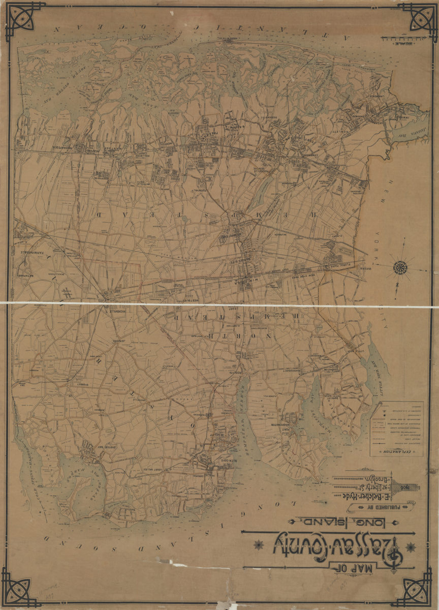
Map of Nassau County, Long Island: C.W. Hooper del
Map of Nassau County, Long Island: C.W. Hooper del
1906
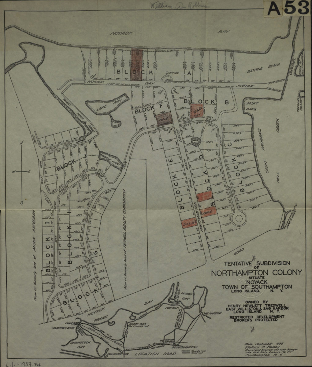
Tentative subdivision of Northampton Colony, situate Noyack, Town of Southampton, Long Island, N.Y. owned by Henry Hewlett Tredwell
Tentative subdivision of Northampton Colony, situate Noyack, Town of Southampton, Long Island, N.Y. owned by Henry Hewlett Tredwell
1937
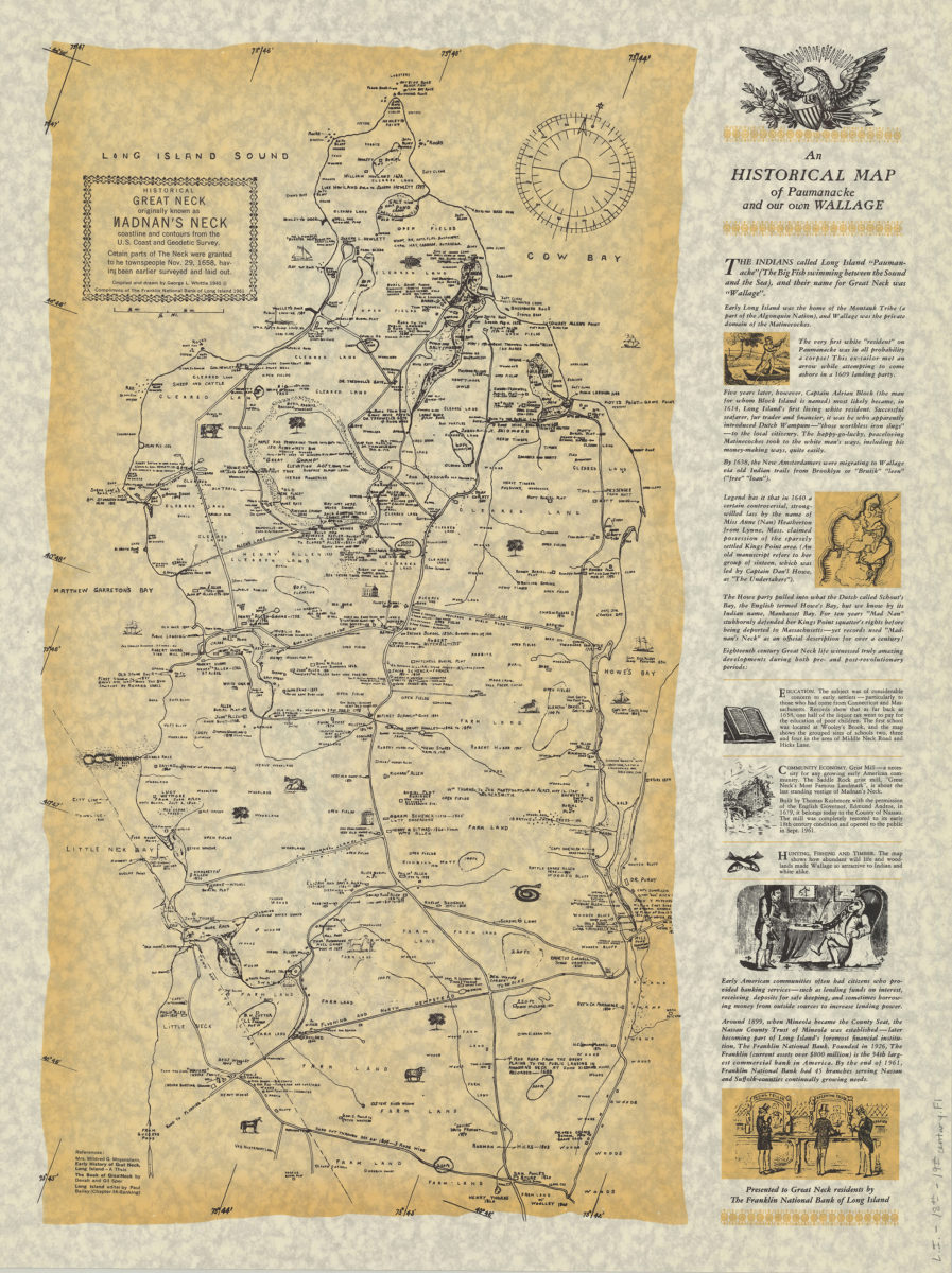
An historical map of Paumanacke and our own Wallage: compiled and drawn by George L. Whittle
An historical map of Paumanacke and our own Wallage: compiled and drawn by George L. Whittle
[ca. 1940, 1961]
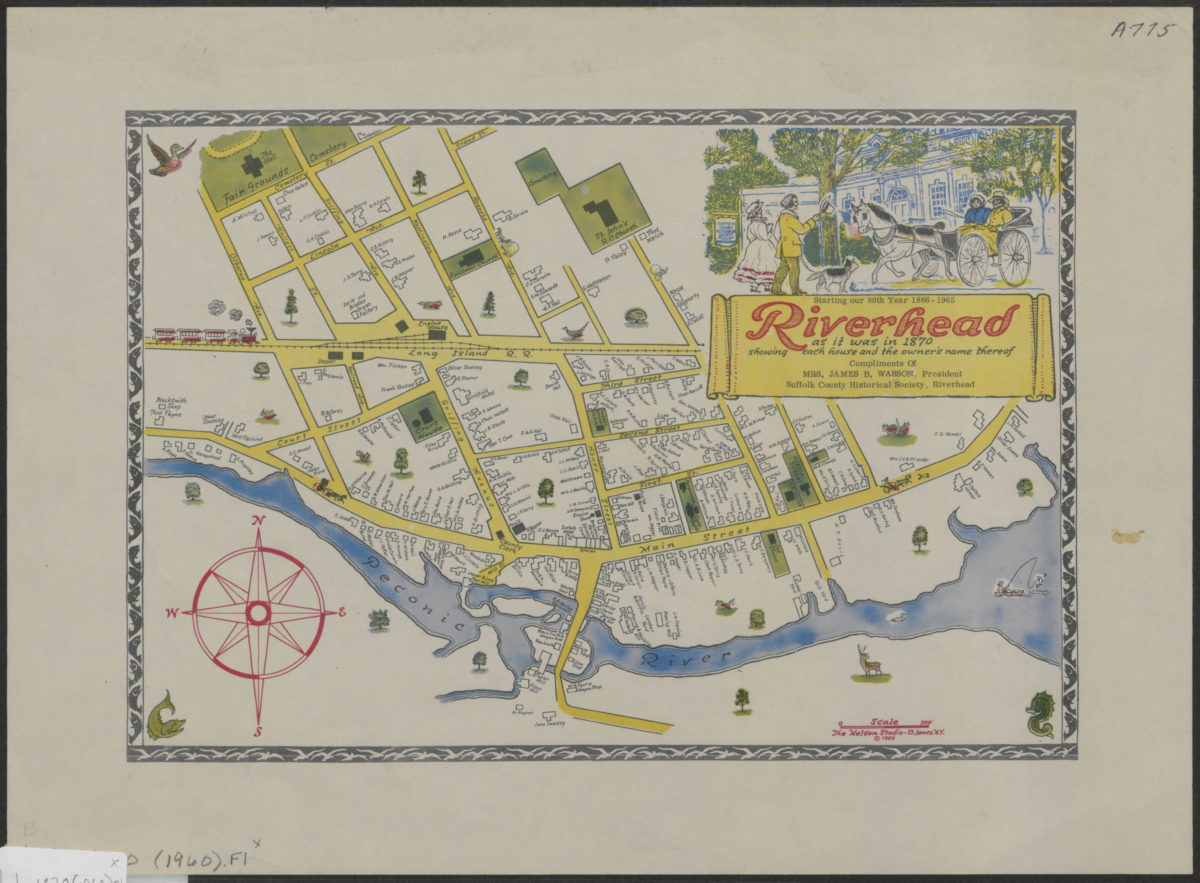
Riverhead as it was in 1870: showing each house and the owner’s name thereof
Riverhead as it was in 1870: showing each house and the owner’s name thereof
[ca. 1960]